
Beantwoord enkele vragen, en binnen seconden geeft AI je een persoonlijk aankoopadvies op maat.
Beantwoord enkele vragen, en binnen seconden geeft AI je een persoonlijk aankoopadvies op maat.


Wandelgids van een deel van Schotland. Deze gids bevat 28 dagwandelingen, variërend van korte tochten tot pittige dagtochten. De bijbehorende kaarten zijn uitstekend: men heeft de topografische kaarten van Ordnance Survey gebruikt waarop de route is ingetekend. Daarnaast praktische informatie over de wandeling en wat beschrijvingen van het gebied. This Pathfinder walking route guidebook for Oban, Mull and Kintyre has 28 circular, graded walks created by experienced seasoned walkers. The routes range from extended strolls of two miles (3.2km) to exhilarating hikes of 13 miles (21km), so there is something for people of all abilities. Key routes in this book include Campbeltown Loch, the Wishing Tree, Isle of Kerrera, Isle of Ulva and Ben More. Each route includes the path shown on an extract of the OS Explorer map for the area, route notes, waypoints and keey features to look out for. It's ideal for both visitors and locals alike. Pathfinder Guides are Britain’s best-loved walking guides. Printed with weather-resistant covers featuring durable rounded corners, they are the perfect companion for country walking throughout Britain.
€18,50
Bekijk product

Wandelgids van een deel van Engeland, Schotland of Wales. Deze gids bevat 28 dagwandelingen, variërend van korte tochten tot pittige dagtochten. De bijbehorende kaarten zijn uitstekend: men heeft de topografische kaarten van Ordnance Survey gebruikt waarop de route is ingetekend. Daarnaast praktische informatie over de wandeling en wat beschrijvingen van het gebied. Each of the Jarrold Pathfinder titles features 28 circular routes, all tried and tested by seasoned walkers. The routes range from extended strolls to exhilarating hikes, so there is something for everyone. They also contain: -Ordnance Survey mapping; -background details of each area; -details of refreshment stops and parking; -walking safety advice; and -information about walkers and the law Approaching the eastern part of central Scotland, where the Grampians dominate the horizon, it appears at first glance to be mountain country. In fact much of the area is low-lying, with flat woodland and agricultural land bordered by gentle, rounded hills and an attractive North Sea coastline. Perthshire has enough lochs to vie with Cumbria's Lake District. Dunsinane Hill and the site of Macbeth's castle can be seen on the Sidlaw Hills in Strathmore, Angus, and there are also coastal walks around the Fife peninsula, with its waterfront villages, sheltered harbours and sandy beaches.
€18,50
Bekijk product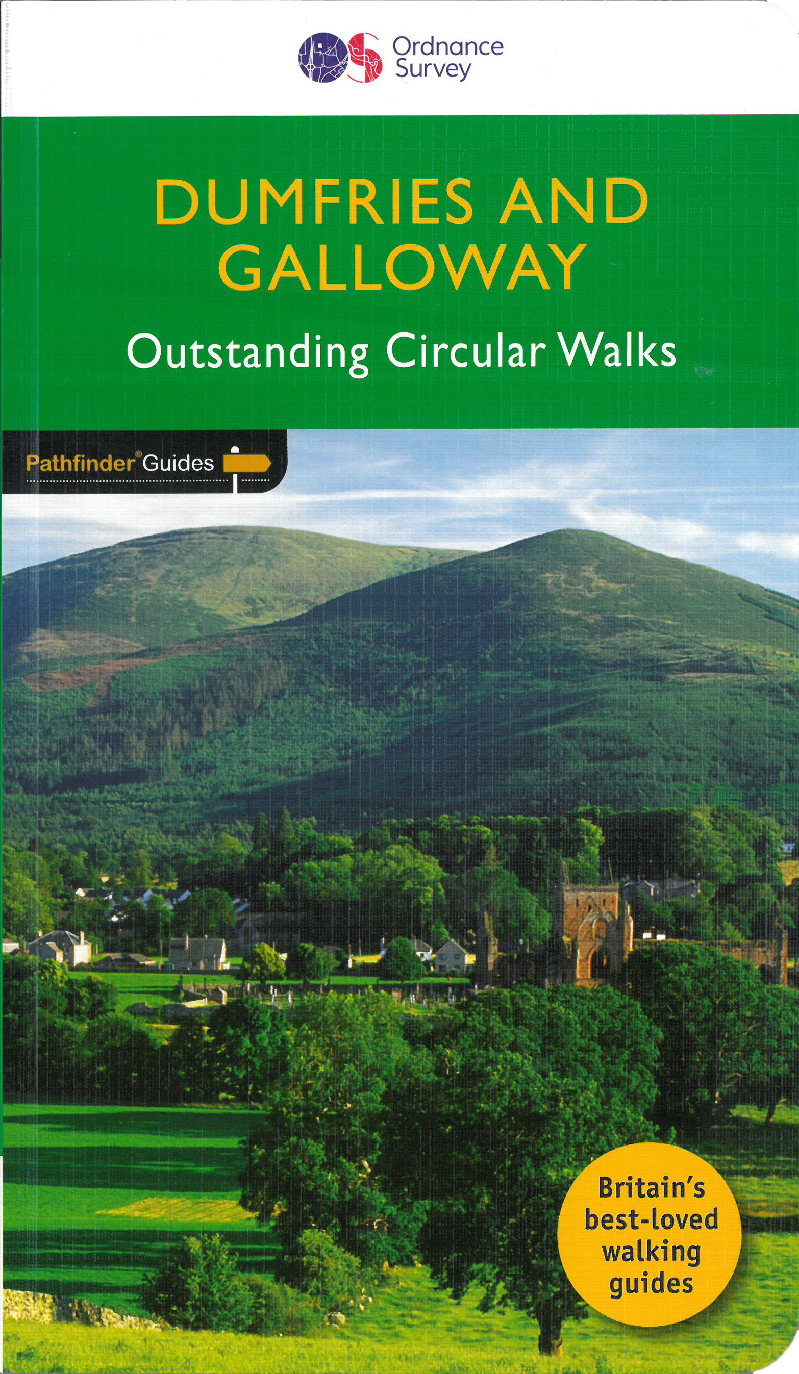
Wandelgids van het zuidwestenl van Schotland. Deze gids bevat 28 dagwandelingen, variërend van korte tochten tot pittige dagtochten. De bijbehorende kaarten zijn uitstekend: men heeft de topografische kaarten van Ordnance Survey gebruikt waarop de route is ingetekend. Daarnaast praktische informatie over de wandeling en wat beschrijvingen van het gebied. With 28 circular walks all created by experienced walkers, this Pathfinder walking guidebook for Dumfries and Galloway is ideal for both visitors and locals. The routes range from extended strolls to exhilarating hikes, so there is something for everyone. Each route includes a detailed description, a difficulty rating, the Ordnance Survey map for the route, GPS waypoints and key historical and landscape features to look out for. Dumfries and Galloway form the south-west of Scotland; a broad wedge of land jutting out into the Irish Sea between the Solway Firth and the Firth of Clyde. The area is also part of Scotland's border country which possesses a mild climate, a great variety of scenery and a rich historic legacy, making it a popular destination for holidays and a lush contrast to the more rugged landscapes found just slightly further north. The mountains of Dumfries and Galloway offer plenty of remote and challenging walking, with over 40 peaks that exceed 2000 feet. Also featured are clifftop walks around the Mull of Galloway and Rascarrel Bay, a route around the Solway Marshes plus the pigramage destination of St Ninian's Cave. Pathfinder Guides are Britain’s best-loved walking guides. Printed with weather-resistant covers featuring durable rounded corners, they are the perfect companion for country walking throughout Britain.
€18,50
Bekijk product
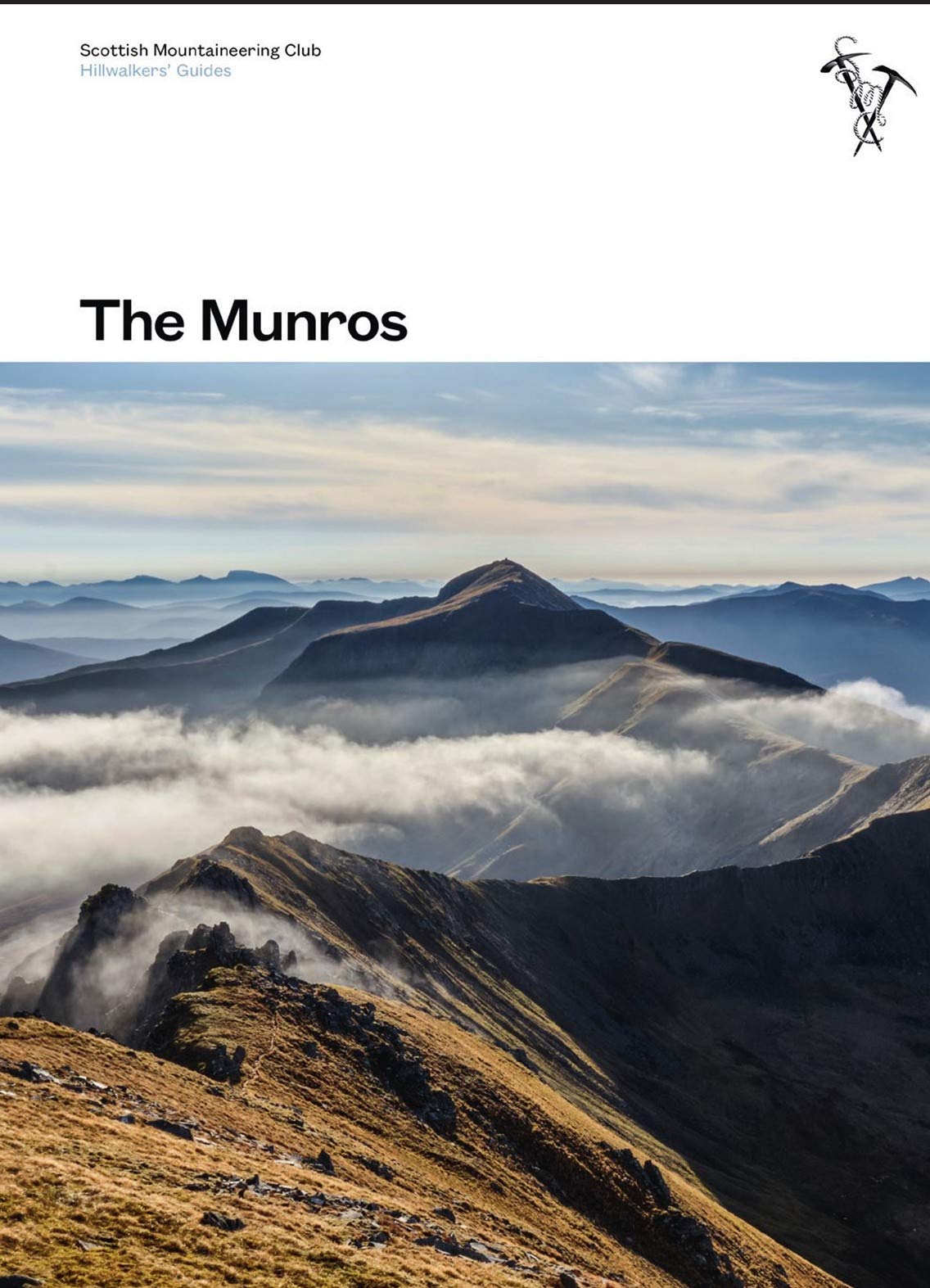
Toonaangevend boek over alle Munros in Schotland, de bergen boven de 3000 feet. Er zijn talloze mensen die in hun leven alle Munros willen beklimmen; het is een hele cultus. This fully revised edition of the Scottish Mountaineering Club’s original and best-selling guidebook The Munros describes the best walking routes on Scotland’s 282 mountains above 3000ft. Comprehensive descriptions in this definitive guide recommend ascent and descent routes for each of the Munros and their 226 subsidiary Tops, with maps of the peaks and principal surrounding hills to help you plan the most enjoyable journeys through Scotland’s wild landscape. The descriptions are brought to life throughout with vivid photography that illustrates the dramatic beauty of these much-loved mountains. In addition to routes themselves the book contains Munros Tables, a complete list of the 508 Munros and subsidiary Tops, listed in height order. Whether you are an occasional walker looking for inspiration or a dedicated Munroist planning to tick off your next peak, The Munros is essential reading for anyhillwalking enthusiast.
€37,95
Bekijk product