
Beantwoord enkele vragen, en binnen seconden geeft AI je een persoonlijk aankoopadvies op maat.
Beantwoord enkele vragen, en binnen seconden geeft AI je een persoonlijk aankoopadvies op maat.

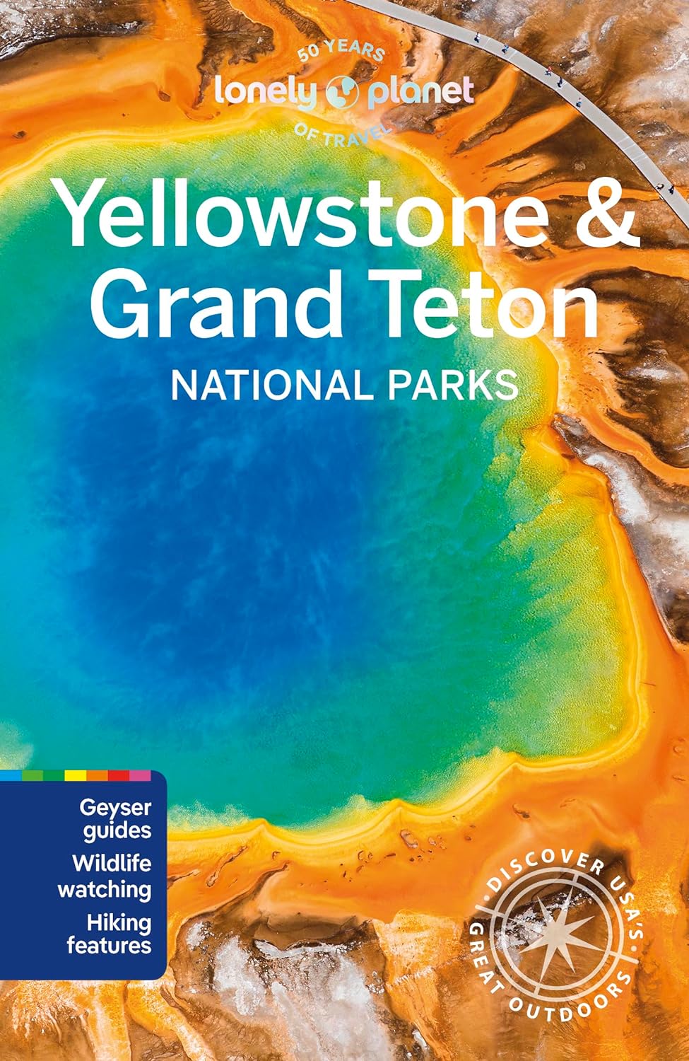
Uitstekende beschrijvingen met veel praktische informatie over dit NP. Wandelingen, overnachtingen, geschiedenis en wildlife. Lonely Planet's Yellowstone and Grand Teton National Parks is your passport to the most relevant, up-to-date advice on what to see and skip, and what hidden discoveries await you. Watch Old Faithful erupt, spot wildlife and climb Mt Teton; all with your trusted travel companion. Get to the heart of Yellowstone and Grand Teton National Parks and begin your journey now! Inside the Lonely Planet's Yellowstone and Grand Teton National Parks Travel Guide: User-friendly highlights and itineraries help you tailor your trip to your personal needs and interests Insider tips to save time and money and get around like a local, avoiding crowds and trouble spots Essential info at your fingertips - hours of operation, phone numbers, websites, transit tips, prices, emergency information, park seasonality, hiking trail junctions, viewpoints, landscapes, elevations, distances, difficulty levels, and durations Focused on the best hikes, drives, and cycling tours Honest reviews for all budgets - eating, sleeping, camping, sightseeing, going out, shopping, summer and winter activities, and hidden gems that most guidebooks miss Contextual insights give you a richer, more rewarding travel experience - history, geology, wildlife, and conservation Over 40 trail and park maps Useful features- Travel with Children,Clothing and Equipment, andDay and Overnight Hikes Covers Yellowstone National Park area, Mammoth Country, Roosevelt Country, Canyon Country, Lake Country, Norris, Geyser Country, Bechler Region, Grand Teton National Park area, Jackson and more
€23,95
Bekijk product
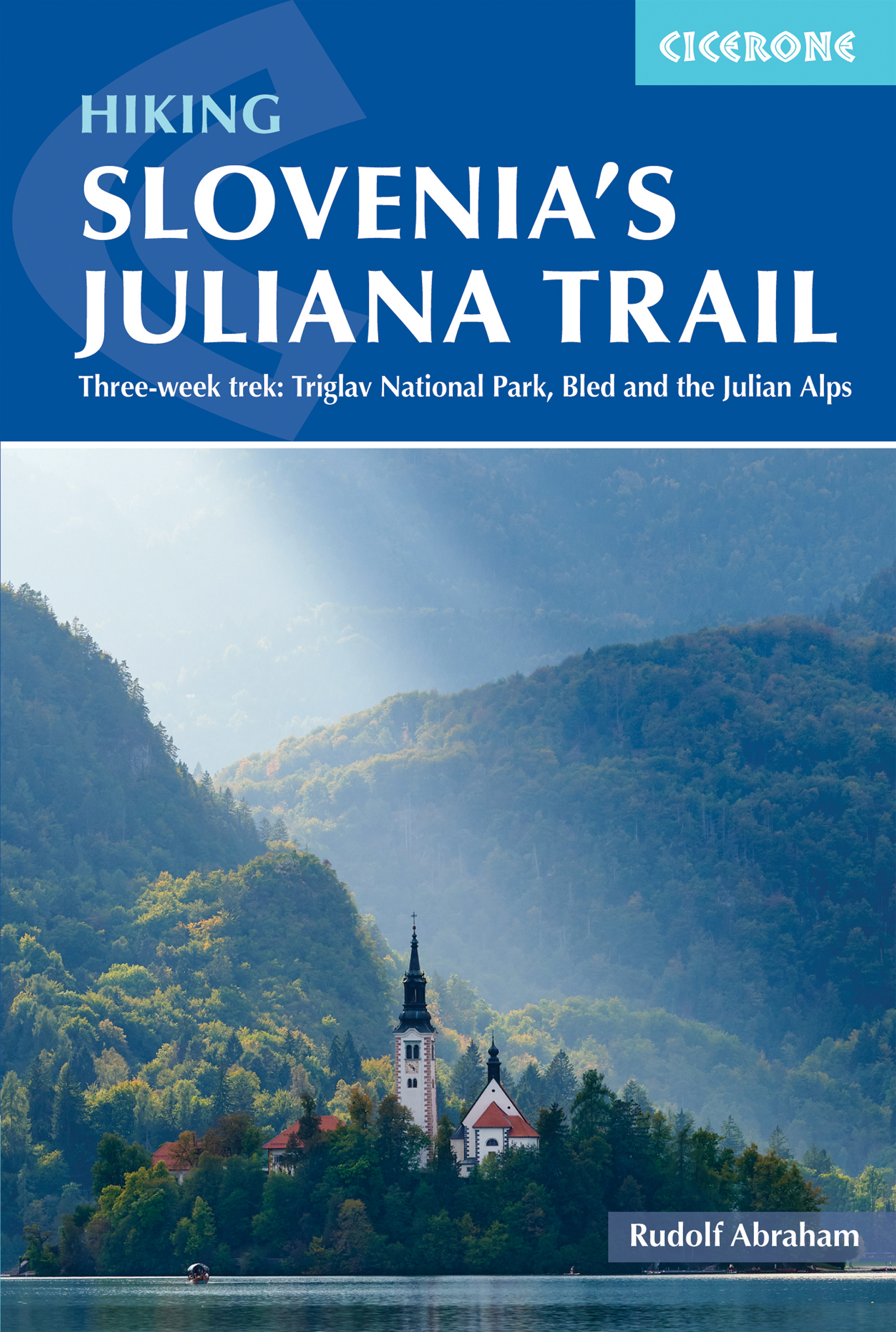
The Juliana Trail is a 330-km-long circular long-distance hiking trail through the Julian Alps in Triglav National Park, Slovenia. The trek takes in some less familiar valleys along with well-known spots such as Lake Bohinj and Bled, swings briefly through the corner of Italy, and into the Brda wine region. Accessible by public transport, the trek is straightforward and relatively easy, perfect for hikers of various skill levels. The guidebook offers route description for every stage of this 20-day trekking route, along with providing background information on local history, geology, and wildlife, as well as planning details on when to go, where to stay, and what facilities are available along the trail. 1:50,000 mapping is provided for each stage. Designed to promote sustainable tourism this trail is a true gem of Slovenia's Julian Alps.
€26,50
Bekijk product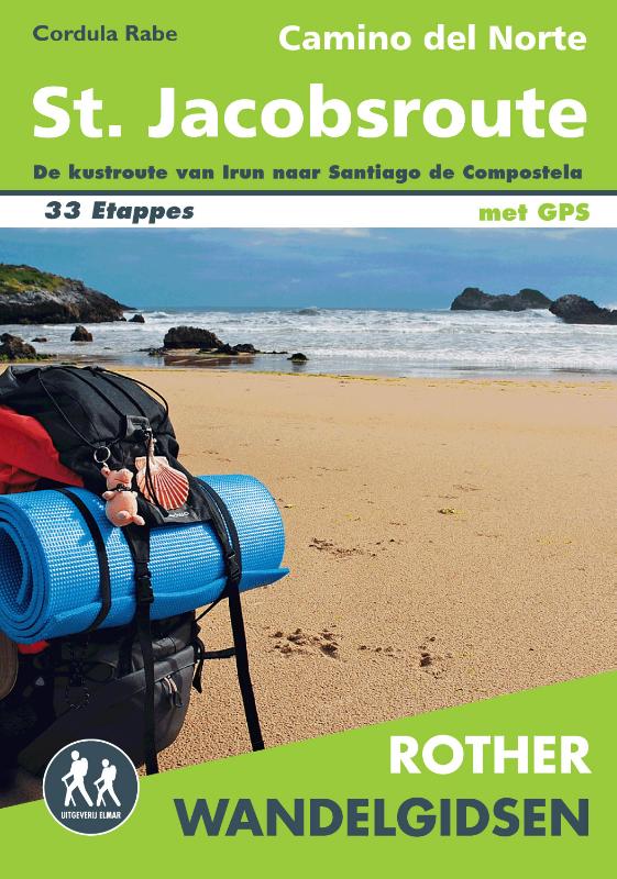
Steeds meer mensen zijn bekend met de Noordelijke kustroute van de Santiago de Compostela, oftewel de Sint Jacobsroute. Deze route wijkt iets af van de traditionele pelgrimsroute en loopt langs de Cantabrische kust. Deze route van de Camino loopt langs plaatsen zoals Bilbao, San Sebastian en Altamira. Deze Rother wandelgids voor de Camino del Norte beschrijft de 29 etappes van Irun naar Santiago de Compostela en vier laatste naar Finisterre en Muxia. Elke etappe is voorzien van een gedetailleerde beschrijving, een duidelijke kaart en hoogteprofielen. Daarnaast heeft deze wandelgids vele praktische informatie voor wandelaars en pelgrims.
€19,99
Bekijk product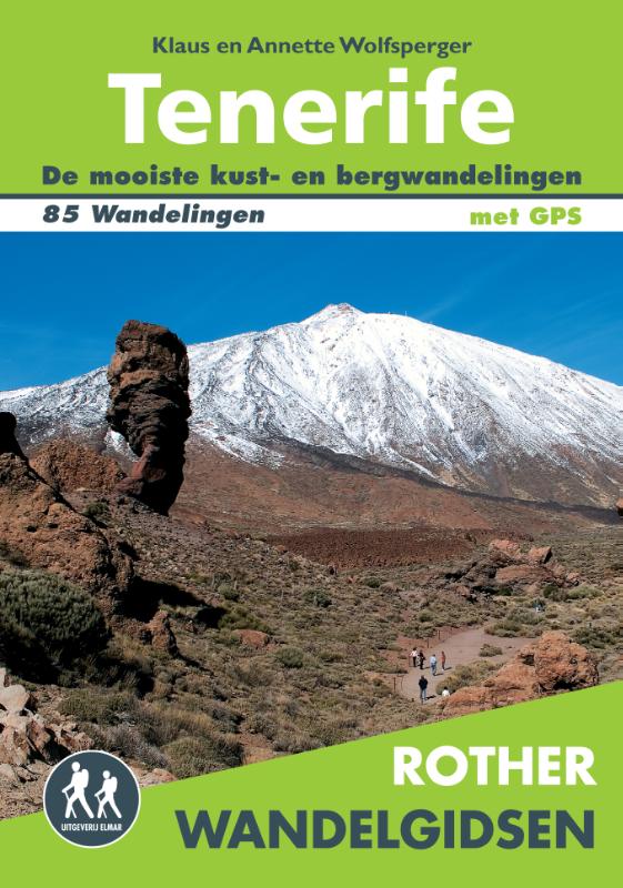
85 wandelingen op het meest veelzijdige van de Canarische Eilanden. Een paradijs voor wandelaars: idyllische valleien, pijnboom- en laurierbossen, wilde ravijnen, majestueuze bergtoppen en de overweldigende Las Cañadas met de Pico del Teide. De duidelijke beschrijvingen van de wandelroutes worden voorafgegaan door een korte samenvatting van de belangrijkste informatie. De duur van de wandeling, de moeilijkheidsgraad, hoogteverschillen en duidelijke wandelkaartjes voorzien u in een goede voorbereiding. Ook worden de bezienswaardigheden beschreven die u tijdens de wandeling tegen kan komen. Een handige en compacte wandelgids die u niet wilt missen tijdens uw vakantie in Tenerife. * Betrouwbare routebeschrijvingen * Gedetailleerde wandelkaarten * Informatieve hoogteprofielen * Downloadbare GPS-tracks Let op: er is enige verwarring omtrent het jaartal van deze Nederlandse wandelgidsen van uitgever Elmar. Dit is een vertaling van de Duitse uitgever Rother maar daarna NIET bijgewerkt. De datum die wij vermelden is het moment van vertaling; er zijn andere – meer recente jaartallen – in omloop maar dat is de datum van een nieuwe druk ZONDER aanpassingen. Wilt u de meest recente wandelgids van dit gebied van deze uitgever: kies dan de Duitstalige versie van uitgever Rother. Deze zijn recent en WEL bijgewerkt.
€19,99
Bekijk product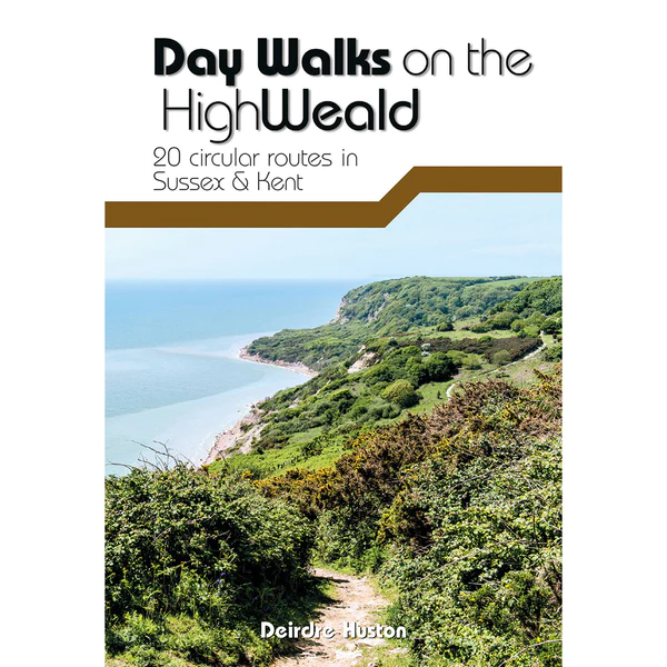
Day Walks on the High Weald features 20 circular routes between 6.5 and 13.9 miles (10.5km and 22.4km) in length, spread across this Area of Outstanding Natural Beauty in the south-east of England. Local author Deirdre Huston has compiled her favourite walks in the region, which showcase the High Weald's rich history and varied landscape. Walk down old coach roads. Clamber through deserted woodland and along riverbanks. March past castles and skirt battlefields. Linger in meadows and leap across Wealden streams. See the countryside that inspired A.A. Milne and Rudyard Kipling. Visit Hastings Country Park, stroll around Bewl Water and through tranquil St Leonard's Forest. Marvel at the Ouse Valley Viaduct and Bodiam castle, and consider the epic history of Battle and its surrounding landscape. Together with stunning photography, each route features Ordnance Survey 1:25,000 maps, easy-to-follow directions, details of distance and navigation information, and refreshment stops and local information.
€20,95
Bekijk product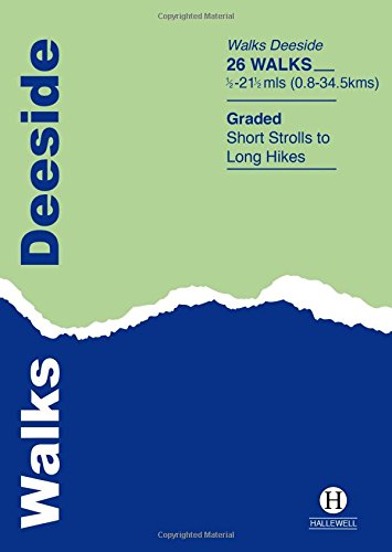
This guide covers the walks around Royal Deeside: Banchory, Aboyne, Ballater and Braemar, as well as Balmoral. Routes include climbs in the Cairngorm National Park, hill paths around Loch Muick and gentler walks in the Dee valley. Walks range from 0.5 miles to 21.5 miles (0.8-34.5km). Routes include: Ben Macdui, Lochnagar, Jock’s Road and Craigendarroch.
€5,95
Bekijk product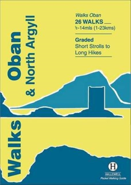
Rewalked and updated in 2018, Walks Oban & North Argyll covers the area around the popular coastal town of Oban, the offshore islands which can be reached from the town, and inland as far as Bridge of Orchy. The coastal area and islands are fairly gentle in character, but there are some fine, challenging hill walks inland. The 26 walks featured range from 0.5 miles to 14 miles (1-23km). Routes include: Oban to Gallanach, two routes on Lismore, Ben Cruachan and Bridge of Orchy to Tyndrum. Part of a popular series of A6 pocket walking guides which describe routes which are suitable for walkers of all abilities and to suit all tastes. Route descriptions are accompanied by 2-colour sketch maps. The guides are illustrated with line illustrations, and will provide walkers with a good introduction to what each area covered has to offer.
€5,95
Bekijk product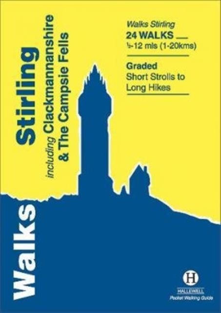
Rewalked and revised in 2021, Walks Stirling (a new edition of our previous guide to Stirling & District) features 24 walks, and now covers the Campsie Fells as well as the western Ochil Hills and the area around the head of the Forth Estuary. There are some fine hill walks, plus long distance paths and coastal walks. Walks range from 0.5 miles to 12 miles (1.2-20kms). Routes include: Dumyat, Ben Cleuch, Dollar to Auchterardar and Dumgoyne. Rewalked and revised 2010 this is part of a popular series of A6 pocket walking guides which describe routes which are suitable for walkers of all abilities and to suit all tastes. Route descriptions are accompanied by 2-colour sketch maps. The guides are illustrated with line illustrations, and will provide walkers with a good introduction to what each area covered has to offer.
€5,95
Bekijk product