
Beantwoord enkele vragen, en binnen seconden geeft AI je een persoonlijk aankoopadvies op maat.
Beantwoord enkele vragen, en binnen seconden geeft AI je een persoonlijk aankoopadvies op maat.

GIds met zowel autotochten, fietstochten en wandelroutes. The go-to Ibiza walking guide for over 30 years. Strap on your boots and discover Ibiza and Formentera on foot with the Sunflower Ibiza travel guide. And on the days when your feet may have had enough, enjoy some spectacular scenery on one of our legendary car or bike tours. The Sunflower Ibiza guide is indispensable for hiking in Ibiza or seeing Ibiza by car. There's an unending wealth of hidden beauty spots to be discovered, and this book helps you to find the best of Ibiza and Formentera by car, bicycle, or on foot. Routes have been recently checked for this new edition of our guidebook to walking in Ibiza and Formentera and there are two bonuses: firstly, there are GPS tracks for all the treks and cycle tours; secondly, for the adventurous, the author has described a round-the-island hike for which detailed stages and GPS tracks are available. Inside the Sunflower Ibiza guide book you'll find:27 long and short walks for all ages and abilities - each walk is graded so you can easily match your ability to the level of walk11 cycle toursTopographical walking maps - give you a clear sense of the surrounding terrainFree downloadable gps tracks - for the techiesSatnav guidance to walk starts for motorists 3 car tours and fold-out touring map - for easy reference on your tour Strolls to idyllic picnic spots - enjoy our recommendations for where to picnic along the wayTimetables for public transport - ideal if you want to link two walks or avoid hiring a car on your holidayOnline update service for the latest information Whether you decide to tour Ibiza and Formentera by bicycle, car or explore on foot we look forward to showing you around.
€21,95
Bekijk product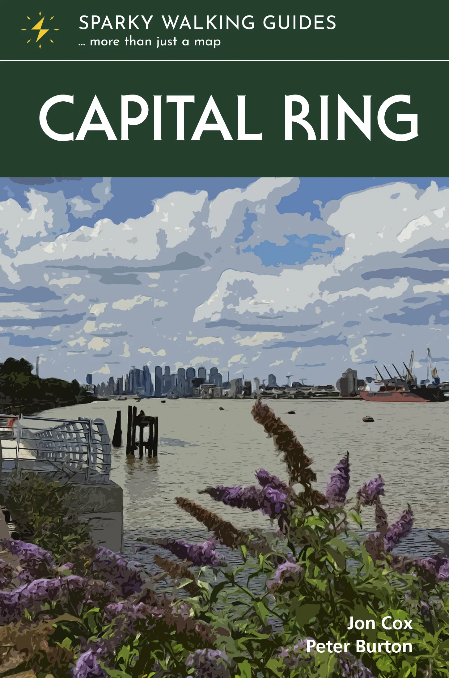
The Capital Ring traces a 78-mile loop between outer and inner London. Linking the city’s diverse communities and districts via green corridors, it provides a fascinating window into the ever-changing capital and the stories of those who have made it home. The variety is dizzying. Flitting between the urban and bucolic, you walk streets humble and high-class, across parks and woodlands, past palaces and factories, beside canals and rivers, taking in world-renowned sights and intriguing backwaters, and with frequent stunning views. No matter how well you think you know the metropolis, the Capital Ring will help you see London with fresh eyes. Guaranteed. * super-clear OS town mapping, with the trail highlighted so you can see it at a glance * information nuggets throughout bring the city alive – past and present, seen and unseen * a handy slip-into-your-pocket design, with cover flaps to mark your page * planning info – practical help to plan your hike, including an overview map of the whole trail * stage descriptors, giving you an overview of what to expect on each leg * links to inspirational resources – websites and books to help you dive deeper * flora & fauna – pictorial guides to nature’s riches along the trail
€24,95
Bekijk product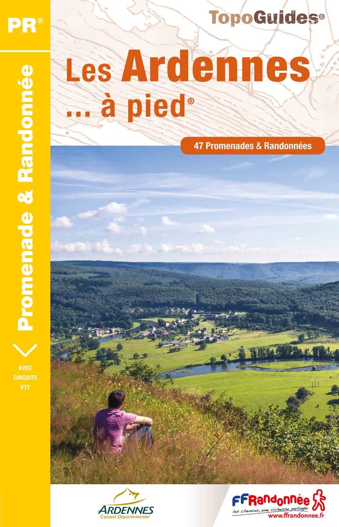
Franstalige wandelgids met een beschrijving van een aantal dagtochten. Uitstekende beschrijvingen met duidelijk kaartmateriaal. Mislopen is nauwelijks mogelijk, maar ja .. de franse taal! Ook praktische informatie staat in deze gids. We doen er een kleine wandelwoordenlijst bij! Méandres de la Meuse et grandes forêts autour de Monthermé et de Rocroi. Ce topo-guide contient des circuits équestres et VTT. "La forêt profonde" ("sylva arduina" en langue celte), c'est ainsi que Jules César qualifie les Ardennes dans sa "Guerre des Gaules". Et c'est en effet une immense forêt au relief quasi montagnard qui, au Nord, couvre un tiers du département; refuge de son animal emblématique : le sanglier. Mais les Ardennes, département pluriel, c'est aussi les fortifications de Rocroi et Sedan, les édifices abbatiaux du Mont-Dieu et de Mouzon, les maisons à pans de bois du Porcien; contrées multiples offrant le plaisir de remonter dans le temps.
€18,50
Bekijk product
Franstalige wandelgids met een beschrijving van een aantal dagtochten. Uitstekende beschrijvingen met duidelijk kaartmateriaal. Mislopen is nauwelijks mogelijk, maar ja .. de franse taal! Ook praktische informatie staat in deze gids. Alle gidsen bevatten een door ons toegevoegde uitgebreide frans - nederlandse wandelwoordenlijst. Dans la belle et profonde forêt jurassienne refuge du lynx et du grand-tétras. Le Jura est synonyme de paysages enchanteurs et variés. Cette région est une succession de terroirs à l'identité prononcée. Vallons tout en douceurs au nord de Dole, mosaïque bleutée des étangs de la Bresse,vignobles du Revermont sertis de reculées, petite montagne plissée de crêtes, plateaux jalonnés de villages isolés, région des lacs, Haut-Jura des monts escarpés parcourus de torrents et de cascades,les panoramas se suivent et ne se ressemblent pas.
€19,95
Bekijk product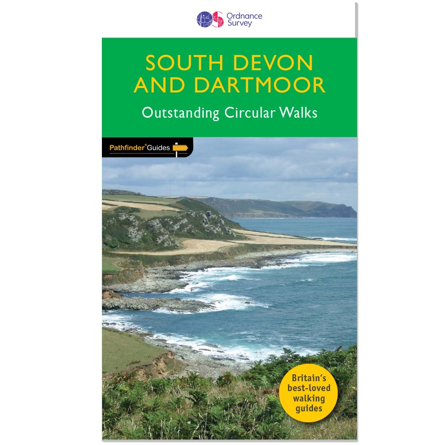
Wandelgids van een deel van Engeland. Deze gids bevat 28 dagwandelingen, variërend van korte tochten tot pittige dagtochten. De bijbehorende kaarten zijn uitstekend: men heeft de topografische kaarten van Ordnance Survey gebruikt waarop de route is ingetekend. Daarnaast praktische informatie over de wandeling en wat beschrijvingen van het gebied. Each of the Pathfinder titles features 28 circular routes, all tried and tested by seasoned walkers. The routes range from extended strolls to exhilarating hikes, so there is something for everyone. They also contain: -Ordnance Survey mapping; -background details of each area; -details of refreshment stops and parking; -walking safety advice; and -information about walkers and the law
€18,50
Bekijk product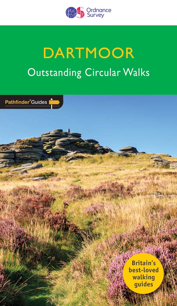
Wandelgids van een deel van Engeland. Deze gids bevat 28 dagwandelingen, variërend van korte tochten tot pittige dagtochten. De bijbehorende kaarten zijn uitstekend: men heeft de topografische kaarten van Ordnance Survey gebruikt waarop de route is ingetekend. Daarnaast praktische informatie over de wandeling en wat beschrijvingen van het gebied. Each of the Jarrold Pathfinder titles features 28 circular routes, all tried and tested by seasoned walkers. The routes range from extended strolls to exhilarating hikes, so there is something for everyone. They also contain: -Ordnance Survey mapping; -background details of each area; -details of refreshment stops and parking; -walking safety advice; and -information about walkers and the law
€18,50
Bekijk product
Engelstalige beschrijving van de mooiste wandeltocht op Corsica. De gids voldoet aan alle verwachtingen die je kunt hebben. Wel heb je voor de zwaardere gedeelte voor de zekerheid goede kaarten nodig ...... The GR20, on the mountainous Mediterranean island of Corsica, is reputated to be the toughest waymarked trail in Europe. This ambitious route for fit and agile walker covers 190km as it makes a complete traverse through the island's high mountains. It can be completed in about two weeks, and calls for backpacking the whole way, sometimes with hands-on scrambling along the way. Facilities are limited to a dozen mountain refuges and a mere handful of hotels or gîtes. The ‘classic’ route is described in the guide, along with high and low-level alternatives, plus extra mountain climbs. This guide explains exactly what is involved in following the GR20, including what walkers need to carry. In the past, many have carried too much, or carried the wrong things, or simply had no idea how difficult the route is in places, but this guide reveals everything you need to know. Detailed route descriptions and stunning photographs leave walkers in no doubt as to what is required of them to walk this exceptionally beautiful, dramatic and rugged route.
€24,95
Bekijk product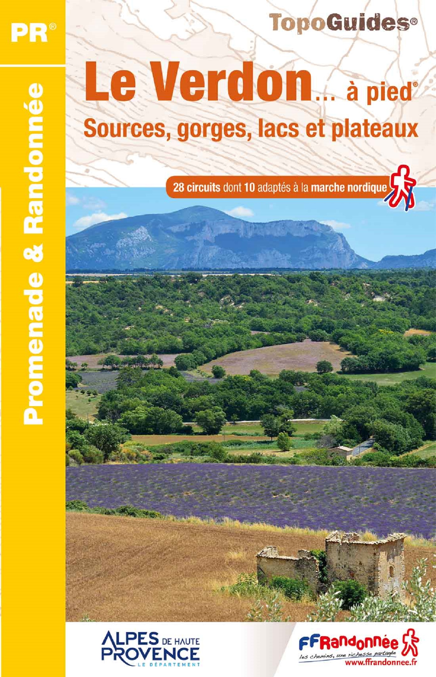
Franstalige wandelgids met een beschrijving van een aantal dagtochten. Uitstekende beschrijvingen met duidelijk kaartmateriaal. Mislopen is nauwelijks mogelijk, maar ja .. de franse taal! Ook praktische informatie staat in deze gids. Alle gidsen bevatten een door ons toegevoegde uitgebreide frans - nederlandse wandelwoordenlijst. "Le Verdon s'étire d'est en ouest entre Var et Alpes-de-Haute-Provence. Il traverse une vaste zone de moyenne montagne jalonnée d'agglomérations perchées sur les reliefs ou installées au cour du plateau de Valensole. Longer la rivière, c'est découvrir des paysages rares : escarpements enrésinés, eaux vertes des lacs de barrages, chaos rocheux, falaises et canyons vertigineux, sérénité des collines, oliviers et lavandes à perte de vue. C'est marcher au paradis de la randonnée. les marcheurs sportifs et entraînés apprécieront le célèbre sentier Martel, qui descend au fond du Grand Canyon. Les familles aimeront flâner dans les ruelles et autours des antiques cités de Castellane, Riez et Moustiers-Ste-Marie."
€16,50
Bekijk product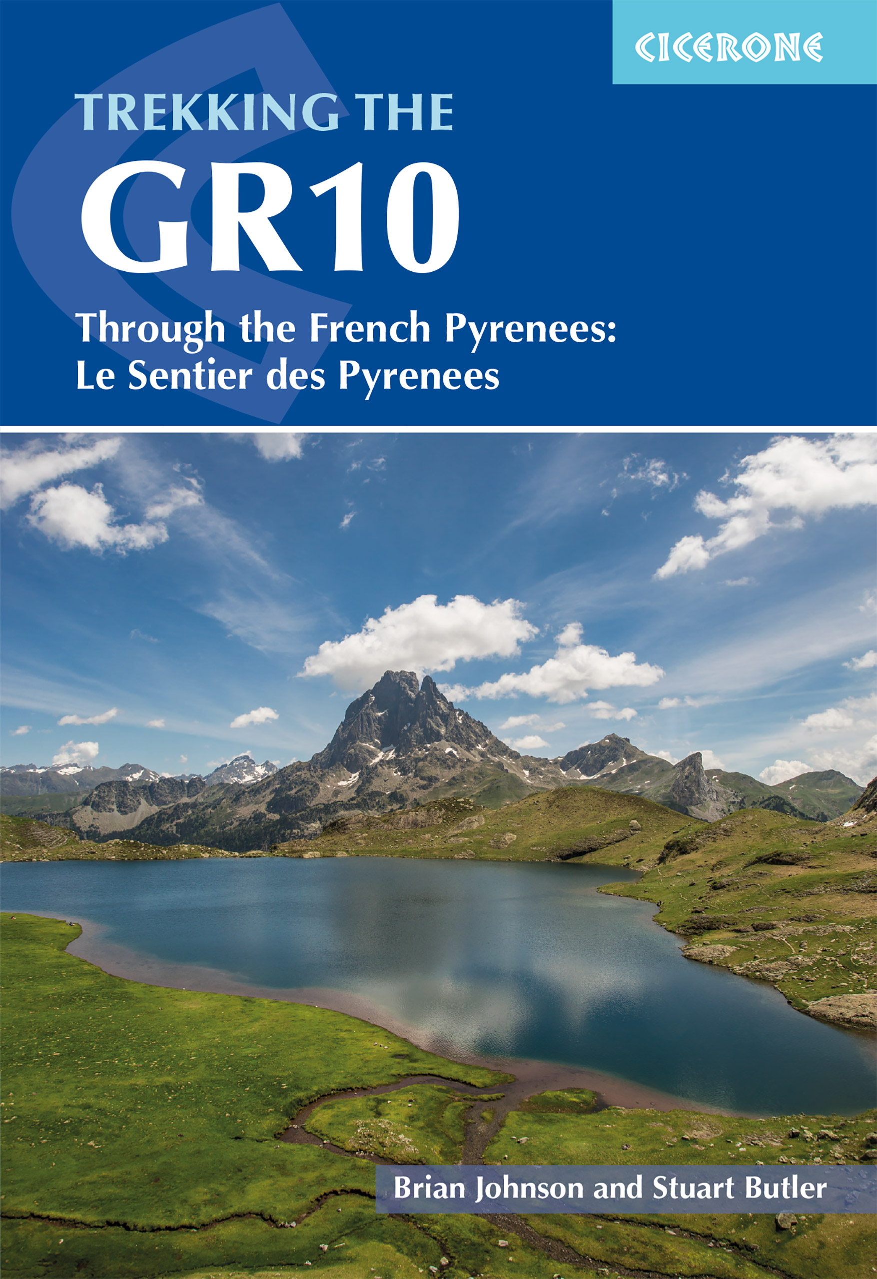
Engelstalige beschrijving van de mooiste wandeltocht in de Pyreneeen. De gids voldoet aan alle verwachtingen die je kunt hebben. Wel heb je voor de zwaardere gedeelte voor de zekerheid goede kaarten nodig ...... Guidebook to the GR10, a 955km trek across the French Pyrenees from Hendaye on the Atlantic Coast to the Mediterranean coast at Banyuls-sur-Mer. Described in 55-day stages, the route can be completed in its entirety, or in shorter sections using the bus and rail links found throughout the Pyrenees. Step by step route descriptions are accompanied by 1:100,000 mapping and gradient profiles. Useful practical information is also included such as when to go, getting there and back, camping, accessing fuel and water, plus handy equipment tips and more. The easiest, oldest and most popular of the three long-distance routes that traverse the mountain range, the GR10 is well waymarked and follows good mountain paths. For many walkers, the highlight of the route is the magnificent wildflowers and associated butterflies. For others, it’s the spectacular mountain terrain, while those keen on bird watching will delight in scanning the sky for the many varieties of birds of prey that can be seen in the region, from the massive Griffon vulture to the distinctly coloured Egyptian vulture. Steden en Dorpen Hendaye-Plage on the Atlantic coast to Banyuls-sur-Mer on the Mediterranean through the French Pyrenees.
€26,50
Bekijk product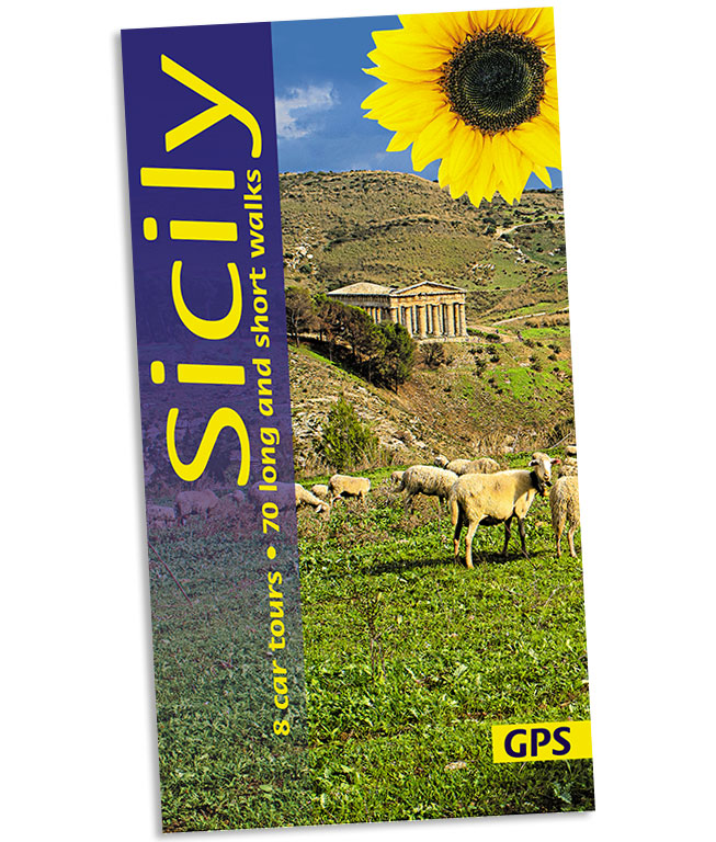
Wandelgids: vele dagtochten worden degelijk beschreven met openbaar vervoer informatie, goede routebeschrijvingen en kaartmateriaal. Tevens enkele autotochten. (Engelstalig) Sicily, the largest island in the Mediterranean and long a Mecca for culture freaks, also rewards the countryside lover with its magnificent landscapes. Peter Amann knows the island intimately; he leads walking groups on Sicily and works for the preservation of its monuments. There is enough material in this book for several holidays. For those touring Sicily by car, the eight car tours (mostly circular and covering 2000 km) follow little-used secondary roads wherever possible. If you’re walking in Sicily, the routes are as varied in length and grade as the landscape itself — a distillation of the best on the island. The best months for walking in Sicily are March to June and September to November. Area covered: the entire island except for the far southwest corner.
€21,95
Bekijk product