
Beantwoord enkele vragen, en binnen seconden geeft AI je een persoonlijk aankoopadvies op maat.
Beantwoord enkele vragen, en binnen seconden geeft AI je een persoonlijk aankoopadvies op maat.

Rewalked and revised in 2021, Walks Exmoor features walks in the Exmoor National Park - a beautiful area including moorland, farmland, wooded valleys and stunning coastal scenery. (The major settlements - Minehead, Ilfracombe and Barnstaple - are all just outside the area.) The 20 walks in the guide range from 1 to 9 miles (1.6 14.4km). The bulk of the routes are in the northern coastal strip (the guide contains a number of short walks from the South West Coast Path), including the path from Lynmouth to the stunning Valley of Rocks and a group of linked walks on Bossington Hill (by Minehead). Elsewhere there is a fine riverside walk to the ancient footbridge of Tarr Steps. Walks Exmoor is part of a popular series of A6 pocket walking guides which describe routes which are suitable for walkers of all abilities and to suit all tastes. Route descriptions are accompanied by 2-colour sketch maps. The guides are illustrated with line illustrations, and will provide walkers with a good introduction to what each area covered has to offer.
€5,95
Bekijk product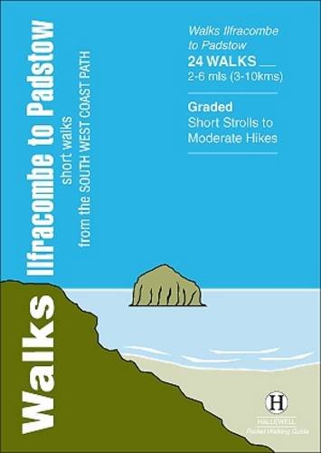
Walks Ilfracombe to Padstow features a selection of the best short walks from the section of South West Coast Path which runs between the towns of Ilfracombe in the north and Padstow in the south. The 24 walks featured range from 2 to 6 miles (3 - 10kms) and range from a short strolls to moderately testing hikes - along cliffs, through dunes, by sandy beaches and muddy creeks. Highlights of the book include cliff walks around the lovely villages of Clovelly and Tintagel, with its dramatic ruined castle, and the sandy beaches at Woolacombe and Rock on the Camel Estuary. This is a highly attractive area with a mass of good walks and the towns and villages along the coast make excellent bases for walking.
€5,95
Bekijk product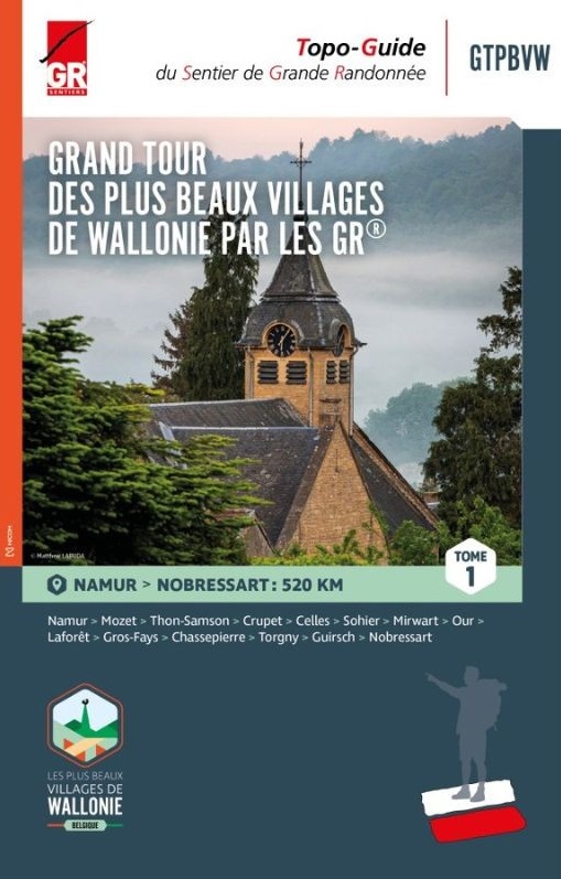
Wandelgids in 3 delen langs de mooiste dorpen van Wallonië Deze route is grotendeel gebaseerd op het bestaande GR- en GRP-netwerk en vormt een 1.500 kilometer lange route die deze 32 karaktervolle dorpen met elkaar verbindt. De gidsen bevatten routes, beschrijvingen en gedetailleerde kaarten. Een specifieke GTPBVW-markering werd geplaatst om de route te markeren. Deze staat verder uit elkaar dan de traditionele GR streepjesmarkeringen. Je wandelt door prachtige landschappen en regio's die soms weinig bekend zijn, maar die je elke keer betoverende plekken laten ontdekken, gelegen in een rijke natuurlijke omgeving en in goed bewaarde oorden waar het onroerend erfgoed de geschiedenis van onze voorouders laat weerklinken. Deel 1: Namur - Nobressart (520 km) Deel 2: Nobressart - Mélin (480 km) Deel 3: Mélin - Namur (525 km) Le topo-guide à thème (GRT), "LES BEAUX VILLAGES DE WALLONIE PAR LES GR GTPBVW®" rédigé en trois tomes, vous invite à parcourir la Wallonie et ses régions si particulières avec pour objectif la découverte des 33 villages labellisés « Plus Beaux Villages de Wallonie » qui font la fierté de leurs habitants et des Wallons amoureux du patrimoine. Cet itinéraire s’appuie sur le réseau GR et déroule un tapis rouge long de 1500 kilomètres reliant 33 villages de caractère. De manière plus espacée, une balise spécifique GTPBVW jalonne le parcours. Vous sillonnerez des paysages magnifiques et des contrées parfois mal connues mais qui, à chaque fois, vous feront découvrir des endroits enchanteurs, logés dans un environnement naturel riche, des endroits préservés où le patrimoine bâti fait résonner l’histoire de nos ancêtres. Les Plus Beaux Villages de Wallonie par les Sentiers GR sont à vos pieds… À vous d’en profiter ! La plupart des chemins empruntés sont basés sur le réseau des GR et GRP existant. Parcours, descriptifs et cartographies détaillées sont à votre disposition dans ce guide rédigé en trois tomes. Vous accommoderez vos parcours selon vos envies, par tronçons, en organisant de courts séjours ou en ciblant une région. À vous de choisir ! L’essentiel est d’inciter chacun à voyager au plus près de chez soi : là où la nature et les richesses se trouvent, au coin d’un sentier ou d’une ruelle … l’aventure commence et est accessible à tous. Le Tome 1 démarre à Namur et vous mènera dans 13 villages jusqu’au Beau Village de Nobressart en province de Luxembourg. Vous sillonnerez le Condroz, la Fagne-Famenne, l’Ardenne et la Lorraine. Tome 1 - de Namur à Nobressart Étape 1 : Namur – Mozet Étape 2 : Mozet – Thon-Samson Étape 3 : Thon-Samson – Crupet Étape 4 : Crupet – Celles Étape 5 : Celles – Sohier Étape 6 : Sohier – Mirwart Étape 7 : Mirwart – Our Étape 8 : Our – Laforêt Étape 9 : Laforêt – Gros-Fays Étape 10 : Gros-Fays – Chassepierre Étape 11 : Chassepierre – Torgny Étape 12 : Torgny – Guirsch Étape 13 : Guirsch – Nobressart
€25,95
Bekijk product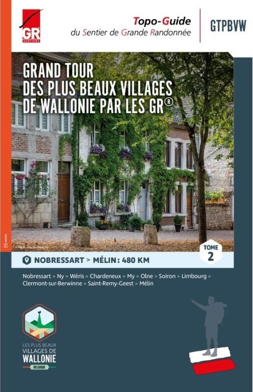
Wandelgids in 3 delen langs de mooiste dorpen van Wallonië Deze route is grotendeel gebaseerd op het bestaande GR- en GRP-netwerk en vormt een 1.500 kilometer lange route die deze 32 karaktervolle dorpen met elkaar verbindt. De gidsen bevatten routes, beschrijvingen en gedetailleerde kaarten. Een specifieke GTPBVW-markering werd geplaatst om de route te markeren. Deze staat verder uit elkaar dan de traditionele GR streepjesmarkeringen. Je wandelt door prachtige landschappen en regio's die soms weinig bekend zijn, maar die je elke keer betoverende plekken laten ontdekken, gelegen in een rijke natuurlijke omgeving en in goed bewaarde oorden waar het onroerend erfgoed de geschiedenis van onze voorouders laat weerklinken. Deel 1: Namur - Nobressart (520 km) Deel 2: Nobressart - Mélin (480 km) Deel 3: Mélin - Namur (525 km) Le topo-guide à thème (GRT), "LES BEAUX VILLAGES DE WALLONIE PAR LES GR GTPBVW®" rédigé en trois tomes, vous invite à parcourir la Wallonie et ses régions si particulières avec pour objectif la découverte des 33 villages labellisés « Plus Beaux Villages de Wallonie » qui font la fierté de leurs habitants et des Wallons amoureux du patrimoine. Cet itinéraire s’appuie sur le réseau GR et déroule un tapis rouge long de 1500 kilomètres reliant 33 villages de caractère. De manière plus espacée, une balise spécifique GTPBVW jalonne le parcours. Vous sillonnerez des paysages magnifiques et des contrées parfois mal connues mais qui, à chaque fois, vous feront découvrir des endroits enchanteurs, logés dans un environnement naturel riche, des endroits préservés où le patrimoine bâti fait résonner l’histoire de nos ancêtres. Les Plus Beaux Villages de Wallonie par les Sentiers GR sont à vos pieds… À vous d’en profiter ! La plupart des chemins empruntés sont basés sur le réseau des GR et GRP existant. Parcours, descriptifs et cartographies détaillées sont à votre disposition dans ce guide rédigé en trois tomes. Vous accommoderez vos parcours selon vos envies, par tronçons, en organisant de courts séjours ou en ciblant une région. À vous de choisir ! L’essentiel est d’inciter chacun à voyager au plus près de chez soi : là où la nature et les richesses se trouvent, au coin d’un sentier ou d’une ruelle … l’aventure commence et est accessible à tous. Le Tome 1 démarre à Namur et vous mènera dans 13 villages jusqu’au Beau Village de Nobressart en province de Luxembourg. Vous sillonnerez le Condroz, la Fagne-Famenne, l’Ardenne et la Lorraine. Le Tome 2 vous mènera dans 10 villages de Nobressart à celui de Mélin en Brabant wallon. Vous sillonnerez la Lorraine, le Condroz, la Fagne-Famenne, le pays de Herve et la Hesbaye. Le Tome 3 vous enverra dans 10 autres villages sillonner la Hesbaye, les Plateaux limoneux brabançon et hennuyer, la Fagne-Famenne et le Condroz. Étape 14 : Nobressart – Ny Étape 15 : Ny – Wéris Étape 16 : Wéris – Chardeneux Étape 17 : Chardeneux – My Étape 18 : My – Olne Étape 19 : Olne – Soiron Étape 20 : Soiron – Limbourg Étape 21 : Limbourg – Clermont-sur-Berwinne Étape 22 : Clermont-sur-Berwinne – Saint-Remy-Geest Étape 23 : Saint-Remy-Geest – Mélin
€25,95
Bekijk product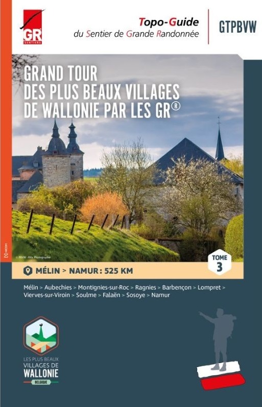
Wandelgids in 3 delen langs de mooiste dorpen van Wallonië Deze route is grotendeel gebaseerd op het bestaande GR- en GRP-netwerk en vormt een 1.500 kilometer lange route die deze 32 karaktervolle dorpen met elkaar verbindt. De gidsen bevatten routes, beschrijvingen en gedetailleerde kaarten. Een specifieke GTPBVW-markering werd geplaatst om de route te markeren. Deze staat verder uit elkaar dan de traditionele GR streepjesmarkeringen. Je wandelt door prachtige landschappen en regio's die soms weinig bekend zijn, maar die je elke keer betoverende plekken laten ontdekken, gelegen in een rijke natuurlijke omgeving en in goed bewaarde oorden waar het onroerend erfgoed de geschiedenis van onze voorouders laat weerklinken. Deel 1: Namur - Nobressart (520 km) Deel 2: Nobressart - Mélin (480 km) Deel 3: Mélin - Namur (525 km) Le topo-guide à thème (GRT), "LES BEAUX VILLAGES DE WALLONIE PAR LES GR GTPBVW®" rédigé en trois tomes, vous invite à parcourir la Wallonie et ses régions si particulières avec pour objectif la découverte des 33 villages labellisés « Plus Beaux Villages de Wallonie » qui font la fierté de leurs habitants et des Wallons amoureux du patrimoine. Cet itinéraire s’appuie sur le réseau GR et déroule un tapis rouge long de 1500 kilomètres reliant 33 villages de caractère. De manière plus espacée, une balise spécifique GTPBVW jalonne le parcours. Vous sillonnerez des paysages magnifiques et des contrées parfois mal connues mais qui, à chaque fois, vous feront découvrir des endroits enchanteurs, logés dans un environnement naturel riche, des endroits préservés où le patrimoine bâti fait résonner l’histoire de nos ancêtres. Les Plus Beaux Villages de Wallonie par les Sentiers GR sont à vos pieds… À vous d’en profiter ! La plupart des chemins empruntés sont basés sur le réseau des GR et GRP existant. Parcours, descriptifs et cartographies détaillées sont à votre disposition dans ce guide rédigé en trois tomes. Vous accommoderez vos parcours selon vos envies, par tronçons, en organisant de courts séjours ou en ciblant une région. À vous de choisir ! L’essentiel est d’inciter chacun à voyager au plus près de chez soi : là où la nature et les richesses se trouvent, au coin d’un sentier ou d’une ruelle … l’aventure commence et est accessible à tous. Tome 3 - de Mélin à Namur Étape 24 : Mélin – Aubechies Étape 25 : Aubechies – Montignies-sur-Roc Étape 26 : Montignies-sur-Roc – Ragnies Étape 27 : Ragnies – Barbençon Étape 28 : Barbençon – Lompret Étape 29 : Lompret – Vierves-sur-Viroin Étape 30 : Vierves-sur-Viroin – Soulme Étape 31 : Soulme – Falaën Étape 32 : Falaën – Sosoye Étape 33 : Sosoye – Namur
€25,95
Bekijk product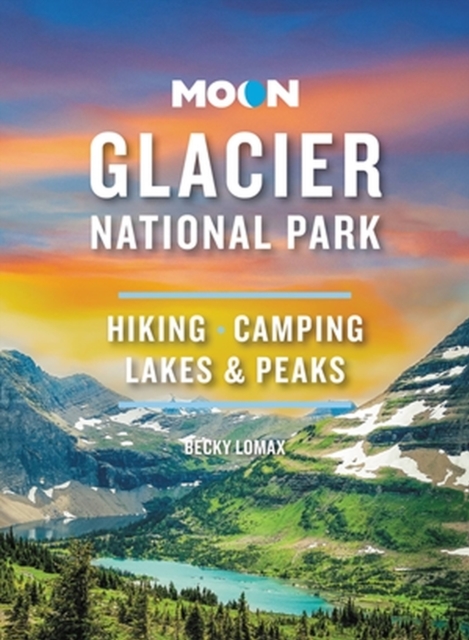
Through lush green parkland and up to the top of jagged summits, forge your own path with Moon Glacier National Park. Flexible Itineraries: Unique and adventure-packed ideas for day trips, a week on the road, families with kids, wildlife enthusiasts, and more The Best Hikes in Glacier: Individual trail maps, mileage and elevation gains, and backpacking options Experience the Outdoors: Trek through fields of alpine wildflowers and walk beneath waterfalls. Go whitewater rafting, cast a line into the Flathead River for wild trout, or hop on a guided horseback ride. Drive or bike the Going-to-Sun Road, take in views of snowy peaks and glaciers, and spot wild moose or grizzlies roaming the mountainside How to Get There: Up-to-date information on gateway towns, park entrances, park fees, and tours Where to Stay: Spend a night in a historic lakeside lodge, or sleep under the stars with campgrounds, resorts, and more both inside and outside the park Planning Tips: When to go, what to pack, safety information, and how to avoid the crowds, with full-color photos and detailed maps throughout Expertise and Know-How: Explore Glacier with former park guide and Whitefish local Becky Lomax Experience the best of Glacier National Park with Moon. Visiting more of North America's national parks? Try Moon Yellowstone & Grand Teton. Trying to hit them all? Check out Moon USA National Parks. About Moon Travel Guides: Moon was founded in 1973 to empower independent, active, and conscious travel. We prioritize local businesses, outdoor recreation, and traveling strategically and sustainably. Moon Travel Guides are written by local, expert authors with great stories to tell--and they can't wait to share their favorite places with you. For more inspiration, follow @moonguides on social media.
€23,95
Bekijk product
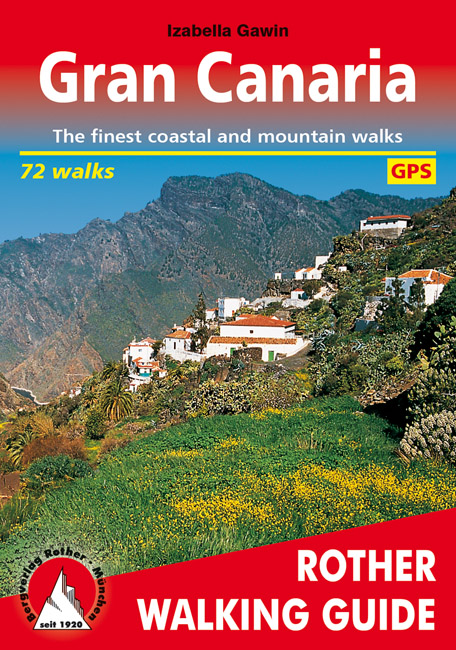
Gran Canary not only enjoys a fabulous reputation as a paradise of sunshine and beaches; it can also be described as one of the most versatile hiking islands of the Canary Archipelago. Connoisseurs praise it as a miniature continent because of its diversity of landscapes: shimmering dunes in contrast with luscious subtropical valleys, deep ravines with palm tree oases and glittering reservoirs, next to which are extensive pine tree forests and green slopes with grazing sheep and goats. To the North West cliffs drop down 800 m deep into the ocean, while in the centre of the island serrated, almost 2000 metre high ridges and bizarre rock monoliths emerge, which the Spanish writer Miguel de Unamuno once interpreted as »fossilised storms of fire and lava. This Rother walking guide includes excursions to beaches and spectacular cave villages, walks through pine forests and atmospheric ridge paths. Due to the increased significance of hiking tourism, parts of what at times are more than 500 year old rocks have been carefully restored over the last years. These Caminos Reales (royal paths) stretch across the entire island and used to link remote mountain villages with coastal territory. Many proposed tours follow these mainly stone-paved hiking paths and are therefore also ideal for less experienced hikers. Experienced mountain hikers who are not afraid of dramatic walks will also find a rich offer of tours. The first comprehensive hiking guide on Gran Canary leaves nothing to desire! Coloured illustrations and excellent hiking maps at an ideal scale of 1:50,000/1:75,000 round off the picture and awaken the curiosity for ever new excursions into the charmingly bizarre world of the mountains. The Rother walking guide has been completely revised for this edition and added to 32 routes.
€18,50
Bekijk product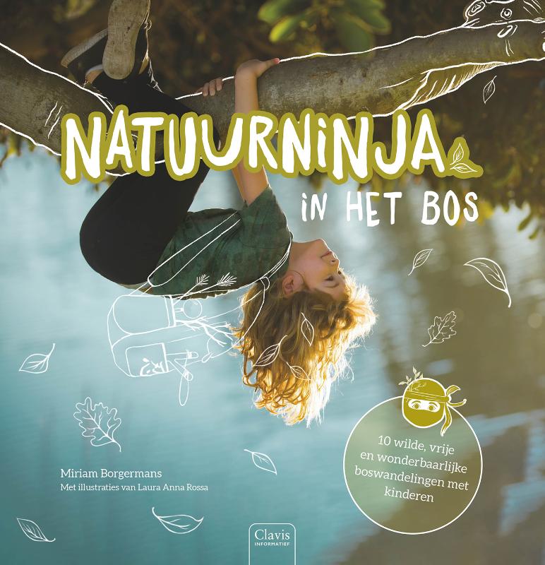
Wandelen saai? Deze heerlijk speelse en inspirerende wandelingen vol NATUURNINJASKILLS prikkelen kinderen om weer in contact te komen met natuur. Door hun ninja binnenin ontdekken ze ook hun verbeelding en leren ze hun eigen monsters verslaan. Natuurtherapie en avontuur? Waar wacht je nog op? Trek onmiddellijk je wandelschoenen aan en volg het pad van de NINJA! Voor frisse neusjes vanaf 5 jaar – en iedereen die met kinderen werkt en ze af en toe in een plas wil gooien. En hun schermen ook.
€29,95
Bekijk product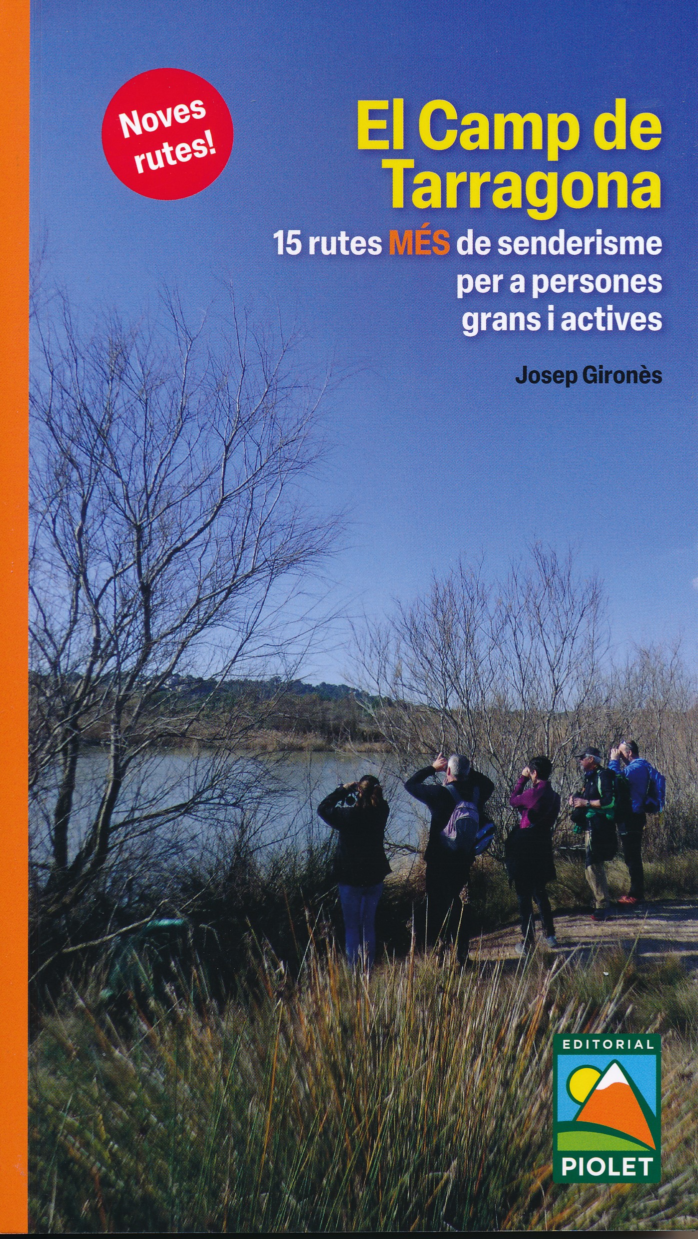
Spaanstalige wandelgids in het gebied van Tarragona. Goede beschrijvingen van de 15 wandelroutes met een degelijke kaart. Después de una primera guía de estas mismas características presentamos 15 rutas MÁS de senderismo por el Camp de Tarragona pensadas para que las puedan realizar personas mayores y activas con una mínima preparación física y con ganas de andar. Trazados con un recorrido inferior a los 15 km. El Camp de Tarragona está formado por las comarcas del Alt Camp, Baix Camp, Baix Penedès, Conca de Barberà, Priorat y Tarragonès. Tiene una orografía muy variada, desde las alturas próximas a los mil metros de la cordillera prelitoral hasta el mar Mediterráneo. Uitgever: Na een eerste gids met dezelfde kenmerken presenteren we 15 MEER wandelroutes door Camp de Tarragona, ontworpen om te worden uitgevoerd door oudere en actieve mensen met minimale fysieke voorbereiding en de wens om te lopen. Routes met een route kleiner dan 15 km. Camp de Tarragona bestaat uit de regio's Alt Camp, Baix Camp, Baix Penedès, Conca de Barberà, Priorat en Tarragonès. Het heeft een zeer gevarieerde orografie, van hoogten van bijna duizend meter van het pre-kustgebergte tot aan de Middellandse Zee.
€5,00
Bekijk product