
Beantwoord enkele vragen, en binnen seconden geeft AI je een persoonlijk aankoopadvies op maat.
Beantwoord enkele vragen, en binnen seconden geeft AI je een persoonlijk aankoopadvies op maat.
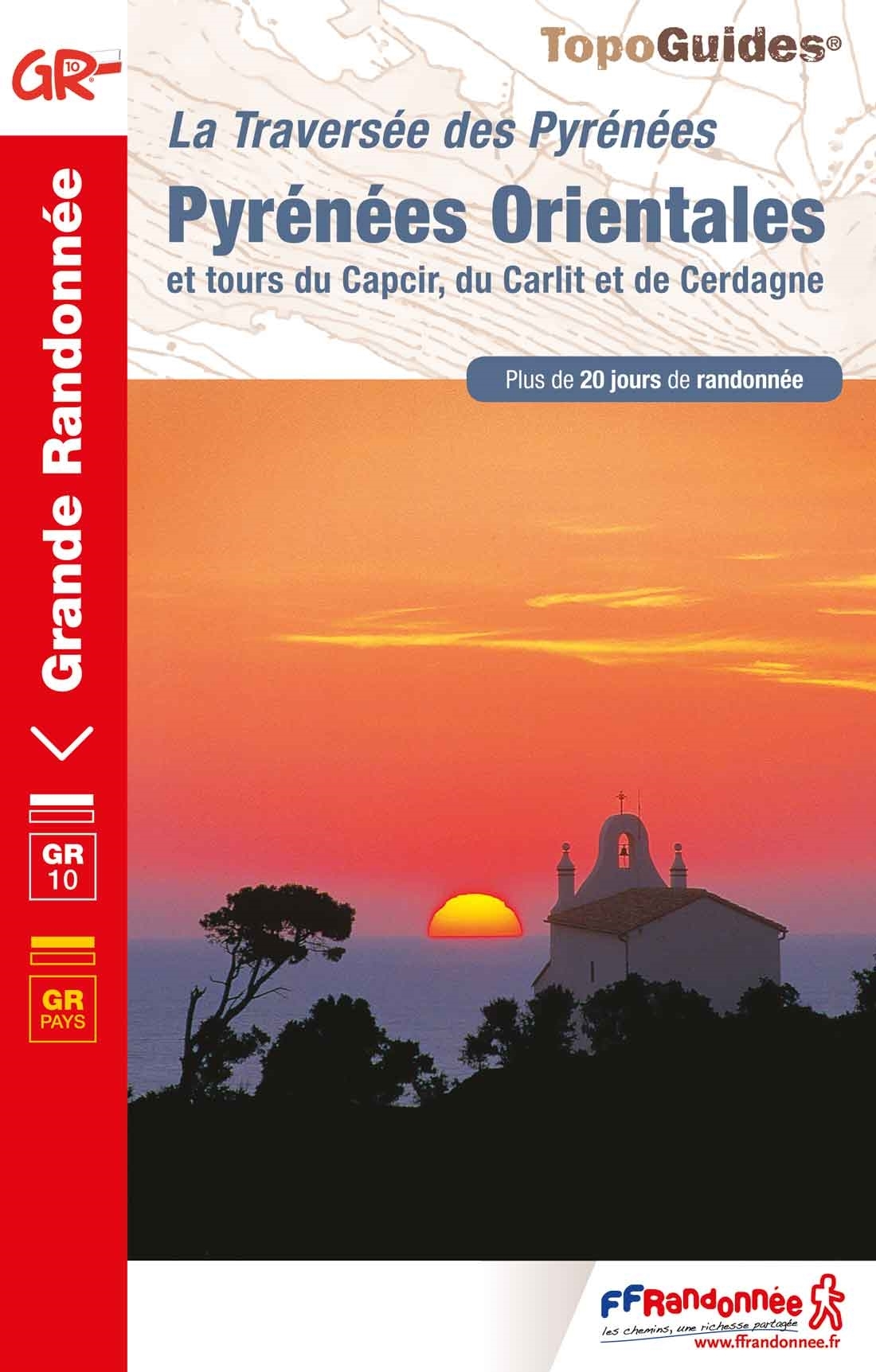
Franstalige wandelgids van de GR10. Uitstekende beschrijving met gedetailleerd kaartmateriaal (topografisch, IGN) en veel praktische informatie over zwaarte, hoogte en hutten. Bijna onmisbaar voor het lopen van deze route. In andere beschrijvingen zijn geen goede kaarten bijgevoegd! Wij leveren er een beknopte Frans-Nederlandse woordenlijst bij. Dit deel beschrijft de route van Mérens les Vals - Banyuls sur Mer + enkele zijtakken. Merens les Vals, Madres, Canigou, Pla de Bezou, Col du Puits de la Neige naar Banyuls sur Mer Entre les hauts sommets du Carlit à près de 3000 mètres d'altitude, la chaîne frontière et le massif mythique du Canigou, entre la mer et les contreforts du Fenouillèdes et des Corbières, les Pyrénées-Orientales méritent à juste titre de figurer parmi les plus beaux stades de randonnée. Pays chargé d'histoire et de culture, où se côtoient tous les reliefs, tous les climats, tous les étages de végétation, il offrira à ceux qui sauront cheminer sur ses sentiers la richesse de son patrimoine naturel et la splendeur de ses paysages et de ses couleurs. Cette dernière tranche du GR®10, mènera le marcheur de Mérens à Banyuls en une douzaine de jours. L'intérêt de l'ouvrage réside également dans la présence de trois boucles (à parcourir en 3 à 4 jours) qui décrivent le Capcir méconnu, la Cerdagne aux accents espagnols ou encore le Tour du Carlit, l'un des plus hauts sommets de la région avec ses 2921 mètres.
€19,95
Bekijk product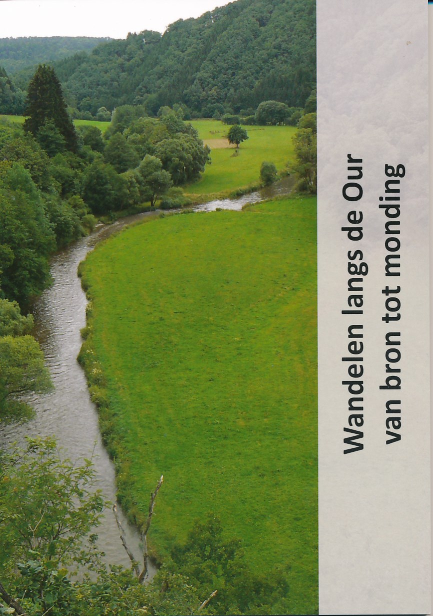
Het boekje (80 pagina's) Wandelen langs de Our van bron tot monding is uitgekomen. Meer dan 100 km wandelplezier door België (Oostkantons), Duitsland en Luxemburg. In de bijlage treft u een paar pagina's aan om een idee te krijgen hoe het boekje er uit ziet. Het formaat is 148 x 210 mm staand (A 5 formaat). De afwerking is genaaid gebrocheerd. Het boekje is ruim voorzien van foto's. Naast de routebeschrijving is er ook informatie over geschiedenis, cultuur en natuur van de streek waar de route door loopt in het boekje opgenomen. De route is aangegeven op topografische kaartjes (1 : 50.000) die zich achterin het boekje bevinden.
€15,95
Bekijk product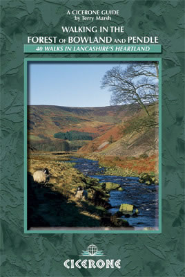
This handy guidebook contains 40 diverse circular day walks suitable for walkers with navigational skills. There is a variety of terrain covered in the Forest of Bowland and Pendle which makes it perfect for those who wish to explore an AONB. Some of the routes covered include: Ward's Stone, Pendle Hill, Longridge Fell and Fair Snape Fell. The Forest of Bowland and Pendle provide vastly differing terrain – from the lush farmlands of the Ribble valley to the more rugged rough pastures of the Forest of Bowland uplands and the huge boggy uplifts of the main Bowland massif itself. The walks in this guidebook are suitable for those who already have good navigational skills and range from 3 miles to 12.5. For walkers who like to ‘collect’ summits, there are six Marilyns within the area of the Forest of Bowland and Pendle, only two of which (White Hill and Easington Fell) are not included in any of the walks. However, this guidebook does offer information on how to access both for those who wish to access them by elongating one of the existing routes. The other Marilyns that are included in the walks are Ward’s Stone, Pendle Hill, Longridge Fell and Fair Snape Fell. None of the walks in this book present technical problems in good weather conditions, especially in summer, and the vast majority may also be tackled in winter by competent walkers. However, some of the walks transverse bleak and featureless moorland where mist becomes a major hazard, and others involve a measure of road walking where you will need to take care against approaching traffic (although road stretches have been kept to a minimum). At the start of each walk there is a box that provides information on the start/finish point (including details of refreshment and toilet facilities), distance, height gain, the terrain along the route and relevant Ordnance Survey maps.
€7,50
Bekijk product
De Rother wandelgidsen beschrijven zeer goed de wandelingen in specifieke gebieden. In de gids vindt men kaarten, routebeschrijvingen en de nodige praktische informatie om van de wandelingen/trekkings een geslaagde onderneming te maken. Die drei großen Fernwanderwege im Schwarzwald sind weit über die Landesgrenzen hinaus bekannt. Sie werden verbunden von zahlreichen schönen Höhen- und Querwegen, die das Gebirge erschließen und grandiose Aussichten auf Berge und Täler bescheren. Der Rother Wanderführer »Schwarzwald Mitte/Nord – Mehrtagestouren« stellt die Querwege im nördlichen und mittleren Teil von Deutschlands höchstem Mittelgebirge vor. Die 11 Mehrtagestouren mit insgesamt 43 Etappen streifen den Kraichgau/Stromberg und führen vom knorrig-bizarren Nord- bis hin zum ländlich idyllischen Mittelschwarzwald. Die meisten sind leichte Genusswanderungen, doch manch hoher Gipfel wird auch den sportlichen Bergsteiger herausfordern. Alle Etappen können auch als Tagestouren begangen werden. Der Autor Martin Kuhnle lebt am Schwarzwaldnordrand und wandert seit vielen Jahren im Schwarzwald. Seine ausführlichen Routenbeschreibungen sowie Kartenausschnitte mit eingezeichnetem Wegverlauf und aussagekräftige Höhenprofile sorgen für optimalen Überblick unterwegs. Informationen zu Verkehrsanbindung, Einkehr und Unterkunft erleichtern die Planung und ermöglichen die Anpassung der Teilstrecken an individuelle Bedürfnisse. Für sämtliche Etappen stehen GPS-Tracks zum Download bereit. Zahlreiche Tipps und Hinweise bringen Sehens- und Wissenswertes am Wegesrand näher; die vielen Fotos stimmen auf ein genussvolles, ausgedehntes Wandern im Schwarzwald ein.
€17,50
Bekijk product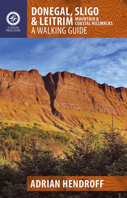
The northwest of Ireland provides a diversity of walks, from the wild, untamed landscape of Donegal to the gentler hills and green valleys of Sligo and Leitrim. This guidebook describes 30 walks of various difficulties, accompanied by quality photographs The northwest of Ireland provides a diversity of walks, from the wild, untamed landscape of Donegal, with its mountains, sea-cliffs and glens, to the gentler hills, green valleys and picturesque escarpments of Sligo and Leitrim. This guidebook describes 30 walks of various grades in this fascinating part of Ireland that has inspired poets, and is rich in folklore and history. Quality photographs and specially-drawn maps will inspire one to get the walking boots on and start exploring this majestic landscape. Since most routes are not signposted or way-marked, an up-to-date guidebook is essential. Walk descriptions also include material on the natural history, folklore, geology and place-names of the area.
€22,50
Bekijk product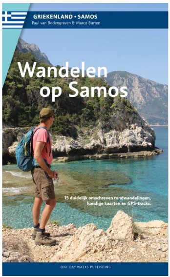
15 rondwandelingen op het Griekse eiland Samos Als er een prijs zou zijn voor de meest ongerepte en onbedorven vakantiebestemming in de Middellandse zee in de 21ste eeuw, dan zou Samos met zijn rust en natuurschoon beslist een goede kanshebber zijn voor de titel. Toerisme is hier weliswaar een belangrijke bron van inkomsten, maar het oogt en voelt toch als van ondergeschikt belang. Door het stelselmatig weren van hoogbouw, grote hotelketens en fastfood-restaurants hebben het eiland en zijn kustplaatsjes een eigen karakter en charme weten te behouden. Natuurlijk zijn er veel restaurants en toeristenaccommodaties, maar nergens is dat zo groots dat het storend wordt. De afwisselende landschappen oefenen grote aantrekkingskracht uit op wandelaars. Het eiland heeft zelf water en is daardoor groen en rijkelijk begroeid. Verschillende loofbossen wisselen af met dennenbossen en olijfboomgaarden. Terrassen met wijnbouw kleuren de berghellingen groen, je treft op meerdere plaatsen riviertjes en beekjes die tot laat in het seizoen water verspreiden over het eiland. Dat is de levensader voor de meest uiteenlopende bloemen, struiken en bomen. De culturele rijkdom, vooral uit de klassieke oudheid, maakt dat Samos naast al zijn wandelmogelijkheden ook een interessante bestemming is voor wie zijn of haar wandelschoenen eens een dagje wil laten staan. Gecombineerd met mooie stranden en gezellige dorpjes bezit Samos zo alle ingrediënten voor een geslaagde wandelvakantie. De wandelingen in deze gids zijn behoorlijk uitdagend, gezien de aanzienlijke hoogteverschillen die je moet overbruggen. Wie wil kan de bergen in, waar de hoogste toppen tot boven de 1.400 meter reiken. Maar er zijn ook wandelingen opgenomen die wat gemakkelijker te doen zijn, variërend van een paar uur tot een hele dag. Geniet van het goede Griekse leven en ontdek de mooiste plekken van Samos te voet.
€15,95
Bekijk product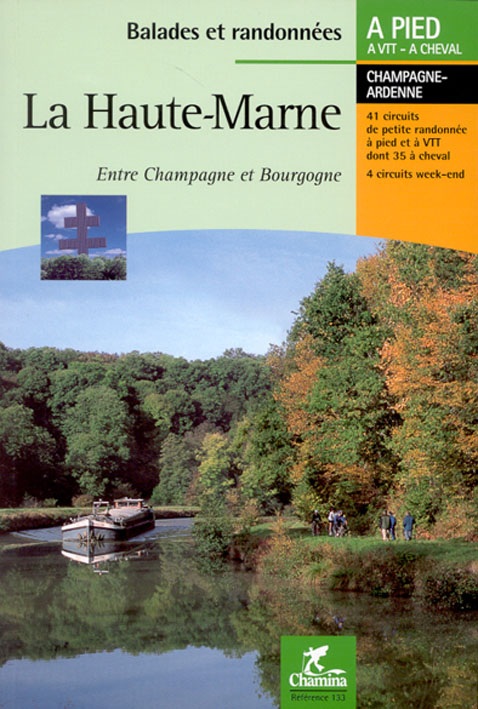
Wandelgids met dagwandelingen - Duidelijk kaartmateriaal met ingetekende routes, de beschrijvingen zijn goed. Daarnaast ook praktische informatie. Entre les coteaux de Champagne et la plaine de Bourgogne, ce guide nous conduit sur des chemins secrets qui mènent vers des villages fleuris au coeur de vallons verdoyants. De chemins creux en plateaux, de forêts en étangs, ce pays de sources s'offre à qui prend le temps de s'émerveiller d'une orchidée, de suivre les grands oiseaux migrateurs, de flâner le long du canal, de découvrir la richesse de tout un patrimoine qui a marqué de son empreinte ce pays et l'âme de ses habitants. Le guide * 41 circuits de petite randonnée * Boucles de 1 h à 6 h 30 de marche, dont 41 praticables à VTT et 35 à cheval. * 4 circuits week-end, des randonnées en boucle de 2 à 4 jours. * Suggestions d'hébergements. * Des pages thématiques Pour tout savoir sur l'histoire, la faune et la flore, la forêt et le vignoble, les ressources du milieu aquatique, le patrimoine industriel et culturel. * Des infos pratiques
€14,95
Bekijk product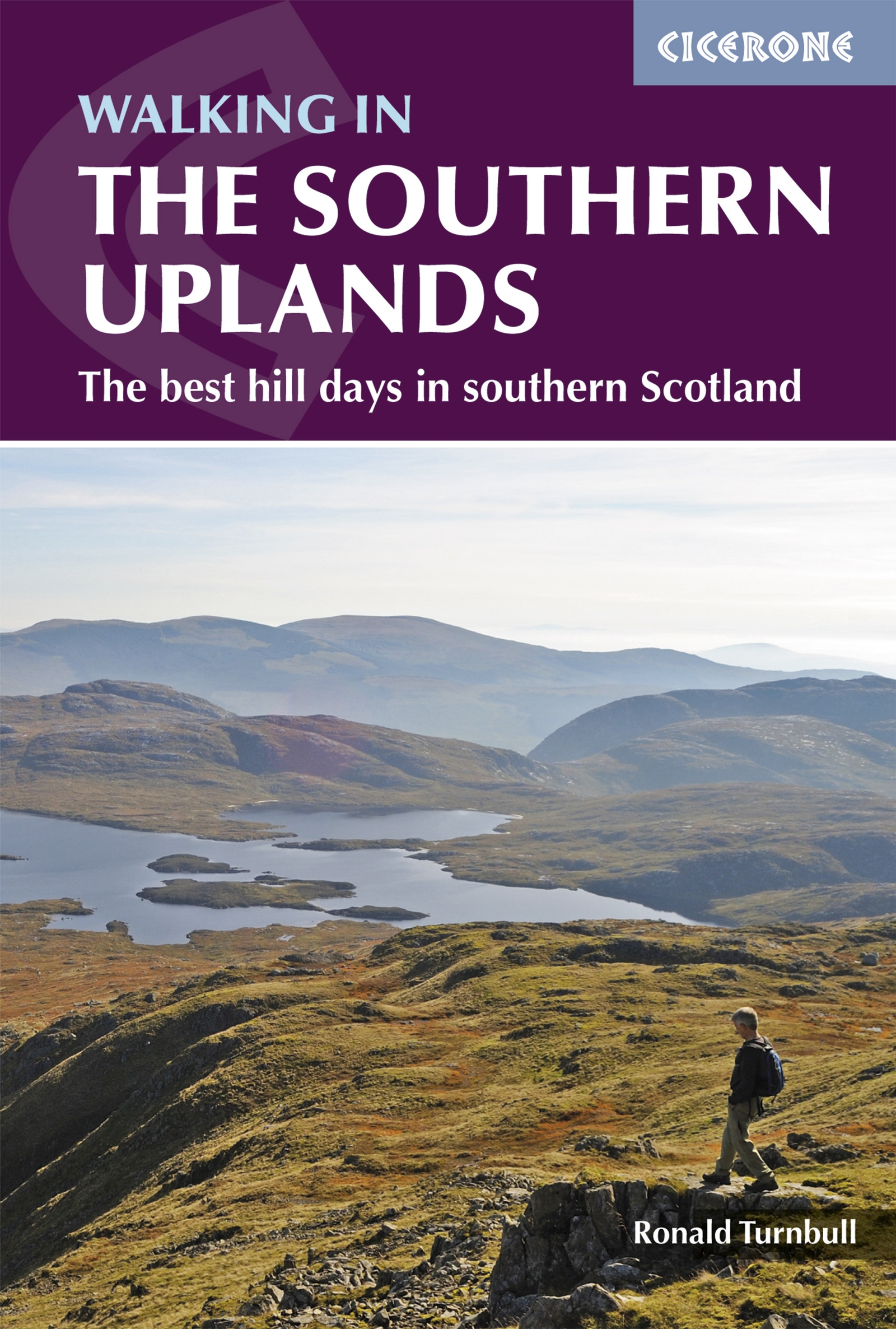
This guidebook describes 44 routes and over 100 summits stretching across the Southern Uplands of Scotland, stretching south-west from Edinburgh to the English border, including the Galloway and Pentland Hills. The walks range between 2 and 29km, suitable for walkers of all abilities. The Scottish Southern Uplands is a range that is about as big as the English Pennines. It is wild hill country, with over 80 hills of 2000ft or more, and it boasts a real remoteness that is difficult to find elsewhere. All hillwalkers should experience these wonderfully characterful landscapes: green and gentle, but with hidden surprises and remote escapes. The routes are suitable from spring to autumn, and on winter days with good weather and snow conditions. Each route provides OS mapping, information on distance, ascent, time, maximum altitude and terrain, as well as details of any variants or shortcuts. With notes on points of interest along the way as well as on transport and accommodation, the guide gives all the information walkers need.
€21,95
Bekijk product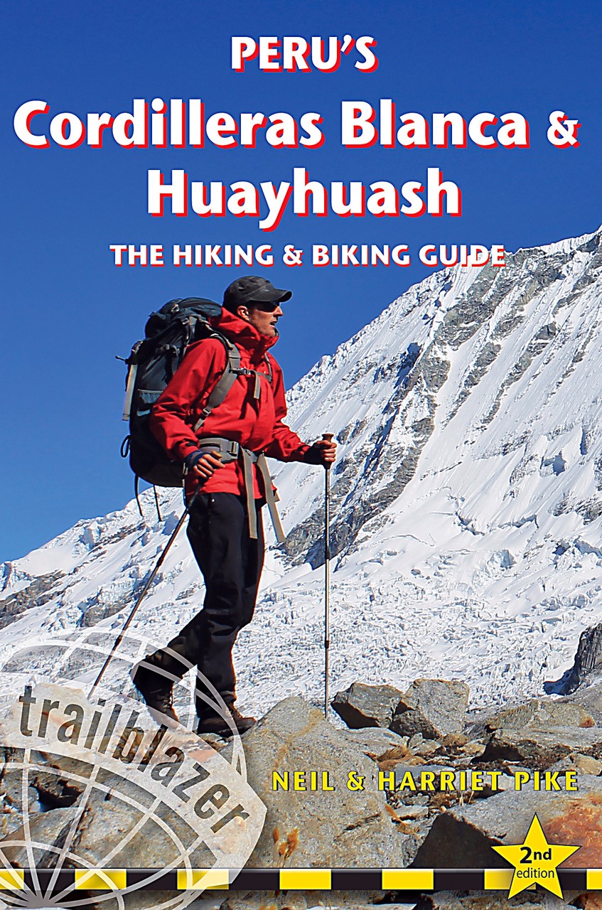
The Cordilleras Blanca and Huayhuash boast some of the most spectacular scenery in the Andes, and some of the most accessible high altitude trekking and cycling in the world. Perfect pyramidal peaks, gargantuan ice falls and turquoise alpine lakes are all easily reached from Huaraz, the region's capital and centre of tourist comforts. This practical guide contains 50 detailed route maps and descriptions covering 20 hiking trails and 30 days of paved and dirt road cycle touring. Trekking – the classic treks: Huayhuash Circuit, Santa Cruz and Alpamayo Basecamp, as well as lesser known, wild walks in valleys which see few visitors. Ranging from easy day hikes to challenging routes of 10 days or more, all can be trekked independently or in guided groups. Cycling – includes the Huascarán Circuit, a loop of Peru's highest mountain, as well as four other multi-day rides and five day-cycles from Huaraz. Covers all the information cyclists need to pedal past glaciers on 6000m peaks or fly down 2500m descents from high passes. Mountain biking – includes two detailed downhill routes and information on organising guides to lead you through the labyrinth of exciting singletrack in the area. South America's top mountain adventure destination As mountain adventure destinations, the Cordilleras Blanca and Huayhuash in northern Peru are unrivalled in South America. The area boasts the most accessible high mountain trekking and biking in the world. Perfect pyramidal peaks, gargantuan ice falls and turquoise alpine lakes are all easily reached from Huaraz, the region's capital and centre of tourist comforts. Trekking 20 hiking trails Includes the classic treks: Huayhuash Circuit, Santa Cruz and Alpamayo Base Camp, as well as lesser known, wild walks in valleys which see few visitors. Ranging from easy day hikes to challenging routes of 10 days or more, all can be trekked independently or in guided groups. Cycling more than 30 days of paved and dirt routes Includes a loop of Peru s highest mountain - the Huascaran Circuit - as well as 6 other multi-day rides and 5 day cycles from Huaraz. Covers all the information cyclists need to pedal past glaciers on 6000m peaks or fly down 2500m descents from high passes. Mountain biking off road routes Includes two detailed downhill routes and information on organising guides to lead you through the labyrinth of exciting singletrack to be found in the area. Practical information planning your trip and getting to Peru City and town guides and maps Lima, Huaraz, Caraz, Carhuaz, Chavin, Chiquian, Pomabamba plus information on Yungay, Yanama, Chacas, Huari, San Marcos Minimum impact hiking and biking how to hike and cycle lightly in a fragile region Flora and fauna Language Spanish words and phrases 60 detailed route maps at 1:50,000 scale for main maps"
€25,50
Bekijk product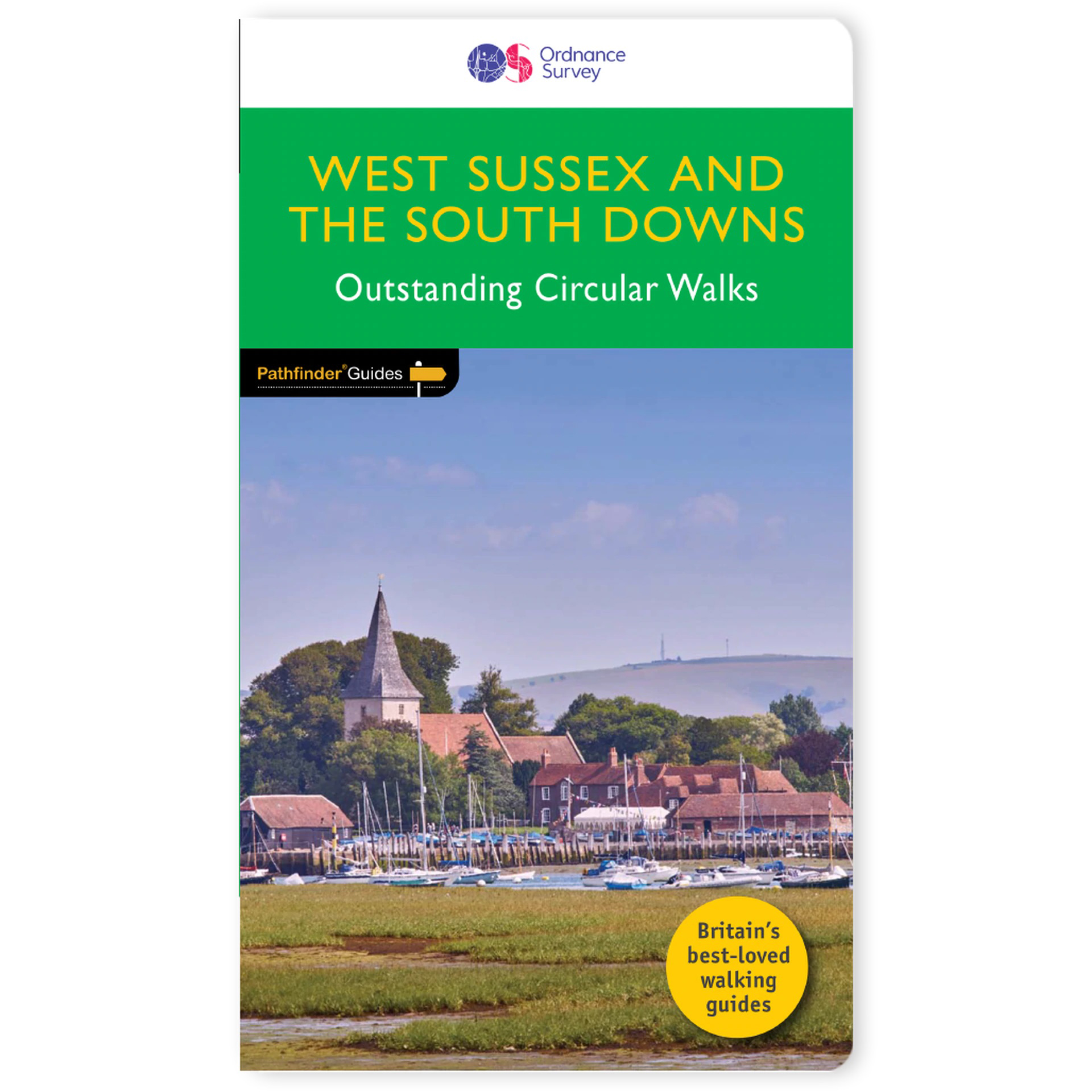
Wandelgids van een deel van Engeland. Deze gids bevat 28 dagwandelingen, variërend van korte tochten tot pittige dagtochten. De bijbehorende kaarten zijn uitstekend: men heeft de topografische kaarten van Ordnance Survey gebruikt waarop de route is ingetekend. Daarnaast praktische informatie over de wandeling en wat beschrijvingen van het gebied. Containing 28 circular, graded walks that have all been created and tested by experienced walkers, this walking guidebook is ideal for both visitors and locals. The routes range from extended strolls to exhilarating hikes, so there is something for everyone. Each route includes a detailed description, the Ordnance Survey map for the route, GPS waypoints and key historical and landscape features to look for. The South Downs has some great opportunities for scenic, but not too challenging routes, including the South Downs Way. Walks in this book include one around Ardingly Reservoir, Devil's Dyke and the Arun Canal. Routes range from 5.6km (3.5 miles) to 17.6km (11 miles), an each is also graded by difficulty Pathfinder Guides are Britain’s best-loved walking guides. Printed with weather-resistant covers featuring durable rounded corners, they are the perfect companion for country walking throughout Britain.
€18,50
Bekijk product