
Beantwoord enkele vragen, en binnen seconden geeft AI je een persoonlijk aankoopadvies op maat.
Beantwoord enkele vragen, en binnen seconden geeft AI je een persoonlijk aankoopadvies op maat.

Die griechische Halbinsel Peloponnes ist das gebirgige Südende des Balkans und gilt noch als Geheimtipp für das Weitwandern. Auf dem Teilstück des Europäischen Fernwanderwegs E4 lässt sie sich auf gut 300 km von Nord nach Süd durchqueren - von Diakopto am Golf von Korinth nach Gythio am Lakonischen Golf. Dabei durchwandern Sie Ausläufer des Berges Chelmos, das Menalo-Gebirge und das Parnon-Gebirge und die letzten Tage führen durch das höchste Gebirge der Peloponnes, das Taygetos. Auf der Wanderung wechseln sich erlebnisreiche Passagen durch einsame Natur, wilde Flusstäler, dramatische Schluchten und alpines Gelände mit winzigen Bergdörfern, belebten Ortschaften und den Städten Tripoli und Sparta ab. Außerdem passieren Sie die UNESCO-Weltkulturerbestätte Mystras. Dieser Wanderführer enthält Vorschläge zu Etappen und zur Aufteilung, detaillierte Wegbeschreibungen, Hinweise zu Unterkünften und Verpflegungsmöglichkeiten sowie viele Tipps zu Highlights, Ortschaften, Transport und mehr. Ergänzt werden die Beschreibungen durch Karten und Höhenprofile sowie GPS-Tracks zum Download.
€15,50
Bekijk product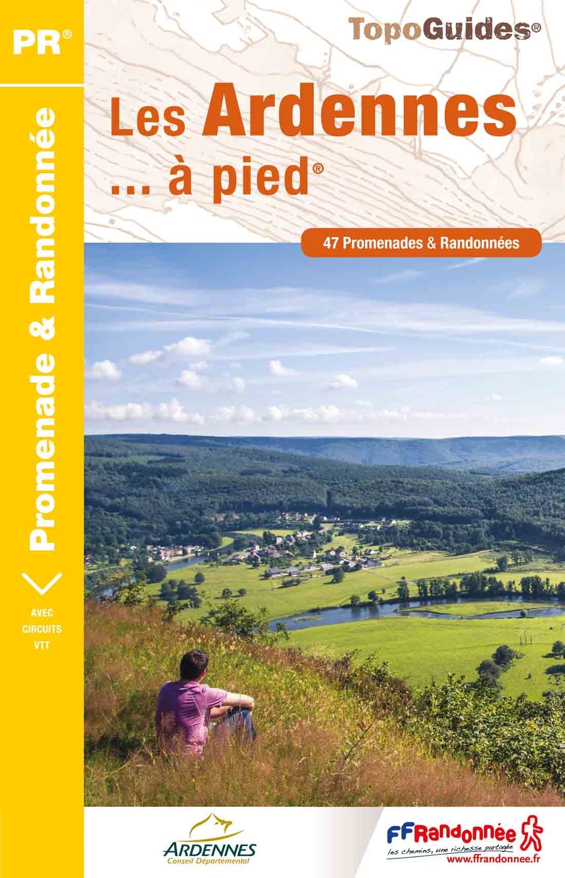
Franstalige wandelgids met een beschrijving van een aantal dagtochten. Uitstekende beschrijvingen met duidelijk kaartmateriaal. Mislopen is nauwelijks mogelijk, maar ja .. de franse taal! Ook praktische informatie staat in deze gids. We doen er een kleine wandelwoordenlijst bij! Méandres de la Meuse et grandes forêts autour de Monthermé et de Rocroi. Ce topo-guide contient des circuits équestres et VTT. "La forêt profonde" ("sylva arduina" en langue celte), c'est ainsi que Jules César qualifie les Ardennes dans sa "Guerre des Gaules". Et c'est en effet une immense forêt au relief quasi montagnard qui, au Nord, couvre un tiers du département; refuge de son animal emblématique : le sanglier. Mais les Ardennes, département pluriel, c'est aussi les fortifications de Rocroi et Sedan, les édifices abbatiaux du Mont-Dieu et de Mouzon, les maisons à pans de bois du Porcien; contrées multiples offrant le plaisir de remonter dans le temps.
€18,50
Bekijk product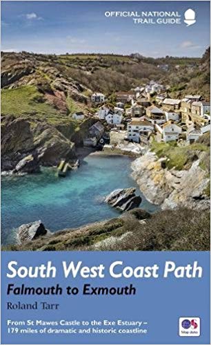
Goede beschrijving van een deel van het beroemde South West Coast path in Cornwall. Men heeft gebruik gemaakt van zeer gedetailleerde kaarten van Ordnance Survey. The South West Coast Path follows Britain's stunning coastline for 630 miles around the southern tip of Britain. This volume covers the 172 miles of the National Trail along the south Cornwall and Devon coast from Falmouth to the mouth of the Exe. It takes in some of Britain's most popular beaches and resorts, as well as arresting clifftop scenery, romantic coves and the spectacular 'drowned' estuaries of the Fal, the Yealm and the Dart. Whether you want golden sands, the steep streets of picturesque fishing villages, or a sight of the rare cirl bunting, this book is all you need as your guide to this wonderful walk. This new edition has been fully revised and updated for 2015 and completely resdesigned to feature many more colour photographs and much added information on the history, wildlife and cultural asociations of the landscape this stretch of the Trail traverses. National Trail Guides are the official guidebooks to the fifteen National Trails in England and Wales and are published in association with Walk Unlimited, the official body charged with developing and maintaining the Trails.
€20,95
Bekijk product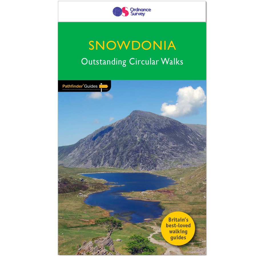
Wandelgids van een deel van Wales. Deze gids bevat 28 dagwandelingen, variërend van korte tochten tot pittige dagtochten. De bijbehorende kaarten zijn uitstekend: men heeft de topografische kaarten van Ordnance Survey gebruikt waarop de route is ingetekend. Daarnaast praktische informatie over de wandeling en wat beschrijvingen van het gebied. Each of the Jarrold Pathfinder titles features 28 circular routes, all tried and tested by seasoned walkers. The routes range from extended strolls to exhilarating hikes, so there is something for everyone. They also contain: -Ordnance Survey mapping; -background details of each area; -details of refreshment stops and parking; -walking safety advice; and -information about walkers and the law
€18,50
Bekijk product
Wandelgids van een deel van Wales. Deze gids bevat 28 dagwandelingen, variërend van korte tochten tot pittige dagtochten. De bijbehorende kaarten zijn uitstekend: men heeft de topografische kaarten van Ordnance Survey gebruikt waarop de route is ingetekend. Daarnaast praktische informatie over de wandeling en wat beschrijvingen van het gebied. Each of the Pathfinder titles features 28 circular routes, all tried and tested by seasoned walkers. The routes range from extended strolls to exhilarating hikes, so there is something for everyone. They also contain: -Ordnance Survey mapping; -background details of each area; -details of refreshment stops and parking; -walking safety advice; and -information about walkers and the law Although deep in South Wales, Pembrokeshire and Carmarthenshire have a strong English influence, but their most striking feature, from the point of view of the walker, is that they contain some of the most spectacular coastal scenery and finest stretches of coast path in Britain. Although the walks in this guide inevitably concentrate on the coast, especially using the Pembrokeshire Coast Path, their characters vary considerably, ranging from the splendid cliff scenery around the peninsula of Dinas Island and to the west of Port-Eynon Bay, to the wooded stretches between Saundersfoot and Tenby.
€18,50
Bekijk product
Engelstalige beschrijving van de mooiste wandeltocht in Wales. De gids voldoet aan alle verwachtingen die je kunt hebben, het enige dat je mist is een overzichtskaart. Inclusief gidsje met routekaarten van 1:25000 (deze is hier ook los te bestellen) This guidebook - which includes both a guide to the route and a separate OS map booklet - describes Offa's Dyke Path National Trail from south to north, following the longest linear earthwork in Britain, running 177 miles along the English-Welsh border between Sedbury (near Chepstow) and Prestatyn on the north Wales Coast. It links the Severn Estuary and the Irish Sea, following the longest linear earthwork in Britain, contouring above the Wye and Dee, visiting hillforts and Norman castles and exploring the hidden heritage of the Marches. The route is exceptional in all seasons, although the Black Mountains and Clwydian range deserve respect in winter conditions. The guidebook splits one of Britain's classic trails into 12 stages, with suggestions for alternative 8 and 16 day schedules. This is a long but not too difficult walk for walkers of all abilities. Step-by-step route descriptions are accompanied by 1:100,000 OS mapping. A trek planner gives at a glance information about facilities, public transport and accommodation available along the route. Also included is a convenient booklet of 1:25,000 OS maps, which provides all the mapping needed to complete the trail. The walk is astonishingly varied, taking in the lower Wye gorge, the Severn and the Dee rift valley, the pastures and woodlands of the border country, the remote moorland of the Black Mountains and the Clwydian range, and the dramatic limestone escarpments of Eglwyseg mountain. What makes it even more special is over 60 miles walking alongside the Saxon earthwork of Offa's Dyke, the path sometimes on the Dyke and sometimes alongside. Steden en Dorpen Chepstow, Hay-on-Wye, Kington, Bishops Castle, Montgomery, Welshpool, Oswestry, Llangollen, Denbigh, Prestatyn
€25,95
Bekijk product
Engelstalige beschrijving van een van de mooiste wandeltochten in Engeland: een stuk boordevol cultuur en geschiedenis!. De gids voldoet aan alle verwachtingen die je kunt hebben. Met apart gidjes met prima wandelkaarten. A guidebook to walking the Thames Path, a 182-mile National Trail from the Woolwich Foot Tunnel in London to the river's source in near Cirencester, passing from central London through Windsor, Henley, and Oxford, and rural countryside. Described in 20 sections, of between 4 and 16 miles (6.5-32km), it is an mainly flat route with good access by public transport and typically takes two weeks to walk. On its way it passes historic sites such as Greenwich, Kew Gardens, Hampton Court, Runnymede, Windsor Castle and Oxford. This guidebook features complete OS 1:50,000 scale mapping of the route and comprehensive information about accommodation, facilities, refreshments and transport links for each stage of the route. It is crammed with fascinating details about the places and features passed along the way. A separate pocket-sized map booklet is also included showing the full route on 1:25,000 scale OS maps, providing all the mapping needed to complete the trail. The Thames Path is an easy riverside walk that discovers the constantly changing character of the River Thames.
€24,95
Bekijk product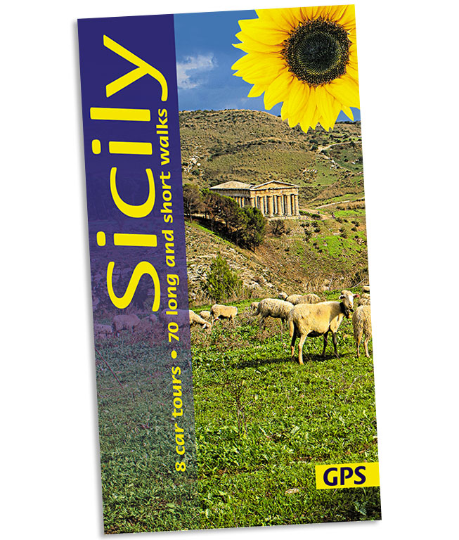
Wandelgids: vele dagtochten worden degelijk beschreven met openbaar vervoer informatie, goede routebeschrijvingen en kaartmateriaal. Tevens enkele autotochten. (Engelstalig) Sicily, the largest island in the Mediterranean and long a Mecca for culture freaks, also rewards the countryside lover with its magnificent landscapes. Peter Amann knows the island intimately; he leads walking groups on Sicily and works for the preservation of its monuments. There is enough material in this book for several holidays. For those touring Sicily by car, the eight car tours (mostly circular and covering 2000 km) follow little-used secondary roads wherever possible. If you’re walking in Sicily, the routes are as varied in length and grade as the landscape itself — a distillation of the best on the island. The best months for walking in Sicily are March to June and September to November. Area covered: the entire island except for the far southwest corner.
€21,95
Bekijk product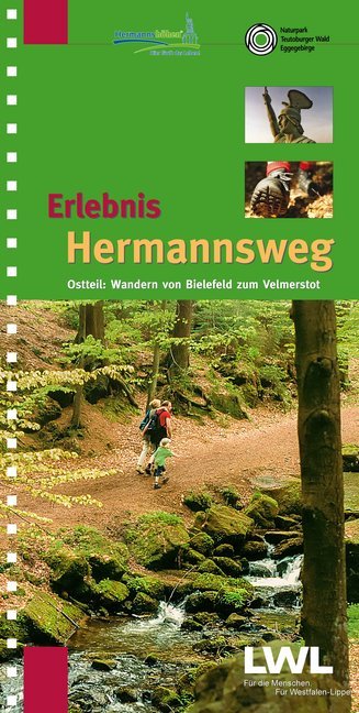
Zeer goede wandelgids met een prima beschrijving, zeer duidelijke kaarten en veel informatie. Bovendien in een ringband, dus uitermate handig in gebruik! Route van Bielefeld naar Horn - Bad Meinberg Östlicher Teil des zweibändigen Wanderführers "Erlebnis Hermannsweg" - Der Hermannsweg im Teutoburger Wald gilt als einer der schönsten Kammwanderwege der deutschen Mittelgebirge! Als Ergänzung zu seinem erfolgreichen Schwesterband "Erlebnis Hermannsweg - Westlicher Teil: Wandern von Rheine bis Bielefeld" stellt dieser Wanderführer die knapp 50 km Hermannsweg zwischen Bielefeld und Horn-Bad Meinberg vor. Von der Sparrenburg über die Bergstadt Oerlinghausen, das Hermannsdenkmal und die Externsteine führt die aussichts- und geschichtsreiche Wanderung bis zum Endpunkt in Leopoldstal am Fuß des Velmerstot. Die Gesamtstrecke hat Autor Horst Gebaulet (LWL-Denkmalpflege, Landschafts- und Baukultur in Westfalen) wieder in 10 praktische Wanderetappen eingeteilt. Zahlreiche Tipps und Exkurse vertiefen den Text, rund 140 Fotos und Grafiken illustrieren ihn. Besonders praktisch sind die auf 9 Doppelseiten beigefügten Karten mit Reliefdarstellung im Maßstab 1:25000, die den Verlauf des Weges, Rückwanderrouten, Erlebnisschwerpunkte, Parkplätze, Nahverkehrshaltepunkte und Gastronomie am Wege darstellen.
€16,50
Bekijk product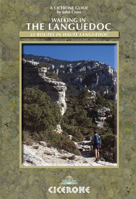
Uitstekende wandelgids van dit geweldige gebied. goed beschreven met veel praktische informatie om de route te kunnen lopen, inclusief redelijke kaarten. 31 walks in the stunningly beautiful Parc Naturel du Haut-Languedoc. The climate is warm, the vineyards stretch out below you, and above is the towering Espinouse Massif. The Languedoc has for too long been in the shadow of Provence. Sharing the same Mediterranean climate and vegetation, it has not had done to it what Peter Mayle did for the Luberon - yet! Apart from its beaches, it is a quiet, beautiful place which retains more than a hint of the old France. This book is the fruit of 10 years' exploration of the central part of the Languedoc, north of Béziers. Much of this area forms the Parc Naturel du Haut-Languedoc, at the heart of which is the stunning Espinouse massif, rising abruptly some 850m from the valley floor. Close by is the valley of Lac du Salagou, an enormous man-made lake surrounded by impressive hills. A little further east is the valley of the river Hérault, which provides the explorer with wonderful limestone gorges, caves and cliffs. All three of these areas are well provided with footpaths on which it is rare to see another human being; and, because this is France, a fine dinner awaits you at the end of the day. The book aims to provide walks into these areas for hikers of all standards; some are very straightforward, others are for the very fit and experienced. All the walks described are circular.
€20,95
Bekijk product