
Beantwoord enkele vragen, en binnen seconden geeft AI je een persoonlijk aankoopadvies op maat.
Beantwoord enkele vragen, en binnen seconden geeft AI je een persoonlijk aankoopadvies op maat.
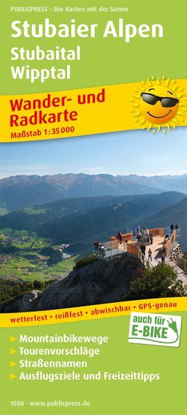
Das Stubaital ist nicht nur ein Wintersportparadies, sondern lockt im Sommer zahlreiche Wanderer, Bergsteiger und Mountainbiker in die Welt der Gletscher. Aber auch der Elfer, als Balkon des Stubaitals, lockt Aktivsportler mit zahlreichen Angeboten. Wer nicht ganz so weit hinaus möchte, dem seien die leicht erreichbaren Naturschauplätze ans Herz gelegt. Abseits der Berge laden lebendige Kultur, sehenswerte Museen und Orte mit historischer Bedeutung zum Besuch ein.
€15,95
Bekijk product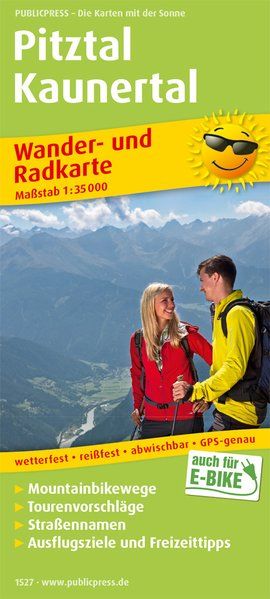
Der Naturpark Kaunergrat reicht vom Oberen Inntal bis in die Höhen der Ötztaler Alpen. Er vereint seltene und sehenswerte Natur- und Kulturlandschaften von der alpinen Hochgebirgslandschaft bis hin zum Gletscher am Talende. Ebenso abwechslungsreich wie die Natur ist das Angebot für Urlauber. Outdooraktivitäten für jeden Anspruch werden ergänzt von kulturellen Erlebnissen, Bergerlebniswelten für kleine und große Abenteurer, einzigartigen Aussichten, beschaulichen Tiroler Dörfern, sehenswerten Museen und gastronomischen Genüssen.
€15,95
Bekijk product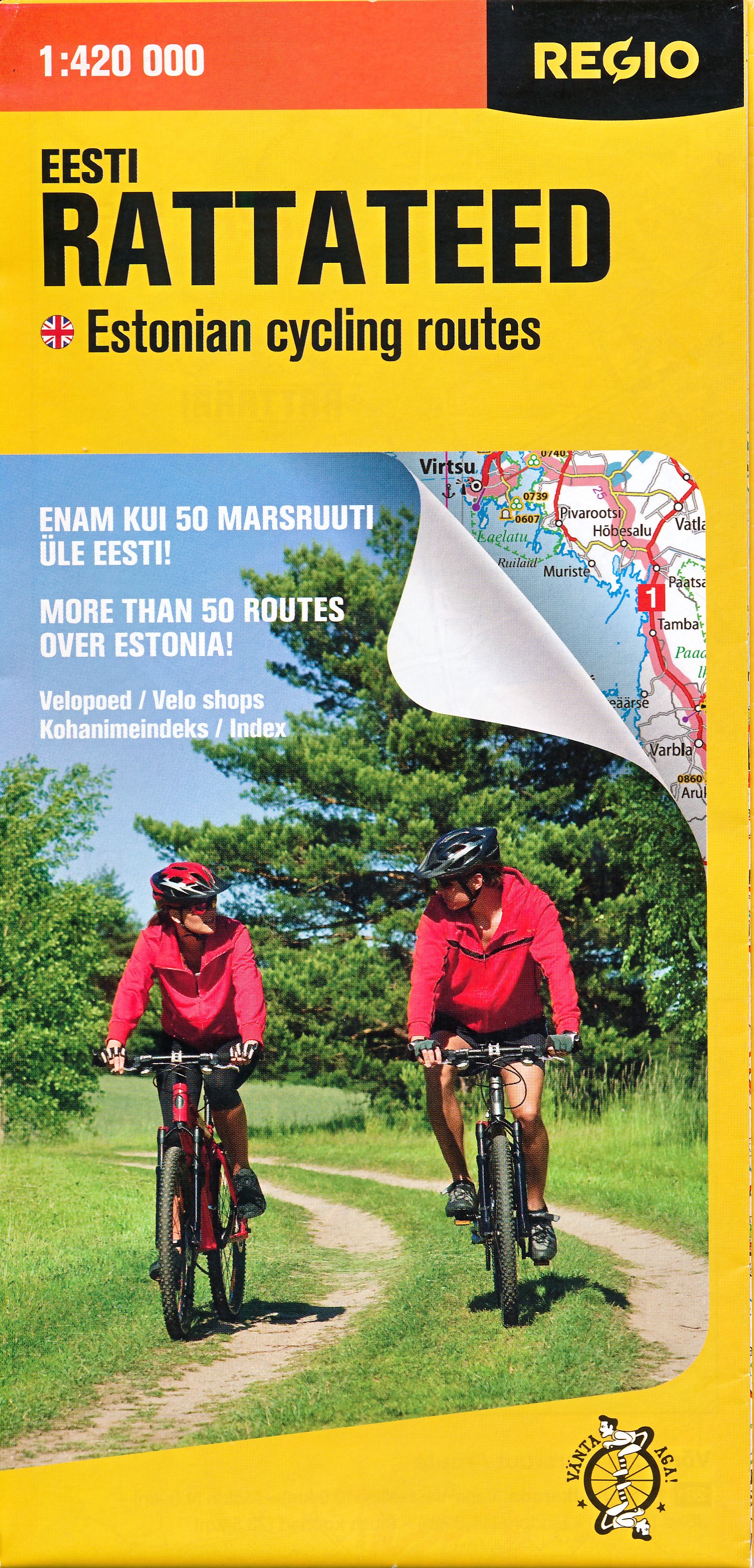
Handige wegenkaart van Estland waarbij een aantal fietstoures zijn ingetekend waaronder de officiele Lange aftands fietsroutes. De uitleg is ook ong eens in het Engels, wel zo makkelijk.
€9,95
Bekijk product
Gedetailleerde fietskaart van een klein gebied. Dit is de meest geschikte fietskaart wanneer u wat langer in één regio verblijft. De kaart is van de ADFC (Algemeine Deutsche Fahrrad Club). Echt alle relevante fietsinfo is op deze kaart terug te vinden. Zeer goede heldere, betrouwbare kaart met ingetekend alle bewegwijzerde routes * Zeer gedetailleerde kaart * Vermelding van verkeersdrukte * Vermelding van type wegdek * Hellingen worden aangegeven middels 1 of 2 pijlen * Hoogtelijnen aanwezig * Relevante info als fietsenmakers, campings, horeca etc..aanwezig * Geschikt voor verblijf in 1 bepaald gebied Ideal für Tagesausflüge und WochenendtourenInhalte vor Ort von ADFC-Scouts recherchiertmit Tagestouren-Vorschlägenmit UTM-Koordinatengitter zur Entfernungsmessung und Standortbestimmung mit GPS-Gerätenwetterfestes und reißfestes Papierzusätzliche kostenfreie Online-Angebote:gpx-Tracks der Themenrouten, Radfernwege und Tourenvorschläge zum Download
€11,95
Bekijk product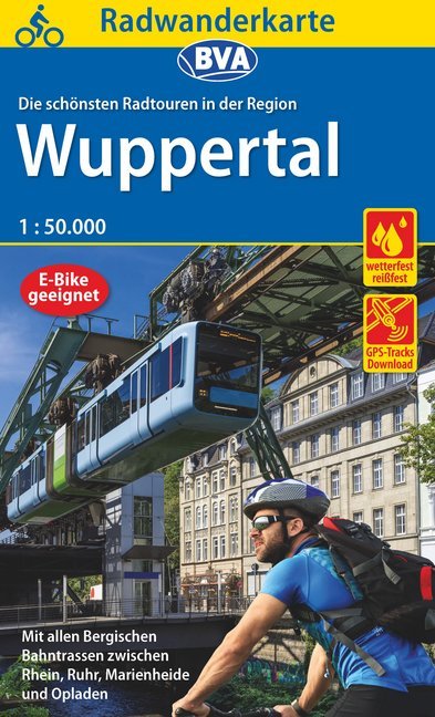
Radwandern in der Region Wuppertal mit allen Bergischen Bahntrassenradwegen zwischen Rhein, Ruhr und Marienheide mit allen Knotenpunkten ideal für Tagesausflüge und Wochenendtouren mit dem speziellen Radwegenetz und allen Radfernwegen der Region mit ausgewählten Straßennamen zur besseren Orientierung mit UTM-Koordinatengitter zur Entfernungsmessung und Standortbestimmung mit GPS-Geräten wetterfestes und reißfestes Papier zusätzliche kostenfreie Online-Angebote: gpx-Tracks der Themenrouten, Radfernwege und Tourenvorschläge zum Download
€11,95
Bekijk product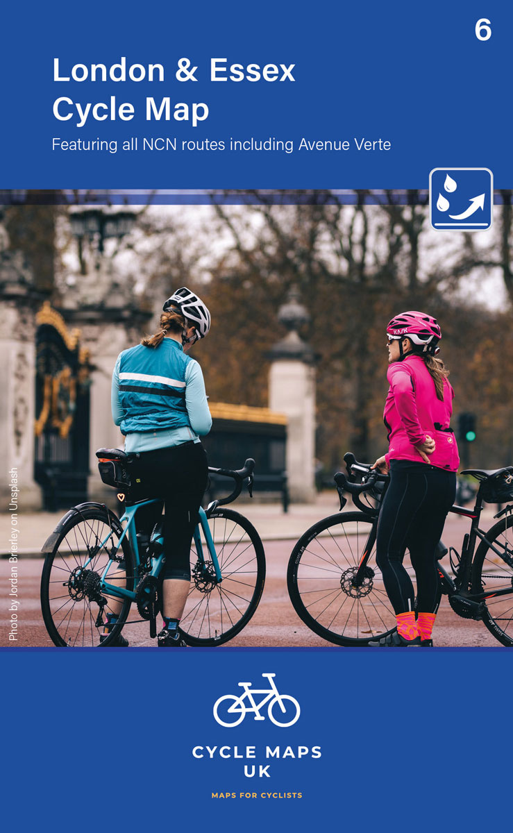
Een nieuwe fietskaarten serie van Groot-Brittannië. Gedrukt op scheur- en watervast papier en mooi handzaam klein formaat. Deze kaarten zijn met name heel goed om de Lange Afstands Fietsroutes (LF) te fietsen, het National Cycle Network staat duideljk ingetekend. Daarnaast vind je op de kaart veel praktische informatie als fietsenmakers, campings, jeugdherbergen en supermarkt. Second in a new series of cycle maps covering the whole country. The London and Essex map covers from Uxbridge in the west to Harwich in the east. As far north as Luton and Halstead and as far south as Canterbury and Leatherhead. The maps are all produced at a scale of 1:100 000 showing important features including the National cycle Network. Sections on road, off road and traffic free are all shown in differing colours along with their route number. Other roads and their classification are shown enabling you to link rides or explore sections and discover new routes at home or further afield. Facilities such as toilets, pubs, accommodation, bike shops, repair stations and railway stations are all shown. The mapping also has relief shading giving you a clear picture of the terrain you are likely to encounter. Scale: 100 000 (10mm = 1 Km, 16mm = 1 Mile) Folded size: 163mm x 105mm Unfolded: 650mm x 800mm Tear and water-resistant paper Double sided
€12,95
Bekijk product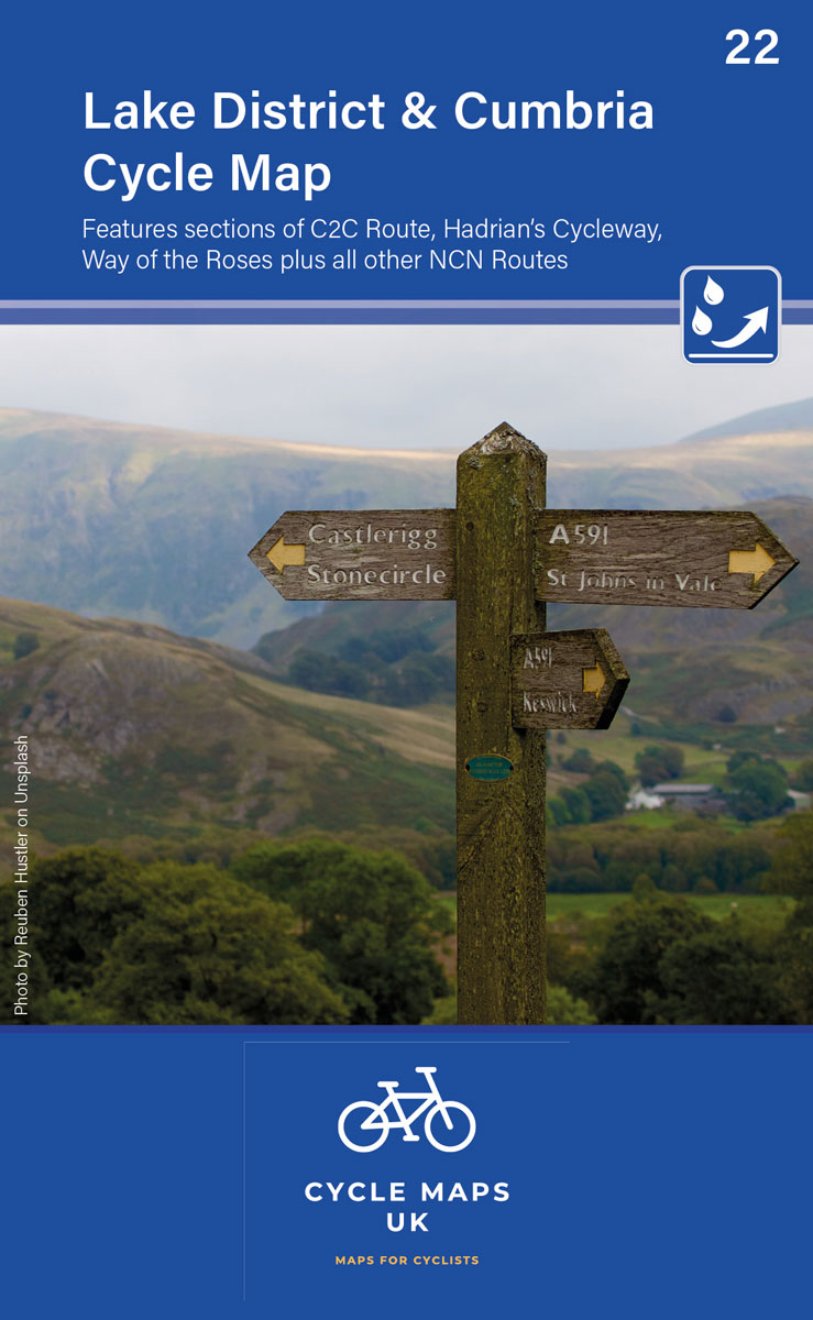
Een nieuwe fietskaarten serie van Groot-Brittannië. Gedrukt op scheur- en watervast papier en mooi handzaam klein formaat. Deze kaarten zijn met name heel goed om de Lange Afstands Fietsroutes (LF) te fietsen, het National Cycle Network staat duideljk ingetekend. Daarnaast vind je op de kaart veel praktische informatie als fietsenmakers, campings, jeugdherbergen en supermarkt. The next map in the all-new Cycle Maps UK series. This covers The Lake District, Cumbria and all the way down to Lancaster. The maps are all produced at a scale of 1:100 000 showing important features including the National cycle Network. Sections on road, off road and traffic free are all shown in differing colours along with their route number. Other roads and their classification are shown enabling you to link rides or explore sections and discover new routes at home or further afield. Facilities such as toilets, pubs, accommodation, bike shops, repair stations and railway stations are all shown. The mapping also has relief shading giving you a clear picture of the terrain (and steepness of any hills) you will encounter. Scale: 100 000 (10mm = 1 Km, 16mm = 1 Mile) Folded size: 163mm x 105mm Unfolded: 650mm x 800mm Tear and water-resistant paper Double sided
€12,95
Bekijk product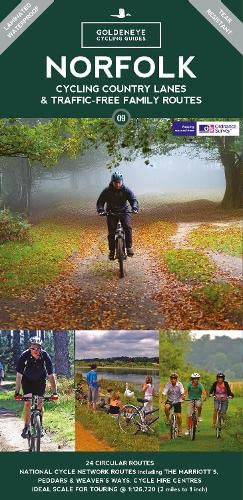
Norfolk is the fourth largest county in England and one of the most rural. It is also one of the flattest and our circular routes have been chosen to explore the quiet lanes linking the isolated and picturesque villages and places of interest. This is ideal cycling territory and fortunately, the Norfolk County Council (and its District Councils) are seriously committed in providing and developing cycling routes and in promoting a cycling culture that is sustainable and family friendly. Some of their routes are illustrated, hitherto. The County has been described as flat (rather gentle undulations) and does not in fact rise much over 300 feet, but it offers great scenic interest; the dark forests of Breckland, the rolling chalk lands of the northwest, the unique watery patch of the Broads, and a coastline of great variety. Ancient churches and picturesque villages are there in abundance, the latter often decorated with the attractive signs designed by Harry Carter in the 1950’s. Recommended Routes/Trails National Cycle Network (NCN) & Regional Routes This is a linked series of traffic-free paths and traffic-calmed roads being developed across the UK linking town centres and the countryside. The so-named route numbers do not always join up as the overall planned route has not been completed and sometimes they overlap with other routes. www.sustrans.org.uk The following NCN routes cross Norfolk:- NCN Route 1. Hull to Harwich. A 370 mile route passing Cathedral cities, towns and villages through pastoral countryside. Connects Norwich to Fakenham and King’s Lynn. Mainly on road but does use the Marriott’s Way. Links with Norfolk Coast Cycleway at Wighton (E1) and with NCN 13 at Gateley (F4). NCN Routes 13. Dereham to Thetford. A 30 mile route passes through the distinctive Breckland landscape of mid-Norfolk. Follows minor roads joining the Peddars Way between Wretham (E9) and Pockthorpe (E8). Route through Dereham has been resurfaced and improvements north of Thetford are planned, as is a route south from Thetford. Regional Routes 1. Norfolk Coast Cycleway NCN 30. A fine route running inland away from the busy coast road. It affords spectacular views; dramatic scenery, endless skies and much birdlife. Originally 59 miles from Cromer to King’s Lynn, now with 39 mile extension to Great Yarmouth. Careful between Sea Palling and Great Yarmouth but be prepared to take alternative route walking beside the River Thurne between Potter Heigham and Martham. 2. Regional Route 30. Norfolk/Suffolk border from Thetford to Beccles and Lowestoft, and Downham Market. Traffic-Free Family Routes 1. Bacton Wood. Circular rides up to 2 miles within 133 hectares. Picnics. Linked to North Coast Cycleway. Hybrid/Mountain bike required. (L3) 2. Bure Valley Railway & Path. 9-mile route between Aylsham and Wroxham with return journey by miniature steam train. (J3-L5) 3. Holkham Hall. Circular route from Wells passes through the grounds. (E1) 4. Hockwold. See our Route No. 12 below. (B9) 5. Marriott’s Way. 26-mile route using the trackbeds of two disused railways named after local railway engineer, William Marriott. Links Aylsham and Reepham with Norwich, and is open to cyclists, walkers and horse riders. Often remote hence an abundance of wildlife, flowers and plants. (H4-5, J4-5) 6. Paston Way. Short one-mile route allowed for cyclists from North Walsham to Knapton. Walkers may continue for further 7 miles. (L3) 7. Peddars Way. A challenging 46-mile route, the origin whose name is obscure, links Knettishall Heath near Thetford with the coast at Holme. For the most part it follows the old Roman road built to restrain the rebellious Iceni tribe. Open to cyclists, walkers and horse riders. (F10-B1) 8. Quiet Lanes Project. See our route no.17. (L2) 9. Thetford Forest. Wide scope of off-road riding with links to Peddars Way. Bike hire at Forest High Lodge. (D9) 10. Weaver’s Way. 56-mile trail linking Cromer with Great Yarmouth by a circuitous route designed to cover a variety of scenery and places of interest using minor roads, footpaths and old railway lines. Named after weaving trade. Cycling only permitted on 13-mile section between Aylsham and Stalham. Surface often pitted. Short section of road through market town of North Walsham. (K3)
€14,95
Bekijk product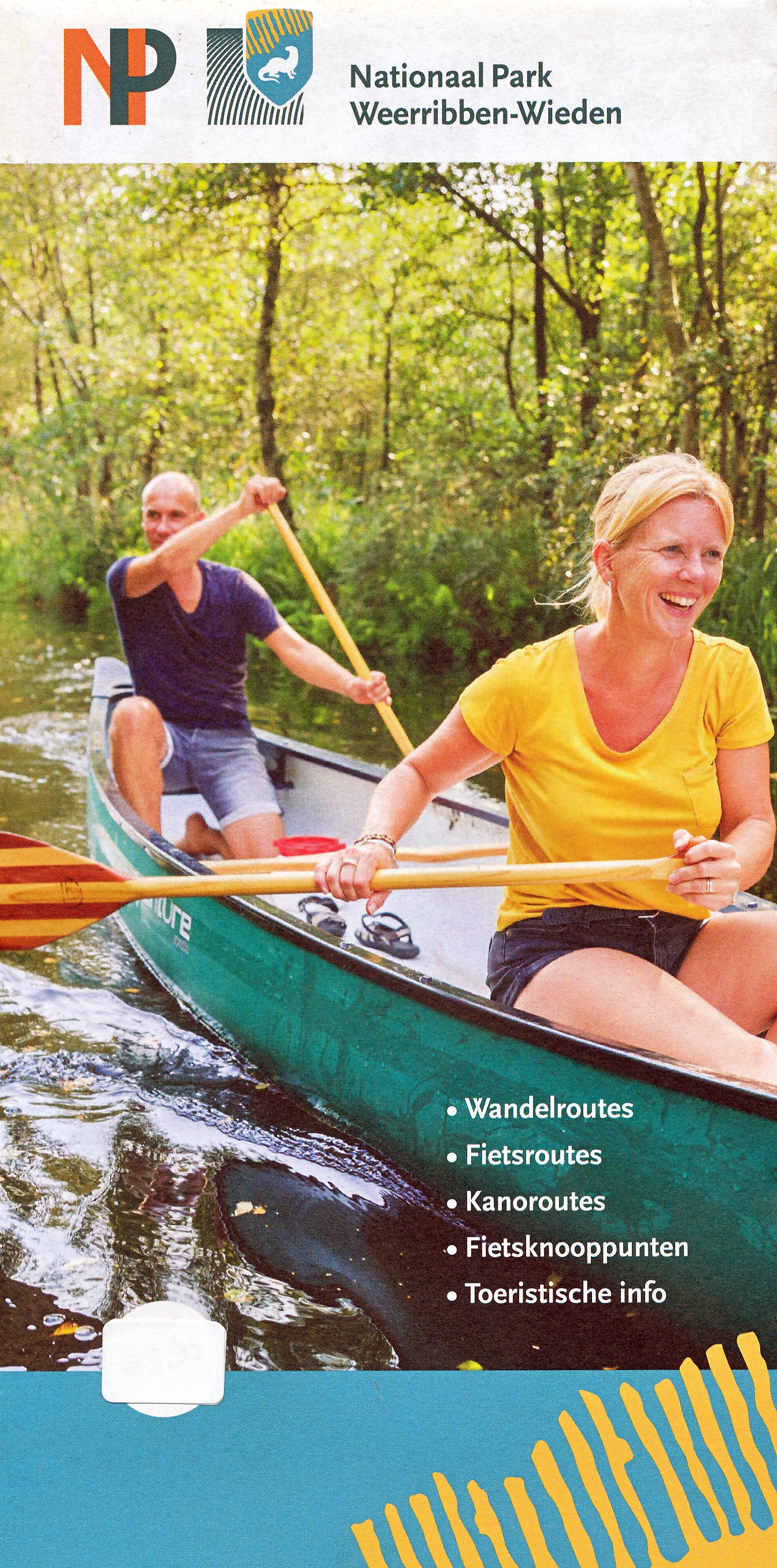
Duidelijke en gedetailleerde kaart van Nationaal Park De Weeribben - De Wieden met alle plaatsen, campings, verblijfsrecreatie, havens, horeca maar ook met ingetekende wandelrouts, kanoroutes en fietsroutes met de fietsknooppunten. Achterop de kaart nog eens extra uitleg van bezienswaardigheden en natuur. Met plaatsen als Ossenzijl, Kalenberg, Steenwijk, Blokzijl, Vollenhove, Zwartsluis, en Giethoorn.
€6,95
Bekijk product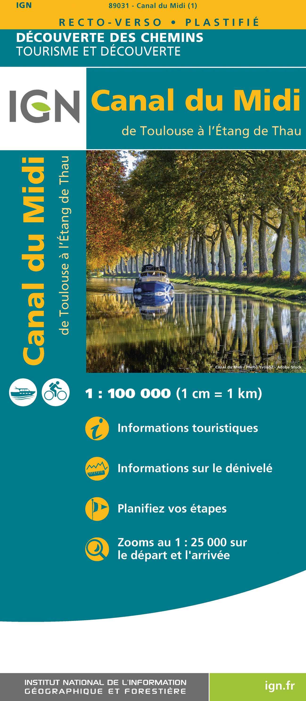
Duidelijke overzichtskaart waarop de fietsroute langs het Canal du Midi goed en helder staat ingetekend. Ideaal om - al dan niet met een fietsgids - deze prachtige fietstocht te maken.Makkelijke route met heel weinig ander verkeer. Le canal du Midi est un canal de navigation français à bief de partage qui relie Toulouse à la mer Méditerranée depuis le xvii? siècle. D'abord nommé « canal royal de Languedoc », les révolutionnaires le rebaptisent en 1789 canal du Midi. van de uitgever En famille ou entre amis, que l’on vienne juste faire un crochet pour l’admirer ou qu’on le suive de Toulouse jusqu'à Marseillan, il se dégage du Canal du Midi une impression de sérénité, de quiétude. Aujourd’hui, c’est l'un des plus majestueux itinéraires de loisirs à découvrir à pied, à vélo, ou en bateau. Sans difficulté particulière, c'est un parcours idéal en famille. Le canal étire ses 250 kilomètres afin de relier l’Atlantique (via la Garonne) à la Méditerranée. Il serpente lentement au cœur des vignes, des collines verdoyantes et des villages aux ruelles étroites baignées de lumière. Le temps s’arrête, la magie opère. La douceur de vivre vous gagne. Ici, même le clapotis de l'eau a l’accent du Sud. Le Canal du Midi, c’est le symbole incontournable du Languedoc, du Midi et de son histoire. Le Grand Bief, est l’une des nombreuses prouesses des ouvrages d'art du Canal du Midi. L'ingénieur Pierre-Paul Riquet a réussi à maintenir la même côte (altitude) de 31,35 mètres au-dessus du niveau de la mer, et ce pendant 54 kilomètres ce qui permet de traverser de beaux villages comme Capestang, Poilhes, Colombiers. Le canal du Midi nommé « canal royal de Languedoc », les révolutionnaires le rebaptisent en 1789 canal du Midi. Echelle 1 : 100 000
€11,95
Bekijk product