
Beantwoord enkele vragen, en binnen seconden geeft AI je een persoonlijk aankoopadvies op maat.
Beantwoord enkele vragen, en binnen seconden geeft AI je een persoonlijk aankoopadvies op maat.
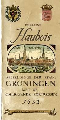
Afbeeldinge der Stadt Groningen met de omliggende fortressen Wie kent niet de kaarten van Egbert Haubois (1643) en stadsarchitect Siebe Jan Bouma (1925)? Iedere kaart is een kunstwerk op zich en meer dan een weergave van straten en bebouwing alleen. Samen vertellen ze ons het verhaal van de stad; haar historie, haar groei en hoe de Groningers leefden. De mooiste kaarten, waaronder ook deze, worden in stijl heruitgegeven en voorzien van bijzondere achtergrondinformatie. Deze kaart, de ‘Kleine Haubois’, is een bijzondere versie van de oorspronkelijke kaart van Egbert Haubois uit 1643: de kaart die decennia lang de meest betrouwbare plattegrond van de stad Groningen was. De oorspronkelijke Haubois kaart verscheen al eerder in de serie. Deze kleurrijke ‘kleine’ versie is verrijkt met nieuwe informatie en bevat bovendien portretten van de stadhouders van Groningen en prachtige afbeeldingen van de destijds rond de stad Groningen liggende forten.
€7,95
Bekijk product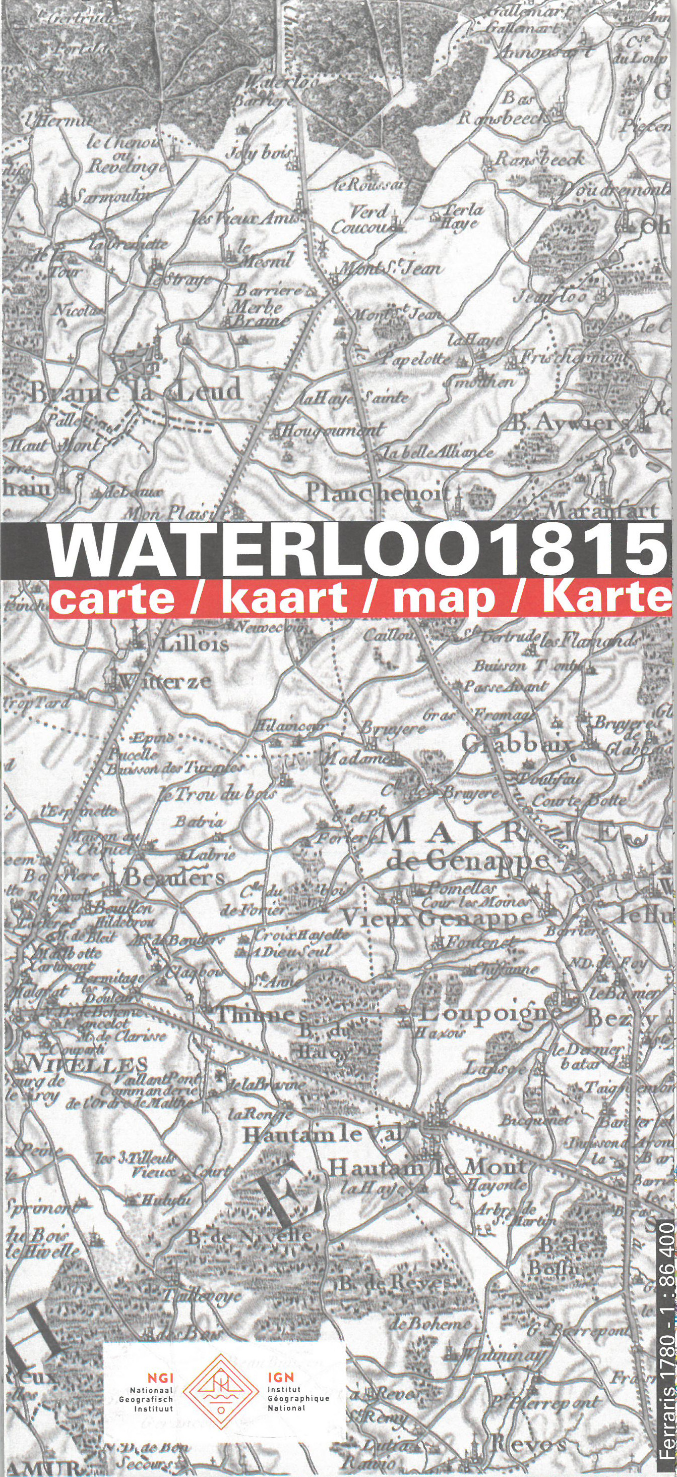
Unieke historische kaart van Waterloo en dirercte omgeving waarbij de Slag om Waterloo in 1915 geografisch wordt weergegeven. Men heeft hiervoor een topografische kaart 1:50.000 gebruikt met daarop ingetekend de posities en richtingen van dee diverse legers. Op de achterzijde nog een aantal inzetten van deelgebieden met veel informatie, o.a. de herdenkingsplaatsen Ligny, Quatre Bras en Waver
€9,95
Bekijk product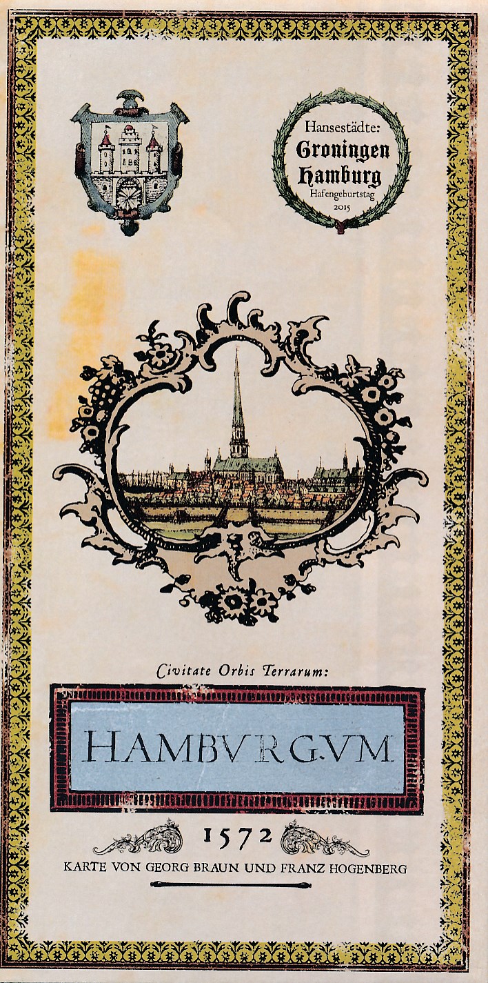
In de zestiende eeuw verscheen de eerste echte plattegrond van de stad Hamburg, toen nog Hamburgum geheten. Het was het begin van een lange cartografische traditie die geresulteerd heeft in talloze prachtige kaarten van de stad. Een van de bekendste kaarten is de stadsplattegrond van Georg Braun en Franz Hogenberg uit 1572. Deze wordt in het kader van het Hafengeburtstag Hamburg 2015 heruitgegeven. Bovendien viert de kaart de eeuwenoude band tussen de Hanzesteden Hamburg en Groningen. De eerste editie van de Civitates orbis terrarum verscheen in 1572 en bevatte kaarten van onder andere Aken, Amsterdam, Brussel, Casablanca, Hamburg, Bremen, Groningen, Keulen, London, Mechelen, Rome en Wenen. De atlas werd erg goed ontvangen en raakte snel ook buiten Duitsland bekend. De complete serie, waarvan het zesde en laatste deel in 1617 verscheen, bevatte 564 aanzichten, vogelvluchten en stadsplattegronden van ruim 200 steden: van Parijs en Londen tot Damascus en Moskou. In de Civitates waren de Duitse en Nederlandse steden goed vertegenwoordigd. Zo vinden we naast de genoemde steden ook afbeeldingen van Worms, Weimar, Rostock, Nuremberg, Munchen, Munster, Magdenburg, Mainz, Leipzig, Emden, Dordrecht, Franeker, Harderwijk, Haarlem, Maastricht Brielle, Utrecht, Leeuwarden en vele anderen. LET OP: de kaart is volledig in het Duits!
€7,95
Bekijk product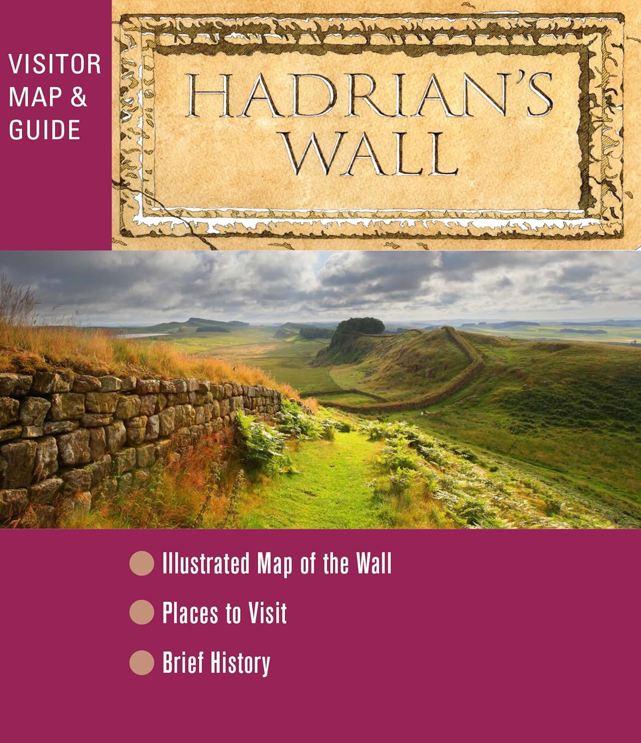
A beautifully illustrated fold-out map of Hadrian's Wall on one side and short history and guide on the other. The historical sites have been chosen because of their archaeological interest and easy accessibility from car parks and bus stops. Many other places along the Wall are well worth visiting.
€7,95
Bekijk product

Historische kaart van het gebied rond Chemin des Dames. De Chemin des Dames is een bijzondere weg gelegen in het noorden van Frankrijk, midden in de driehoek Soissons, Laon en Reims. De weg is grotendeels gelegen op een heuvelrug die enkele tientallen meters uitsteekt boven het omringende, zacht glooiende, land. Op deze kaart zijn de troepen en slagvelden ingetekend rond 1917 ten tijde van de 1e Wereldoorlog. L'IGN édite la carte de « Bataille du Chemin des Dames 1917 » pour commémorer son centenaire. Cette carte, à l’échelle du 1 : 75 000 (1cm =750m) présente les lignes de front, les lieux de mémoire (mémoriaux, cimetières militaires, anciens ouvrages défensifs, musées). Réalisée en partenariat avec la Mission du Centenaire de la première guerre mondiale et le Comité Départemental du Tourisme de l’Aisne, cette carte propose une légende et des informations éditoriales en trois langues : français, anglais et allemand. WW1, 1e wereldoorlog, Eerste wereldoorlog
€11,95
Bekijk product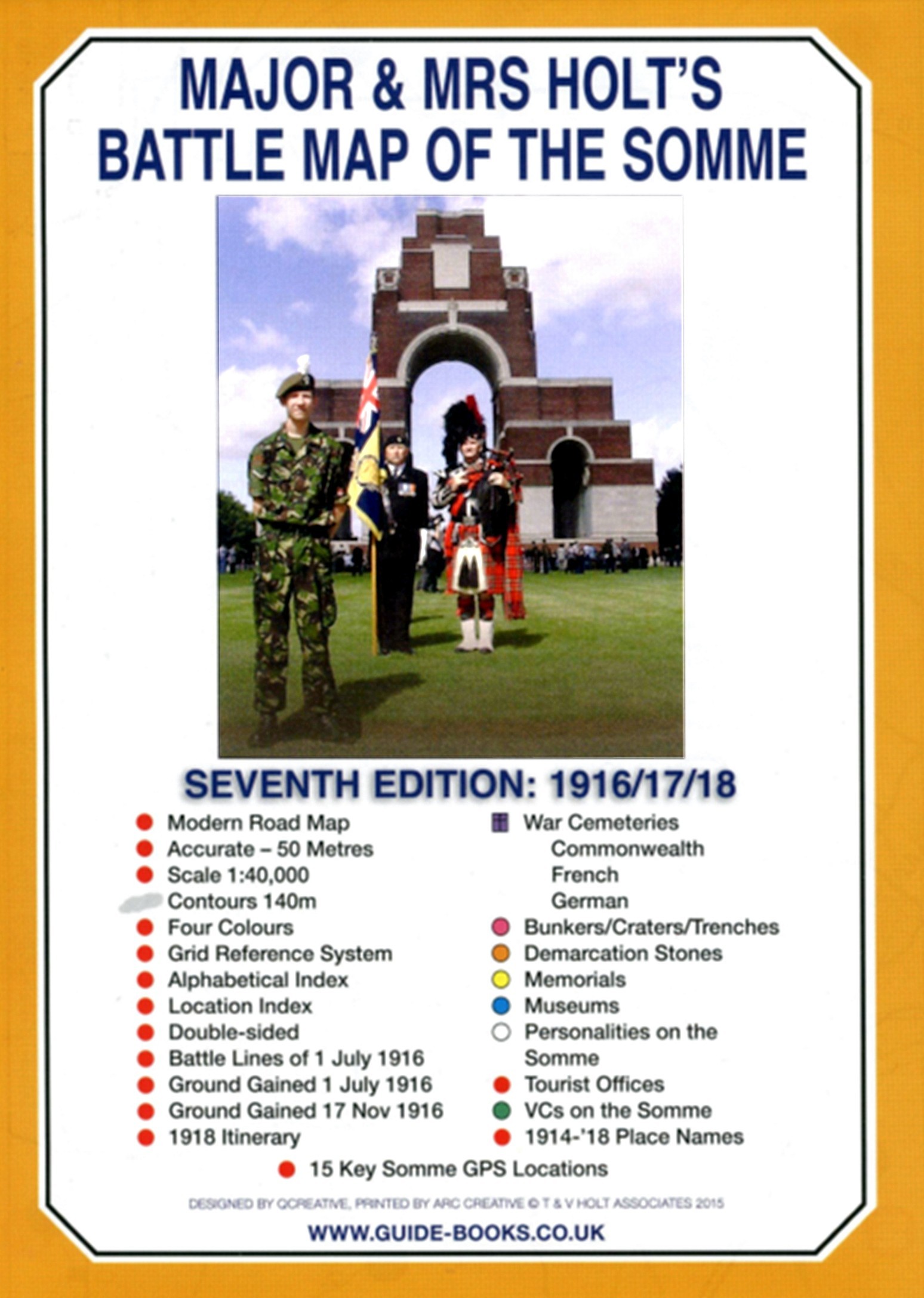
This is the only map available that shows the exact locations of 300 memorials and places of interest on the battlefields of the Somme This Sixth Edition also covers the American and Canadian areas between Amiens and Montdidier. It is double sided in four colours with an overall view on one side and a detailed view on the other, both showing battle lines and ORBAT information There are detailed alphabetical and thematic indexes to all 300 points. Size - The map measures 19.5 inches (49cm) by 28 inches (71cm). It is printed in four colours and is double sided on firm glossy paper. On one side at a scale of 1:70,000 is shown the whole of the Somme battle area from Bullecourt in the north to Amiens in the south and from Doullens in the west to Pyronne in the east. Also on this side are the colour coded indexes and the map of the 1918 sector from Villers Bretonneux to Cantigny. On the other side at a scale of 1:40,000 the battle area mostly, but not exclusively, associated with the 1 July 1916 operations is shown in great detail.Click here to view large image What is Marked on the Map There are about 125 memorials shown as well as over 150 cemeteries, 11 museums and a host of general information. Sites are precisely marked using coloured lollipops whose stick end indicates the exact position of what is represented. Thus - Somme map key Also marked are the front lines of 1 July 1916 giving the Army, Corps and Divisional boundaries for the British forces including their Commanding Generals. 1914/18 place names are marked in red, heights over 140m are shaded in grey clearly showing the barrier of the Thiepval - High Wood ridge and significant woods are coloured green. Modern roads and motorways are shown and numbered enabling the map to be used for navigation as well as for relating to battle accounts
€9,95
Bekijk product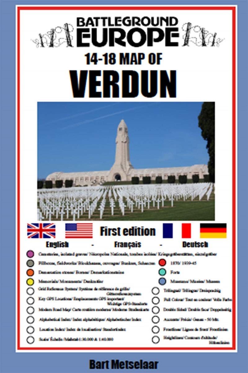
Comprehensive mapping for the Battle of Verdun 1916 and a sizable part of the early days of the Meuse-Argonne Offensive 1918. Clearly produced in full color, with different types of feature in different colors, all supported by two comprehensive keys. For many years the Holts have provided tourers to the battlefields with excellent mapping for the Ypres Salient and the Somme. This map of the Verdun/Meuse area fills one of the many gaps in the coverage of the Western Front. This map of the Verdun battlefield is in the same style, using a color coded system to distinguish the different types of features. It includes some 300 locations of memorials, cemeteries, significant remnants of the battle terrain, remaining fortifications, trenches, the destroyed villages and other vestiges of the war. On the reverse there is a cut out and enlarged section of the Verdun battlefield in particular - the most visited part of the area, which provides greater detail. This section includes the Ossuary at Douamont, Forts Douamont, Vaux and Souville and many more features. The front line at key stages of the battle in 1916 is clearly indicated. GPS references are given for the more significant sites. Roads and major tracks are shown, with restrictions in access as known at the date of publication. The map extends from the eastern fringes of the Argonne Forest to the west and encompasses the whole of the 1916 Verdun battlefield to the east. This means that several places of interest to the student of the American army's offensive in late 1918 are shown. The map is trilingual - in English, French and German - so far as is practicable given the constraints of space. The map is of a manageable size, both in a vehicle and when being used outside.
€9,95
Bekijk product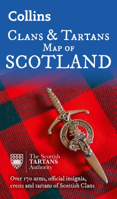
Prachtige kaart van Schotland waarin duideljk wordt welke cland er zijn geweest en nog zijn. Met een mooi overzicht van alle Tartans (Stoffen) die er aan gekoppeld zijn. Discover Scotland with this authoritative guide to clans, tartans, and their origins. These popular maps are highly detailed, showing hundreds of arms, official insignia, crests, and tartans of the Scottish clans. This beautifully illustrated map is both decorative and informative. This map includes: Two double-sided, full-colour maps of ScotlandMore than 170 arms, the official insignia of clan chiefs, crest badges, and the locations of their ancient territories around the time of King James VIMore than 240 tartans with corresponding clan/ family names, alphabetically arranged for easy look-upAdditional information about the history of the clans and their tartans The map is ideal for those those with an interest in Scottish heraldry, clans and family history. Other titles in the series include:* Castles Map of Scotland (99780007508532)* Whiskey Map of Scotland (9780008368319)d of Old Clans Map
€12,95
Bekijk product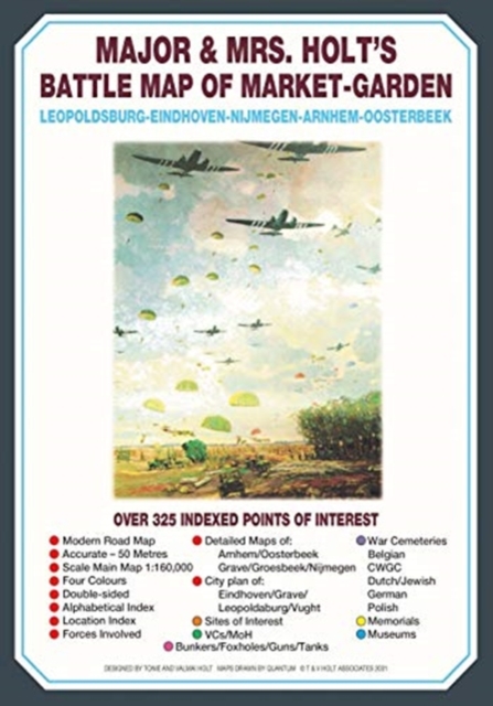
This is the only map of its kind devised and created by Major and Mrs Holt and is used by many guides It shows the locations of 300 memorials and war cemeteries over THE WHOLE OPERATION MARKET-GARDEN AREA It shows the progress of the battle from Leopoldsburg to Eindhoven, Nijmegen, Arnhem and Oosterbeek overlaid on modern roads In four colours, double sided and with 10 inset maps it shows all drop and landing zones Suitable for navigation by car, bicycle or foot Size - The map measures 19.5 inches (49cm) by 28 inches (71cm). It is printed in four colours and is on firm glossy paper. On one side at a scale of 1:180,000 is shown the whole of the Market Garden corridor of operations from Arnhem in the north to Leopoldsburg in the south and from Vught in the west to Overloon in the east. See below for details of the other side. What is Marked on the Map This map is quite unique and no other exists that shows the Market Garden Corridor in such detail. Over 230 memorials are clearly indicated as well as a dozen museums and 42 military cemeteries or military burial plots. On the 1:180,000 side are indexes that cover that map and the inset maps of Leopoldsburg, Eindhoven and Vught. Overlaid on the map are the routes taken by the ground forces from the XXX Corps start line at Joe's Bridge on the Belgian border as well as the drop zones used by the British 1st Airborne Division and the American 101st and 82nd Airborne Divisions. On the other side is a greatly expanded map of the Arnhem to Oosterbeek area showing the exact drop/landing zones for the British 1st Airborne Division and the routes taken forward towards the bridge over the Rhine. Inset into that map are detailed maps of the St Elisabeth Hospital area, the John Frost Bridge area and the Oosterbeek perimeter. Also on this side is a similarly expanded map showing the drop zones and movements of the American 82nd 'All American' Airborne Division from Groesbeek towards Nijmegen and with inset and indexed maps to Nijmegen and to Grave. On both sides is a base map showing modern roads thus making navigation simple.
€9,95
Bekijk product