
Beantwoord enkele vragen, en binnen seconden geeft AI je een persoonlijk aankoopadvies op maat.
Beantwoord enkele vragen, en binnen seconden geeft AI je een persoonlijk aankoopadvies op maat.


Goede stadsplattegrond van Shanghai. Met register en suburban treinsysteem. De echte buitenwijken van deze megastad staan er niet op. daarnaast een overzichtskaart van zuidoost China. This updated map of rapidly-changing Shanghai has been enhanced in this edition by being printed on ITM waterproof plastic paper and by the addition of a separate map on the reverse side of all of South East China. The regional map covers from Nanning to Beijing, so perhaps covers a wider area than just Fujian and Guangdong provinces, but this is a much more detailed map than anything we have attempted before, and is an excellent aid to anyone based in Shanghai and thinking of travelling to Xi’an, or Guilin, as well as closer destinations. The Shanghai side has been updated with the latest road and subway additions including, for the first time on any map, the route of the new MAGLEV line being built through the southern part of the city. Double-sided, on ITM plastic, Legend Includes: Roads/highways, public transportation, points of interest, accommodation, temples, information, and other attractions.
€13,95
Bekijk product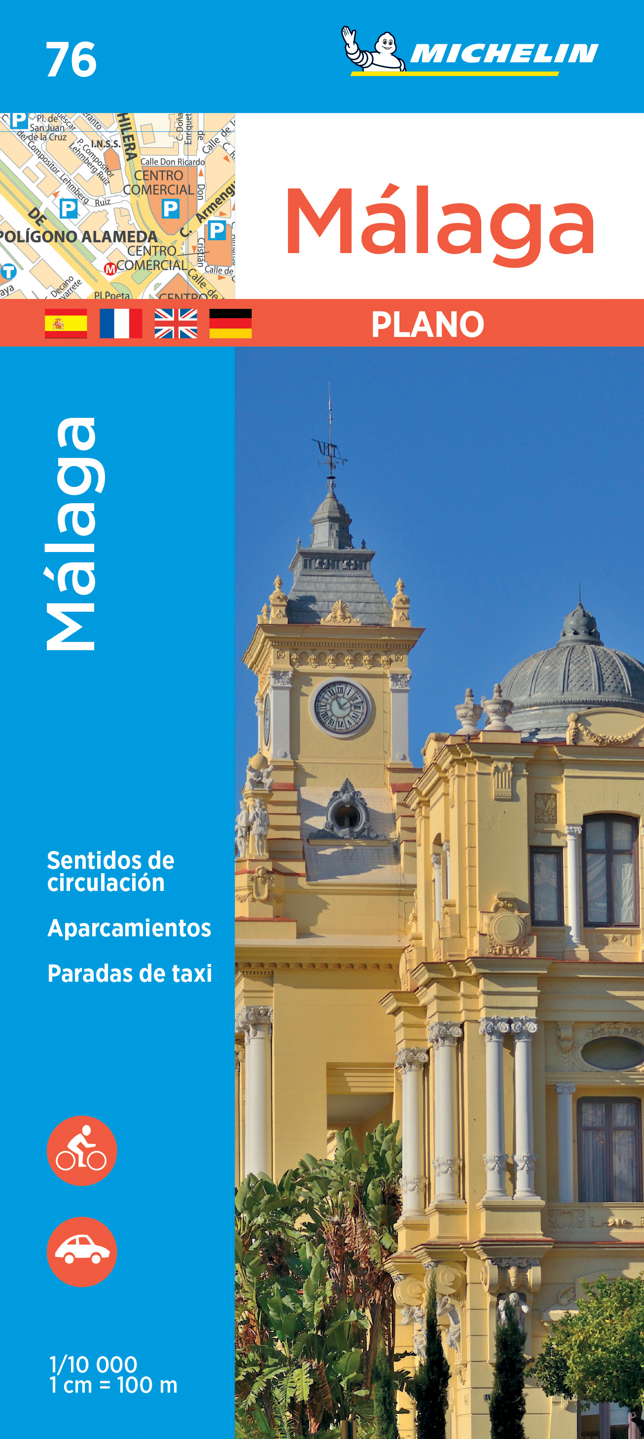
Dit is een uitgebreide en heldere stadsplattegrond van Malaga en El Palo met compleet straatnamenregister en o.a. parkeergarages en eenrichtingsverkeerpijlen. Ook bevat hij een uitvergroting van het toeristische centrum van Malaga. Zoals gebruikelijk goed leesbaar!
€9,95
Bekijk product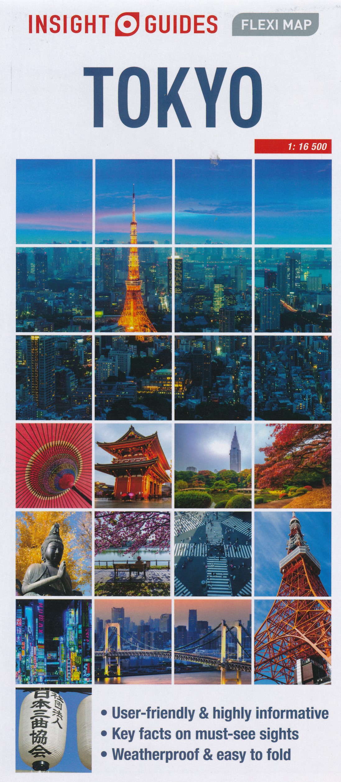
Geplastificeerde kaart van Tokyo, met register. Voor de 'gewone' toerist een handige kaart, geen groot formaat, overzichtelijk met alle belangrijke plaatsen goed weergegeven. Insight Guides Flexi Map: fold out plastic map of a destination with sights marked Newly updated edition of Insight Guides Flexi Map Tokyo High production values - fold out water proof map, full colour Includes key facts on the top sights marked on the map with corresponding numbered dots Content overview: Detailed cartography, information on top sites, facts for the visitor, travel information, comprehensive index, detailed street plans and detailed legend
€9,95
Bekijk product
Behoorlijk uitgebreide stadsplattegrond van Belfast, de hoofstad van noord Ierland. Met register. A fully coloured map covering an area of about 12 miles north/south by 8 miles east/west around Belfast, The Greater Belfast street map, is based on our large scale digital database and provides the clearest possible coverage of the city and surrounding area. With this double sided map is a useful booklet containing every street name in the greater Belfast area, with grid references for ease of location.
€19,95
Bekijk product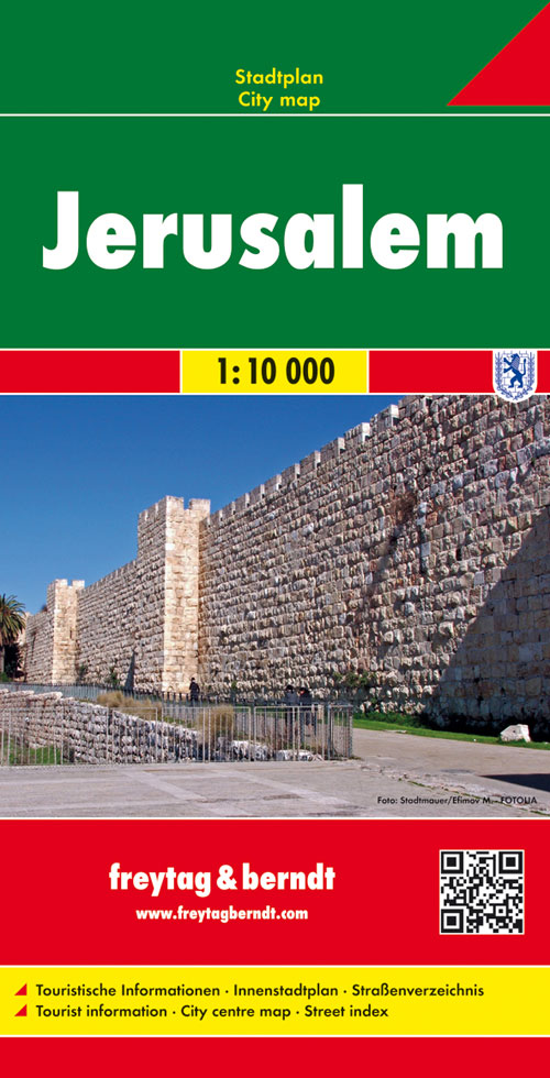
Stadsplattegrond met register. Helder kaartbeeld waarbij de naamgeving goed leesbaar is weergegeven. Met de toeristische bezienswaardigheden in symbolen weergeven: monumenten, musea, stadions e.a. Daarnaast handige zaken als postkantoren, parkeergarages en stations. Veelal ook met een openbaar vervoer of metro kaart als inzet Large, general street plan of the city with a clear enlargement of the Old City at 1:4,500. The main plan extends west to beyond the Jerusalem Forest and east to Mount of Olives. Coverage north/south is from Ramat Polin and Beit Khanina to Gilo. Public buildings a highlighted and symbols mark places of worships, monuments, etc. A large inset provides more detailed coverage of the Old City, indicating various places of worship and historical monuments, car parks, etc. All place names are in Roman alphabet only. Multilingual map legend included English and Hebrew.
€13,95
Bekijk product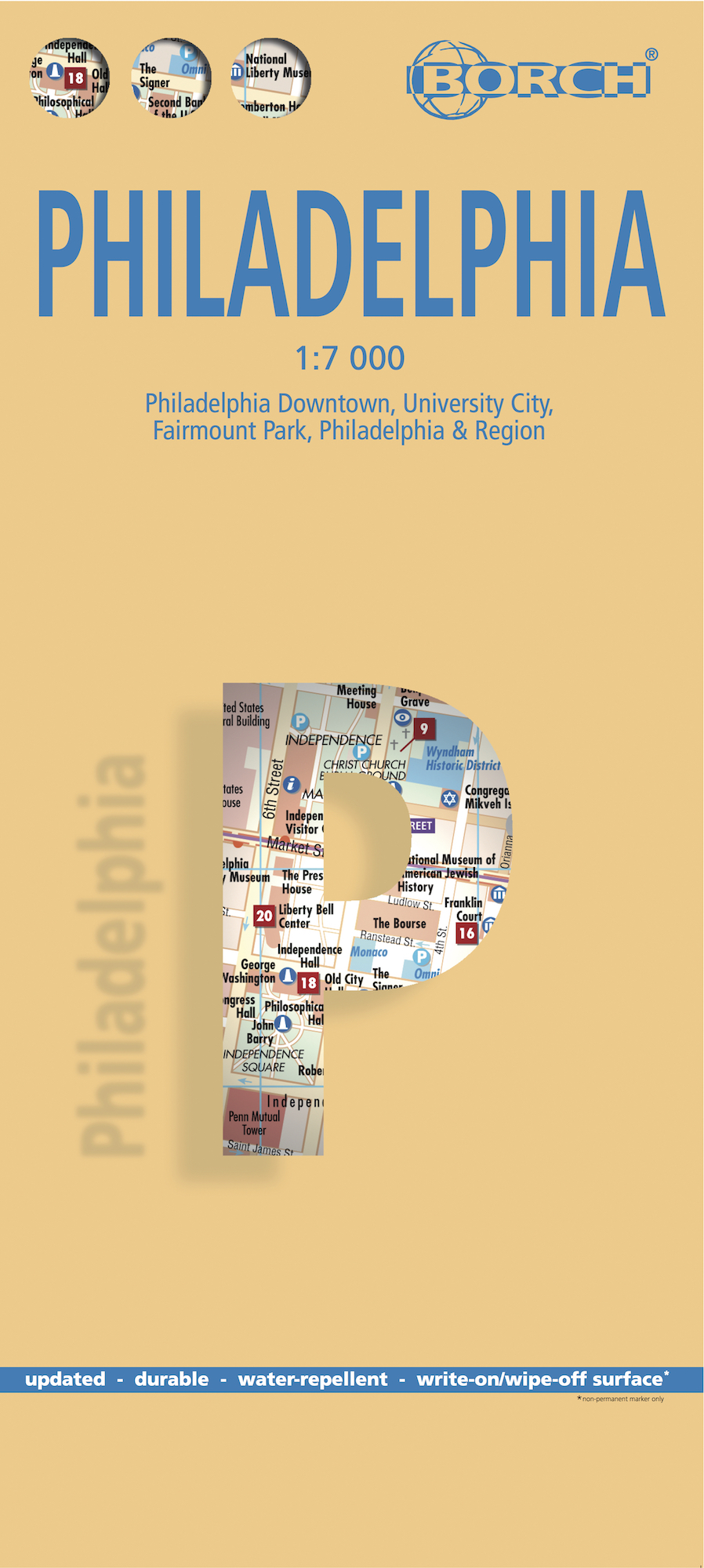
Borch Philadelphia is een duidelijke, geplastificeerde plattegrond van het centrum met informatie over openbaar vervoer en bezienswaardigheden. Inclusief straatnamenregister. Our soft-laminated folded map of Philadelphia shows: Philadelphia Downtown 1:7 000, Philadelphia & Region 1:125 000, University City 1:12 000, Fairmount Park 1:15 000, Public Transport Philadelphia, Top 30 Sights, USA administrative & time zones. Borch Maps are easy to fold, durable and water-repellent with a wipeable surface. Borch Maps show hotels, museums, monuments, markets, public transport, top sights and points of interest, useful statistics, conversion charts for temperatures, weights and measurements, climate charts showing temperatures, sunshine hours, precipitation and humidity, overview maps, time zones, and much more... Thanks to Benjamin Franklin, one of the founding fathers of the United States, the ideas and actions leading to the American Revolution were formed in Philadelphia and for this reason the city is known as "The Birthplace of America". Philadelphia was the center of the original 13 American colonies and is today the largest city in Pennsylvania. Affectionately called "Philly", Philadelphia is an important commercial, educational and cultural center. The most impressive sight of historical importance is Independence Hall, where the Declaration of Independence was signed and the Liberty Bell can be seen in the nearby Liberty Bell Center. Apart from its many historical museums the city has several art museums, science museums and museums for natural history, archaeology and anthropology. Philly's vibrant night life can be experienced on South Street and in the Old City, and music fans shouldn't miss the Avenue of the Arts in City Center, home to the Philadelphia Opera and Orchestra as well as many excellent restaurants.
€11,50
Bekijk product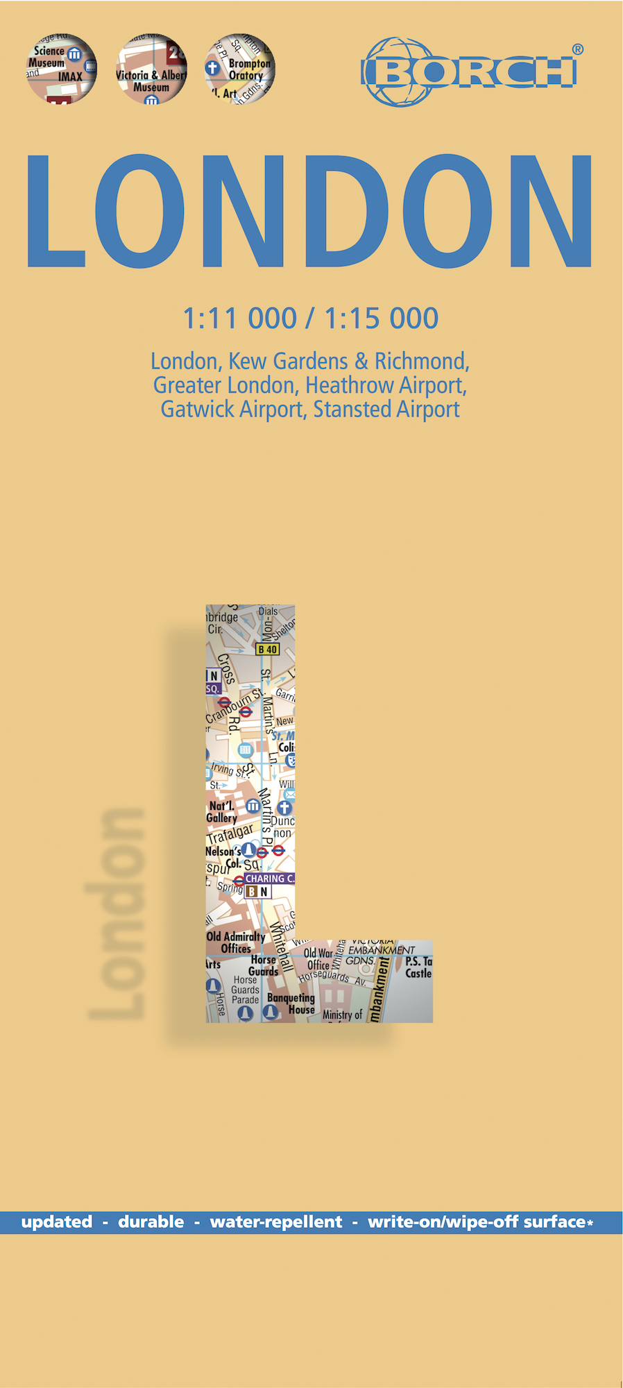
Stevige, geplastificeerde stadsplattegrond van Londen op een handzaam formaat. Schaal 1:11.000 en 1:15.000, afhankelijk van de deelkaart. De kaart bevat een gedetailleerde kaart van centraal Londen. Verder zijn er inzetten van Greater Londen en detailkaartjes van de vliegvelden en enkele toeristische plaatsen in opgenomen. Bevat ook een kaart van de metrolijnen. Ideaal voor een stedentrip of zakenreis naar de City. Our soft-laminated folded map of London shows: London 1:15 000, Kew Gardens & Richmond 1:35 000, Central Sights 1:11 000, Greater London 1:375 000, Airports Heathrow, Gatwick, Stansted, Public Transport London, Great Britain administrative. Borch Maps are easy to fold, durable and water-repellent with a wipeable surface. Borch Maps show hotels, museums, monuments, markets, public transport, top sights and points of interest, useful statistics, conversion charts for temperatures, weights and measurements, climate charts showing temperatures, sunshine hours, precipitation and humidity, overview maps, time zones, and much more... London is - in every sense - global! It is one of the largest and most populous cities in Europe, a centre of world trade, transport, tourism, finance, fashion and culture. London is unique in its diversity and is a melting pot of countless cultures. Its inhabitants are courteous and friendly, they contribute to making this world capital a pleasure to visit. London is served by five international airports, it has one of the oldest underground public transport systems in Europe and - we must mention it again - the friendliest taxi drivers in the world. The vast list of sights in and around London includes several world heritage sites including the Tower of London, Westminster Palace, Westminster Abbey, Greenwich, the Royal Botanic Gardens in Kew. London also offers innumerable museums, galleries and monuments, parks, gardens, more botanic gardens, stunning architecture, trendy and traditional world-class shopping and among the best restaurants and nightlife you’ll find anywhere.
€9,95
Bekijk product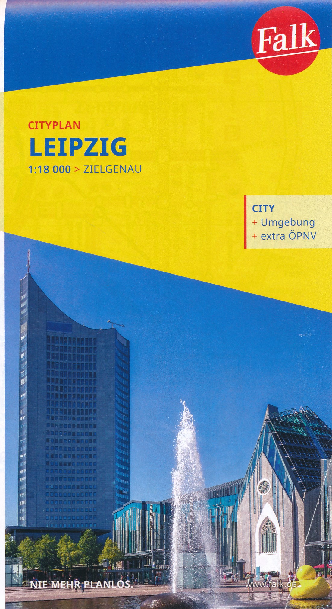
Goede handzame stadsplattegrond van Leipzig met register. Centrumkaartje op betere schaal en een aparte OV inzet. Für deutsche Großstädte sind die Falk Citypläne im Pocket-Format einfach nützlich. Mit Straßenverzeichnis, Durchfahrtsplan und Verkehrslinienplan. Mit dem FALK Cityplan ist man im Kernbereich einer Großstadt unterwegs. Dieser handliche Plan ist der ideale Wegweiser für die schnelle Orientierung in der fremden Stadt. Für den Touristen ist dieser #kleine FALK" bei der Stadtbesichtigung nahezu unentbehrlich. Großflächige Nebenkarten geben wertvolle Auskünfte; man erhält hier Hinweise für eine gezielte Zufahrt, Detailinformationen zum Innenstadtbereich und lernt die schnellen, öffentlichen Verkehrsmittel der Stadt kennen. Wird eine bestimmte Straße gesucht, so findet man diese im Straßenverzeichnis auf der Rückseite des Planes. Neben dem blauen Suchgitter enthalten alle Citypläne ein schwarzes UTM- Gitternetz (nicht bei den Hyperboloid-Projektionen). Das Netz hat eine Maschenweite von 2.000 Metern mit einer Feineinteilung von 100 Metern # einfach ideal zur Entfernungsabschätzung für die Entdeckungstouren durch die Stadt. Hauptkarte 1:20 000 mit mehrsprachiger Legende (D, GB, F) - Cityplan Zentrum Leipzig 1:10 000 - Durchfahrtsplan 1:110 000 - LVB Liniennetzplan; Auf der Rückseite: - Straßenverzeichnis mit Postleitzahlen und Suchfeldangaben - Daten und Fakten
€9,95
Bekijk product