
Beantwoord enkele vragen, en binnen seconden geeft AI je een persoonlijk aankoopadvies op maat.
Beantwoord enkele vragen, en binnen seconden geeft AI je een persoonlijk aankoopadvies op maat.
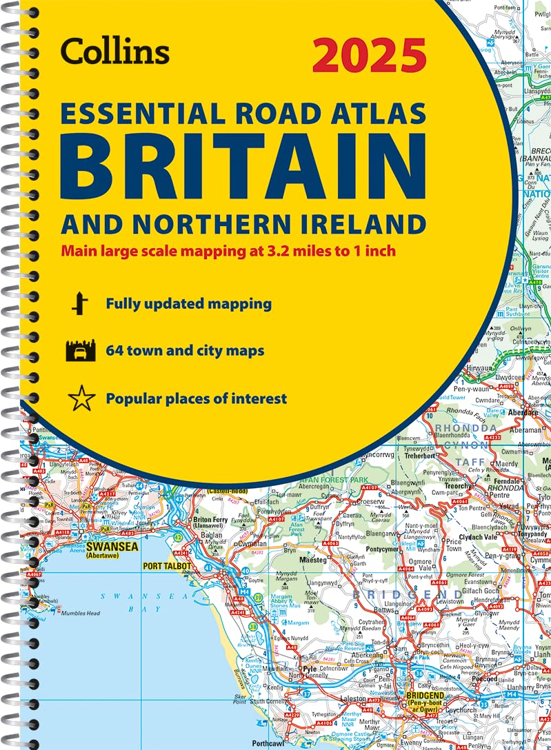
This A4 road atlas with lie-flat spiral binding provides clear and detailed road mapping for England, Wales and Southern Scotland at a scale of 3.2 miles to 1 inch (1:200,000). For Northern Scotland the mapping is at a scale of 4.2 miles to 1 inch (1:266,000), with land height shown by different layers of colouring. Main features: Route planning section including maps at a scale of 22 miles to 1 inch for long distance route planning, motorway services information, and a handy distance calculator chart26 urban area approach maps at a larger scale which clearly show the best routes through and into the busiest built-up-areas 64 street maps focused on town centres showing places of interest, car park locations and one-way streets. All the street maps are fully indexedOver 30 categories of places of interest including castles, theme parks, sports venues, universities, mountain bike trails and surfing beachesThe top 1000 most visited places of interest are indexed with full postcodes to aid integration with satnav systems This is the ideal purchase for drivers, navigators and route planners who want the very best road atlas of Britain in an A4 format.
€20,95
Bekijk product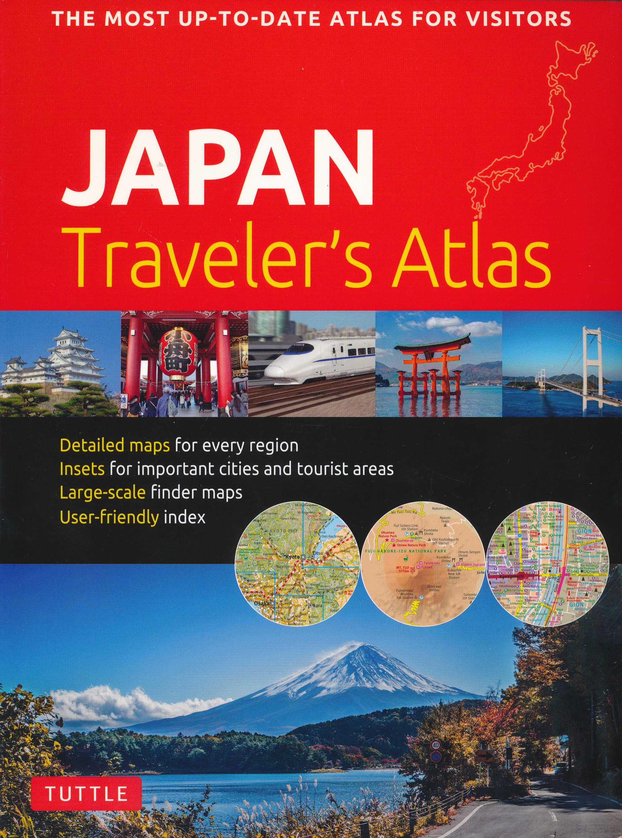
Finding your way around the various regions of Japan is a breeze with this handy Tuttle Japan Traveler's Atlas. Designed for the adventurous traveler and containing all the maps you'll need on your explorations, this atlas includes many views that are not available anywhere else. The atlas is conveniently divided into the major regions of Japan: Tokyo Mt. Fuji & Around Tokyo Central Honshu Kyoto Kansai Hiroshima & Western Honshu Northern Honshu Hokkaido Shikoku Kyushu Okinawa & the Southwest Islands Each of the 148 maps in this atlas is presented in a logical, easy-to-follow manner, with emphasis on the most frequently-visited areas. All cities, towns, villages, places of interest including nature reserves are indexed for quick reference. Comprehensive: detailed insets are given for all the major cities, travel destinations and business hubs in Japan. Informative: Precise locations are indicated for all popular sights, hotels, restaurants, temples, shopping malls and other essential locations. Practical: The handy size, well-designed key maps and comprehensive index help you find any place you are looking for quickly. Reliable: No need to worry about cell service or battery—the maps in this atlas are thoroughly researched and regularly updated by the leading publisher of Asia Pacific maps.
€19,95
Bekijk product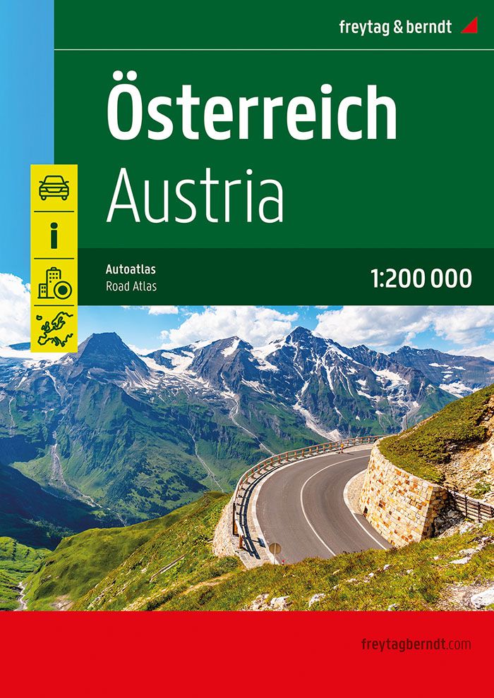
Neben der übersichtlichen Gestaltung bietet der "Straßen-Atlas Österreich 1:200.000" zahlreiche Zusatzinformationen wie z.B. Sehenswürdigkeiten, Campingplätze und zahlreiche Stadtpläne. - Erweiterter Kartenteil- Ortsregister mit Postleitzahlen- Planungskarte Europa 1:3,5 Mio.- Staateninformationen Europa- Stadtpläne mit Straßenverzeichnis von Bregenz, Eisenstadt, Graz, Innsbruck, Klagenfurt am Wörthersee, Linz, Salzburg, St. Pölten und Wien; freytag & berndt Autoatlanten sind für viele Länder und Regionen weltweit erhältlich.
€16,95
Bekijk product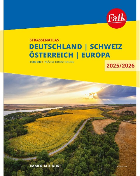
Der Falk Straßenatlas Deutschland wird ergänzt durch die beiden angrenzenden Reiseländer Österreich und Schweiz. In dem Detailmaßstab 1:300 000 sind selbst kleine Orte zu finden.Die praktische Spiralbindung sorgt zusätzlich für bestes Handling.
€16,95
Bekijk product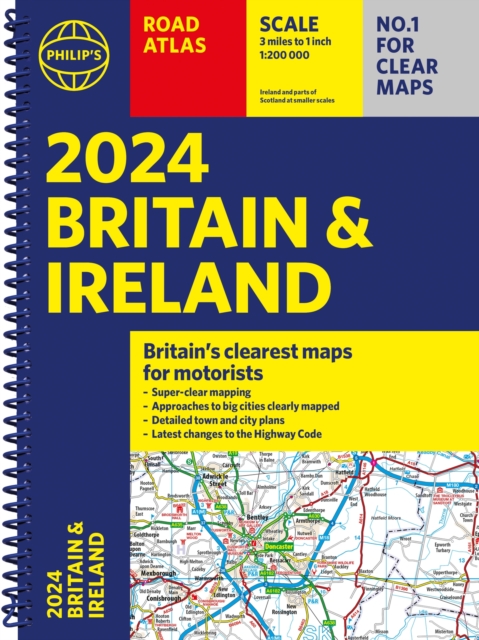
Let op! Ierland en een gedeelte van Schotland hebben een andere schaal dan de rest van de atlas. PHILIP'S - Market leaders and No. 1 in the UK for clear maps'Good balance between detail and clarity with excellent town maps' What Car? * Super-clear mapping at a scale of 3 miles to 1 inch = 1:200,000* Includes the latest highway code requirements* Completely updated and revised for 2024* New map showing Smart Motorways- Practical spiral bound, lie-flat format- 160 pages of fully updated super-clear road maps - 10 pages of detailed route-planning maps - plan your route in advance - 88 indexed town-centre maps - 14 pages of city approach maps with named arterial roads - 2 page road map of Ireland- Map of scenic Britain and a map highlighting railways, airports and ferry ports Philip's 2024 Road Atlas Britain and Ireland is the top-of-the-range spiral road atlas featuring the latest maps from the Philip's digital database. Voted Britain's clearest and most detailed in an independent consumer survey, the mapping is super-clear. Philip's 2024 Road Atlas Britain and Ireland contains 160 pages of road maps covering Britain at 3 miles to 1 inch, with the Western Isles, Orkney and Shetland at smaller scales. The maps clearly mark service areas, roundabouts and multi-level junctions, and in rural areas distinguish between roads over and under 4 metres wide. The atlas also includes a 2-page road map of Ireland, 10 pages of route-planning maps, a distance table, 10 large-scale city approach maps with named arterial roads, and 88 extra-detailed and fully indexed town and city plans.
€23,95
Bekijk product
Das international bewährte Standardwerk für sportlich-touristisch eingestellte Auto- und Zweiradfahrer! Aus der Vielzahl anfahrbarer Hochpunkte innerhalb des weiten Alpenbogens von Wien bis Marseille wurden rund 700 der interessantesten Hochstraßen und Ziele gewählt, sowohl asphaltierte als auch geschotterte Strecken berücksichtigt. Detailliert beschrieben werden alle landschaftlich besonders reizvollen Touristen- und Panoramastraßen, die letzten "wilden Pässe", ehem. Militärsträßchen, Schluchtstrecken und sonstigen kuriosen Fahrwege im Gebirge. Gegenüber der vorigen Ausgabe wurden zusätzliche Routen aufgenommen, es gibt nun 518 Kennzahlen auf 624 Seiten. Ausführliche Schilderungen der Straßenverhältnisse und aktuellen Zustände.345 Farbfotos, 109 farbige Kartenskizzen, 2 Sprechende Grafiken. Höhenprofile (Längsschnitte) geben Auskunft über den Verlauf von Steigungen bzw. Gefälle. Steigungsangaben für alle Straßen in Prozent. Für Wohnmobil- und Busfahrer wichtige Tunnel- und Galeriehöhen. Die Bewertung der fahrtechnischen Schwierigkeiten erfolgt in differenzierter Weise nach der Denzel-Alpenstraßen-Skala von 1 bis 5 und den Zwischenstufen. Für die landschaftlichen Klassifikationen werden 0 bis 3 Sterne vergeben. Länderweises Farbleitsystem, Symbole für leichte und schwierige Schotterpisten, Symbole für Mautstraßen. Übersichtliches Layout. Handliches, bequem mitzuführendes Format 12,5 x 22 cm, strapazierbarer Einband. Ein Spezialführer, welcher die Herzen leidenschaftlicher Alpenfahrer höher schlagen lässt! Eingeteilt in 518 Kennzahlen werden rund 700 Hochpunkte in den Alpen (Asphalt- und Schotterstraßen) beschrieben. Ein länderweises Farbleitsystem macht das Buch besonders benützerfreundlich. Symbole für leichte und schwierige Schotterstrecken geben einen schnellen Überblick, wie eine Straße einzuschätzen ist. Fahrtechnische Beurteilungen nach Schwierigkeitsgraden von 1 bis 5. Symbole für Mautstraßen.
€52,40
Bekijk product
Kleine, handzame wegenatlas van de oorspronkelijke zijderoute van Libanon tot en met het westen van China. Handig met index, stadsplattegronden, goede legenda en behoorlijk gedetaillerde kaarten. A5 formaat, gebonden. De schaal van de kaarten verschilt per land. The Great Silk Road has been the traditional trading route between Europe and China for two thousand years. Starting in Xi’an in the east and ending at Antioch in the west. Much of the Silk Road still exists and can be visited. This 73-page atlas follows the route from west to east, starting in ancient Tyre (now Sour, in southern Lebanon) and in Samandag in Turkey, heading eastward through Syria and Iraq (with a two-page inset map of Damascus and a six-page spread for fabled Baghdad) before heading north of the Kavir Desert to Tehran (another four-page spread) and eastward into Afghanistan to follow either the northern or southern routes through modern-day Samarkand and Tashkent (more insets) before moving on to the Urumqi region of far-western China and eventually ending at Xi’an. The atlas is fully indexed and can be used east to west as easily as west to east.
€16,50
Bekijk product
Zeer gedetailleerde fietsatlas van Tsjechie met fietsroutekaarten op een schaal van 1:75.000 en regionale, lange afstandsfietsroutes, bewegwijzerde routes van de tsjechische fietsroutenetwerk, spiraalbinding - meertalige legenda, ook in Engels en Duits Dies ist der detaillierteste erhältliche Straßenatlas Tschechiens. Er enthält außerdem die bereits beschilderten und die geplanten Routen des tschechischen Radwandernetzes. Für Radwanderer auf größerer Tschechien-Rundreise ist dieser Atlas eine preiswerte Alternative zum Kartensatz. HINWEIS: Das Produkt liegt in tschechischer Sprache vor, die zusätzlichen touristischen Hinweise und Tourenbeschreibungen erschließen sich deshalb nur Sprachkundigen. Auf die Kartografie hat das natürlich keinen Einfluss.
€34,95
Bekijk product
Wegenatlas - A5 formaat - verschillende schalen - voor de het Noord-Amerikaanse gedeelte van de Pan-Americana ( Pan-American Highway ) van Alaska langs the Pacific kust van British Colombia in Canada, de staten Washington, Oregon en Californie, Mexico, Guatemala tot Panama. The Pan-American Highway was created by the USA to improve road communications within the Western Hemisphere post-WW2. The highway started at the Mexican border and eventually reached somewhere south of Santiago in Chile. It was a vote-buying gimmick by the Americans to fund allies, but it also created an essential 'spine' road through Central America to the Darien Gap and along the west coast of South America to the then-limits of Chile. Driving the Pan-Am has become a travel experience. More recently, the improvement in more northerly highways, such as the Dalton Highway from Fairbanks to Prudhoe Bay in Alaska, the paving of most of the Stewart Highway through British Columbia, and the tremendous improvement in highway infrastructure in Mexico over the past two decades, has made possible the long-awaited Panamericana Adventure Highway. Stretching from the Arctic Ocean at Prudhoe Bay south to the famous Alaska Highway, then east into Canada's Yukon, the Panamericana takes a westerly route along the coast and an easterly route through Edmonton and south to Texas. The western route is more interesting, in that much of it runs through pristine mountain wilderness. We have chosen the western route for this atlas, following the Pacific Coast as closely as possible through BC, Washington/Oregon/California to Tijuana. From here, the route can follow south through Baja California or head east and south along the eastern side of the Gulf of Colorado, past Mazatlan and Acapulco to join the original Pan-American at the Guatemala border. From Guatemala south to Panama, the Panamericana North (or Norte) is the original and well-maintained Pa-Am. The Darien Gap still prevents the North and South segments from joining, but this is more a political issue than a technical one. This is an epic atlas covering an epic journey. As often is the case with ITMB, this is another unique title of an interesting part of the world. We plan to do a South edition at a later date. Legend Includes: Roads by classification, International Boudaries, Time Zone Border, Points of interest, Historic site, Hotels, Museums, Golf courses, Restaurants, Caves, Lighthouses, Gas Stations, Waterfalls, Hotsprings,Hospitals, Historical Sites, Tourist information, Mountain Peaks, Churches,Schools, Embassies,Shipping Centers, Banks,Railway Stations, Bus Terminals, Police Station,Universities, Post Offices,Ferries, Parkings, Stadium and much more
€16,50
Bekijk product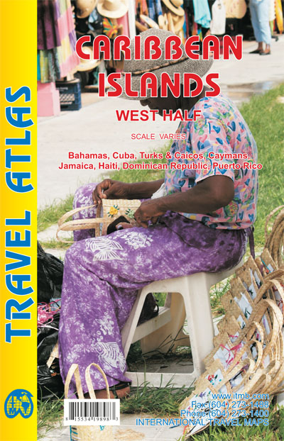
Wegenatlas voor de westelijke Caraïbische eilanden - verschillende schalen : Bahamas, Turks- en Caicoseilanden, Cuba, Kaaimaneilanden, Jamaica, Dominikaanse Republiek, Puerto Rico. Met inzetjes van Freeport, Nassau, Havana, Varadero, Georgetown, Kingston, Port-au-Prince, Santo Domingo, San Juan The Caribbean is a particularly difficult part of the world to map effectively. It is a combination of larger islands in the west and a string of small islands in the east. Some can be shown as separate maps, but others are too small (or too lacking in market appeal) to be mapped adequately as folded paper maps. This atlas covers the Bahamas and the Turks and Caicos Islands in the north with Cuba, the Cayman Islands, Jamaica, the Dominican Republic, and Puerto Rico in scales ranging from 1:18,000 for Puerto Rico to 1:600,000 for Cuba The atlas is the same size as all ITM atlases (8''x5'' or 21x13.5cm) and has a straight spine edge with title for displaying spine outwards on store shelves, if desired. Essentially, this atlas covers six different areas mapped by ITMB folded maps and adds the Turks area. Inset maps of Freeport, Nassau, Havana, Varadero, Georgetown, Kingston, Port Au Prince, Santo Domingo, and San Juan are included. The level of detail is identical with ITM's folded maps; this is a marketing concept for those wishing the convenience of information in a convenient book format, with no loss of detail. Legend Includes: Roads by classification, International Boudaries, Time Zone Border, Points of interest, Historic site, Hotels, Museums, Golf courses, Restaurants, Caves, Lighthouses, Gas Stations, Waterfalls, Hotsprings,Hospitals, Historical Sites, Tourist information, Mountain Peaks, Churches,Schools, Embassies,Shipping Centers, Banks,Railway Stations, Bus Terminals, Police Station,Universities, Post Offices,Ferries, Parkings and much more
€16,50
Bekijk product