
Beantwoord enkele vragen, en binnen seconden geeft AI je een persoonlijk aankoopadvies op maat.
Beantwoord enkele vragen, en binnen seconden geeft AI je een persoonlijk aankoopadvies op maat.
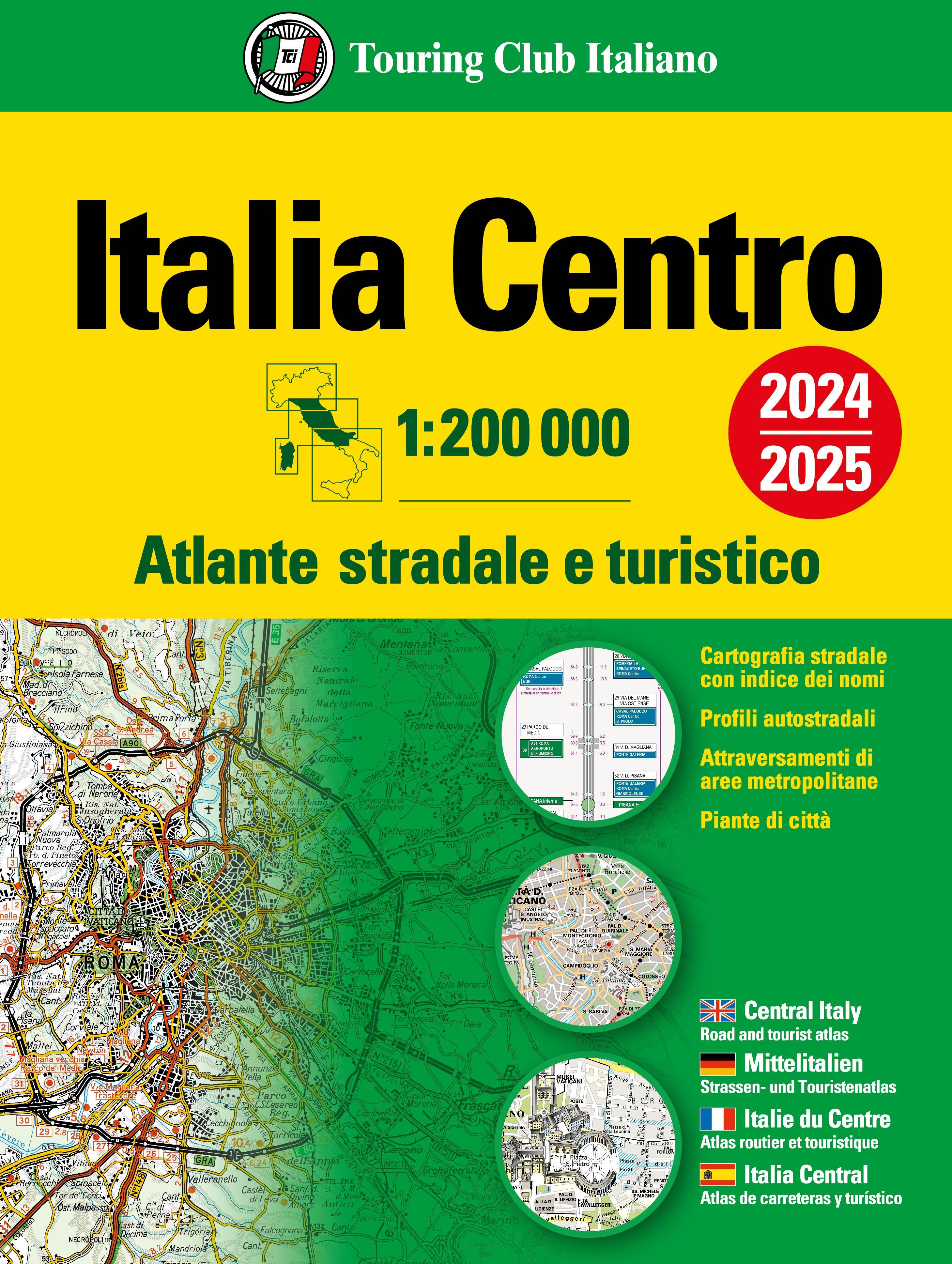
Atlas van de Italiaanse ANWB, goed kaartbeeld. Wel met omgevingskaarten van belangrijke steden en stadsplattegronden. Kaarten van Bologna tot net boven Napels. Kaartbeeld met veel schaduwwerking waarbij hoogteverschillen sterk uitkomen. Zachte kaft, register, A4 formaat Cartografia stradale 1:200 000 9 attraversamenti di aree metropolitane 1:80 000 47 piante di città con stradario e principali punti di interesse Indice dei nomi Distanze stradali fra capoluoghi di provincia 9 route maps 1:80 000 / 47 town plans with street guide and places of interest marked / Index of place-names / Road distances between provincial capitals 9 Durchfahrtspläne 1:80 000 / 47 Stadtpläne mit Strassenverzeichnis und wichtigen interessanten Punkten / Ortsregister / Strassenentfernungen zwischen den Provinzhauptstädten Insostituibile per pianificare il tuo viaggio! È l’atlante Touring per eccellenza, il più autorevole, il più diffuso, di facile e immediato utilizzo! Suddiviso in 3 volumi è indispensabile per pianificare viaggi e trasferimenti in tutta Italia, per scoprire i grandi e piccoli tesori e le più belle strade panoramiche. I volumi contengono: • Profili autostradali con tutte le informazioni di servizio • 218 pagine di Cartografia stradale in scala 1:200 000 • 29 piante di attraversamento delle principali aree metropolitane in scala 1:80 000 • 150 piante di città con stradario e principali punti di interesse turistico, ZTL (zona a traffico limitato) e sito ufficiale del comune • Indice dei nomi con oltre 63 000 toponimi • Tabella delle distanze stradali chilometriche tra le principali località
€24,95
Bekijk product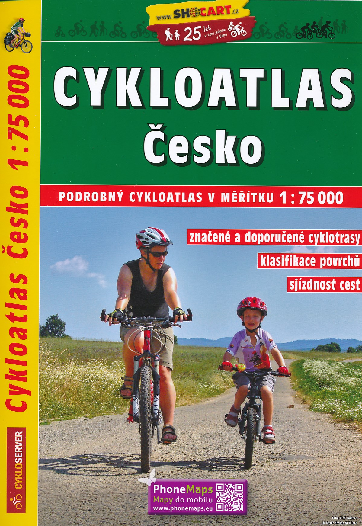
Zeer gedetailleerde fietsatlas van Tsjechie met fietsroutekaarten op een schaal van 1:75.000 en regionale, lange afstandsfietsroutes, bewegwijzerde routes van de tsjechische fietsroutenetwerk, spiraalbinding - meertalige legenda, ook in Engels en Duits Dies ist der detaillierteste erhältliche Straßenatlas Tschechiens. Er enthält außerdem die bereits beschilderten und die geplanten Routen des tschechischen Radwandernetzes. Für Radwanderer auf größerer Tschechien-Rundreise ist dieser Atlas eine preiswerte Alternative zum Kartensatz. HINWEIS: Das Produkt liegt in tschechischer Sprache vor, die zusätzlichen touristischen Hinweise und Tourenbeschreibungen erschließen sich deshalb nur Sprachkundigen. Auf die Kartografie hat das natürlich keinen Einfluss.
€34,95
Bekijk product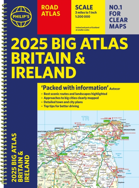
Goede gedetailleerde wegenatlas van Groot-Brittannië, schaal 1:200.000 met een overzichtskaart van Ierland, schaal 1:1.000.000. Groot formaat, A3, en in ringband. 'Good balance between detail and clarity with excellent town maps' What Car? PHILIP'S is No. 1 in the UK for clear maps. The latest 2025 Philip's Big Road Atlas of Britain and Ireland, in a supersize large format, has fully updated mapping from the Philip's digital database alongside all the detail and information needed for successful travel. * Top driving tips for safety and skill including how to parallel park * The best scenic routes, natural features and landscape highlighted for enhanced travelling * Practical 'more to view per page' A3 size * Main scale of maps: 3 miles to 1 inch = 1:200,000 for ease of use * Route-planning section for the easiest navigation * Special wide-vehicle access indicators for rural areas * 64 fully indexed and detailed town and city plans * City approach maps with named roads for the best access with the latest ULEZ clearly outlined * Clear road map showing all of Ireland 2025 Philip's Big Road Atlas of Britain and Ireland contains 96 pages of road maps covering Britain at 3 miles to 1 inch (Scottish Highlands and Western Isles at 4 miles to 1 inch, Orkney and Shetland at 5.25 miles to 1 inch). The maps clearly mark service areas, roundabouts and multi-level junctions for easy navigation, and in rural areas distinguish between roads over and under 4 metres wide, to help wide vehicles. There are extra-detailed town plans for easy navigation with all counties marked for clarity. The atlas also includes a 2-page road map of Ireland, route-planning maps, a distance table, and 12 large-scale city approach maps with named arterial roads. Wherever you are driving in Britain or Ireland, this is the ultimate road companion.
€23,50
Bekijk product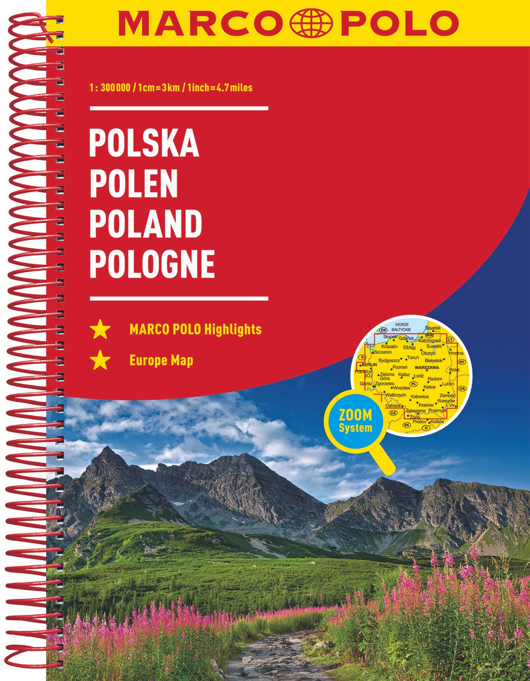
Wegenatlas op prima schaal, geschikt voor automobilisten, maar bij gebrek aan beter ook voor fietsers! Er staat veel informatie op ingetekend. Met inleidende tekst en register. Der MARCO POLO Reiseatlas zeichnet sich durch moderne Kartographie aus und bildet Polen im optimalen Maßstab 1:300 000 ab. Mit Highlights aus Kultur und Natur und landschaftlich schönen Strecken wird dein Roadtrip damit zum echten Erlebnis. Länder- und Reiseinformationen bewahren dich vor dem Knöllchen, und das praktischen Zoom-System bietet von der Europakarte bis zum Stadtplan immer das richtige Kartendetail, sowohl für die Planung als auch während der Fahrt. Blattübersichtskarte zum Ausklappen, Fernfahrtenkarte mit Kartenübersicht und Marco-Polo-Highlight-Sternen, Kartenübersicht mit Verwaltungsgliederung, Erläuterung des Zoomsystems (4-farbiges Leitsystem), Marco-Polo-Highlights, Mehrsprachige Legende (PL, D, GB, F, I, P, E, NL, CZ, SK, H, DK), Kartenteil Europa im Maßstab 1 : 4 500 000, Hauptkarten im Maßstab 1 : 300 000, Tabelle der Entfernungen und Fahrzeiten, 6 Transitkarten 1 : 100 000: - Gliwice - Katowice - Kraków - Lódz - Warszawa - Wroclaw 17 Citypläne 1:20 000 mit mehrsprachiger Legende: - Bialystok - Bielsko-Biala - Czesochowa - Gdansk - Gliwice - Jelenia Góra - Katowice - Kraków - Lódz - Lublin - Olsztyn - Poznan - Szczcin - Tarnów - Torun - Warszawa - Wroclaw Reiseinformationen/ Verkehrsinformationen/ Liste der UNESCO Welterbestätten Polens/ Ortsnamenverzeichnis mit Postleitzahl, Woiwodschaft und Suchfeldangabe. Fully updated and now with ZOOM system for even better orientation! Unique spiral binding with wrap-around spine. High quality cartography with distance indicators and scale converters to aid route planning.
€16,95
Bekijk product
Wegenatlas van Bulgarije, behoorlijk gedetaileerd met veel informatie, enkele stadskaarten en register. De hoofdplaatsen kennen ook een leesbaar schrift, de rest is in cyrillisch schrift uitgevoerd. Detailed road atlas of Bulgaria. Nearly all place names on the maps are in Latin (English) and cycrillic script. Eight levels of roads are shown, from motorways to dirt tracks. Distances are shown between road junctions. Symbols located tourist sites and services such as spas, resorts, camp-sites, caves, airports, ports, border crossings, and much more. Includes a list of 100 national tourist sites, each with contact information. Fully indexed, but only in cyrillic.
€12,50
Bekijk product
Visitor’s Guide to the Garden Route & Route 62 is your GPS Companion This Visitor’s Guide includes 14 street maps along with the various routes and detailed listing of places of interest and top attractions. All featuring what to see, do and experience in the Garden Route and Route 62. This new edition of the Visitor’s Guide includes a detailed route planner with all National Parks and Reserves along the Garden Route. Also listed is the top sites to visit around the Garden Route and Route 62, highlighting all major and minor roads, airports and airfields. Main maps within the Visitor’s Guide : – Robertson – Ashton – Montagu – Barrydale – Ladismith – Mossel Bay – Dana Bay – Oudtshoorn – George – Knysna Lagoon Area – Knysna Central – Humansdorp – Jeffreys Bay
€14,50
Bekijk product
Handige wegenatlas van Ierland en Noord-Ierland, schaal 1:200.000. Met 10 stadsplattegronden: Belfast, Cork, Londonderry, Dublin, Galway, Killarney, Kilkenny, Limerick, Sligo and Waterford. Created from brand new mapping data, this atlas includes AA inspected camping sites and AA listed golf courses, picnic sites, port plans and ferry routes. Plus, motorway strip maps detailing all of Ireland's motorway junctions. Toll motorways are clearly highlighted.There are 10 detailed city and town plans with street indexes: Belfast, Cork, Londonderry, Dublin, Galway, Killarney, Kilkenny, Limerick, Sligo and Waterford and an easy-to-read place name index, with top tourist sites highlighted.New district maps of Dublin and Belfast show the surrounding area in more detail.
€11,95
Bekijk product
Handzame, maar behoorlijk dikke stadsatlas van Londen. Gebonden uitgave, maar toch redelijk makkelijk open ter klappen. Met register achterin. Zeer uitgebried met alle staten en steegjes. Centrumgedeelte met meer details (1:11.000) dan de kaarten buiten het centrum (1:22.000) First published in 1936, this iconic atlas is a trusted means of finding your way around the capital city. The main mapping extends beyond Central London from Heathrow Airport to Chingford at a scale of 2.88 inches to 1 mile (4.55 cm to 1 km), featuring postcode districts, one-way streets, the Congestion Charging Zone and Low Emission Zone. The large-scale street map of Central London – at a scale of 5.75 inches to 1 mile – cover Regent’s Park and Shoreditch, Chelsea and Vauxhall, Hyde Park and Bermondsey. A comprehensive index lists streets, selected flats, walkways and places of interest, place, area and junction names. Additional healthcare (hospitals, walk-in centres and hospices) and transport connections (National Rail, London Tramlink, Docklands Light Railway, London Underground and Overground stations, and River Bus pier) are indexed as well. Also included are: • Overview map of the Congestion Charging Zone, Ultra Low Emission and Low Emission Zones • West End Theatre map • London Connections rail services map
€13,50
Bekijk product
Handzame wegenatlas op A5 formaat van Ierland. Vrij grove schaal maar heel handig door formaat en goed kaartbeeld. Met enkele stadsplattegronden en een paar pagina's met hoogtepunten van het land. Explore Ireland with this handy format route-planning atlas in full colour, complete with information on places of tourist interest. There are also fully indexed town centre plans of Belfast, Cork, Dublin, Galway, Limerick and Londonderry. Now with places of interest marked including famous film locations. This atlas, at A5 size, contains mapping of the whole of Ireland at 9 miles to 1 inch (1:570,240). The mapping is beautifully designed with colour classified roads and subtle layered height tinting. The atlas is ideal for residents, visitors and tourists alike. Key features of the atlas include:* All Ireland route planning maps* Town centre plans* Places of interest including TV and film locations such as Game of Thrones, Star Wars and Harry Potter* Blue Flag and Green Coast beaches map* List of tourist information centres* Full index to place names and places of interest* Information on airports, ferries and radio stations* Mileage chart
€9,95
Bekijk product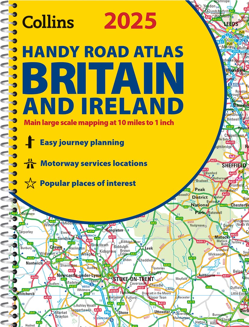
Handzame A5 wegenatlas van Engeland, Wales, Schotland en Ierland met register en stadsplattegronden This easy-to-use, handy A5 sized road atlas with popular lie-flat spiral binding features extremely clear route planning maps of Britain and Ireland and fits neatly into your glove box or bag. The maps of Britain are at 10 miles to 1 inch (1:625,000) and the whole of Ireland is covered at 15.8 miles to 1 inch (1:1,000,000). There are also a selection of more detailed urban area maps at 4.5 miles to 1 inch (1:285,000) to aid route planning in these busy areas. Main features: Road maps that focus on the main roads, motorways and settlementsMore detailed maps of London, Manchester, Merseyside and West MidlandsPark & Ride locations (for bus and rail)Handy distance calculator chart highlighting distances between the major towns
€9,95
Bekijk product