Beantwoord enkele vragen, en binnen seconden geeft AI je een persoonlijk aankoopadvies op maat.
Beantwoord enkele vragen, en binnen seconden geeft AI je een persoonlijk aankoopadvies op maat.
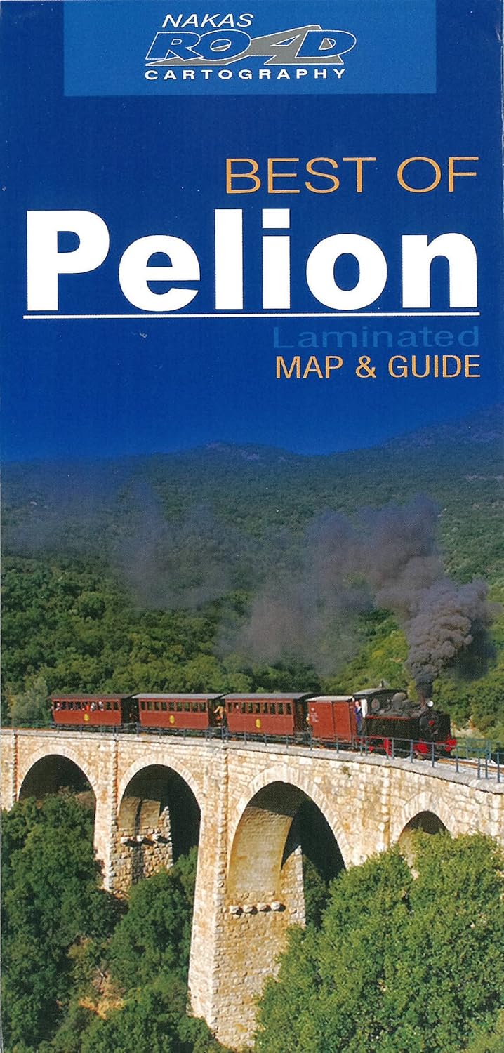
Overzichtskaart van Pelion - Pilion met op de achterzijde een overzicht, in het Engels, van de belangrijkste toeristische bezienswaardigheden het eiland. Geplastificeerd.
€7,95
Bekijk product
We start in Cape Town in the west and move along the southern coast through the Overberg, Winelands, Garden Route, Klein Karoo R62, Baviaanskloof to eventually arrive in the Addo National Park up to Gqeberha (Port Elizabeth) in the east. The maps are highly detailed and well researched. Our map scale is 1:200 000 which allows us to show a lot of detail including minor gravel roads, hiking trails, farm boundaries and points of interest which are relevant to self-drive tourists. The size of the paper is kept small enough to allow this to be the perfect road tripping map. We use Duraflex paper and print two maps per sheet of A1 paper, making this a four-sheet series. Each map sheet is individually packed in a plastic protective sleeve. The maps are perfect for day drives, overlanding or just doing road trips in your sedan, 4WD or motorbike along our beautiful southern coast, Klein Karoo and parts of the proper Karoo. Mountain passes form a prominent feature in this area, and these are indicated together with scenic route options. As with other Tracks4Africa maps, these maps include drive times over and above driving distances. Adventure bikers will be pleased to know that minor gravel roads are included together with various accommodation options. The map has a relief background onto which farm boundaries, protected areas and other geographical features are shown. For each town we indicate what basic services are offered, e.g. fuel, shops, camping accommodation. We also show the facilities and activities of the various nature reserves. This Map – the SC1 & SC2 : Cape Town to Montagu is perfect for day trips in and around Cape Town or from the Winelands towns of Stellenbosch, Paarl and Franschhoek. It covers some of the most iconic tourism attractions in the Western Cape which include Cape Point and Table Mountain, Robben Island where Nelson Mandela was held prisoner during the apartheid era, the wine routes of the Cape, the whale watching along the coast of Hermanus and further east, the southernmost point of Africa at L’Agulhas and shark cage diving at Gansbaai. Plan your trips with our driving times on each road and include scenic routes indicated on the map together with the various mountain passes of the Western Cape. The area boasts top-end destinations which include world-class restaurants and wine estates. As the name suggests, these two maps, printed on either side of a single sheet of Duraflex paper, stretch from Cape Town in the west to Montagu in the east. The coastline forms the southern boundary and to the north towns such as Malmesbury and Worcester are included. Key areas of interest include Cape Peninsula, Boland, Winelands, False Bay, Walker Bay and the Overberg region. Prominent towns on these maps include Cape Town, Durbanville, Somerset West, Stellenbosch, Malmesbury, Paarl, Franschhoek, Hermanus, Gansbaai, Montagu, L’Agulhas, Worcester, Caledon, Robertson and De Doorns.
€29,95
Bekijk product
The Cape to Addo map series covers the southern parts of the Western Cape of South Africa in a series of eight highly detailed maps, printed on four sheets of A1 durable paper. We start in Cape Town in the west and move along the southern coast through the Overberg, Winelands, Garden Route, Klein Karoo R62, Baviaanskloof to eventually arrive in the Addo National Park up to Gqeberha (Port Elizabeth) in the east. The maps are highly detailed and well researched. Our map scale is 1:200 000 which allows us to show a lot of detail including minor gravel roads, hiking trails, farm boundaries and points of interest which are relevant to self-drive tourists. The size of the paper is kept small enough to allow this to be the perfect road tripping map. We use Duraflex paper and print two maps per sheet of A1 paper, making this a four-sheet series. Each map sheet is individually packed in a plastic protective sleeve. The maps are perfect for day drives, overlanding or just doing road trips in your sedan, 4WD or motorbike along our beautiful southern coast, Klein Karoo and parts of the proper Karoo. Mountain passes form a prominent feature in this area, and these are indicated together with scenic route options. As with other Tracks4Africa maps, these maps include drive times over and above driving distances. Adventure bikers will be pleased to know that minor gravel roads are included together with various accommodation options. The map has a relief background onto which farm boundaries, protected areas and other geographical features are shown. For each town we indicate what basic services are offered, e.g. fuel, shops, camping accommodation. We also show the facilities and activities of the various nature reserves. SC7 & SC8 : Baviaanskloof to Addo : The Addo Elephant National Park is world famous and forms the main feature on these two maps. Along with it we cover the eastern section of the Baviaanskloof and we continue with the Garden Route between Cape St. Francis to Gqeberha (Port Elizabeth). These two maps are printed on either side of a single sheet of Duraflex paperand stretch from Cape St. Francis in the west to Alexandria in the east. The coastline forms the southern boundary and to the north it includes places like Jansenville and Middleton. - Key areas of interest include the eastern section of the Garden Route and Baviaanskloof, the Addo Elephant National Park and places like Cape St. Francis and Jeffrey’s Bay for its world-famous surfing. - Prominent towns include Cape St. Francis, Humansdorp, Patensie, Jansenville, Jeffrey’s Bay, Kariega (Uitenhage), Kirkwood, Paterson, Colchester, Alexandria and Gqeberha (Port Elizabeth).
€29,95
Bekijk product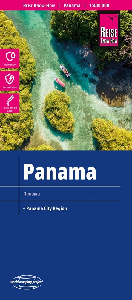
Reis Know-How-kaarten (wereldkaart-projectreeks) zijn gemakkelijk te lezen, waterdichte en zeer duurzame reiskaarten die speciaal zijn ontworpen voor dagelijks gebruik op de weg. Onze kaarten combineren state-of-the-art, GPS-compatibele cartografie (inclusief hypsometrische tinten en contourlijnen) met een gedetailleerde weergave van wegennetwerken en toeristische informatie. Ze bieden de best mogelijke schaal, detailniveau en leesbaarheid, of het nu een kaartje is van een klein eiland of een half continent. De kaarten zijn voorzien van een verwijderbare omslag, zodat de kaarten gemakkelijk kunnen worden gevouwen en in elke zak passen. Hoewel op plastic wordt gedrukt, zorgt een speciale coating ervoor dat de kaarten een papierachtig gevoel behouden en zelfs met potlood kunnen worden beschreven. Reise Know-How maps (world mapping project series) are easy-to-read, waterproof and highly durable travel maps specifically designed for everyday use on the road. Our maps combine state-of-the-art, GPS-compatible cartography (including hypsometric tints and contour lines) with a detailed rendering of road networks and touristic information. They offer the best possible scale, level of detail and readability, be it a map of a small island or half a continent. The maps feature a detachable paper sleeve so that the maps can be folded easily and fit in every pocket. Although printed on plastic, a special coating makes sure the maps retain a paper-like feel and can even be written on with a pencil.
€13,95
Bekijk product
The Overberg is one of the premier tourist regions of South Africa. Here the Cape Fold Mountains march eastward from Sir Lowry’s Pass, a rugged backdrop to this old Cape landscape of farmsteads, gravel passes and unspoiled views. Delightful towns await you – historic Swellendam, McGregor and the wine farms of the Bonnievale valley, Hermanus and the fishing villages beyond. Missions, beaches littered with shipwreck sites, whales trolling the surf — all kinds of wonders await you! This double sided, full-relief map covers the whole of the official Overberg Tourism Region. Side one extends from Somerset West along the coast to Cape Hangklip, Hermanus thence to Cape Agulhas and on eastwards to Port Beaufort/Witsand and the Breede River, then north to Heidelberg, Barrydale and Montagu. From Robertson the map extends west to Villiersdorp and back to Stellenbosch. Side two includes enlarged inset maps of 24 of the larger towns in the region, at the greatly-enlarged scale of 1:25 000, or 4cm to the kilometre.
€29,95
Bekijk product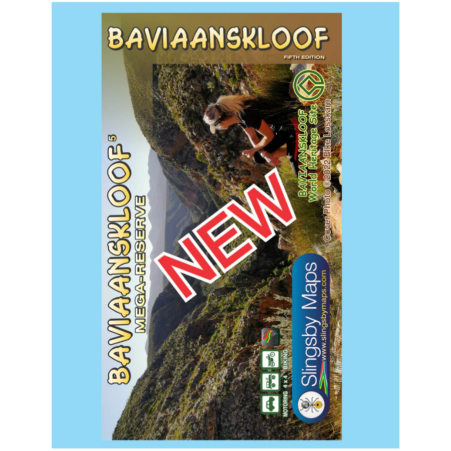
Whether you’re a hiker, mountain biker or 4×4 enthusiast this is the map you need for your visit to the spec- tacular Baviaanskloof. This is the most comprehensive, fully researched and detailed map of the Baviaansk- loof ever published. The map is fully GPS-compatible and will enable you to explore this fabulous, rugged wilderness, its geological marvels, extraordinary flora and fauna, and the poignant reminders of its Khoisan past… Includes the new Leopard Trail and several interactive features.
€29,95
Bekijk product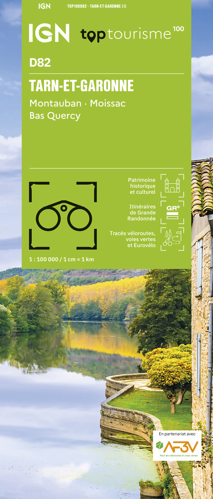
Een nieuwe serie die de oude 1:100.000 serie van IGN vervangt: de indeling van deze kaartenserie is gebaseerd op de Franse departementen. Ideale kaart voor fietsen en autotochten vanuit een vaste plaats als een camping of huisje. Zelfs de kleinste wegen staan ingetekend en geven met symbolen toeristische informatie. De belangrijkste doorgaande GR's staan ook ingetekend. Nieuw zijn de VELO Voie Vertes, lokale fietspaden die meestal gemarkeerd zijn; ook deze zijn ingetekend. Het omvat fietsroutes in samenwerking met de vereniging AF3V – VéloRoutes en Voies Vertes. Ook is deze kaart voor wandelaars nog behoorlijk goed bruikbaar: veel details, hoogtelijnen en allerlei andere landschapskenmerken. Berghutten en gites d'etappes zijn weergeven, helaas staan er dan wel weer geen campings op. Van de uitgever: In de cartografie is een grote hoeveelheid toeristische informatie zeer nauwkeurig weergegeven: parken en natuurreservaten, monumenten, kastelen, musea, grotten, uitkijkpunten, toevluchtsoorden, klim- en wildwatersportplaatsen, bewaakte stranden, enz. Een verrijkt netwerk van secundaire wegen, zodat fietstochten in alle veiligheid mogelijk zijn: • Voor ontdekking te voet, de volledige GR® en GR de Pays® • Voor het verkennen per fiets van het volledige lokale wegennetwerk en alle Vélo-routes en Voies Vertes met de AF3V-classificatie met asfalt- of grindwegen, op eigen terrein of gedeeld met andere voertuigen • Voor ontdekking met de auto, het gehele wegennet: nationaal, regionaal, departementaal en secundair. Om de kaart compleet te maken: • reliëf wordt weergegeven door contourlijnen en maatpunten • een index van gemeenten maakt het gemakkelijk om uw weg te vinden Aangepaste productcodes: D + Afdelingsnummer.
€10,95
Bekijk product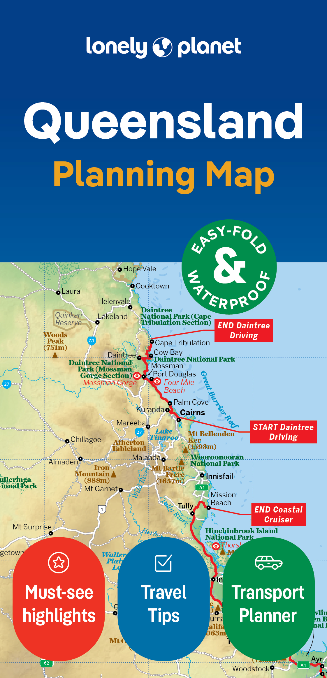
Durable and waterproof, with a handy slipcase and an easy-fold format, Lonely Planet's Queensland Planning Map is your essential navigation tool. This full-colour map features accompanying images and information about top attractions, itinerary suggestions, a transport guide, themed lists and practical travel tips. Durable and waterproof Easy-fold format and convenient size Handy slipcase Full colour and easy to use Before-you-go info Beautiful imagery Tailored itineraries Can't-miss regional highlights Detailed town index Transport planner Themed lists Covers Queensland Looking for more extensive coverage? Check out Lonely Planet's Coastal Queensland and the Great Barrier Reef, our most comprehensive guidebook to Queensland, covering the top sights and most authentic offbeat experiences. Or check out Lonely Planet's Experience East Coast Australia, a concise visual guide highlighting the top experiences of Queensland. About Lonely Planet: Lonely Planet is a leading travel media company, providing both inspiring and trustworthy information for every kind of traveller since 1973. Over the past four decades, we've printed over 145 million guidebooks and phrasebooks for 120 languages, and grown a dedicated, passionate global community of travellers. You'll also find our content online, and in mobile apps, videos, 14 languages, armchair and lifestyle books, ebooks, and more, enabling you to explore every day. 'Lonely Planet guides are, quite simply, like no other.' New York Times 'Lonely Planet. It's on everyone's bookshelves; it's in every traveller's hands. It's on mobile phones. It's on the Internet. It's everywhere, and it's telling entire generations of people how to travel the world.' Fairfax Media (Australia)
€10,95
Bekijk product