
Beantwoord enkele vragen, en binnen seconden geeft AI je een persoonlijk aankoopadvies op maat.
Beantwoord enkele vragen, en binnen seconden geeft AI je een persoonlijk aankoopadvies op maat.
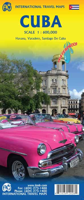
Een degelijke wegenkaart van Cuba met aanduidingen van o.a. nationale parken, vliegveld, benzinepomp, dirt-roads en kleine plattegrond van hoofdstad. Als overzichtskaart goed te gebruiken. Cuba is the hidden agenda in this year's US election. Thus far, no candidate is making extreme statements about it. This is good, because with the withdrawal of Fidel from active politics, the government is starting to open its doors and effect some real changes. As a tourist destination, Cuba is without doubt the Number One attraction in the Caribbean. With easy access from Toronto, Mexico City, and the Bahamas, Cuba is within reach by everyone - even American running-dog imperialist war-mongers are welcomed. Hey, it's Cuba, man; everyone parties! Printed on ITM plastic paper, double-sided. Legend Includes: Roads by classification, international and domestic airports, mines, rivers, parks, points of interests, beaches, viewpoints, caves, dams, ports, hotels, gas stations, lighthouses, and other information.
€13,95
Bekijk product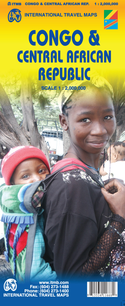
Een degelijke kaart met aanduidingen van o.a. nationale parken, vliegveld, benzinepomp, dirt-roads en kleine plattegrond van hoofdstad. Als overzichtskaart goed te gebruiken. This is a really exciting map, in that an area as large as Europe has been added to ITMB's Africa series. We have been working on this artwork for over three years. It covers all of the Democratic Republic of Congo (the former Congo-Kinshasa, or Zaire), all of the People's Republic of the Congo (known as Congo-Brazzaville or French Congo), and the Central African Republic to the north. This is in reality a map of the vast rain forest known as the Congo River Basin, and matches our equally complicated map of the Amazon River Basin and the Mekong, Mississippi/Missouri, Nile, and Mackenzie maps that we have published previously. A word of warning: the road network in the Congo is primitive - that means largely non-existent or in such poor condition as to wreck army trucks. We show the roads, and tried to classify them by quality, but this is a 'work in progress' and I hope that this map will create sufficient feedback to improve this aspect of the map. For this edition, we have laid the ground work for developing more detailed sectional maps as the need arises. Legend Includes: Roads by classification, Airports, Point of Interest, Hospitals, Hotels, Mines, Gas Stations, Churches, Mosques, Camping grounds, National Park, Harbour, Border Crossing, Telephone, and much more.
€13,95
Bekijk product
Een degelijke kaart met aanduidingen van o.a. nationale parken, vliegveld, benzinepomp, dirt-roads en kleine plattegrond van hoofdstad. Als overzichtskaart goed te gebruiken. This map has been a difficult update, coming in the midst of the turmoil in Haiti caused by the earthquake in the spring of 2010. This is actually two separate maps sharing a single sheet of paper. The Dom Rep side was fairly straight-forward to update, as there has been little change, but the Haiti side needed a lot of time and energy. The earthquake revealed a previously unrealized reality – nobody had any information on Haiti. Our map was the only one in existence, and it proved to be too weak to meet the needs of humanitarian groups. They, however, provided a wealth of useful information as they reached out to isolated villages about road conditions, spelling of place names, and actual locations, which we have added to our artwork. This is a work in progress, so don’t expect perfection, but this map is far better than anything anyone has ever done for this country previously. We also have a vastly improved inset map of Port-au-Prince, the capital. Double-sided, printed on plastic. Legend Includes: Roads by classification, Airports, Harbors, Shipwrecks, Accommodation, Palaces, Museums, Monuments, Churches, Historical Sites, Ruins, Viewpoints, Point of Interests, Hospitals, Light Houses, Beaches, Caves, Parks, Zoos, and more.
€13,95
Bekijk product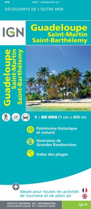
Landkaart van deze voormalige Franse kolonie. Vanzelfsprekend gemaakt door de Franse topografische dienst. Gedetailleerde topografische wegenkaart Guadeloupe, Sint Maarten en St Barts schaal 1:80.000 met opdruk van bezienswaardigheden, stranden en wandelpaden en stadsplattegronden van Basse-Terre en Pointe a Pitre Les cartes routières et touristiques des départements et territoires d’Outre-mer vous permettent de découvrir ces destinations exotiques que sont la Guyane, la Réunion, les Comores, la Martinique, la Guadeloupe, la Nouvelle Calédonie et la Polynésie. Une gamme de 22 titres, tous riches de renseignements touristiques (marchés locaux, artisanat, sites intéressants) et d’informations sur les activités de plein-air (surf, plongée sous-marine, vol libre, équitation) sont à votre disposition pour vous faire connaitre et apprécier ces destinations lointaines.
€12,95
Bekijk product
Tweetalige kaart (Engels en Duits) met Estland, Letland en Litouwen. Door ingetekende lengte- en breedtegraden is het gebruik van GPS mogelijk. Met hoogtelijnen en uitgebreid wegennetwerk: daarnaast worden ook de afstanden tussen belangrijke plaatsen duidelijk leesbaar weergegeven. Het kleurgebruik is zodanig dat je een goede indruk krijgt van hoogteverschillen en soorten landschap. Natuurlijk staan de toeristische bezienswaardigheden duidelijk vermeld. Gedrukt op water- en scheurvast papier! Polyart is een synthetisch product vrij van giftige stoffen dus duurzaam. Het papier gaat echt lang mee. Topography is indicated by altitude colouring with numerous spot heights and names of mountain ranges and passes. Salt lakes, swamps, seasonal rivers and glacier are also shown. Detailed presentation of the road network includes minor roads and tracks and railways are also shown. Internal administrative units are presented with their boundaries and names. National parks and other protected areas are highlighted. A wide range of symbols mark various places of interest. Map legends include English and all the maps have an index of localities.
€13,95
Bekijk product
San Francisco met schaal 1: 12.500 San Fran is one of my favourite cities; almost as nice as Vancouver. Names such as Chinatown, Nob Hill, the Tenderloin, and Cow Hollow evoke memories of a city that has long moved past its early reputation as a port feeding the goldfields around Sutter's Run, but it is still a clean and sophisticated city to visit. I personally like the old restored trolleys trundling down Market Street, and the restaurants in the Sunset district. This edition adds great value to our map in two ways: first, we have added an extremely detailed and attractive map of all of northern California to the reverse, to help visitors enjoy the Napa Valley, Sacramento, and the Redwood Sequoia trees, and secondly, the map has been printed on plastic paper for durability and attractiveness. Legend Includes: Roads by classification, Provincial Boundaries,State Highways, Main Roads, Secondary and other Roads, Capital, Cities, Nature sights, Airports, Point of Interests, Museums, Hot Springs, Gas Stations, Medical Facility, National Reserve, Hotels, Border Crossing,Hospitals,Lodges,Golf courses and much more
€13,95
Bekijk product
Een degelijke kaart met aanduidingen van o.a. nationale parken, vliegveld, benzinepomp, dirt-roads en kleine plattegrond van hoofdstad. De kracht van deze kaart is dat met kleurgebruik het landschap en de hoogtes heel duidelijk zichtbaar zijn, de natuurkundige aspecten van het land worden daardoor benadrukt. Als overzichtskaart goed te gebruiken. Met een stadsplattegrond (klein) van het cdentrum van Tiblisi en Yerevan. Europeans consider Georgia to be in Asia because, by an accident of history, the country ended up on the wrong side of an arbitrary line drawn through some rolling hills called the Caucasus. Regardless, this is a European country, bound by ethnicity, history, and religion to the west, not the east. The country has been threatened fairly recently by the Russian bear, but the country is recovering and the people are warm and hospitable. Historically, Georgia has much to offer – ancient cities, churches and monasteries, mountain villages, and everywhere, smiling faces. This is a very popular touristic destination, and we have updated information, improved readability, and generally done our best to portray this interesting country favorably. The other side of the map covers Armenia in good detail showing the road and transport infrastructure as well as the geography.
€13,95
Bekijk product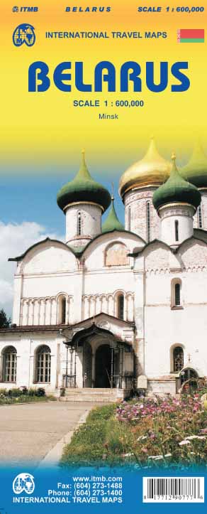
Een degelijke kaart met aanduidingen van o.a. nationale parken, vliegveld, benzinepomp, dirt-roads en kleine plattegrond van hoofdstad. Als overzichtskaart goed te gebruiken. Folded travel map. Color changes show elevations. Shows roads and highways, settlements of all sizes including abandoned settlements, physical features and places of interest. Distinguishes roads from highways to unpaved roads, with distances in kilometers; railways; navigable canals; river ports; airports; churches; castles; palaces; places of interest. Includes index of places. Main map scale 1:600,000. With Minsk city center map (1:15,000) showing transit stations; information centers; museums; theaters; churches; places of interest; hotels; restaurants; embassies; more. Distances in kilometers.
€13,95
Bekijk product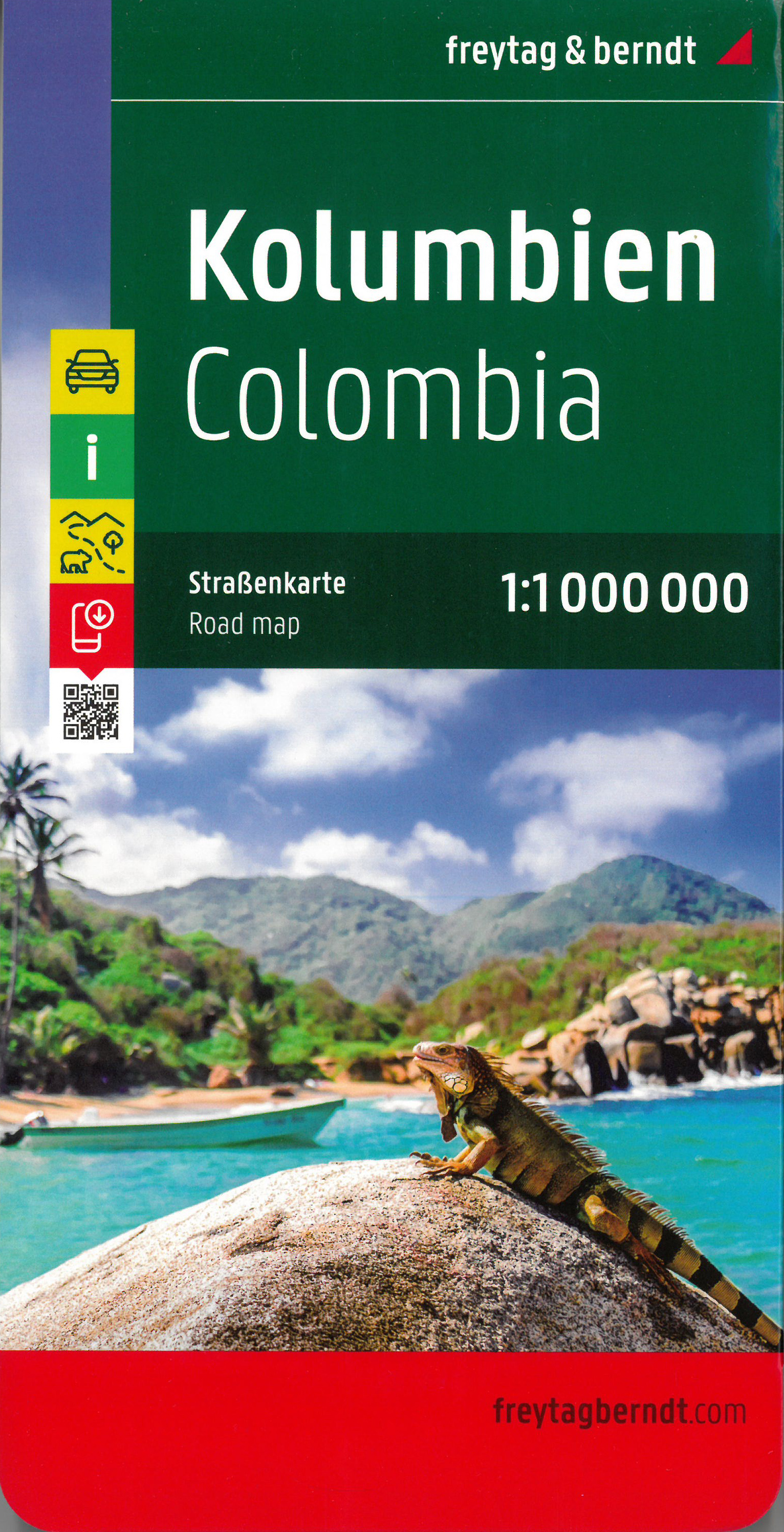
Gedetailleerde, tweezijdige landkaart van Colombia, prima geschikt voor planning en rondtrekken over alle eilanden. De berijdbare wegen zijn goed weergeven, zowel de hoofdwegen als provinciale en lokale wegen; wegnummers worden vermeld. Afstanden tussen plaatsen zijn in kilometers op de kaart ingetekend, daarnaast worden ook op belangrijke plekken benzinepompen gemarkeerd. Explore Columbia with this Freytag & Berndt double-sided road map. The best way to plan your trip, prepare your itinerary, and to travel independently in this country. As with all Freytag & Berndt maps the cartography is clear and detailed with the topography shown by relief shading with plenty of spot heights. Freytag & Berndt maps make good use of an icon system. Icons show tourist information such as: Surfing areas and Diving Sites Monuments and Places of Interest Camping Sites and Hiking Trails Lake, Rivers and Canals Distances between points are shown as well as indications of steep gradients, all distances are in kilometres. The legend is in several languages inlcuding English.
€14,95
Bekijk product
Gedetailleerde wegenkaart en wandelkaart met alle kleine wegen, wandelpaden, hoogtelijnen en toeristische informatie aangegeven. Alle tekst is tweetalig in Engels en Grieks en de waterproof kaart is geschikt voor gebruik met GPS. This is a great map because: It is the first and only –to date – GIS map of Rhodes, and the only one made with data collected 100% through field survey, making it the only truly accurate and GPS compatible map of the island. Also, It comes in the most detailed scale available (competitor maps are in the 1:100,000 scale) It is printed on Polyart material, making it totally waterproof and rip-proof. You can fold it and unfold it a hundred times, fold it in irregular ways, dunk it in the sea or leave it out in the rain. This map is indestructible! It features the most complete road network. Also, on the back side of the map there is a detailed plan of the town of Rhodes and an enlarged one of the old town, listing all sights, restaurants, hotels and bars. The major trails of Rhodes are shown for the first time and the boundaries of NATURA 2000 areas are indicated so that you will know which parts of the island are of special environmental interest and beauty – thus you can enjoy traveling through them, but also take care to protect them. Hotel sites are indicated so you can easily locate them. The famous “Valley of the butterflies” (Petaloudes) is shown and all the wineries of the island are shown as well.
€12,50
Bekijk product