
Beantwoord enkele vragen, en binnen seconden geeft AI je een persoonlijk aankoopadvies op maat.
Beantwoord enkele vragen, en binnen seconden geeft AI je een persoonlijk aankoopadvies op maat.

Voor alle treinreizgers en interrailers is dit een zeer volledige kaart van het treinennet in Europa. Door het grote gebied en de grove schaal zijn bij de kleinere landen sommige verbindingen wat oeilijk leesbaar. Met register. Die freytag & berndt Eisenbahnkarte Europa erstreckt sich vom Nordkap bis hinunter zum Roten Meer und von Marrakesch bis Taschkent! Sie wurde für Eisenbahnenthusiasten, Trainspotter und Interrailer entwickelt und zeigt neben den Bahnlinien auch Hochgeschwindigkeitsstrecken und Fährverbindungen. Auf der Rückseite der Karte sind die wichtigsten internationalen Zugverbindungen mit Fahrtdauer zwischen den Hauptstädten angegeben. Details: Bahnstrecken, Fähren, Europäische Fahrtzeiten, Ortsregister.
€14,95
Bekijk product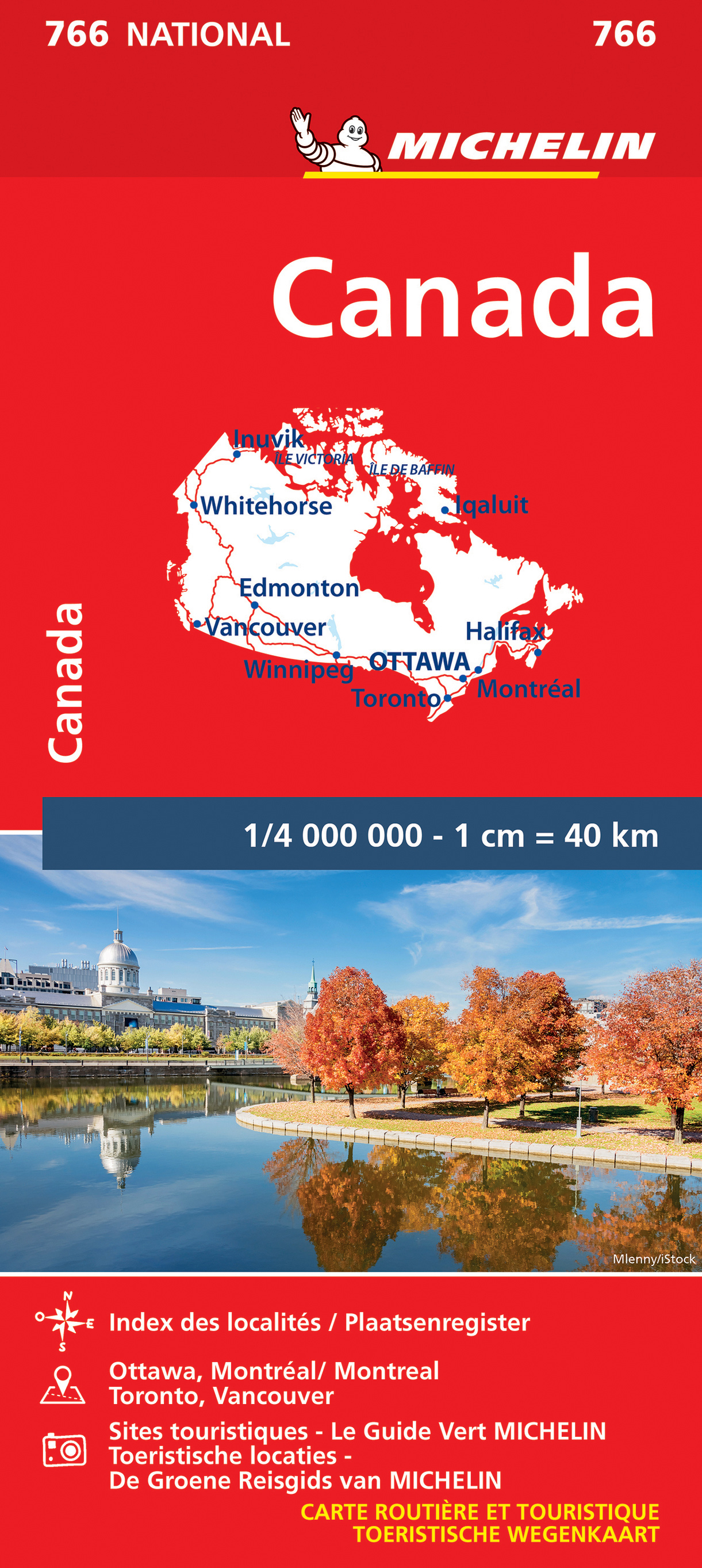
Zoals je van Michelin mag verwachten is deze kaart zeer overzichtelijk en heeft een duidelijk helder kaartbeeld. De kaart geeft uitgebreide toeristische informatie weer. De perfecte overzichtskaart! This Canada map from Michelin is part of their red national map series. These are perfect for route planning as well as getting around by car once you're there. They clearly mark out major roads and also show many of the more important minor roads. The map's simple folding design with durable paper cover, allows it to be read like a book and easily folded back together. Road numbers and intermediate distances are clearly displayed with the more scenic routes highlighted in green. The map also features: Political boundaries Regional and National Parks Important sights (points of interest, historic sites, etc.) Driving Times and Distances Road Safety Information A legend in multiple languages (Dutch, English, French, German and Spanish) Canada, Edmonton, Inuvik, Montréal, Ottawa, Toronto, Vancouver, Whitehorse, Winnipeg
€12,95
Bekijk product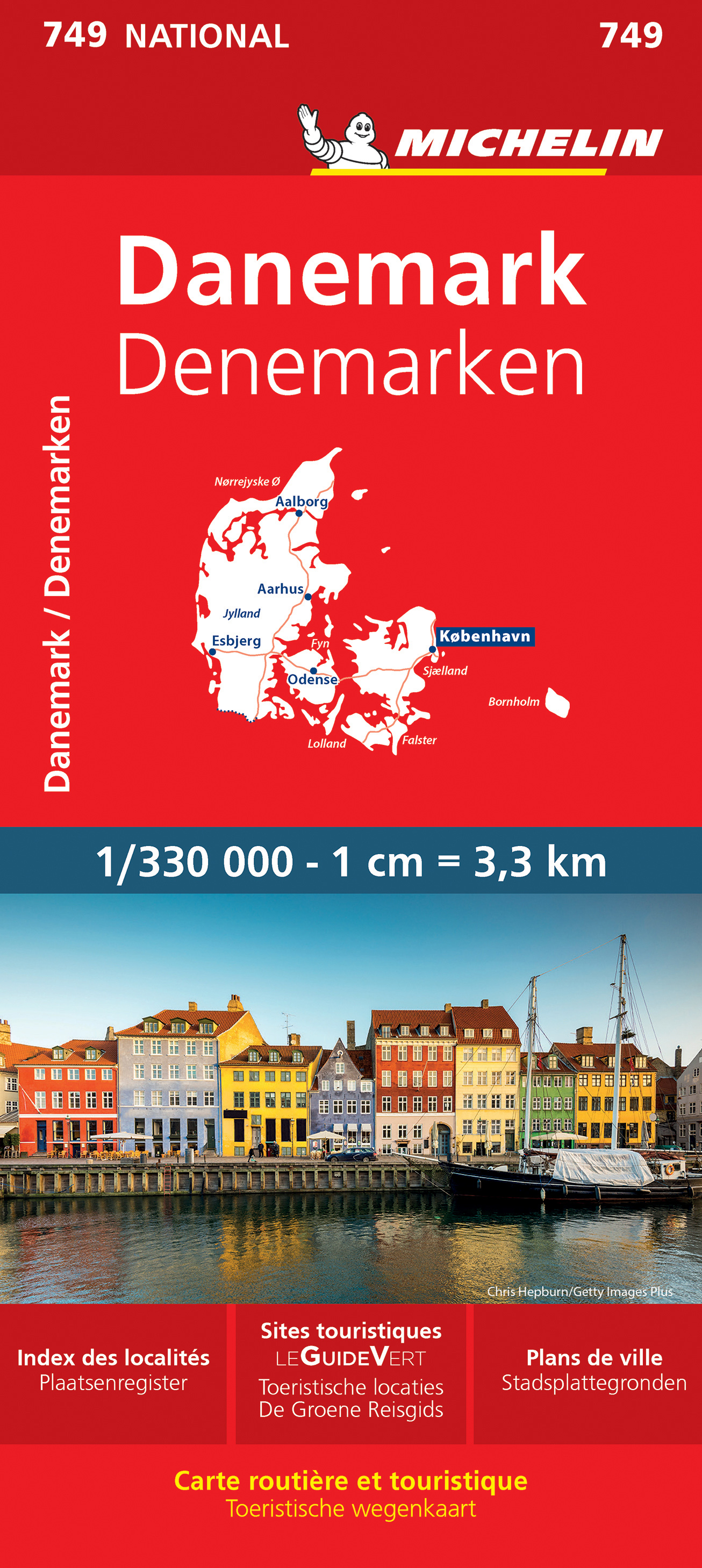
Zoals je van Michelin mag verwachten is deze kaart zeer overzichtelijk en heeft een duidelijk helder kaartbeeld. De kaart geeft uitgebreid toeristische informatie weer. Met register, afstanden en reistijden. Wegen worden naar verschillende klasse ingedeeld en - mooi van Michelin - de interessante mooie routes worden gemarkeerd met een groene streep. Hindernissen voor automobilsiten met caravans zijn gemarkeerd: steile hellingen, bergpassen of een anderzins moeilijke route. Bezienswaardigheden als een kasteel, religieus gebouw, ruine of grot zijn door een symbool goed te vinden. Michelin Denmark Map 749 in its sturdy cardboard cover is invaluable for driving in Denmark. It encompasses the Danish network of motorways and primary and secondary roads, includes inset maps for Copenhagen, Odense, Aarhus and Aalborg, and contains an extensive place name index and an English-language legend for reading the map symbols. Visitors will appreciate the many points of interest, parks and recreational sites indicated on the map. For effective trip planning before and during the journey, turn to Michelin maps. Aalborg, Aarhus, Copenhague, Danemark, Odense, Roskilde
€11,95
Bekijk product
Mooie duidelijke wegenkaart van Noord Zweden, van Lulea - Kiruna - Narvik. Met o.a. campings, jeugdherbergen, wegnummers en bezienswaardigheden aangegeven. Kummerly and Frey regional road map covering North Sweden. A product from this regional range is ideal for tourists, and is intended to be taken around in a glove compartment. Mapping gives at-a-glance navigation between tourist attractions within the coverage areas, so that travelling times can be easily calculated and minimised, with easily followable numbered roads so that incorrect routes are avoided.
€14,75
Bekijk product
Mooie kaart van de bekende kaartenmaker National Geographic. Veel details door kleurgebruik. De wegen zijn met kleuren verdeeld in drukke en minder drukke, de wegnummers zijn goed terug te vinden. De kaart onderscheidt zich van andere series door de hoeveelheid topografische details als counties, plaatsnamen en waterwegen en het bevat een register waarin het eenvoudig zoeken is. Daarnaast is de kaart gedrukt op scheur- en watervast papier. The Southeastern Plains and Gulf Coast Adventure Map will guide you through the southern Mississippi River basin from the midwestern states of Illinois and Indiana through Missouri, Kentucky, Tennessee, Arkansas to the Gulf Coast states of Louisiana, Mississippi, Alabama, and the pan handle of Florida. The names of cities in this region of the country recall the classics of jazz, blues, and country music, which were born in rivers, bayous, fields, and farms of this scenic and storied region. The map includes the cities of Indianapolis, Nashville, St. Louis, Memphis, Tallahassee, Panama City, and New Orleans. There is simply no better map for exploring the states of the Southern Plains and Gulf Coast of the United States. National Geographic’s US Adventure Maps provide the most authoritative and convenient travel maps available to plan and guide your USA Adventure. Each map delivers the perfect combination of detail and perspective, highlighting travel routes, topography, and points of interest for those venturing beyond the city centers. Whether you’re on a classic American road trip or planning a grand tour to visit several cities or national parks, these maps offer the ultimate geographic resource as only National Geographic can provide. Every Adventure Map is printed on durable synthetic paper, making them waterproof, tear-resistant and tough — capable of withstanding the rigors of international travel.
€17,50
Bekijk product
Mooie kaart van de bekende kaartenmaker National Geographic. Veel details door kleurgebruik. De wegen zijn met kleuren verdeeld in drukke en minder drukke, de wegnummers zijn goed terug te vinden. De kaart onderscheidt zich van andere series door de hoeveelheid topografische details als counties, plaatsnamen en waterwegen en het bevat een register waarin het eenvoudig zoeken is. Daarnaast is de kaart gedrukt op scheur- en watervast papier. The United States Southwest Adventure Map will guide you through one of the most iconic and awe-inspiring regions on Earth. The states of Arizona and New Mexico contain Grand Canyon, Petrified Forest, and Saguaro National Parks, Monument Valley, Sonoran Desert, and dozens of celebrated National Monuments, Forests, and Wilderness Areas. The map includes the cities of Phoenix, Tucson, Sedona, Flagstaff, Santa Fe, and Albuquerque as well as the Navajo, Apache, Hopi, and many other Indian Reservations. It covers the entire Four Corners Region including the southern halves of Utah and Colorado. There is simply no better map for exploring the Southwestern United States. National Geographic’s US Adventure Maps provide the most authoritative and convenient travel maps available to plan and guide your USA Adventure. Each map delivers the perfect combination of detail and perspective, highlighting travel routes, topography, and points of interest for those venturing beyond the city centers. Whether you’re on a classic American road trip or planning a grand tour to visit several cities or national parks, these maps offer the ultimate geographic resource as only National Geographic can provide. Every Adventure Map is printed on durable synthetic paper, making them waterproof, tear-resistant and tough — capable of withstanding the rigors of international travel.
€17,50
Bekijk product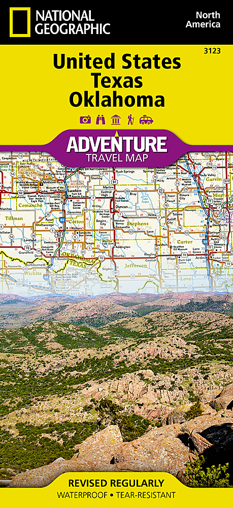
Mooie kaart van de bekende kaartenmaker National Geographic. Veel details door kleurgebruik. De wegen zijn met kleuren verdeeld in drukke en minder drukke, de wegnummers zijn goed terug te vinden. De kaart onderscheidt zich van andere series door de hoeveelheid topografische details als counties, plaatsnamen en waterwegen en het bevat een register waarin het eenvoudig zoeken is. Daarnaast is de kaart gedrukt op scheur- en watervast papier. The United States Texas and Oklahoma Adventure Map will guide you through the vast state of Texas and plains and hills of Oklahoma. For a short time in the 1800's Texas was an independent country which is not surprising since it is larger than France, Spain, or Germany. The map stretches from the Gulf Coast of Texas with white sand beaches, through the famous Texas Hill Country surrounding Austin and the desert landscape of Big Bend along the Rio Grande to the Red River valley that divides Texas from Oklahoma. This map includes the cities of Houston, San Antonio, Austin, Dallas, Fort Worth, El Paso, and Oklahoma City. There is simply no better map for exploring Texas and Oklahoma. National Geographic’s US Adventure Maps provide the most authoritative and convenient travel maps available to plan and guide your USA Adventure. Each map delivers the perfect combination of detail and perspective, highlighting travel routes, topography, and points of interest for those venturing beyond the city centers. Whether you’re on a classic American road trip or planning a grand tour to visit several cities or national parks, these maps offer the ultimate geographic resource as only National Geographic can provide. Every Adventure Map is printed on durable synthetic paper, making them waterproof, tear-resistant and tough — capable of withstanding the rigors of international travel.
€17,50
Bekijk product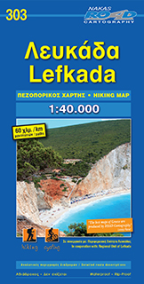
Gedetailleerde wegenkaart van Lefkada met aanduiding van de wandelwegen, lijst van hotels en toeristische informatie. Voor alle doeleinden een zeer geschikte kaart.
€9,95
Bekijk product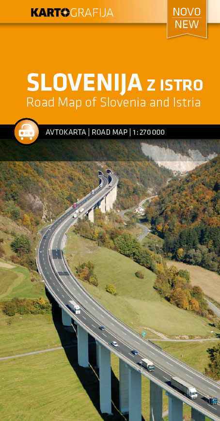
Wegenkaart van Slovenie met alle noodzakelijke gegevensL onderscheid in soorten wegen, afstanden tussen steden, aanduidingen voor campings, hotels, bezienswaardigheden een ook benzinepompen. Tweezijdig, met een register. De kaart omvat heel Slovenië en heel Istrië en dekt grote delen van Karinthië en Noordwest Kroatië met Zagreb. Aan de achterkant de eilanden Krk, Cres, Rab en het noordelijke gedeelte van Pag.
€10,95
Bekijk product
Tweeizijdige kaart van heel Italie , waardoor deze behoorlijk gedetailleerd kan zijn. Met allerlei details zijn belangrijke zaken weergegeven als bezienswaardigheden, maar ook bijvoorbeeld campings. Wegen natuurlijk in goed te onderscheiden gradatie prima leesbaar. Maßstab 1 : 650 000 gefaltete Karte ReiseInfo & Register: Fernstraßenkarte - Reiseservice - Cityplan: Rom- Reiseführer - Ortsregister Karte: Sehenswürdigkeiten - landschaftlich schöne Strecken - Natur- und Nationalparks Im jeweils optimalsten Maßstab (von 1:300.000 bis 1:800.000) bieten die ADAC Länderkarten eine Übersicht des jeweiligen Landes, und vermitteln gleichzeitig eine Vielzahl an Details zu Tourismus und Verkehr, wie z. B. Kilometerangaben an Haupt- und Nebenstraßen, landschaftlich schöne Strecken, Ferienstraßen, schöne Orte, Natur- und Nationalparks und etc. Die Karten haben überwiegend Ortsregister und Citypläne der wichtigsten Großstädte.Eine Übersichtskarte Europa im Maßstab 1:4.500.000 rundet das Kartenprogramm ab.
€13,50
Bekijk product