Beantwoord enkele vragen, en binnen seconden geeft AI je een persoonlijk aankoopadvies op maat.
Beantwoord enkele vragen, en binnen seconden geeft AI je een persoonlijk aankoopadvies op maat.
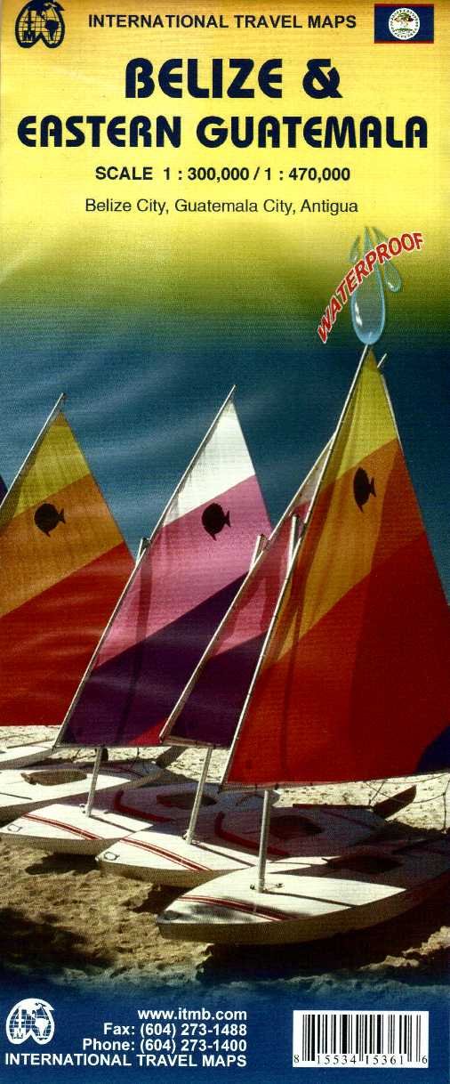
Een degelijke kaart met aanduidingen van o.a. nationale parken, vliegveld, benzinepomp, dirt-roads en kleine plattegrond van hoofdstad. Als overzichtskaart goed te gebruiken. Met oost Guatemala waaronder Tikal. A folded travel and road map in color showing elevations. Indexed with town, camps, and villages. Scale 1:250,000. Legend is in English and Spanish. The map distinguishes paved and unpaved roads, seasonal roads, and tracks. Icons locate international airport, domestic airports with scheduled service, airstrips/ landing ground, lakes, rivers, swamps, coral reefs, protected area, bird sanctuaries, diving, border crossings, bridges, ports, fishing, major and minor archaeological sites. Includes: location of the barrier reefs, marine reserves, forest reserves, and other sites of ecological interest
€13,95
Bekijk product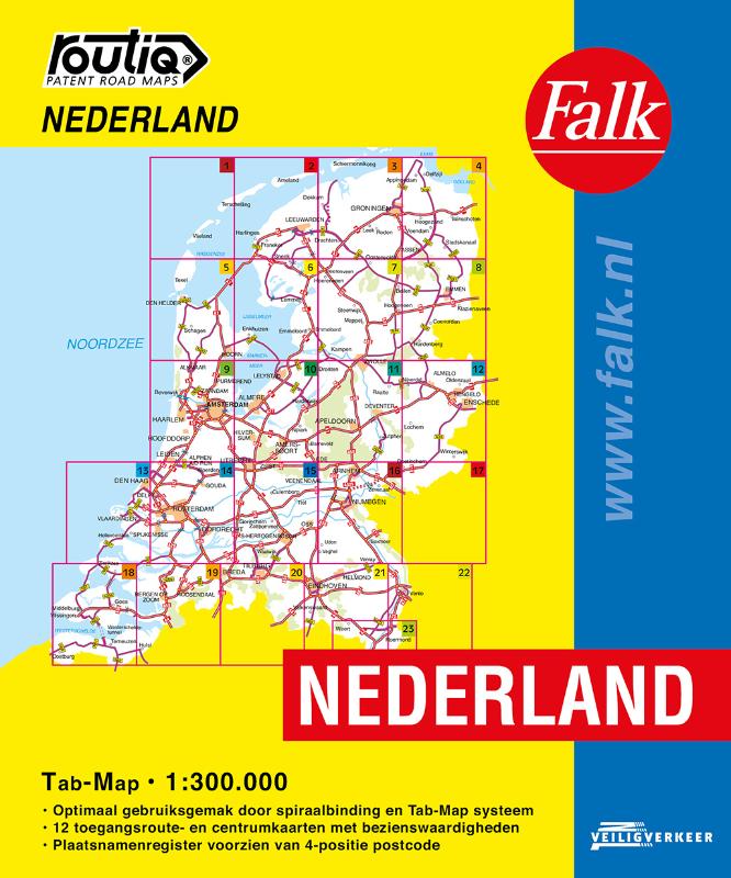
De meest gebruiksvriendelijke wegenkaart van Nederland is ongetwijfeld de Falk Routiq Tab Map. De Routiq Tab Map bladen zijn in een handige ringband gebonden, waar je op de rechterzijde inzoomt op het gebied waar je je bevindt en de linkerzijde geeft aan waar je je globaal bevindt. Het perfecte formaat van de individuele kaarten maakt dat je deze gemakkelijk kunt lezen in de auto. De nummer 1 wegenkaart voor professionele bestuurders! De meest actuele kaart van Nederland Optimaal gebruiksgemak door het Tab Map systeem Wire-O Spiraalbinding. Uitgebreid met toegangsroute- en centrumkaarten met Insider Tips Plaatsnamenregister, afstandentabel
€19,99
Bekijk product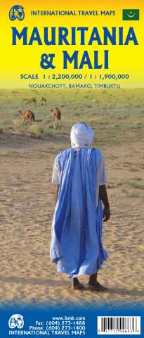
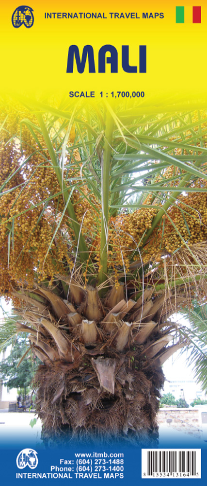
Een degelijke kaart met aanduidingen van o.a. nationale parken, vliegveld, benzinepomp, dirt-roads en kleine plattegrond van hoofdstad. Als overzichtskaart goed te gebruiken. Mali 1:1.900.000 Mauretanië 1:2.200.000 In this edition, we have combined Mauritania with Mali. Although both are interesting countries, the two fit naturally together as a unit, albeit at slightly differing scales. Technically, this should be a 1st edition map, as it is the first time we have combined these two desert countries on to one sheet, but I ll let Robert at the Library of Congress worry about the niceties of bibliographic accuracy as soon as Trump allows him to do the work he loves for a salary. Mauritania was one of the most unusual countries I visited as a young traveller. Of course, I had an advantage, in that I was too young to know that what I was doing was supposed to be impossible. I entered from what was then the Spanish Sahara via a piste (a sandy track with multiple pathways, only some of which avoid soft sand), travelling with a young Bedouin man. In Zouerate, a mining camp, I had to tie my VW campervan onto a railway flatbed car, and endure hundreds of kilometres of a sand dune wasteland before reaching Choum, and a siding where I could off-load the vehicle. The track south to Nouakchott was covered with sand and treacherous. Nowadays, there is a paved road to the southern border of Morocco, and a good road all the way along the coast to Rosso, where a ferry can take one across to Senegal. Mali adjoins Mauritania, both being formerly part of French West Africa. The capital, Bamako, is an interesting town with quite a bit of colonial architecture still in place. East of there is Djenne, a forbidden city for infidels when I was there (see cover photo), but a fascinating mud-brick city. Further east again is Mopti, a river port where camel caravans off-load tablets of salt mined still far in the Sahara for transport by boat to Dakar. Further east again is Timbuktu (or Tombouctou as it is now spelled), at one time the most exotic isolated destination known to mankind. Further south is the Bandiagara escarpment, a must-see living area for locals who have created a living space from the sheer walls of the cliff. Both countries are fascinating places to visit.
€13,95
Bekijk product

Een degelijke kaart met aanduidingen van o.a. nationale parken, vliegveld, benzinepomp, dirt-roads en kleine plattegrond van hoofdstad. Als overzichtskaart goed te gebruiken. Folded road and travel map in color. Scale 1:2,400,000. Distinguishes roads ranging from primary paved roads to other roads or tracks. Legend includes international airport/national airports, air fields, gasoline/petrol stations, post office, hospital/medical facilities, hotels, motels/lodging, resthouse or hostel, campsites or huts, museums, border crossings, no border crossings, points of interest, crafts/pottery, archaelogical sites, historic ruins or sites, mines, bus station, forts, mosques, churches/missions, oasis, caves, fishing ports, beaches, hiking/trekking. Includes inset map of Bamako and Timbuktu, road distance chart and extensive index.
€13,95
Bekijk product