
Beantwoord enkele vragen, en binnen seconden geeft AI je een persoonlijk aankoopadvies op maat.
Beantwoord enkele vragen, en binnen seconden geeft AI je een persoonlijk aankoopadvies op maat.

Wegenkaart van Tanzania, Rwanda en Burundi met vermelding van veel bezienswaardigheden, nationale parken en attrakties. Watervast en scheurvast. Juist door deze vermeldingen onderscheidt de kaart zich van andere wegenkaarten. National Geographic's Tanzania, Rwanda, and Burundi Adventure Map is designed to meet the unique needs of adventure travelers with its durability and accurate information. This folded map provides global travelers with the perfect combination of detail and perspective, highlighting hundreds of points of interest and the diverse and unique destinations within the country. The map includes the locations of cities and towns with a user-friendly index, plus a clearly marked road network complete with distances and designations for major highways, main roads, and tracks and trails for those seeking to explore more remote regions. The front side of the Tanzania map details the southern region of the country, from Zambia to the south, to the bordering country of Burundi to the west. The reverse side of the map details the northern region, showing the bordering country of Kenya to the north, and the Indian Ocean to the east. Key Features: Waterproof and tear-resistant Accurate topography/terrain with a clearly labeled road network Hundreds of points of interest, including the locations parks and nature reserves, protected lands, historical and cultural attractions Thousands of place names including towns and natural features; detailed place names index\ Important travel networks including airports, lighthouses, ferry routes, and rail lines
€17,50
Bekijk product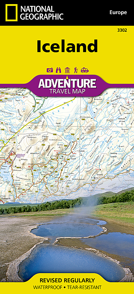
Wegenkaart van IJsland met vermelding van veel bezienswaardigheden, nationale parken en attrakties. Watervast en scheurvast. Juist door deze vermeldingen onderscheidt de kaart zich van andere wegenkaarten. National Geographic's Iceland Adventure Map is designed to meet the unique needs of adventure travelers—detailed, durable, and accurate. Iceland includes the locations of thousands of cities and towns with an index for easily locating them, plus a clearly marked road network complete with distances and designations for expressways, motorways, and more. Transportation within and beyond the country is made easier with the locations of airports, airfields, railroads, ferry routes, and lighthouses. What sets National Geographic Adventure Maps apart from traditional road maps are the hundreds of points of interest that highlight the diverse and unique destinations within Iceland. Outdoor activities abound on the island and activity symbols note popular locations to ski, golf, camp, fish, and swim. Travelers will find plenty to explore in Iceland’s cities as well, including World Heritage sites, museums, churches, and other points of interest. Iceland’s western half is shown on the front side of the map including the cities of Reykjavik, Hafnarfjordur, Kopavogur, Gardabaer, Mossfellsbaer, Keflavik, Borgarnes, Stykkisholmur, and Siglufjordur. The reverse side of the map covers the eastern portion of the country showing the cities of Akureyri, Egilsstadir, Eskifjordur, Neskaupstadur, Husavik, and Hofn. Popular places included on the map Reykjavik, Kopavogur, Hafnarfjordur, Gardabaer, Mossfellsbaer, Vatnajokull National Park, Akureyri, Thingvellir National Park, Vatnsfjordur Nature Reserve, Egilsstadir, Hofn, Thjorsarver Nature Reserve, Geitland Nature Reserve, Blue Lagoon Thermal Spa, Eskifjrdur, Reykjanesfolkvangur Nature Reserve, Gullfoss & Geysir, Skaftafell National Park, Neskaupstadur, Husavik.
€17,50
Bekijk product
Wegenkaart van Noord Spanje met vermelding van veel bezienswaardigheden, nationale parken en attrakties. Watervast en scheurvast. Juist door deze vermeldingen onderscheidt de kaart zich van andere wegenkaarten. National Geographic's Northern Spain Adventure Map is designed to meet the unique needs of adventure travelers—detailed, durable, and accurate. Northern Spain includes the locations of thousands of major cities and towns with an index for easily locating them, plus a clearly marked road network complete with distances and designations for expressways, motorways, and more. St. James Way, one of the most important Christian pilgrimages during medieval times, is noted for travelers seeking to retrace to route to the Cathedral of Santiago de Compostela in Galicia where the remains of the apostle Saint James are believed to be buried. What sets National Geographic Adventure Maps apart from traditional road maps are the hundreds of points of interest that highlight the diverse and unique destinations within Northern Spain. National parks, World Heritage sites, scenic viewpoints, archeological sites, forts, castles, churches, and more are included, making it invaluable to travelers hoping to experience all the history, art, and culture the region has to offer. Beaches and yachting harbors dot Spain’s extensive Atlantic coastline while the location of golf courses, camping sites, waterfalls, caves, and spas make it easy to enjoy the region’s abundant outdoor activities. The front side of the Northern Spain map shows the eastern half of Northern Spain from its border with France on the north to the city of Tudela on the south. It continues west to Cangos de Onis and Palencia. The reverse side of the map stretches from Cangos de Onis and Leon to the region’s western Atlantic coast.
€17,50
Bekijk product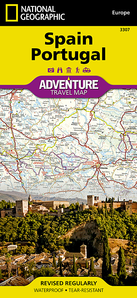
Wegenkaart van Spanje en Portugal met vermelding van veel bezienswaardigheden, nationale parken en attracties. Watervast en scheurvast. Juist door deze vermeldingen onderscheidt de kaart zich van andere wegenkaarten. National Geographic's Spain and Portugal Adventure Map is designed to meet the unique needs of adventure travelers—detailed, durable, and accurate. Spain/Portugal includes the locations of thousands of major cities and towns with an index for easily locating them, plus a clearly marked road network complete with distances and designations for expressways, motorways, and more. What sets National Geographic Adventure Maps apart from traditional road maps are the hundreds of points of interest that highlight the diverse and unique destinations within Spain/Portugal. National parks, World Heritage sites, caves, scenic viewpoints, archeological sites, museums, castles, churches, monasteries, and ruins are included, making it invaluable to travelers hoping to experience all the history, art, and culture the countries have to offer. Additional aids including the location of airports and airfields, hotels, campsites, lighthouses, ferry routes, and border crossings with checkpoints make travel within and beyond the countries easier. The front side of the Spain/Portugal map shows the eastern half of Spain from its northern borders with France and Andorra south along its Mediterranean coastline to Almería. Portugal and the western half of Spain including the Canary Islands are covered on the reverse side of the map.
€17,50
Bekijk product
Wegenkaart van Frankrijk Zuid met vermelding van veel bezienswaardigheden, nationale parken en attrakties. Watervast en scheurvast. Juist door deze vermeldingen onderscheidt de kaart zich van andere wegenkaarten. National Geographic's Southern France Adventure Map is designed to meet the unique needs of adventure travelers with its durability and accurate information. Each folded map provides global travelers with the perfect combination of detail and perspective, highlighting the area’s terrain and best locations for adventure activities like snorkeling, surfing, fishing, and more. Adventure Maps include hundreds of points of interest that highlight diverse and unique destinations within the region. The map includes the locations of thousands of cities and towns with a user-friendly index, plus a clearly marked road network complete with distances and designations for major highways, main roads, and tracks and trails for those seeking to explore more remote regions. The front side of the Southern France map details the eastern region, from its border with Monaco and Italy to the east, and the Riviera (Cote d’ Azur), Mediterranean Sea and Golfe Du Lion to the south. The reverse side of the map details Southern France’s western region, extending from the Bay of Biscay to the west, Spain and Andorra to the south, and the Golfe du Lion to the east. Adventure Maps are printed in the United States on a durable synthetic paper, making it waterproof, tear-resistant and tough—capable of withstanding the rigors of international travel. Key Features: Waterproof and tear-resistant Detailed interpretive information and local travel tips Detailed topography complete with activity symbols, ideal for exploring the country City overview maps Hundreds of points of interest, including the location of World Heritage sites, national parks and nature reserves, aboriginal settlements and protected lands, mines, archeological sites, wildlife parks and more Thousands of place names Important travel aids including airports, lighthouses, ferry routes and rail lines Developed in cooperation with local agencies Updated regularly to ensure accuracy
€17,50
Bekijk product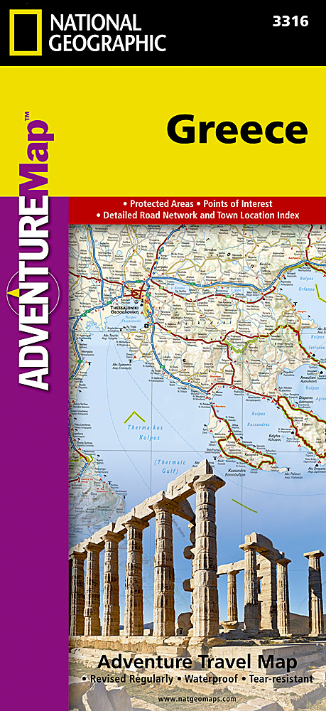
Wegenkaart van Griekenland met vermelding van veel bezienswaardigheden, nationale parken en attrakties. Watervast en scheurvast. Juist door deze vermeldingen onderscheidt de kaart zich van andere wegenkaarten. National Geographic's Greece Adventure Map is designed to meet the unique needs of adventure travelers with its durability and accurate information. This folded map provides global travelers with the perfect combination of detail and perspective, highlighting hundreds of points of interest and the diverse and unique destinations within the country. The front side of the Greece map shows the northern region of the country with Macedonia and Bulgaria to the north, Albania to the west, and Turkey to the east. There are insets detailing the islands of Kerkyra and Zakynthos. The reverse side of the map details the southern portion of Greece showing the islands down to Crete. The map includes the locations of cities and towns with a user-friendly index, plus a clearly marked road network complete with distances and designations for major highways, main roads, and tracks and trails for those seeking to explore more remote regions. Every Adventure Map is printed on durable synthetic paper, making them waterproof, tear-resistant and tough—capable of withstanding the rigors of international travel. Key Features: Waterproof and tear-resistant Detailed interpretive information and local travel tips Detailed topography complete with activity symbols, ideal for exploring the country City overview maps Hundreds of points of interest, including the location of World Heritage sites, national parks and nature reserves, aboriginal settlements and protected lands, mines, archeological sites, wildlife parks and more Thousands of place names Important travel aids including airports, lighthouses, ferry routes and rail lines Developed in cooperation with local agencies Updated regularly to ensure accuracy
€17,50
Bekijk product
Wegenkaart van Kreta met vermelding van veel bezienswaardigheden, nationale parken en attrakties. Watervast en scheurvast. Juist door deze vermeldingen onderscheidt de kaart zich van andere wegenkaarten. National Geographic's Crete Adventure Map is designed to meet the unique needs of adventure travelers with its durability and accurate information. This folded map provides global travelers with the perfect combination of detail and perspective, highlighting hundreds of points of interest and the diverse and unique destinations within the country. The front side of the Crete map details the eastern region of the island with the Sea of Crete to the north. The reverse side of the map shows the western region of the island with the Aegean Sea to the north and the Mediterranean Sea to the south. The map includes the locations of cities and towns with a user-friendly index, plus a clearly marked road network complete with distances and designations for major highways, main roads, and tracks and trails for those seeking to explore more remote regions. Every Adventure Map is printed on durable synthetic paper, making them waterproof, tear-resistant and tough—capable of withstanding the rigors of international travel. Key Features: Waterproof and tear-resistant Detailed interpretive information and local travel tips Detailed topography complete with activity symbols, ideal for exploring the country City overview maps Hundreds of points of interest, including the location of World Heritage sites, national parks and nature reserves, aboriginal settlements and protected lands, mines, archeological sites, wildlife parks and more Thousands of place names Important travel aids including airports, lighthouses, ferry routes and rail lines Developed in cooperation with local agencies Updated regularly to ensure accuracy
€17,50
Bekijk product
Wegenkaart van Cyprus met vermelding van veel bezienswaardigheden, nationale parken en attrakties. Watervast en scheurvast. Juist door deze vermeldingen onderscheidt de kaart zich van andere wegenkaarten. National Geographic's Cyprus Adventure Map is designed to meet the unique needs of adventure travelers with its durability and accurate information. This folded map provides global travelers with the perfect combination of detail and perspective, highlighting hundreds of points of interest and the diverse and unique destinations within the country. The front side of the Cyprus map shows the western portion of the island. This side details the regions of Paphos, Limassol, Nicosia, Larnaca, and Kyrenia. The reverse side of the map shows the eastern part of the island. This side details the regions of Larnaca, Kyrenia, and Famagusta. The map includes the locations of cities and towns with a user-friendly index, plus a clearly marked road network complete with distances and designations for major highways, main roads, and tracks and trails for those seeking to explore more remote regions. Every Adventure Map is printed on durable synthetic paper, making them waterproof, tear-resistant and tough—capable of withstanding the rigors of international travel. Key Features: Waterproof and tear-resistant Detailed interpretive information and local travel tips Detailed topography complete with activity symbols, ideal for exploring the country City overview maps Hundreds of points of interest, including the location of World Heritage sites, national parks and nature reserves, aboriginal settlements and protected lands, mines, archeological sites, wildlife parks and more Thousands of place names Important travel aids including airports, lighthouses, ferry routes and rail lines Developed in cooperation with local agencies Updated regularly to ensure accuracy
€17,50
Bekijk product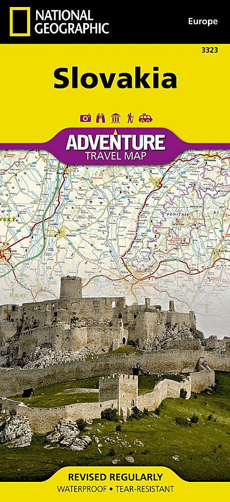
Wegenkaart van Slowakije met vermelding van veel bezienswaardigheden, nationale parken en attrakties. Watervast en scheurvast. Juist door deze vermeldingen onderscheidt de kaart zich van andere wegenkaarten. National Geographic's Slovakia Adventure Map is designed to meet the unique needs of adventure travelers with its durability and accurate information. Each folded map provides global travelers with the perfect combination of detail and perspective, highlighting the area’s terrain and best locations for adventure activities like snorkeling, surfing, fishing, and more. Adventure Maps include hundreds of points of interest that highlight diverse and unique destinations within the country. The map includes the locations of thousands of cities and towns with a user-friendly index, plus a clearly marked road network complete with distances and designations for major highways, main roads, and tracks and trails for those seeking to explore more remote regions. Key Features: Waterproof and tear-resistant Detailed interpretive information and local travel tips Detailed topography complete with activity symbols, ideal for exploring the country City overview maps Hundreds of points of interest, including the location of World Heritage sites, national parks and nature reserves, aboriginal settlements and protected lands, mines, archeological sites, wildlife parks and more Thousands of place names Important travel aids including airports, lighthouses, ferry routes and rail lines Developed in cooperation with local agencies Updated regularly to ensure accuracy
€17,50
Bekijk product
Goede wegenkaart van de Benelux. Met register en enkele stadsplattegronden. De berijdbare wegen zijn goed weergeven, zowel de hoofdwegen als provinciale en lokale wegen; wegnummers worden vermeld. Afstanden tussen plaatsen zijn in kilometers op de kaart ingetekend, daarnaast worden ook op belangrijke plekken benzinepompen gemarkeerd. In het kaartbeeld wordt door middel van schaduw het reliëf weergegeven en soms enkele punten in het landschap met de daadwerkelijke hoogte. Provinciegrenzen zijn goed terug te vinden, nationale parken en reservaten ook. Met allerhande symbolen worden toeristische bezienswaardigheden weergegeven als monumenten, historisch belangrijke plekken en uitzichtpunten. In bepaalde plaatsen zijn hotels en campings te vinden, luchthavens, treinverbindingen en havens vindt u er ook op!
€14,95
Bekijk product