
Beantwoord enkele vragen, en binnen seconden geeft AI je een persoonlijk aankoopadvies op maat.
Beantwoord enkele vragen, en binnen seconden geeft AI je een persoonlijk aankoopadvies op maat.
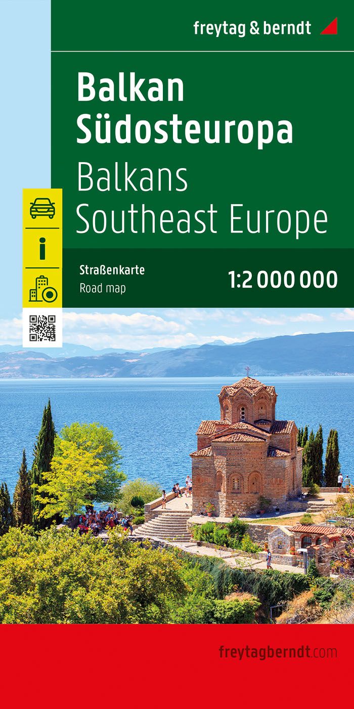
A nicely detailed travelers map of Southeast Europe from Prague east to Odessa and south to Italy, Greece and western Turkey, including the Danube, Romania, Bulgaria and the Black Sea from Odessa to Istanbul. At a scale of 1:2,000,000. Explore the Balkans and South-East Europe with this Freytag & Berndt road map - the best way to prepare your trip, to plan your itinerary, and to travel independently. This map covers the following countries: Greece, Albania, FYROM, Bulgaria, Kosovo, Serbia, Montenegro, Bosnia Herzegocina, Croatia, Slovenia, Hungary, Romania, Moldova, the Czech & Slovak Republics, Western Turkey, Western Ukraine, Austria, and Southern Italy. The map includes a localities index and more detailed city maps of Athens, Belgrade, Bratislava, Bucarest, Budapest, Chisinau, Istanbul, Kiev, Ljubljana, Podgorica, Prague, Pristina, Sarajevo, Skopje, Sofija, Tirana, Vienna, and Zagreb.
€14,95
Bekijk product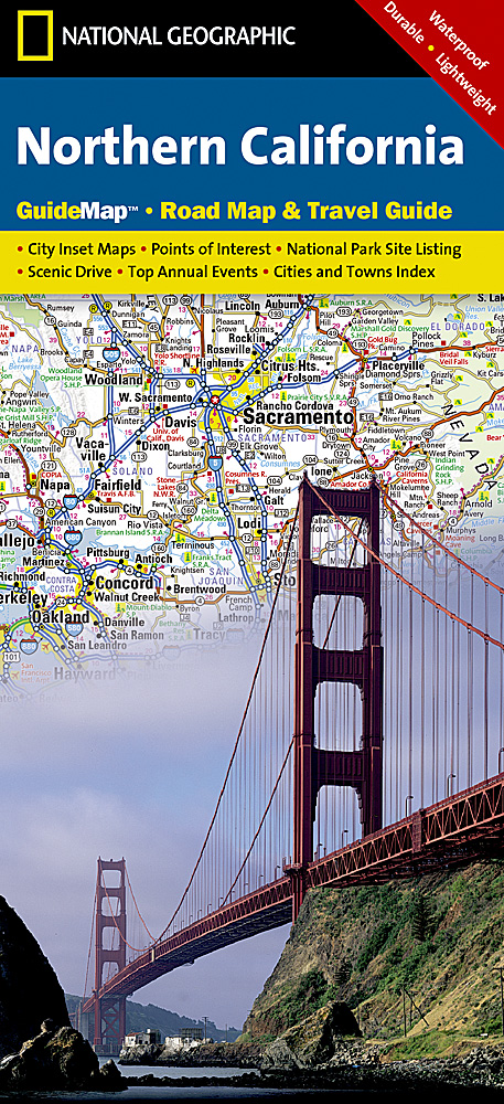
The front side is an easy-to-read road map with insets of: * San Francisco Bay Area * Stockton * Sacramento * Lake Tahoe * Redwood National and State Parks The back includes: * Map and information for San Francisco * Information for Yosemite National Park * Points of interest * Scenic drive * Park Service sites in Northern California
€12,95
Bekijk product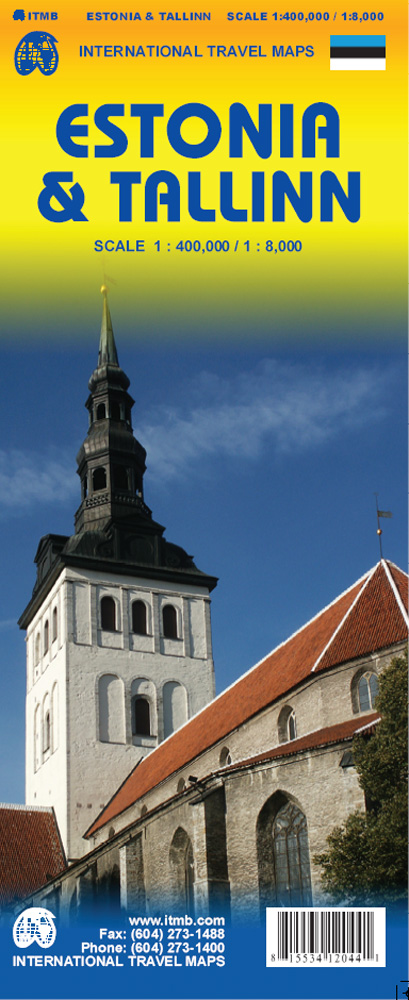
Goede wegenkaart van Estland met bezienswaardigheden, kilometers etc. daarop aangegeven. The map displays Estonia on one side and Tallin on the other, each showing a separate index. Road networks distinguish motorways, major and minor roads with intermediate distances on connecting roads. Railways and ferry routes are also shown, while symbols clearly indicate parking and international and domestic airports. Topography is represented by altitude colouring and graphics locate rivers, lakes, national parks and reserves, Unesco World Heritage sites, scenic spots, hotsprings etc. Symbols mark locations of various places of interest including hotels, campsites, historic ruins, castles, beaches, ports etc. International and administrative boundaries are marked. Latitude and longitude lines are drawn at intervals of 20’. The street plan of Tallin is a clearly laid out and extends from the Gulf of Tallin to Tallin international airport and the intercity bus station in the south, the Central railway terminal in the west and the Kadriorg Art Museum in the east. The plan clearly illustrates the different types of roads with different colours, as well as the tram, intercity rail and electric trolley bus lines. Information for tourists includes monuments, information points, shopping centres, theatres, embassies, bicycle routes, walking paths etc. Separate enlargements represent Tallin Old Town at approximately 1:4,000, Tallin public transport network and Estonia’s main roads network. The map is annotated with historical and tourist information of places of interest, it is indexed and all place names are shown transliterated only. The multilingual legend includes English.
€13,95
Bekijk product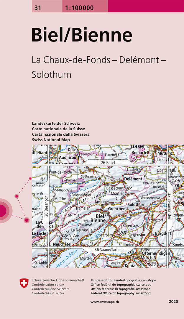
Prachtige topografische kaart van een deel van Zwitserland, gemaakt door de Zwitserse topografische dienst: zij zijn verantwoordelijk voor de mooiste topo-kaartenm met Zwitserse precisie. De schaal van 1:100.000 is naast een duidelijke overzichtskaart ook goed te gebruiken als fietskaart en motorkaart. Hoogteverschillen worden duidelijk gemaakt d.m.v. hoogtelijnen maar ook door goed kleurgebruik. Alle spoorwegen, autowegen, snelwegen en kleinere wegen zijn aangeven. Steden/dorpen/gebieden/bergen/dalen/rivieren/meren: Biel / Bienne, Solothurn, La Chaux-de-Fonds, Delémont, Lyss, Moutier, St.-Ursanne, Burgdorf, Maiche, Aarberg, Chasseral, Weissenstein, Passwang, Bielersee
€15,95
Bekijk product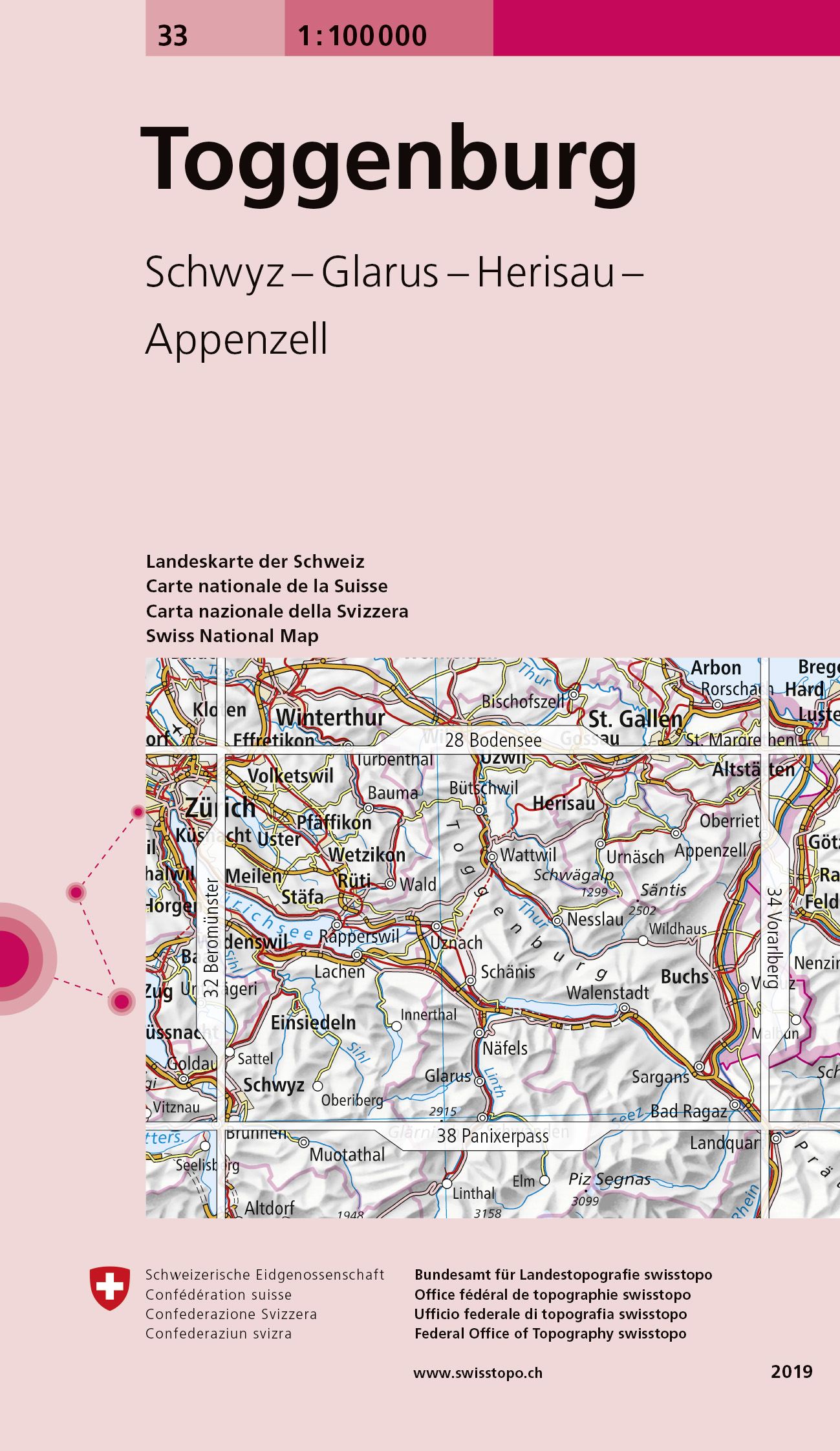
Prachtige topografische kaart van een deel van Zwitserland, gemaakt door de Zwitserse topografische dienst: zij zijn verantwoordelijk voor de mooiste topo-kaartenm met Zwitserse precisie. De schaal van 1:100.000 is naast een duidelijke overzichtskaart ook goed te gebruiken als fietskaart en motorkaart. Hoogteverschillen worden duidelijk gemaakt d.m.v. hoogtelijnen maar ook door goed kleurgebruik. Alle spoorwegen, autowegen, snelwegen en kleinere wegen zijn aangeven. Steden/dorpen/gebieden/bergen/dalen/rivieren/meren: St. Gallen, Buchs, Stäfa, Schwyz, Pfäffikon, Herisau, Walenstadt, Einsiedeln, Wädenswil, Effretikon, Gossau, Glarus, Bad Ragaz, Säntis, Glärnisch, Churfirsten, Alpstein, Walensee, Zürichsee / Zürisee, Sihlsee, Greifensee
€15,95
Bekijk product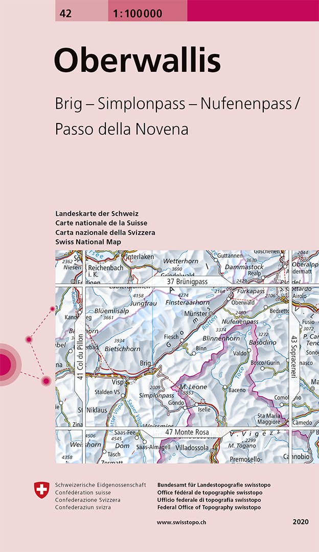
Prachtige topografische kaart van een deel van Zwitserland, gemaakt door de Zwitserse topografische dienst: zij zijn verantwoordelijk voor de mooiste topo-kaartenm met Zwitserse precisie. De schaal van 1:100.000 is naast een duidelijke overzichtskaart ook goed te gebruiken als fietskaart en motorkaart. Hoogteverschillen worden duidelijk gemaakt d.m.v. hoogtelijnen maar ook door goed kleurgebruik. Alle spoorwegen, autowegen, snelwegen en kleinere wegen zijn aangeven. Steden/dorpen/gebieden/bergen/dalen/rivieren/meren: Brig / Glis, Visp, Münster, Oberwald, Binn, Valdo, Bacena, Finsteraarhorn, Jungfrau, Blüemlisalp, Fletschhorn, Fiescherhorn, Aletschhorn, Bietschhorn, Simplonpass, Nufenenpass, Gotthardpass, Grimselpass, Goms, Lötschental, Valle Antigorio, Konkordiaplatz, Aletschgletscher
€15,95
Bekijk product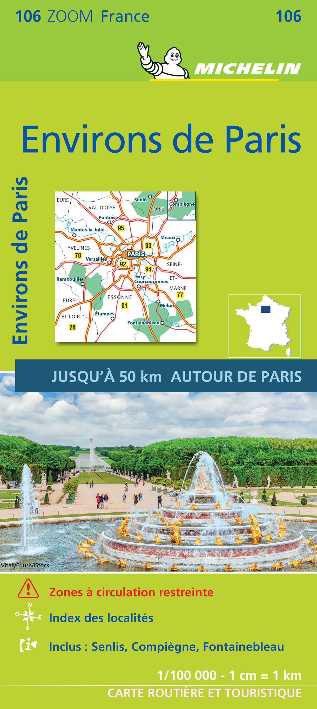
Goede michelin wegenkaart van de omgeving van Parijs met stadsplattegrond van het centrum. Speciale toeristische kaart, gemaakt voor een goed bezocht gebied en uitvergroot. Daardoor zeer prettig leesbaar met een hoog niveau wat we van Michelin al veel langer gewend zijn. Alle wegen staan er op, met verschillende kleuren voor de aparte soorten wegen. Verder veel aandacht met symbolen voor de bezienswaardigheden in de regio, de bekende groene stroken naast de mooie wegen en ingetekende doorgaande wandelroutes als grande randonnees. Chantilly, Chartres, Fontainebleau, Île-de-France, Meaux, Paris, Provins, Versailles
€10,95
Bekijk product
Mooie, geplastificeerde kaart van het Argentinië. Deze kaart biedt een goed overzicht van het land met detailkaarten. Our soft-laminated folded map of Argentina shows: Argentina 1:3 800 000, Isla Grande de Tierra del Fuego 1:1 900 000, Los Glaciares National Park 1:750 000, Mount Fitz Roy 1: 250 000, Greater Buenos Aires 1:650 000, Buenos Aires 1:18 000, Cordoba 1:14 000, Salta 1:16 000, Argentina administrative and time zones. Borch Maps are easy to fold, durable and water-repellent with a wipeable surface. Borch Maps show hotels, museums, monuments, markets, public transport, top sights and points of interest, useful statistics, conversion charts for temperatures, weights and measurements, climate charts showing temperatures, sunshine hours, precipitation and humidity, overview maps, time zones, and much more... Enchanted by the sophisticated European flair of Buenos Aires, watching the world go by from a sidewalk café whilst taking a break from the buzzing nightlife, one could almost forget that the land of tango, pampas, and legendary gauchos has more to offer than just charming clichés. Windsurfers, sun-worshippers and fishing enthusiasts enjoy the fabulous surf and broad sandy beaches around Mar del Plata. Cuyo, Argentina's wine country, offers outdoor activity all year round - from trekking and hang-gliding to waterskiing and sailing. In Patagonia, the eastern slopes of the Andes create a breathtaking landscape of towering volcanoes, shimmering lakes and sprawling forests - unforgettable sights for nature lovers who will be delighted by the abundant wildlife on Península Váldes, the jagged glacial peaks on windswept Tierra del Fuego, and the thunderous cascades of the Iguazú Falls. The scenic desert canyons in the northwest, with their colonial churches and largely indigenous population, ensure an authentically Andean experience.
€11,50
Bekijk product
Bijzondere kaart van de loop van de Yangzse, de grootste rivier van China. Gericht op het maken van cruises en andere toeristische zaken rond de rivier. De schaal is variabel door de verschillende kaarten die men gebruikt. Stretching to nearly 4,000 miles, the Yangzi is the third largest river in the world and without a doubt China's single most important river artery. These high-quality, hypsometric-shaded relief maps feature numerous captions informing the traveller of geographical, cultural and historical facts about the river and surrounding areas along the upper and lower regions of the Yangzi. + First comprehensive map of the entire Yangzi River + Separate sections detail the upper and lower reaches + Three Gorges area greatly enlarged + Covers three key river cities + Numerous annotations detailing geographical, cultural and historical facts + 28 superb color photographs of the people and surrounding countryside
€16,95
Bekijk product
Goede wegenkaart van een deel van Griekenland. Waar beschikbaar worden hotels en campings getoond en met symbolen worden allerhande toeristische symbolen aangeduid als historische plaatsen, kloosters, museas etc. Tweetalig. Op elke kaart staat van de belangrijkste steden een centrumkaart en er is een behoorlijk uitgebreid register (wel kleine letters!) Kleurgebruik is duidelijk, maar een beetje flets, waardoor hoogteverschillen niet echt goed uitkomen.
€10,25
Bekijk product