Beantwoord enkele vragen, en binnen seconden geeft AI je een persoonlijk aankoopadvies op maat.
Beantwoord enkele vragen, en binnen seconden geeft AI je een persoonlijk aankoopadvies op maat.
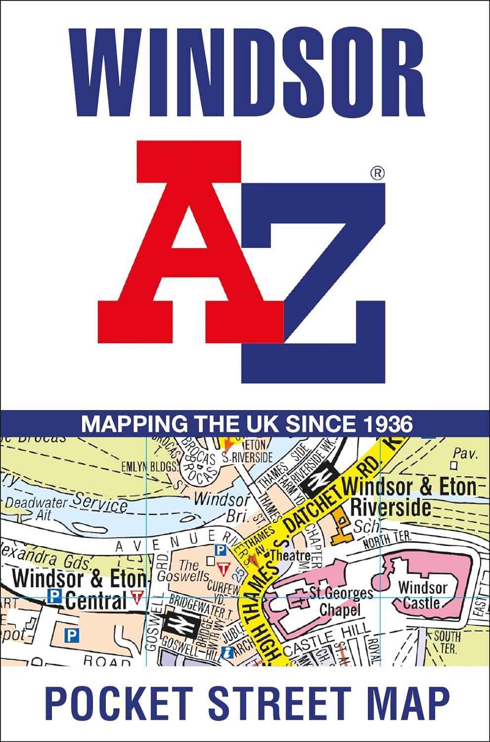
<div> Navigate your way around Windsor with detailed street maps from A-Z</div> <div> This up-to-date, folded A-Z street map includes all of the 1,500 streets in and around Windsor.</div> <div> </div> <div> Postcode districts, one-way streets and car parks</div> <div> Places of interest</div> <div> On the reverse there is a handy index to streets, places of interest, place and area names, park and ride sites, national rail stations, hospitals and hospices</div> <div> Detailed coverage of an area extending from Chalvey and the M4 motorway in the north to Old Windsor in the south, and from Sunnymeads in the east to Oakley Green in the west.</div> <div> </div> <div> The perfect reference map for finding your way around Windsor.</div>
€7,95
Bekijk product
<div> Navigate your way around Peterborough with detailed street maps from A-Z</div> <div> This up-to-date, folded A-Z street map includes all of the 1,500 streets in and around Peterborough.</div> <div> Detailed coverage of an area extending from Walton in the north to Hampton Gardens in the south, and from Fengate in the east to Thorpe Wood Golf Course in the west.</div> <div> </div> <div> This street map includes the following:</div> <div> </div> <div> Postcode districts, one-way streets and car parks</div> <div> Places of interest</div> <div> On the reverse there is a handy index to streets, places of interest, place and area names, park and ride sites, national rail stations, hospitals and hospices</div> <div> With clear mapping at a scale of 5.5 inches to 1 mile, this is the perfect reference map for finding your way around Peterborough.</div>
€7,95
Bekijk product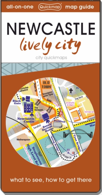
<div> Know Newcastle like a local with area flavours. See all the attractions inside and surrounding including Durham and find easy ways to get to them without a car. Instantly understand the city on the zippy folding maps inside the discreet pocket-sized cover. This map-guide is ideal for visitors who are interested in experiencing this dynamic city.</div> <div> </div>
€6,95
Bekijk product

<div> Der FALK Cityplan ist für deine nächste Stadterkundung unentbehrlich. Der kleine kompakte Plan bietet dir eine schnelle Orientierung und leitet dich zu deinem nächsten Ziel in Dresden. Mit Hilfe des blauen und grauen Suchgitters wird die Entfernungsabschätzung innerhalb der Stadt zum Kinderspiel. Mit einer Maschenweite von 2.000 Metern und einer Feineinteilung von 100 Metern kannst du dich so optimal in der Stadt zurechtfinden. Auf der Rückseite findest du nicht nur Wissenswertes über Dresden sondern auch ein Straßenverzeichnis mit Postleitzahlen und Suchfeldangaben, einen Innenstadtplan von Dresden sowie eine Durchfahrtskarte. Der DVB Liniennetzplan hilft dir darüber hinaus bei der Planung deiner Fahrten mit dem öffentlichen Nahverkehr.</div> <div> </div>
€9,50
Bekijk product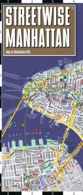
<div> Some people think Manhattan and New York City are synonymous, but technically they are not. Manhattan is one of the five boroughs that make up New York City. The others are Brooklyn, The Bronx, Queens, and Staten Island. It's a persnickety detail, but detail is what STREETWISE® is about. For example, the architectural details drawn on the Manhattan New York map are in outline form. A solid drawing would obscure the streets surrounding the location, and therefore hamper the usability of the map. Only in unobstructed locations will you find a solid drawing. You may not notice this or any of the many other details that combine to make a NY city map that has been called the best selling map on earth*. </div> <div> </div> <div> The STREETWISE® Manhattan Map is detailed from lower tip to upper tip. It is layered with information about sites and mass transit routes. The New York City Subway system is one of the most important and vital rail networks in the world. It is also the fastest and cheapest way to travel north-south in New York. Our Manhattan street map has the best designed diagram of the Subway system ever produced on a street map. An inset of Manhattan bus routes complements the Subway system. You are now prepared to travel the length and breadth of Manhattan. From shopping in SOHO, dining in the Village, working in Midtown, visiting the Met on the Upper East Side or strolling thru Central Park, you're covered with the STREETWISE® Manhattan Map of NYC.</div> <div> </div> <div> From the Staten Island Ferry up to the rediscovered realm of Harlem, you can navigate like a native New Yorker with this pocket size Manhattan Map. Good city Maps, like the STREETWISE® map of Manhattan, will guide you in the right direction and directly impact your experience of New York. A good Manhattan map will also keep you grounded, relaxed and confident in your decisions about where to go and how to get there. Whether by car, train, bus or on foot you are confident because you carry the most knowledgeable travel companion when you carry our NYC street map. </div> <div> </div> <div> Our pocket size map of Manhattan is laminated for durability and accordion folding for effortless use. To enhance your visit to Manhattan, pick up the Michelin Green Guide to New York City, which details sites and attractions using a star-rating system so you can prioritize your trip by time and interest. For a selection of the best restaurants, buy the red MICHELIN Guide New York City. For driving or to plan your trip to and from Manhattan, use the Michelin Mid-Atlantic/Allegheny Highlands Road and Tourist Map No. 582.</div>
€9,95
Bekijk product