
Beantwoord enkele vragen, en binnen seconden geeft AI je een persoonlijk aankoopadvies op maat.
Beantwoord enkele vragen, en binnen seconden geeft AI je een persoonlijk aankoopadvies op maat.
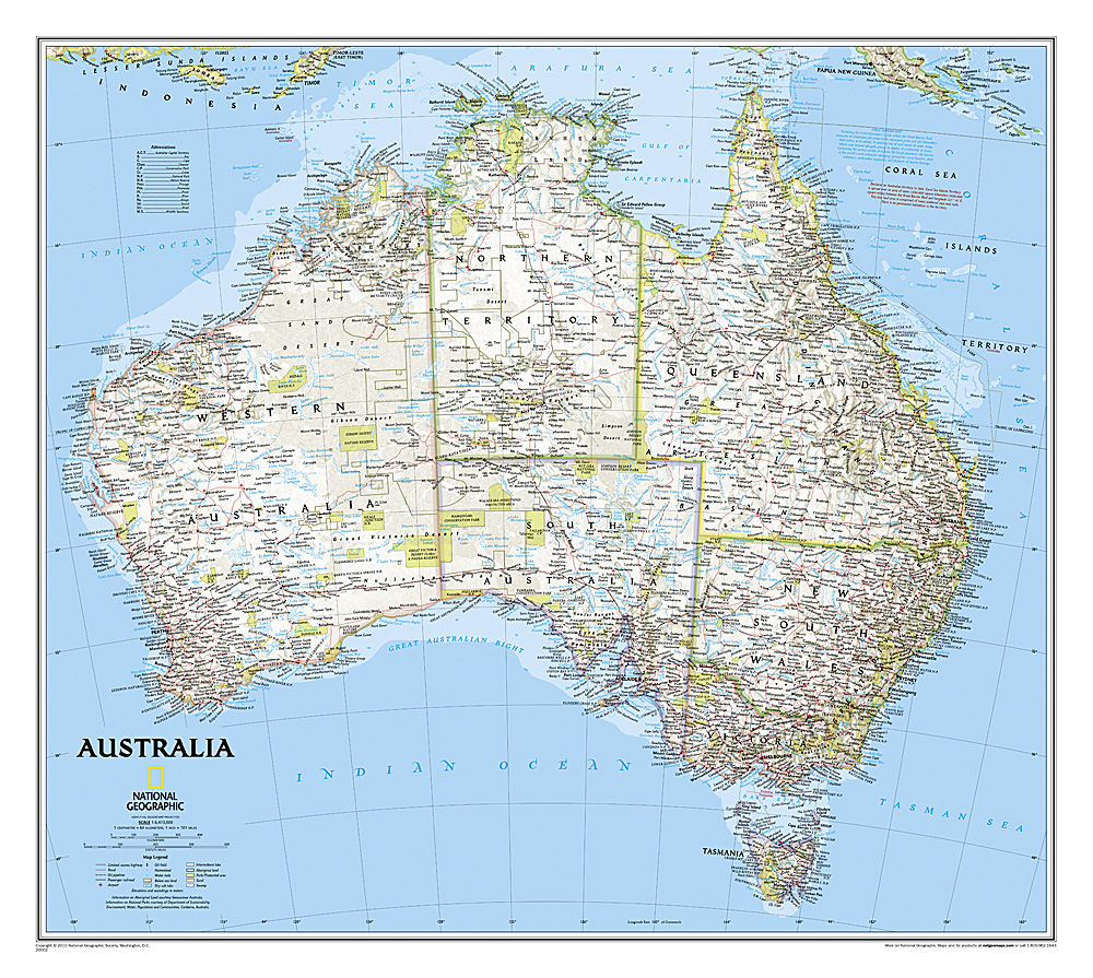
<p> Highly accurate Australia political map clearly shows state boundaries, place names, bodies of water, parks and preserves, and more. Includes inset maps for Tasmania and major Australian cities.</p>
€25,95
Bekijk product
<p> Highly accurate Australia political map clearly shows state boundaries, place names, bodies of water, parks and preserves, and more. Includes inset maps for Tasmania and major Australian cities. This version is laminated—featuring a "write and wipe" surface and durable plastic covering.</p>
€31,95
Bekijk product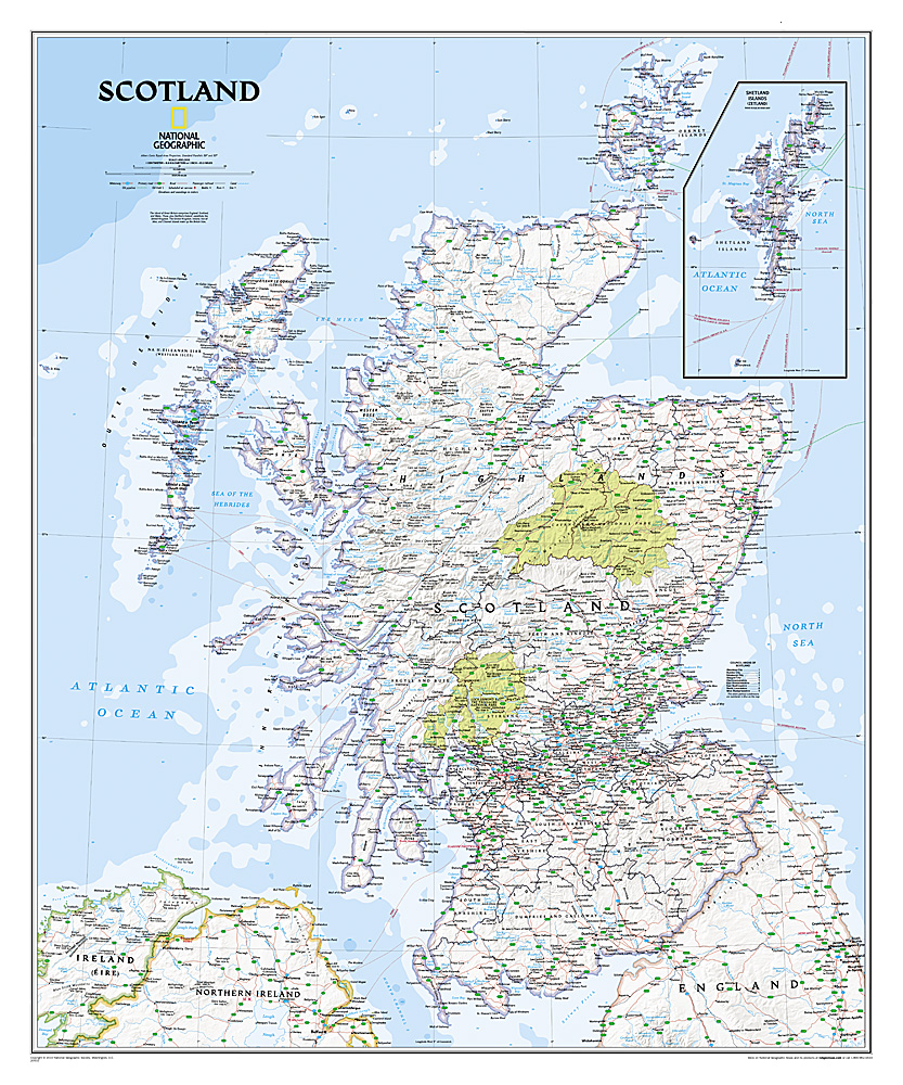
<p> This new map of Scotland, features our rich, antique-inspired Executive style. This beautiful map includes thousands of place names, accurate political boundaries, national parks, archeological sites, and major infrastructure networks such as roads, canals, ferry routes, and railroads. Scotland’s diverse terrain is detailed through accurate shaded relief, coastal bathymetry, and symbolism for water features and other landforms.</p>
€25,95
Bekijk product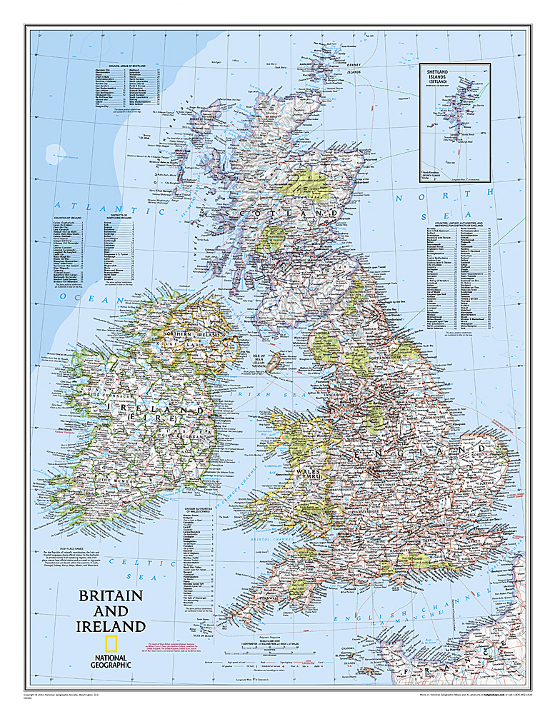
<p> This classic-style map of England and Wales shows political boundaries, major highways and roads, cities and towns, airports, and other geographic details. Thousands of place-names and exact borders are carefully researched by National Geographic’s map researchers and editors ensuring the utmost accuracy.</p>
€31,95
Bekijk product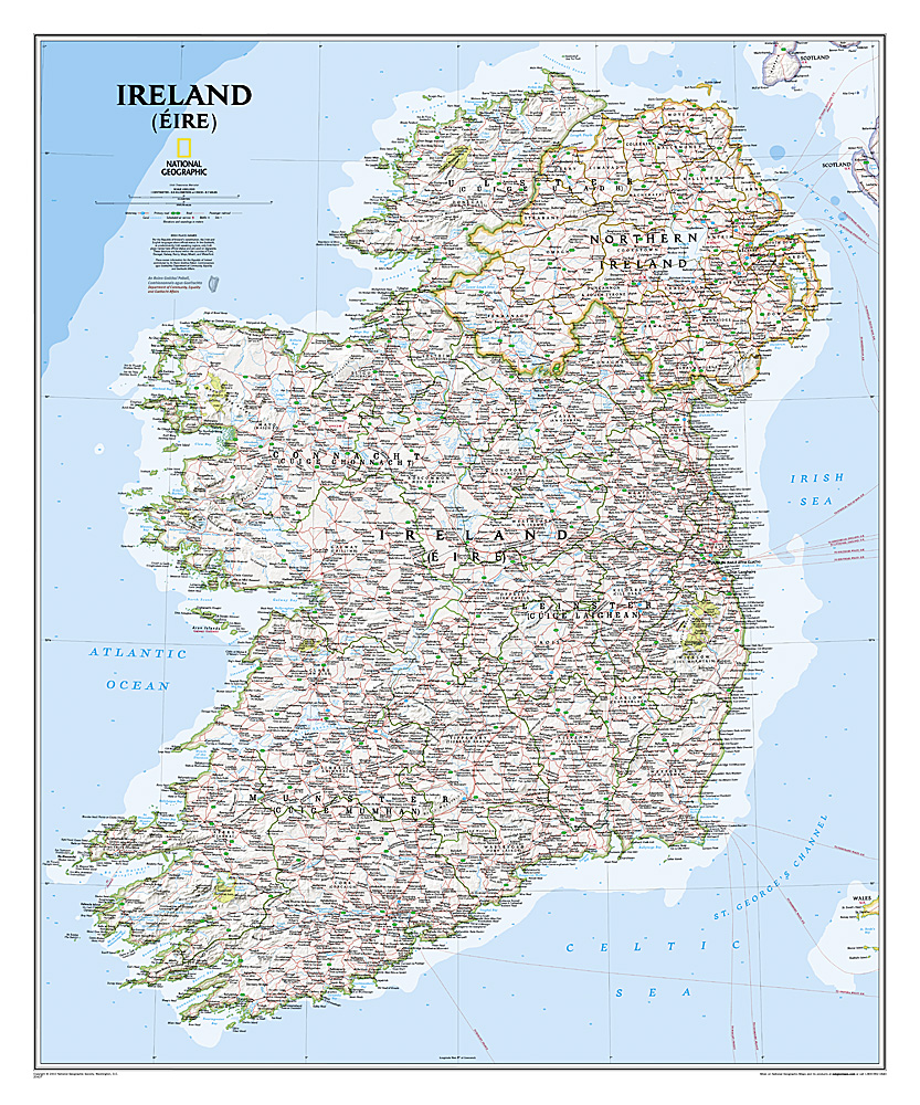
<div> National Geographic Maps' new Ireland wall map is one of the most authoritative maps yet published of the Emerald Isle. Of the nearly 1,000 place-names shown on this map, all within the Republic of Ireland adhere to that nation's constitution—that the Irish and English language share official status. Thus, Gaelic (Irish) place-names, along with their English variants in parentheses, are shown within Irish-speaking regions while English place-names, along with their Gaelic variants, are shown outside these areas.</div> <div> </div> <div> Ireland Classic is ideal for those researching their Irish ancestry, a perfect tool for business reference, and a beautiful addition to any décor. It’s one of the largest and most detailed wall maps specifically for Ireland available today. Shown on the map are over 1,000 named places including primary and secondary towns, counties, political boundaries, infrastructure, and selected historical sites for both Ireland and Northern Ireland.</div> <div> </div> <div> Place-name Details:</div> <div> Per the Republic of Ireland’s constitution, the Irish and English languages share official status. In the Gaeltacht, or predominantly Irish-speaking regions, only Irish place-names have official status and are used on signposts. These districts are found within the counties of Cork, Donegal, Galway, Kerry, Mayo, Meath, and Waterford.</div> <div> </div> <div> Place-names information for the Republic of Ireland contributed by An Roinn Gnotai Pobail, Comhionannais agus Gaeltachta/ Department of Community, Equality and Gaeltacht Affairs.</div>
€31,95
Bekijk product
<p> National Geographic Wall Maps offer a special glimpse into current and historical events, and they inform about the world and environment. Offered in a variety of styles and formats, these maps are excellent reference tools and a perfect addition to any home, business or school. There are a variety of map options to choose from, including the world, continents, countries and regions, the United States, history, nature and space.</p>
€25,95
Bekijk product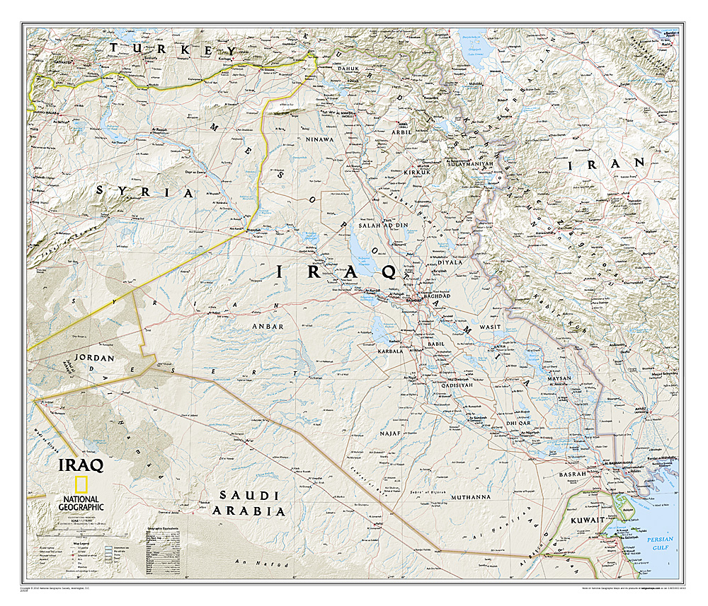
<p> This new map of Iraq, features the classic National Geographic reference styling. Features hundreds of place names, accurate political boundaries, and major infrastructure networks such as roads, oil fields and pipelines, aqueducts, and railroads. Iraq’s terrain is detailed through accurate shaded relief and symbolism for water features and other landforms. This map also includes table of geographic equivalents translated into English. Elevations of major peaks and depth soundings are expressed in meters. The bordering countries of Iran, Syria, Saudi Arabia, Kuwait, Jordan and Turkey are also shown.</p>
€31,95
Bekijk product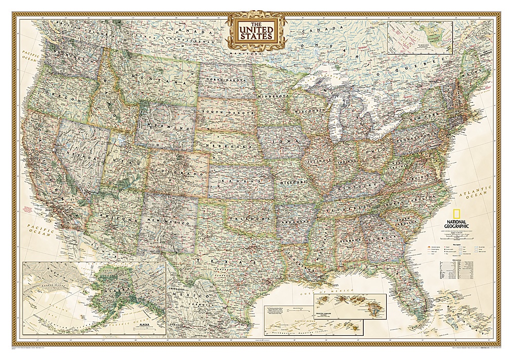
<div> Wandkaart van de USA waarbij de kleuren in 'antieke' look zijn weergegeven, de staatgrenzen zeer duidelijk zijn en er veel plaatsen op staan.</div> <div> </div> <div> This Antique-style USA Wall Map by National Geographic Maps combines classic antique-style cartography with fully updated geographical representation. Displaying elegant use of earth-tone color and extensive detail for type placement to aid readability, this USA map is loaded with information.</div> <div> </div> <div> This USA wall map includes:</div> <div> </div> <div> State Boundaries</div> <div> Capitals and Cities</div> <div> National Parks, Monuments and Recreation Areas</div> <div> Airports and Air Force Bases</div> <div> US Interstates and Highways</div> <div> Physical Terrain Shading</div> <div> Latitude and Longitude Graticule</div> <div> Insets of Hawaiian Islands and Alaska</div> <div> Legend and Abbreviation List</div> <div> Includes portions of Canada and Mexico</div>
€36,95
Bekijk product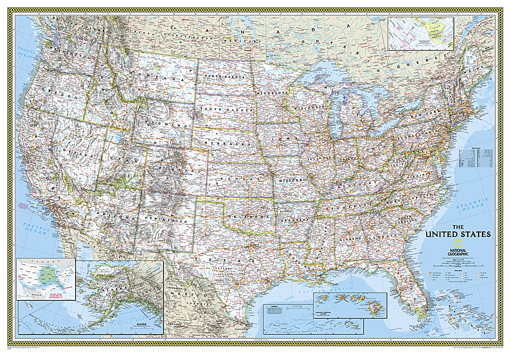
<div> Het klassieke kaartbeeld van National Geographic, de grenzen van de staten van Amerika zijn apart gekleurd. De wandkaart is heel gedetailleerd met veel plaatsen, wegen, rivieren en nationale parken, het reliëf wordt met schaduw aangegeven. Dit is de grote versie (zie afmetingen)</div> <div> </div> <div> The National Geographic Classic United States map uses bright color bands to outline each state. Capitals, major cities, selected towns, bodies of water, highways, and national parks are all shown. Shaded relief, rich in detail, emphasizes the many mountains, valleys, and plateaus of the United States. </div> <div> </div> <div> Our most popular United States wall map. Features all 50 States with insets for Alaska and Hawaii. All major cities, transportation routes, State boundaries, National Parks, inland waterways, and mountain ranges are clearly displayed and labeled. </div>
€68,95
Bekijk product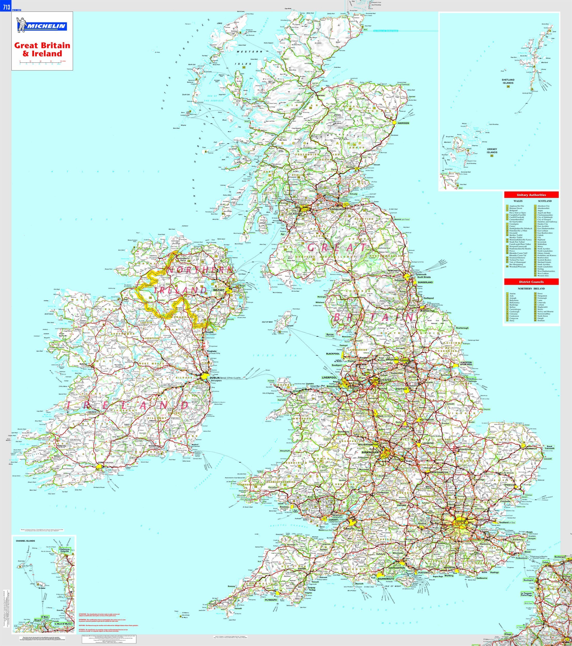
<p> This Great Britain and Ireland wall map will give an overview of British and Irish cities, administrative boundaries, as well as primary and secondary road networks at a glance. This laminated map, suitable to use with marker pens, is presented on a scale 1/1,000,000 and measures 100 x 88 cm </p>
€32,95
Bekijk product