
Beantwoord enkele vragen, en binnen seconden geeft AI je een persoonlijk aankoopadvies op maat.
Beantwoord enkele vragen, en binnen seconden geeft AI je een persoonlijk aankoopadvies op maat.
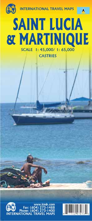
<p> Een degelijke kaart van Saint Lucia, schaal 1:45.000, en Martinique, schaal 1:65.000, met aanduidingen van o.a. nationale parken, vliegveld, benzinepomp, dirt-roads en kleine plattegrond van hoofdstad. Als overzichtskaart goed te gebruiken.</p> <p> Legend Includes:</p> <p> Roads by classification, Highways , Main Roads, Minor Roads, Dirt Roads, Hiking Trails, Larger Urban Areas, Smaller Urban Areas, Parks, UNESCO World Heritage Sites, Diving / Scuba Locations or Dive-shops, Points of Interest / Churches, Hotels / Accommodations, Gas / Petrol Stations, Marinas / Sea Ports / Watersports, Coral Reefs, Camping / Hot Springs / Caves, Park Areas, Industrial / Parking, Institutional Areas, Attractions / Shopping, Cruise Ship Terminals / Shopping / Restaurants, Police Stations / Post Offices / Churches, Hospitals / Embassies / Schools, Regional Boundaries and more.</p>
€13,95
Bekijk product
<p> Een degelijke kaart met aanduidingen van o.a. nationale parken, vliegveld, benzinepomp, dirt-roads en kleine plattegrond van hoofdstad. Als overzichtskaart goed te gebruiken.</p> <p> Togo and Benin. These two countries have developed an incredible tourism industry and are very popular with visitors. They are larger than one expects; small in comparison to neighbouring Nigeria, but large as countries go. This map is brand new artwork at a much more attractive scale than the previous version; printed double-sided with much more information than was available to us when the original map was being developed. We’ve also added a few capsule comments about interesting facts related to the two countries, and large inset maps of Lome and Porto Novo. The map is divided into a north half and south half, as most attractions are in the south. As with all ITM maps, this one shows physical features, road conditions, and petrol stations in more isolated parts of both countries.</p> <p> Legend Includes:</p> <p> Roads by classification, International Airports, Churches, Hotels, Points of Interest, Hospitals, Gas Stations, Ports, Telephones, Historic and Archaeological sites, Forests, National Parks, Rivers, Lakes, Swamps and more.</p>
€13,95
Bekijk product
<p> Een degelijke kaart met aanduidingen van o.a. nationale parken, vliegveld, benzinepomp, dirt-roads en kleine plattegrond van hoofdstad. Als overzichtskaart goed te gebruiken.</p> <p> The Canadian province of New Brunswick, called Acadia by its original French settlers, is perhaps best known for being the source of the famous epic poem Evangeline. It is also the home of the Cajun people. The British, unfairly regarding the Acadians (Cajuns), expelled thousands of them to French-controlled Louisiana in the mid-1750s. Some Acadians made the long trek back to the land they considered ‘home’, while many others re-built their lives in New Orleans. Today, the province is an industrious mix of French and English Canadians, sharing a land steeped in history. NB, for short, is the link between Central Canada and the Maritime Provinces. Historic Fredericton, Saint John, and St. Stephen retain many of the buildings built by loyalists fleeing the terror of the colonial revolution in what was to become the USA. The Bay of Fundy tidal bore and the amazing ‘magnetic’ hill that ‘tows’ cars uphill (go see for yourself) are two of the attractions of this interesting part of Canada. This map also completes our ITM mapping of each of the ten provinces and three territories of Canada. This map is double-sided.</p> <p> Legend Includes:</p> <p> Roads by classification, airfield, points of interests, national park, lakes, museum, fishing, picnic areas, camping, ski area, golf courses, gas stations, tourist information, and more.</p>
€13,95
Bekijk product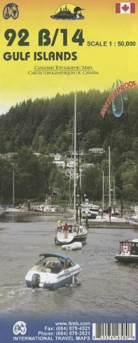
<p> This is completely new artwork and a new approach to ITMB’s mapping of the islands in the Gulf of Georgia, between the mainland and Vancouver Island. This double-sided map incorporates two NTS topographical maps into its artwork, with points of interest, hiking trails, boat launching spots, and B&Bs included. It also covers a wider area than previously, so we have decided to call this map a 1st Edition; printed on durable ITM plastic paper.</p> <p> Legend Includes:<br /> Roads by classification, Ferry terminal, camping sites, museums, canoeing, fishing, tourist information sites, hiking roads, lighthouse, picnic areas, parks, and point of interest.</p>
€13,95
Bekijk product
<div> Tweetalige kaart (Engels en Duits). Door ingetekende lengte- en breedtegraden is het gebruik van GPS mogelijk. Met hoogtelijnen en uitgebreid wegennetwerk: daarnaast worden ook de afstanden tussen belangrijke plaatsen duidelijk leesbaar weergegeven. Het kleurgebruik is zodanig dat je een goede indruk krijgt van hoogteverschillen en soorten landschap. Natuurlijk staan de toeristische bezienswaardigheden duidelijk vermeld.</div> <div> </div> <div> Gedrukt op water- en scheurvast papier! Polyart is een synthetisch product vrij van giftige stoffen dus duurzaam. Het papier gaat echt lang mee.</div> <div> </div> <div> Topography is indicated by altitude colouring with numerous spot heights and names of mountain ranges and passes. Salt lakes, swamps, seasonal rivers and glacier are also shown. Detailed presentation of the road network includes minor roads and tracks and railways are also shown.</div> <div> </div> <div> Internal administrative units are presented with their boundaries and names. National parks and other protected areas are highlighted. A wide range of symbols mark various places of interest. Map legends include English and all the maps have an index of localities.</div>
€13,95
Bekijk product
<div> Tweetalige kaart (Engels en Duits). Door ingetekende lengte- en breedtegraden is het gebruik van GPS mogelijk. Met hoogtelijnen en uitgebreid wegennetwerk: daarnaast worden ook de afstanden tussen belangrijke plaatsen duidelijk leesbaar weergegeven. Het kleurgebruik is zodanig dat je een goede indruk krijgt van hoogteverschillen en soorten landschap. Natuurlijk staan de toeristische bezienswaardigheden duidelijk vermeld.</div> <div> </div> <div> Gedrukt op water- en scheurvast papier! Polyart is een synthetisch product vrij van giftige stoffen dus duurzaam. Het papier gaat echt lang mee.</div> <div> </div> <div> Topography is indicated by altitude colouring with numerous spot heights and names of mountain ranges and passes. Salt lakes, swamps, seasonal rivers and glacier are also shown. Detailed presentation of the road network includes minor roads and tracks and railways are also shown.</div> <div> </div> <div> Internal administrative units are presented with their boundaries and names. National parks and other protected areas are highlighted. A wide range of symbols mark various places of interest. Map legends include English and all the maps have an index of localities.</div> <p> </p>
€15,95
Bekijk product
<div> Tweetalige kaart (Engels en Duits). Door ingetekende lengte- en breedtegraden is het gebruik van GPS mogelijk. Met hoogtelijnen en uitgebreid wegennetwerk: daarnaast worden ook de afstanden tussen belangrijke plaatsen duidelijk leesbaar weergegeven. Het kleurgebruik is zodanig dat je een goede indruk krijgt van hoogteverschillen en soorten landschap. Natuurlijk staan de toeristische bezienswaardigheden duidelijk vermeld.</div> <div> </div> <div> Gedrukt op water- en scheurvast papier! Polyart is een synthetisch product vrij van giftige stoffen dus duurzaam. Het papier gaat echt lang mee.</div> <div> </div> <div> Topography is indicated by altitude colouring with numerous spot heights and names of mountain ranges and passes. Salt lakes, swamps, seasonal rivers and glacier are also shown. Detailed presentation of the road network includes minor roads and tracks and railways are also shown.</div> <div> <br /> Internal administrative units are presented with their boundaries and names. National parks and other protected areas are highlighted. A wide range of symbols mark various places of interest. Map legends include English and all the maps have an index of localities.</div> <p> </p>
€18,50
Bekijk product
<div> Tweetalige kaart (Engels en Duits). Door ingetekende lengte- en breedtegraden is het gebruik van GPS mogelijk. Met hoogtelijnen en uitgebreid wegennetwerk: daarnaast worden ook de afstanden tussen belangrijke plaatsen duidelijk leesbaar weergegeven. Het kleurgebruik is zodanig dat je een goede indruk krijgt van hoogteverschillen en soorten landschap. Natuurlijk staan de toeristische bezienswaardigheden duidelijk vermeld.</div> <div> </div> <div> Gedrukt op water- en scheurvast papier! Polyart is een synthetisch product vrij van giftige stoffen dus duurzaam. Het papier gaat echt lang mee.</div> <div> </div> <div> Topography is indicated by altitude colouring with numerous spot heights and names of mountain ranges and passes. Salt lakes, swamps, seasonal rivers and glacier are also shown. Detailed presentation of the road network includes minor roads and tracks and railways are also shown.</div> <div> </div> <div> Internal administrative units are presented with their boundaries and names. National parks and other protected areas are highlighted. A wide range of symbols mark various places of interest. Map legends include English and all the maps have an index of localities.</div>
€11,50
Bekijk product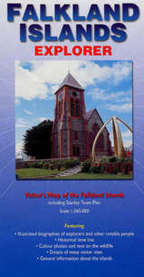
<p> Overzichtskaart van de Falkland Eilanden.</p> <p> - Met geillustreerde biografieën van ondekkers en andere notabelen.<br /> - Historische tijdslijn<br /> - Kleuren foto's en wildlife<br /> - Details van veel bezienswaardigheden<br /> - Algemene informatie over de eilanden.</p> <p> General map showing main roads and tracks, airports, rivers, lakes and settlements. Mountain peaks and highland ranges are identified and very subtle tinting shows the general relief. Twenty places of interest are highlighted and described in annotations around the map. Locations of tourist accommodation sites are marked. Latitude and longitude lines are at 30' intervals.</p> <p> On the reverse: information on wildlife, geography, history, economy and notable historical figures in the exploration of the region. A basic street plan of Stanley is included.</p> <p> </p>
€19,95
Bekijk product
<p> <span style="font-size: 12px;">Explore Europe, the Middle East and Central Asia with this Freytag & Berndt road map. The best way to plan your trip, prepare your itinerary, and to travel independently in this country. </span></p> <div> <span style="font-size: 12px;">One side is the detailed map of these areas, and the other side is a full index for this map. </span></div> <div> </div> <div> Touristic information on the map include: </div> <div> </div> <div> Places of interest</div> <div> Airports, castles & antique sites</div> <div> World Heritage sites</div> <div> </div> <div> The legend is in English, Arabic, French, German, Italian, Spanish, Dutch, Hungarian, Slovak, and Czech.</div> <div> </div>
€14,95
Bekijk product