
Beantwoord enkele vragen, en binnen seconden geeft AI je een persoonlijk aankoopadvies op maat.
Beantwoord enkele vragen, en binnen seconden geeft AI je een persoonlijk aankoopadvies op maat.

<p> Duidelijk leesbare kaart (aan twee kanten bedrukt) van Thailand. Met allerlei symbolen worden de bezienswaardigheden goed weergegeven.</p> <p> Detailkarte: Bangkok Vicinity 1 : 500.000<br /> Ko Chang 1 : 190.000<br /> Ko Samet 1 : 83.000<br /> Ko Samui 1 : 500.000<br /> Phuket 1 : 370.000<br /> <br /> Stadtplan: Central Bangkok 1 : 15.300<br /> Chiang Mai 1 : 48.000<br /> Hat Yai 1 : 13.000<br /> Pattaya 1 : 40.000</p>
€11,95
Bekijk product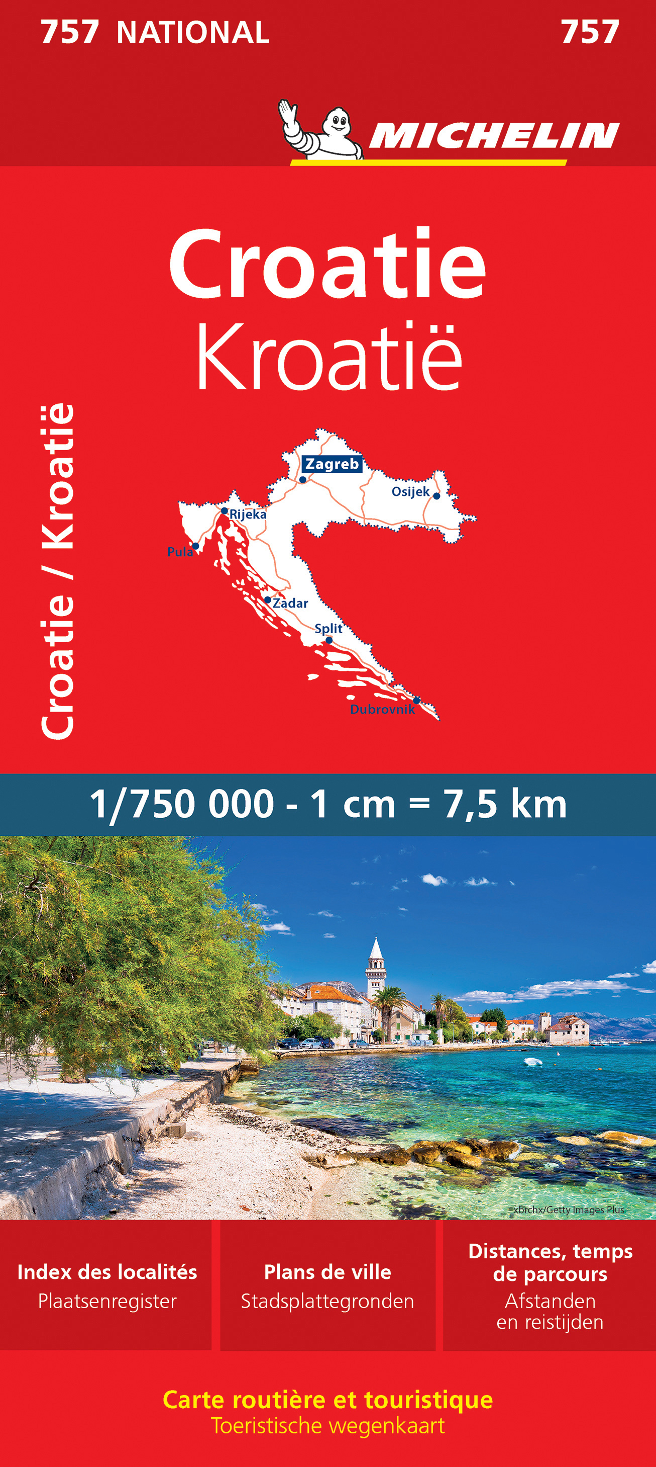
<div> Zoals je van Michelin mag verwachten is deze kaart zeer overzichtelijk en heeft een duidelijk helder kaartbeeld. De kaart geeft uitgebreid toeristische informatie weer. Met register, afstanden en reistijden.</div> <div> </div> <div> Wegen worden naar verschillende klasse ingedeeld en - mooi van Michelin - de interessante mooie routes worden gemarkeerd met een groene streep. Hindernissen voor automobilsiten met caravans zijn gemarkeerd: steile hellingen, bergpassen of een anderzins moeilijke route. Bezienswaardigheden als een kasteel, religieus gebouw, ruine of grot is door een symbool goed te vinden.</div> <div> </div> <div> <strong>Van de uitgever</strong></div> <div> <div> Une carte routière et touristique Michelin pour être maître de votre itinéraire : - Mise à jour régulièrement - Une vue d'ensemble claire de la Croatie - Une cartographie précise et ultra lisible - Echelle : 1/750 000 (1cm = 7, 5km) - Format : 11. 3 x 0. 9 x 25 cm - Les plus : tableau des distances et des temps de parcours, index des localités, légende intuitive - Plans : Dubrovnik, Zagreb Pensez à utiliser en complément notre Guide Vert Croatie, notre Carte National Slovénie, Croatie, Bosnie-Herzégovine, Serbie, Monténégro, Macédoine.</div> <div> Avec la carte MICHELIN trouvez bien plus que votre route !</div> <div> </div> <div> Croatie, Dubrovnik, Zagreb</div> </div> <p> </p>
€11,95
Bekijk product
<p> Een degelijke kaart met aanduidingen van o.a. nationale parken, vliegveld, benzinepomp, dirt-roads en kleine plattegrond van hoofdstad. Als overzichtskaart goed te gebruiken.</p> <div> </div> <div> This is a modest upgrading, with little change over the previous edition; same cover, same ISBN, same price. We ran out of copies faster than expected and found few changes necessary to make to the artwork. Yucatan is one of those parts of Mexico seemingly unaffected by the Drug Wars, which appear to be tapering off in any case, and is as popular as ever.</div> <div> </div> <div> Legend Includes:</div> <div> Roads by classification, International Airports, Domestic Airports, Lighthouses, Points of Interest, Archaeological Sites, Beaches, Caves, Gas Stations, Reefs, National Parks, Swamps, Mangroves, Temples, Camp Ground, Museums, Forts, Shipwrecks, Sinkholes, Border Crossings, Harbours, Churches, Monasteries, Mines, Other Archaeological Remains, Trailer Parks, Airstrip, Viewpoints, Cultural World Heritage, Fishing, Paragliding, Diving, Sailing, Surfing, Hospitals, Accommodations, Universities, and much more.</div>
€13,95
Bekijk product
<p> Mexico is one of our favourite places to visit, and is also very popular with American travelers. The five states that border Texas – Coahuila, Nuevo Leon, Tamaulipas, Zacatecas, and San Luis Potosi may not be well-known internationally, but Monterrey (the third largest city in Mexico), Nuevo Laredo, Matamoros, Torreon, Tampico, Aguascalientes, and Ciudad Victoria evoke images of the Mexico of ranches and vast distances. This is actually a fertile and economically developing part of the country, bordered by the Gulf of Mexico on the east, Texas on the north, and ITMB’s maps of Central Mexico on the south and our new map of Sonora and Chihuahua States on the west. This is an excellent map for cross-border expeditions; printed single-sided, on paper, showing main and secondary road connections, rail lines, gas stations in smaller towns, and whatever tourist attractions we were able to locate.</p> <p> Legend Includes:<br /> Airports, roads by classifications, distances between points, gas station, point of interests, archaeological sites, hypsography and other information.</p>
€13,95
Bekijk product
<p> Goede stadsplattegrond van Kuala Lumpur. Met register en suburban treinsysteem. De echt verre buitenwijken van deze megastad staan er niet op. Aan de achterzijde een overzichtskaart van het vasteland van Maleisië met een schaal van 730.000</p> <p> Street map of Kuala Lumpur at 1:10,000 covering the city from the Sentul Terminal and the Setapak Park in the north to the Chinese Cemetery in the south, and from the Parliament House (Bangunan Paliament) in the west to the Royal Selangor Golf Club in the east.</p> <p> TDetail includes markets, notable and public buildings, shopping malls, various religious buidings, accommodation, museums, theatres and cinemas, points of interest, post offices and police stations, bus terminals. Various railway systems and pedestrian roads are also indicated alongside land use, e.g. parks, markets, industrial areas, attractions, etc.</p> <p> Includes an extensive index of place names.</p> <p> </p>
€13,95
Bekijk product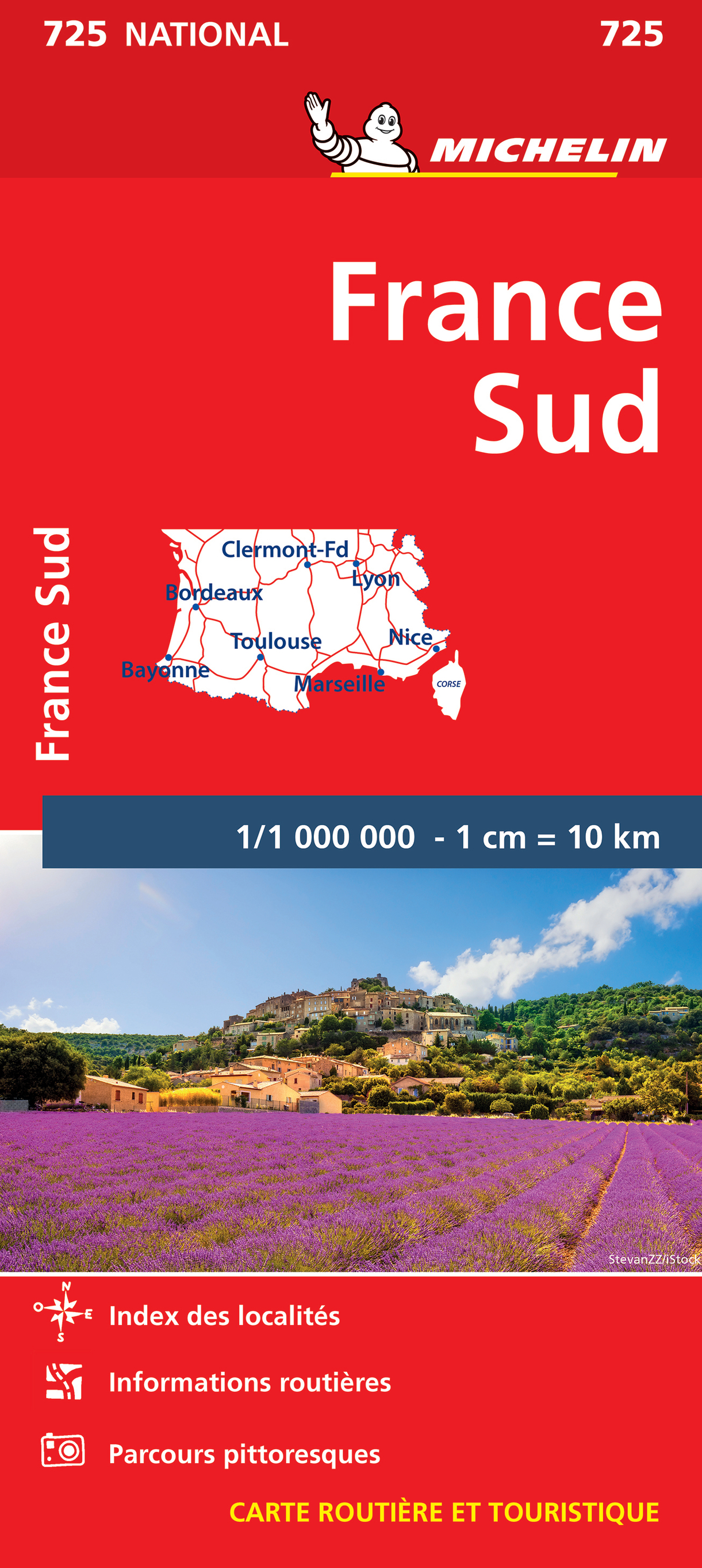
<p> Zoals je van Michelin mag verwachten is deze kaart zeer overzichtelijk en heeft een duidelijk helder kaartbeeld. De kaart geeft uitgebreide toeristische informatie weer. De perfecte overzichtskaart van alleen de zuidelijke helft van Frankrijk.</p> <div> Michelin’s annually updated coverage of France at 1:1,000,000, available as two folded maps or two different format pocket atlases covering the whole country, plus as separate maps of just the northern or the southern half.</div> <div> </div> <div> The mapping emphasizes the network of motorways and dual carriageway roads with motorway characteristics, distinguishing by colouring between charge-free and toll sections. Junctions are shown with numbers, indicating complete or limited interchanges. Other roads are classified according to their width and density of traffic. Driving distances are given on all routes except on small local roads. Scenic routes are highlighted and gradient marking shows steep roads.</div> <div> </div> <div> Railway lines are not included. Small symbols indicate some places of interest, but the maps are not designed to highlight tourist sights or amenities. Topography is shown by relief shading, with boundaries of national/regional parks. The maps have no geographical coordinates. All the versions are indexed. Map legend includes English</div> <div> </div> <div> Bayonne, Bordeaux, France, Lyon, Marseille, Nice, Toulouse</div>
€11,95
Bekijk product
<div> Overzichtskaart van Lefkas met op de achterzijde een overzicht, in het Engels, van de belangrijkste toeristische bezienswaardigheden het eiland.</div> <div> </div>
€7,95
Bekijk product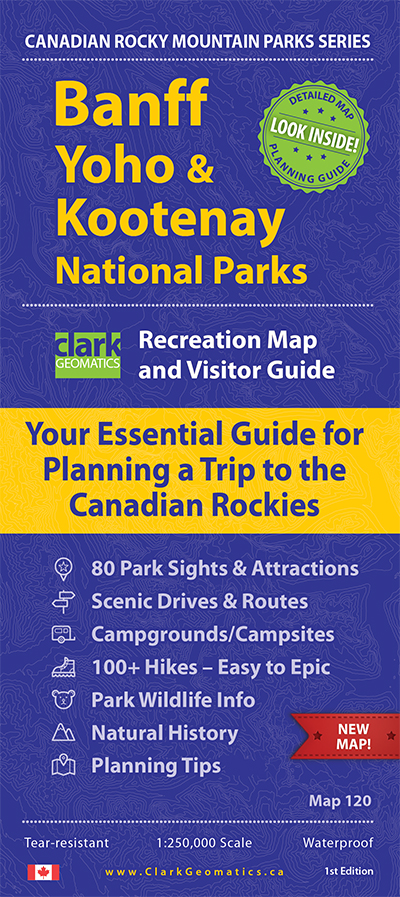
<div> Handige geplastificeerde overzichtskaart van Banff, Yaho & Kootenay Nationaal Park in west Canada. Een duidelijk leesbare kaart die goed te gebruiken is voor het plannen van de route en het bezoek aan dit gebied. Op de achterzijde vindt u veel informatie over de wandelmogelijkheden, campings & de natuur.</div> <div> </div> <div> Information on 80 Sights & Park Attractions</div> <div> Popular Scenic Drives & Routes</div> <div> Campgrounds & Backcountry Campsites</div> <div> 100+ Hikes – From Easy to Epic</div> <div> Wildlife Info – Where and When to Watch</div> <div> Awesome Planning Tips – Your Time is Precious</div>
€14,95
Bekijk product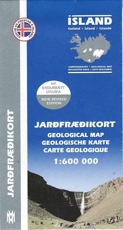
<p> Prachtige geologische kaart van IJsland. Aan de hand van veel verschillende kleuren wordt de samenstelling, leeftijd en type van de bodem duidelijk weergegeven. Voor een eiland als IJsland zeer aan te raden!</p> <p> The Geological Map of Iceland shows the main features of the bedrock geology. Formations are classified by age, type and composition. The map also clearly shows the island's volcanic zones and the distribution of the recent eruption sites. Lava fields of the Holocene are shown as pre-historic or historic. This is the second, revised, edition of the map.</p>
€22,50
Bekijk product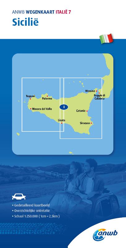
<div> <div> De ANWB heeft een grote serie wegenkaarten van de belangrijkste landen en streken. Het zijn echte overzichtskaarten van vaak een wat groter gebied. Deze keuze zorgt er voor dat de schaal vrij grof is en bepaalde details zijn weggelaten. De kleurstelling is een beetje flets waardoor je niet altijd even makkelijk onderscheid kan maken tussen verschillende landschappen of natuurlijke aspecten. </div> <div> Ook het register ontbreekt. Het grote voordeel is vaak dat het gebied op de kaart overeenkomt met de vraag van klanten. Voor het plannen van een vakantie een prima kaart!</div> <div> </div> <div> Vergeleken met andere uitgevers van kaarten als Michelin, Freytag und Berndt of Reise KnowHow heeft de ANWB duidelijke keuzes gemaakt en gekozen voor een echte overzichtskaart. </div> <div> </div> <div> MET DE ANWB WEGENKAART, WEET JE WAAR JE STAAT! ANWB wegenkaarten zijn een begrip in het land. Dat laten de verkoopcijfers ook zien. Afgelopen decennia zijn meer dan 10 miljoen kaarten over de toonbank gegaan. De wegenkaarten zijn allemaal vernieuwd, met dikker karton voor de omslagen en papier dat minder makkelijk scheurt, zodat ze veelvuldig in- en uitgevouwen kunnen worden. Ze bieden een duidelijker overzicht van het wegennet en zijn nu nog compacter en handzamer. </div> </div> <p> </p>
€12,99
Bekijk product