
Beantwoord enkele vragen, en binnen seconden geeft AI je een persoonlijk aankoopadvies op maat.
Beantwoord enkele vragen, en binnen seconden geeft AI je een persoonlijk aankoopadvies op maat.
<div> Tweetalige kaart (Engels en Duits). Door ingetekende lengte- en breedtegraden is het gebruik van GPS mogelijk. Met hoogtelijnen en uitgebreid wegennetwerk: daarnaast worden ook de afstanden tussen belangrijke plaatsen duidelijk leesbaar weergegeven. Het kleurgebruik is zodanig dat je een goede indruk krijgt van hoogteverschillen en soorten landschap. Natuurlijk staan de toeristische bezienswaardigheden duidelijk vermeld.</div> <div> </div> <div> Gedrukt op water- en scheurvast papier! Polyart is een synthetisch product vrij van giftige stoffen dus duurzaam. Het papier gaat echt lang mee.</div> <div> </div> <div> Topography is indicated by altitude colouring with numerous spot heights and names of mountain ranges and passes. Salt lakes, swamps, seasonal rivers and glacier are also shown. Detailed presentation of the road network includes minor roads and tracks and railways are also shown.</div> <div> </div> <div> Internal administrative units are presented with their boundaries and names. National parks and other protected areas are highlighted. A wide range of symbols mark various places of interest. Map legends include English and all the maps have an index of localities.</div>
€11,50
Bekijk product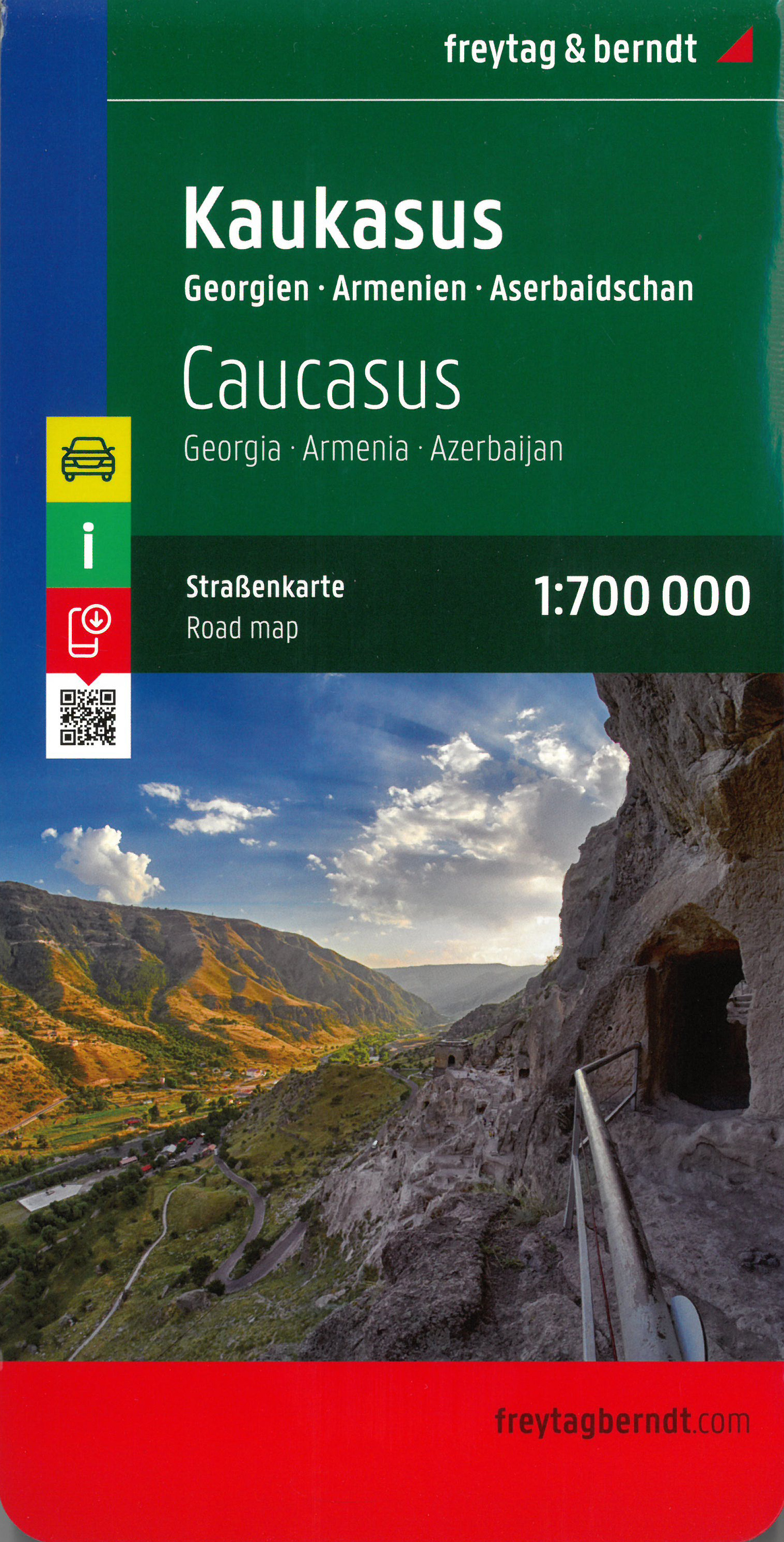
<p> Goede, gedegen wegenkaart van de Kaukasus met Georgië, Armenië, Azerbijan met toeristische informatie, nationale parken en afstanden in kilometers. Met register.</p> <p> The Caucasus countries, Georgia, Armenia and Azerbaijan, on an indexed road map from Freytag and Berndt, with coverage of the adjoining Russian republics of Chechnya, Northern Ossetia, Kabardino-Balkaria and Karachaevo-circassia.</p> <p> Gedetailleerde landkaart van de Kaukasus, prima geschikt voor planning en rondtrekken. De berijdbare wegen zijn goed weergeven, zowel de hoofdwegen als provinciale en lokale wegen; wegnummers worden vermeld. Afstanden tussen plaatsen zijn in kilometers op de kaart ingetekend, daarnaast worden ook op belangrijke plekken benzinepompen gemarkeerd.</p> <p> In het kaartbeeld wordt door middel van schaduw het reliëf weergegeven en soms enkele punten in het landschap met de daadwerkelijke hoogte. Provinciegrenzen zijn goed terug te vinden, nationale parken en reservaten ook. Met allerhande symbolen worden toeristische bezienswaardigheden weergegeven als monumenten, historisch belangrijke plekken en uitzichtpunten. In bepaalde plaatsen zijn hotels en campings te vinden, luchthavens, treinverbindingen en havens vindt u er ook op!</p> <p> </p>
€14,95
Bekijk product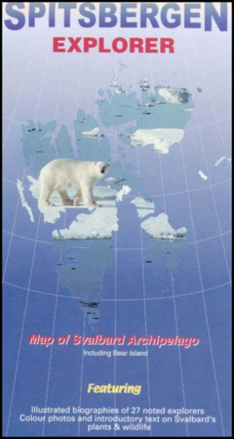
<p> The Spitsbergen Explorer is the ideal map to accompany cruising amongst these dramatic islands.<br /> The Svalbard Archipelago was a pioneer destination for Arctic tourism, and the Explorer contains essential details on the flora and fauna that have attracted visitors since the mid-19th century.</p> <p> Featuring:</p> <p> Illustrated biographies of 27 noted explorers..<br /> Color photos and introductory text on plants & wildlife.<br /> Map showing protected areas.<br /> Diagram charting the rising & setting of the midnight sun.</p>
€19,95
Bekijk product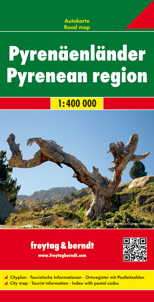
<p> Uitstekende kaart van Pyreneeën Landen. Met index, toeristische informatie en afstanden in kilometers.</p> <p> De berijdbare wegen zijn goed weergeven, zowel de hoofdwegen als provinciale en lokale wegen; wegnummers worden vermeld. Afstanden tussen plaatsen zijn in kilometers op de kaart ingetekend, daarnaast worden ook op belangrijke plekken benzinepompen gemarkeerd.</p> <p> In het kaartbeeld wordt door middel van schaduw het reliëf weergegeven en soms enkele punten in het landschap met de daadwerkelijke hoogte. Provinciegrenzen zijn goed terug te vinden, nationale parken en reservaten ook. Met allerhande symbolen worden toeristische bezienswaardigheden weergegeven als monumenten, historisch belangrijke plekken en uitzichtpunten. In bepaalde plaatsen zijn hotels en campings te vinden, luchthavens, treinverbindingen en havens vindt u er ook op!</p>
€14,95
Bekijk product
<p> Een degelijke kaart met aanduidingen van o.a. nationale parken, vliegveld, benzinepomp, dirt-roads. Als overzichtskaart goed te gebruiken.</p> <p> The area of coverage has been extended to cover everything on Mexico’s western coast, from Mazatlan to Acapulco, and shows all of the roads and sights inland as far as Zacatecas, San Luis Potosi, and Queretaro. As a bonus, we have included a detailed map of Mexico’s third largest city, Guadalajara, on the reverse side, for the convenience of visitors to this fascinating section of the country; printed on paper, double-sided.</p>
€13,95
Bekijk product
<p> Toeristische wegenkaart met veel aanduidingen van interessante punten. Heldere kaart, goed leesbaar. speciaal stukje Africa:</p> <div> Mpumalanga, Kruger National Park and Panorama Route Road Map covers the entire Kruger National Park, includes a detailed exploring map of Mpumalanga and the Panorama Route, plans of camps in the Kruger National Park and is up-to-date with all research compiled and updated in Africa</div> <div> </div> <div> Detailed streetmaps and site maps with text and photography of Pilgrims Rest, Mashishing (Lydenburg), Dullstroom, Sudwala Caves, eMakhazeni (Belfast), eNtokozweni (Machadodorp), White River, Sabie, eMgwenya (Waterval Boven), Hazyview, Mbombela (Nelspruit) and Barberton</div> <div> </div> <div> Easy-to-use map symbols showing hotel, lodges, rest camps, campsites, concession areas, bush camps, private rest camps and lodges, caravan facilities, caves, lookout points, waterholes, hides and much more. Information on hiking, trekking, walking and fly-fishing areas. Along with an alphabetised index, enlarged map of the Sudwala Caves and full-colour images, this road map is a great holiday reference.</div> <div> </div> <div> Key selling points</div> <div> • Ideal Mpumalanga, Kruger National</div> <div> Park & Panorama Route touring map</div> <div> • 11 detailed town plans</div> <div> • Detailed Kruger National Park map</div> <div> • Key tourist information</div> <div> </div> <div> Barberton, Berg-en-dal, Bosbokrand, Bushman, Crocodile Bridge, Drakensberg, Dullstroom, eMakhanzeni, eMgwenya, eNtokozweni, GaMametsa, Game Reserve, Hamilton's, Hartebeesvlakte, Hazyview, Hendriksdal, Klipspruit, Krokodilspoortberge, kruger national park, Kruger National Park & Panorama Route Road Map, Letaba, Lower Sabie, Malelane, Mashishing, Matibidi, Mbombela, Mopani, Mpumalanga, Mpumalanga and Kruger National Park, National Parks, Nature Reserve, Numbi, Olifants, Orpen, Panorama, Panorama Route Road Map, Paul Kruger, Phabeni, Pilgrims rest, Pretoriuskop, Punda Maria, Rietfontein, road maps, Rusplaas, SAbi sand game reserve, Sabie and White river, Satara, Shingwedzi, Skukuza, Steenkampsberg, Sudwala Caves, Vaalhoek, Wonderfontein</div>
€16,95
Bekijk product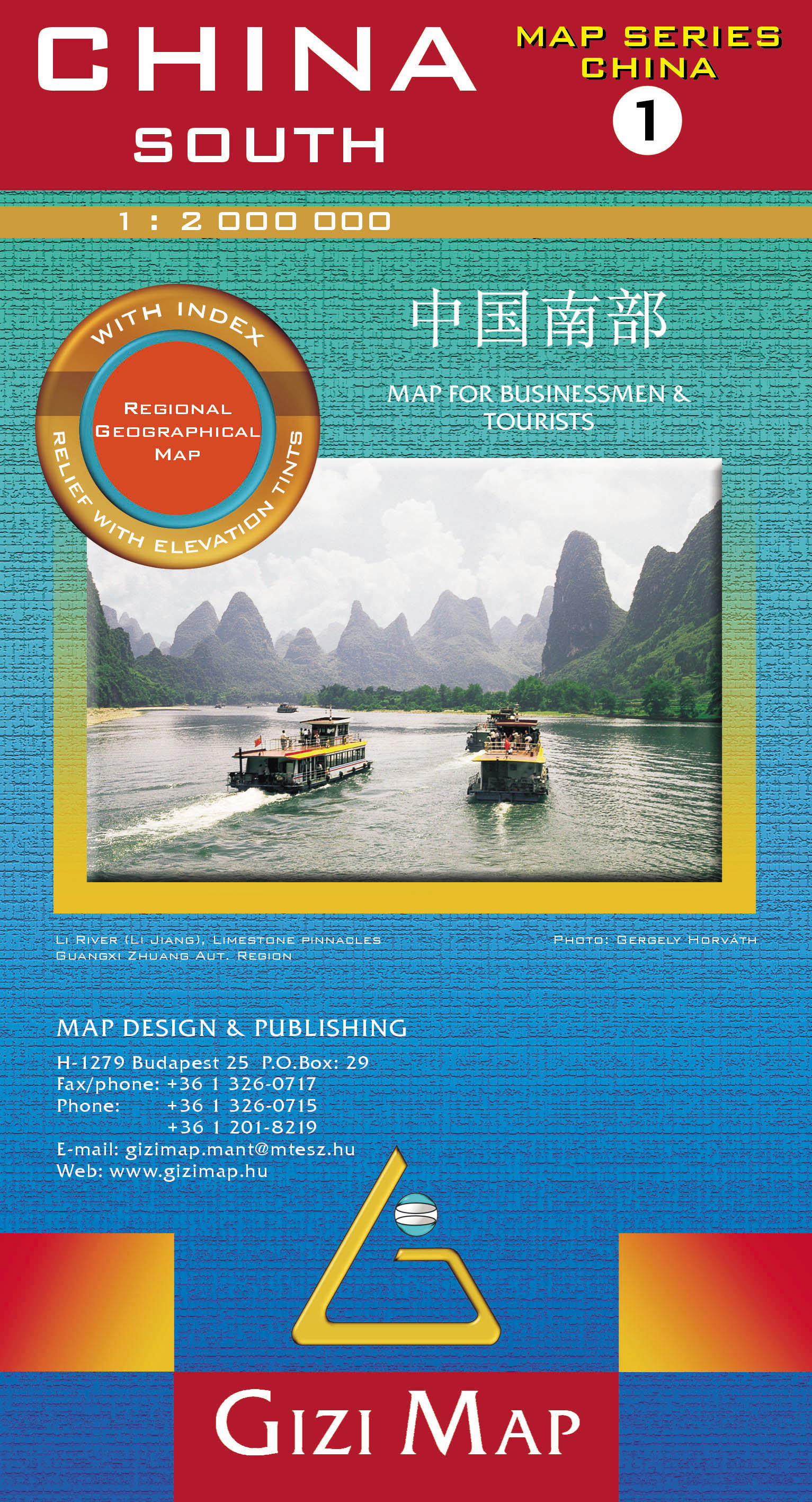
<p> Mooie overzichtskaart van alleen Zuid China met fraai kleurgebruik voor hoogte en reliëf. De kaart is tweetalig en heeft een groot aantal plaatsen, topografisch zonder meer goed.</p> <p> Het gebied betreft zuid-oosten van China en Taiwan, van Nanjing en Shanghai in het noorden tot Hainan Island en het noorden van Vietnam en Laos.</p> <p> Bold altitude colouring, with spot heights and names of mountain ranges and other geographical features, provides an excellent picture of the terrain. The maps show various categories of roads including selected tracks, with intermediate driving distances marked on many routes. Railways, shipping and ferry lines, and local airports are also shown. Province boundaries are indicated and national parks are highlighted. Symbols marks landmarks and features such as tombs, monasteries, churches, temples, ruins, UNESCO sites including the Great Wall, and other places of interest.</p> <p> </p>
€15,95
Bekijk product
<div> Tweetalige kaart (Engels en Duits). Door ingetekende lengte- en breedtegraden is het gebruik van GPS mogelijk. Met hoogtelijnen en uitgebreid wegennetwerk: daarnaast worden ook de afstanden tussen belangrijke plaatsen duidelijk leesbaar weergegeven. Het kleurgebruik is zodanig dat je een goede indruk krijgt van hoogteverschillen en soorten landschap. Natuurlijk staan de toeristische bezienswaardigheden duidelijk vermeld.</div> <div> </div> <div> Gedrukt op water- en scheurvast papier! Polyart is een synthetisch product vrij van giftige stoffen dus duurzaam. Het papier gaat echt lang mee.</div> <div> </div> <div> Topography is indicated by altitude colouring with numerous spot heights and names of mountain ranges and passes. Salt lakes, swamps, seasonal rivers and glacier are also shown. Detailed presentation of the road network includes minor roads and tracks and railways are also shown.</div> <div> <br /> Internal administrative units are presented with their boundaries and names. National parks and other protected areas are highlighted. A wide range of symbols mark various places of interest. Map legends include English and all the maps have an index of localities.</div> <p> </p>
€18,50
Bekijk product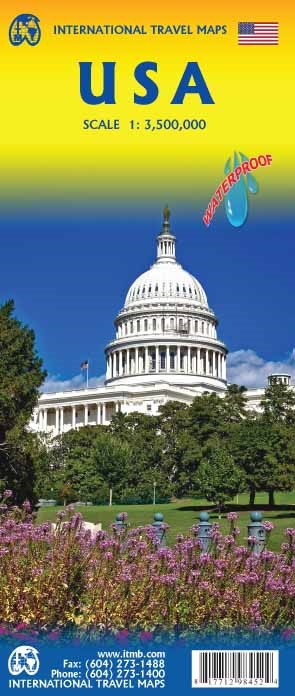
<p> Een degelijke kaart met aanduidingen van o.a. nationale parken, vliegveld, benzinepomp, dirt-roads en kleine plattegrond van hoofdstad. Als overzichtskaart goed te gebruiken.</p> <p> United States of America (USA) Travel Reference Map has been mapped before, but the USA is a huge country, extremely developed, and almost impossible to show on a map without over-simplification. Most commercial maps use small sheets of paper and print single-sided, making it impossible to show this vast country to advantage. Well, Lan’s been hard at work developing a ‘proper’ traveller’s aid to navigating around the USA, and here it is. We printed it on an exceptionally large sheet of paper, 39” tall by 54” wide (our normal printing size is 27”x39”). To do this, we merged our four existing databases into one, then split them so that the west side is on one side and the east side on the other. What results is a very large sheet, but a map at a VERY good scale. We were able to fit in 6,765 urban areas, all the Interstate motorways, major highways, state highways, pretty much all of the secondary highways, physical features, parks, historic/natural sites, battlefields, airports, dinosaur pits (yes, they exist), and so much more. This is a great map! As a country, the USA offers so much for visitors that it is one of the most-visited countries on earth. Now, finally, it has its own ITMB map. I never thought I’d see the day when I’d be writing such a press release! How far we’ve come in 30 years! Seriously, the USA NEEDS new maps to replace the rather staid and basic Rand-type of maps with a fresh approach. This is new, and hot off the press.</p> <p> Legend Includes:</p> <p> Roads by classification, borders, highways, world heritage sites, airports, point of interests, hot springs, museums, fishing, caves, lighthouses, water falls, beaches, parks, forests, lakes, and more.</p>
€13,95
Bekijk product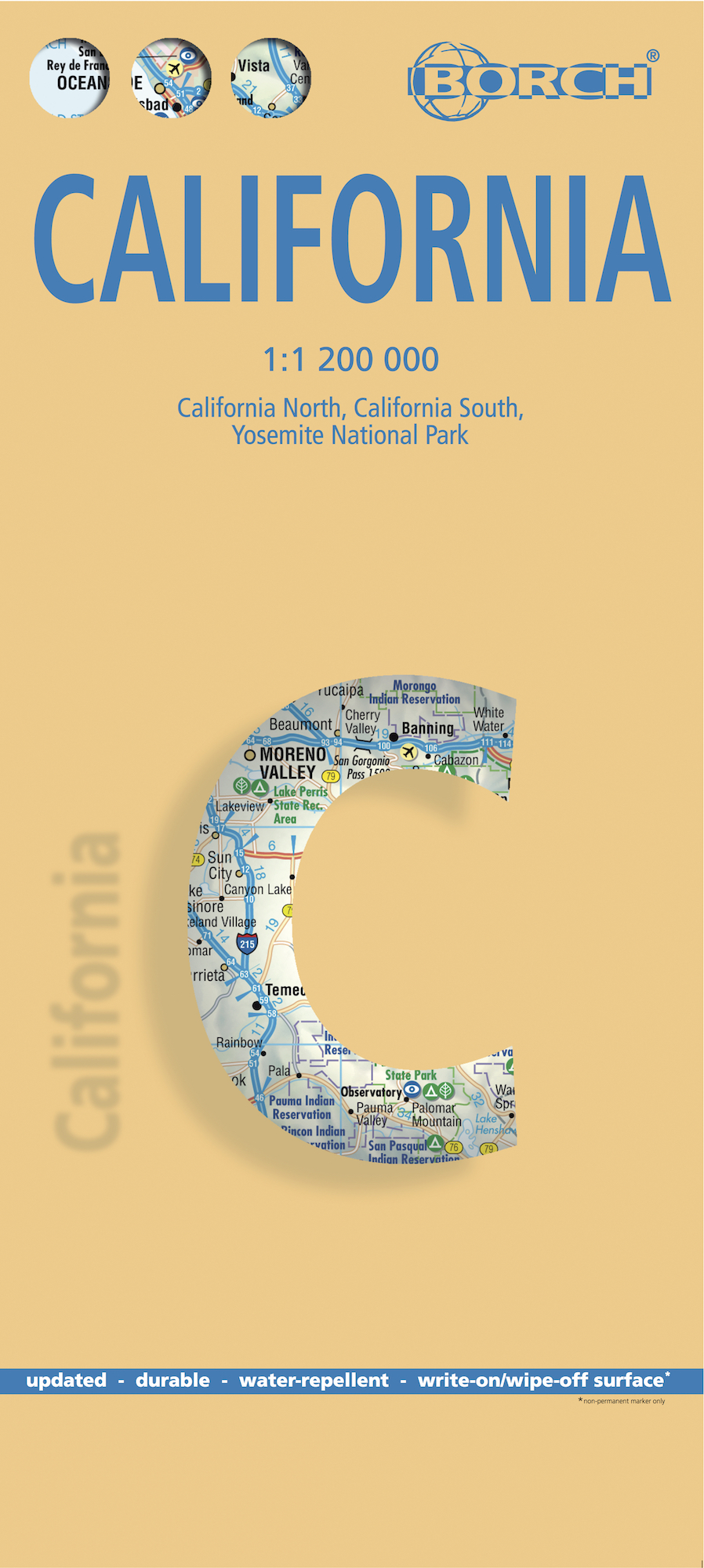
<div> <span style="color: rgb(0, 0, 0); font-family: 'Helvetica Neue', Helvetica, sans-serif, Arial;">Mooie geplasticieerde kaart van Californië. Deze kaart biedt een goed overzicht van dit deel van de Verenigde Staten met detailkaarten.</span></div> <div> </div> <div> Our soft-laminated folded map of California shows: California North 1:1 200 000, California South 1:1 200 000, Yosemite National Park 1:675 000, USA administrative and time zones. Borch Maps are easy to fold, durable and water-repellent with a wipeable surface. Borch Maps show hotels, museums, monuments, markets, public transport, top sights and points of interest, useful statistics, conversion charts for temperatures, weights and measurements, climate charts showing temperatures, sunshine hours, precipitation and humidity, overview maps, time zones, and much more...</div> <div> </div> <div> Mountains, ocean, forest, desert - California has everything to offer the visitor. And in Los Angeles, anything is possible: lying on Venice Beach in the morning, skiing in the nearby San Gabriel Mountains in the afternoon, a visit to Disneyland, an exciting tour through Universal Studios, a glimpse of the homes of the rich and famous in Beverly Hills, reminiscing the golden days of Hollywood on the Walk of Fame. But there is still so much more to see and experience, such as San Francisco, Palm Springs, and San Diego with its 112 km of beachfront almost within arm's reach of the Mexican border. Death Valley is the greatest natural attraction and the hottest area in the U.S., boasting spectacular canyons and rock formations. Those who prefer a more moderate climate will enjoy the laid back atmosphere of California's beautiful coastal towns, such as Monterey and Santa Barbara.</div> <div> </div>
€11,50
Bekijk product