
Beantwoord enkele vragen, en binnen seconden geeft AI je een persoonlijk aankoopadvies op maat.
Beantwoord enkele vragen, en binnen seconden geeft AI je een persoonlijk aankoopadvies op maat.
<div> Tweetalige kaart (Engels en Duits). Door ingetekende lengte- en breedtegraden is het gebruik van GPS mogelijk. Met hoogtelijnen en uitgebreid wegennetwerk: daarnaast worden ook de afstanden tussen belangrijke plaatsen duidelijk leesbaar weergegeven. Het kleurgebruik is zodanig dat je een goede indruk krijgt van hoogteverschillen en soorten landschap. Natuurlijk staan de toeristische bezienswaardigheden duidelijk vermeld.</div> <div> </div> <div> Gedrukt op water- en scheurvast papier! Polyart is een synthetisch product vrij van giftige stoffen dus duurzaam. Het papier gaat echt lang mee.</div> <div> </div> <div> Topography is indicated by altitude colouring with numerous spot heights and names of mountain ranges and passes. Salt lakes, swamps, seasonal rivers and glacier are also shown. Detailed presentation of the road network includes minor roads and tracks and railways are also shown.</div> <div> </div> <div> Internal administrative units are presented with their boundaries and names. National parks and other protected areas are highlighted. A wide range of symbols mark various places of interest. Map legends include English and all the maps have an index of localities.</div> <p> </p>
€13,95
Bekijk product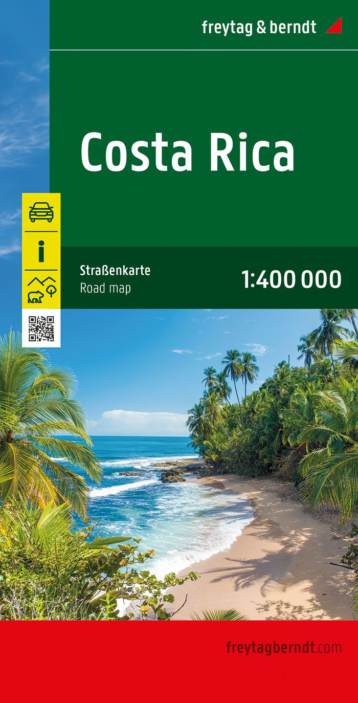
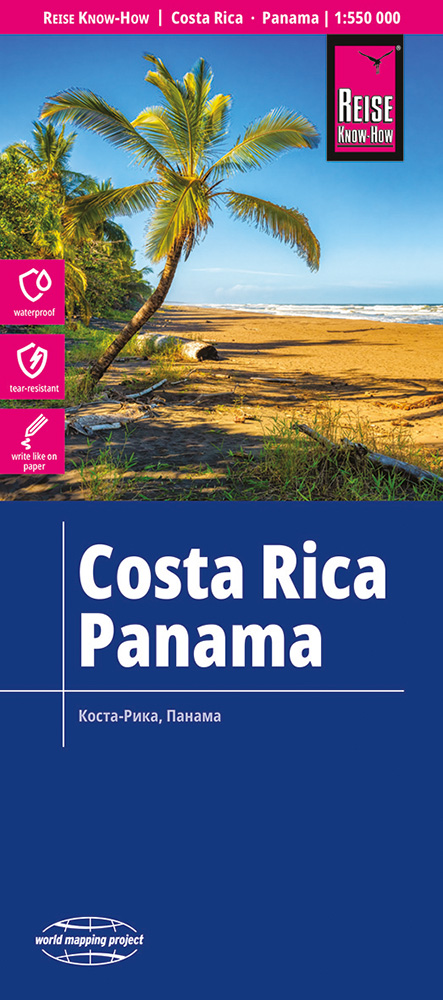
<p> Uitstekende landkaart van Costa Rica. Met index, Nationale parken en afstanden in kilometers en register.</p> <p> Goede duidelijke wegenkaart. Wel een grote lap kaart, maar daardoor bestrijkt het een groot gebied. Alle toeristische details staan er op, ook campings worden vermeld.</p> <p> Gedetailleerde, tweezijdige landkaart, prima geschikt voor planning en rondtrekken. De berijdbare wegen zijn goed weergeven, zowel de hoofdwegen als provinciale en lokale wegen; wegnummers worden vermeld. Afstanden tussen plaatsen zijn in kilometers op de kaart ingetekend, daarnaast worden ook op belangrijke plekken benzinepompen gemarkeerd.</p> <p> In het kaartbeeld wordt door middel van schaduw het reliëf weergegeven en soms enkele punten in het landschap met de daadwerkelijke hoogte. Provinciegrenzen zijn goed terug te vinden, nationale parken en reservaten ook. Met allerhande symbolen worden toeristische bezienswaardigheden weergegeven als monumenten, historisch belangrijke plekken en uitzichtpunten. In bepaalde plaatsen zijn hotels en campings te vinden, luchthavens, treinverbindingen en havens vindt u er ook op!</p> <p> </p> <div> This detailed road map of Costa Rica is very suitable for planning and traveling around the country.</div> <div> The road network is well represented, both the main roads, provincial and local roads. Road numbers are also clearly stated. Distances between places are marked on the map in kilometers, and gas stations are also marked in important places.</div> <div> </div> <div> Shadow shows the relief and sometimes some points with the actual height. Province borders, national parks and reserves are easy to find. Symbols indicate the location of tourist sites, monuments, historically important places and viewpoints. In certain places you can find hotels and campsites, airports, train connections and ports.</div>
€14,95
Bekijk product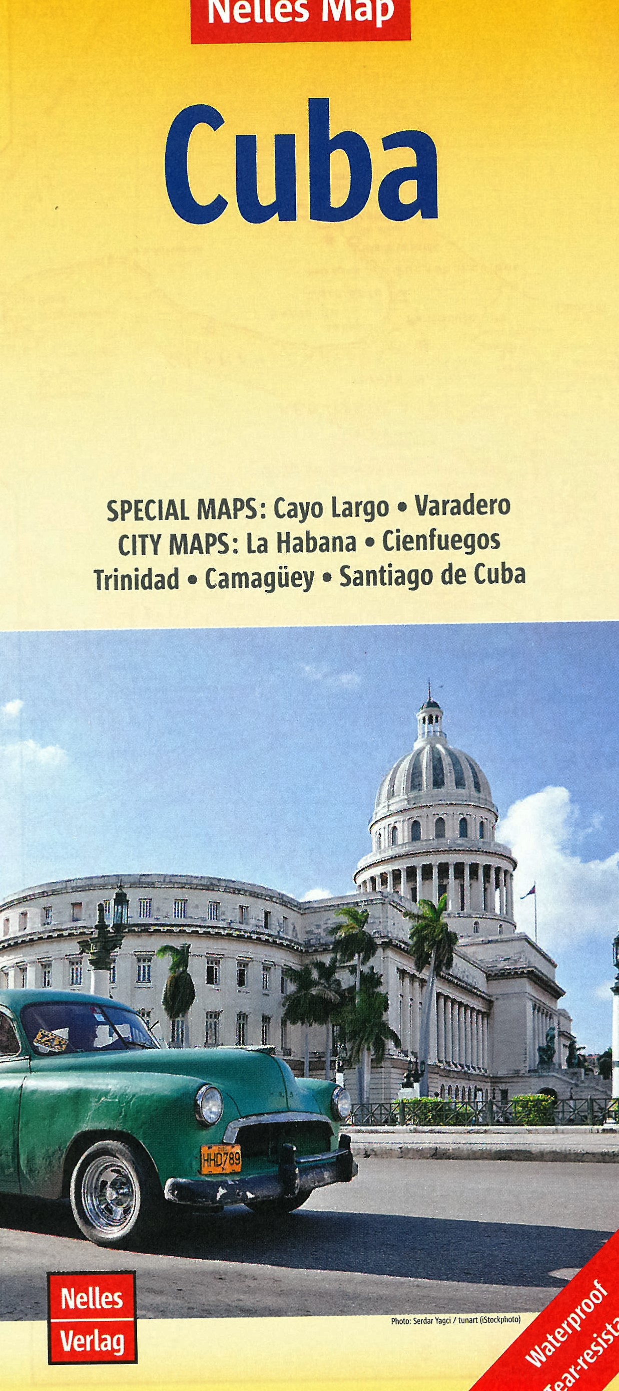
<p> Goede wegenkaart van Cuba. Aan beide kanten bedrukt. Met veel toeristische aanduidingen als nationale parken en culturele bezienswaardigheden. Prima leesbare kaart, nu ook op scheur- en watervast papier</p> <div> Folded road and tourist map of Cuba at 1:775 000 scale. Places of interest, national parks, and beaches are all highlighted and shaded-relief colouring clearly depicts the topography.</div> <div> </div> <div> The map includes insets showing Varadero at 1:32 000, Camaguey at 1:15 000, Santiago de Cuba at 1:15 000, La Habana (Havana) at 1:15 000, Cienfuegos at 1:23 000 and Trinidad at 1:12 100. The legend is in four languages, including English.</div> <div> </div> <div> For over 20 years Nelles maps have been renowned throughout the world for their quality, faithfulness to detail and up-to-dateness. </div> <div> </div> <div> So that streets, ferry links, railway lines, etc are always up to date, Nelles are continuously upgrading their maps - with the help of their international team of correspondents. Roads are provided with an exact kilometerage. Sights are highlighted extra clearly so that you don't miss any tourist attractions.</div> <div> </div> <div> A good map must be hard-wearing and allow itself to be folded up simply and quickly. Nelles Maps are a handy pocket size with the reliable, practical concertina fold. In addition they use an extra high-quality speciality paper resulting in considerably increased fold strength.</div> <p> <span style="font-size: 12px;">Varadero 1 : 32.000</span></p> <p> Camagüey 1 : 15.000<br /> Cienfuegos 1 : 23.000<br /> La Habana 1 : 15.000<br /> Santiago de Cuba 1 : 15.000<br /> Trinidad 1 : 12.100</p>
€11,95
Bekijk product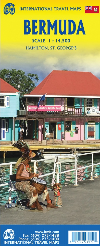
<p> Een degelijke kaart met aanduidingen van o.a. nationale parken, vliegveld, benzinepomp, dirt-roads. Als overzichtskaart goed te gebruiken.</p> <div> Bermuda is a lovely mid-Atlantic island far off the coast of South Carolina. It is full of colonial architecture and an ‘island’ way of life. Tourism is a key ingredient of the colony’s lifeblood and the island is very popular with cruise ships. There is ample accommodation for longer-term visitors, good roads, and much history. The airport was built by the US Navy during WW2 and is still a US Naval Air Station, but shares the runway with civil aviation. The map includes an excellent inset of St. George’s, which still has its stocks close to the town hall, and another of Hamilton, the capital. This is where most cruise ships dock. For those with the time, the map shows the Railway Trail along the former route of the island’s now-defunct rail line. Lots to see; lots to do!</div> <div> </div> <div> Map size: 27*39"</div> <div> </div> <div> Legend Includes:</div> <div> Roads by classification, Rivers and Lakes, National Park, Airports, Points of Interests, Highways, Main Roads, Zoos, Fishing, and much more...</div>
€13,95
Bekijk product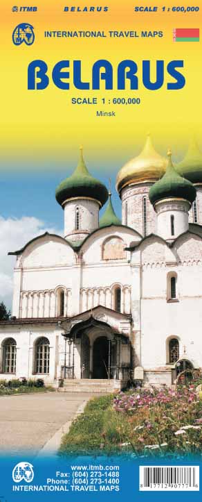
<p> Een degelijke kaart met aanduidingen van o.a. nationale parken, vliegveld, benzinepomp, dirt-roads en kleine plattegrond van hoofdstad. Als overzichtskaart goed te gebruiken.</p> <p> Folded travel map. Color changes show elevations. Shows roads and highways, settlements of all sizes including abandoned settlements, physical features and places of interest. Distinguishes roads from highways to unpaved roads, with distances in kilometers; railways; navigable canals; river ports; airports; churches; castles; palaces; places of interest. Includes index of places. Main map scale 1:600,000. With Minsk city center map (1:15,000) showing transit stations; information centers; museums; theaters; churches; places of interest; hotels; restaurants; embassies; more. Distances in kilometers.</p>
€13,95
Bekijk product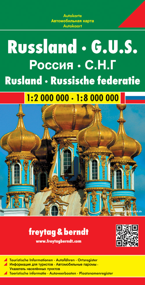
<p> Uitstekende landkaart van Rusland. Met index, toeristische informatie en afstanden in kilometers. Het westen op een schaal van 1 op 2 miljoen en na de Oeral wordt het een grove schaal van 1 op 8 miljoen. Toch een van de betere kaarten van Rusland!</p> <div> Explore Russia and the other members of the Commonwealth of Independent States (C.I.S) with this Freytag & Berndt double-sided road map. The best way to plan your trip, prepare your itinerary, and to travel independently on this region. As with all Freytag & Berndt maps, the cartography is clear and detailed with the topography shown with relief shading with plenty of spot heights.</div> <div> </div> <div> One side of the map features a 1: 200 000 scale map of Eastern Europe, while the other side features a large scale 1: 8 000 000 map showing the members of the C.I.S. Names of townships in former Soviet countries are listed in both English and the Cyrillic script.</div> <div> </div> <div> A icon system is used to show tourist information. Icons are displayed for:</div> <div> </div> <div> Railways and canal systems</div> <div> Airports and seaports</div> <div> </div> <div> Distances between points is shown in kilometres. The legend is in German, English, French and Italian.</div>
€14,95
Bekijk product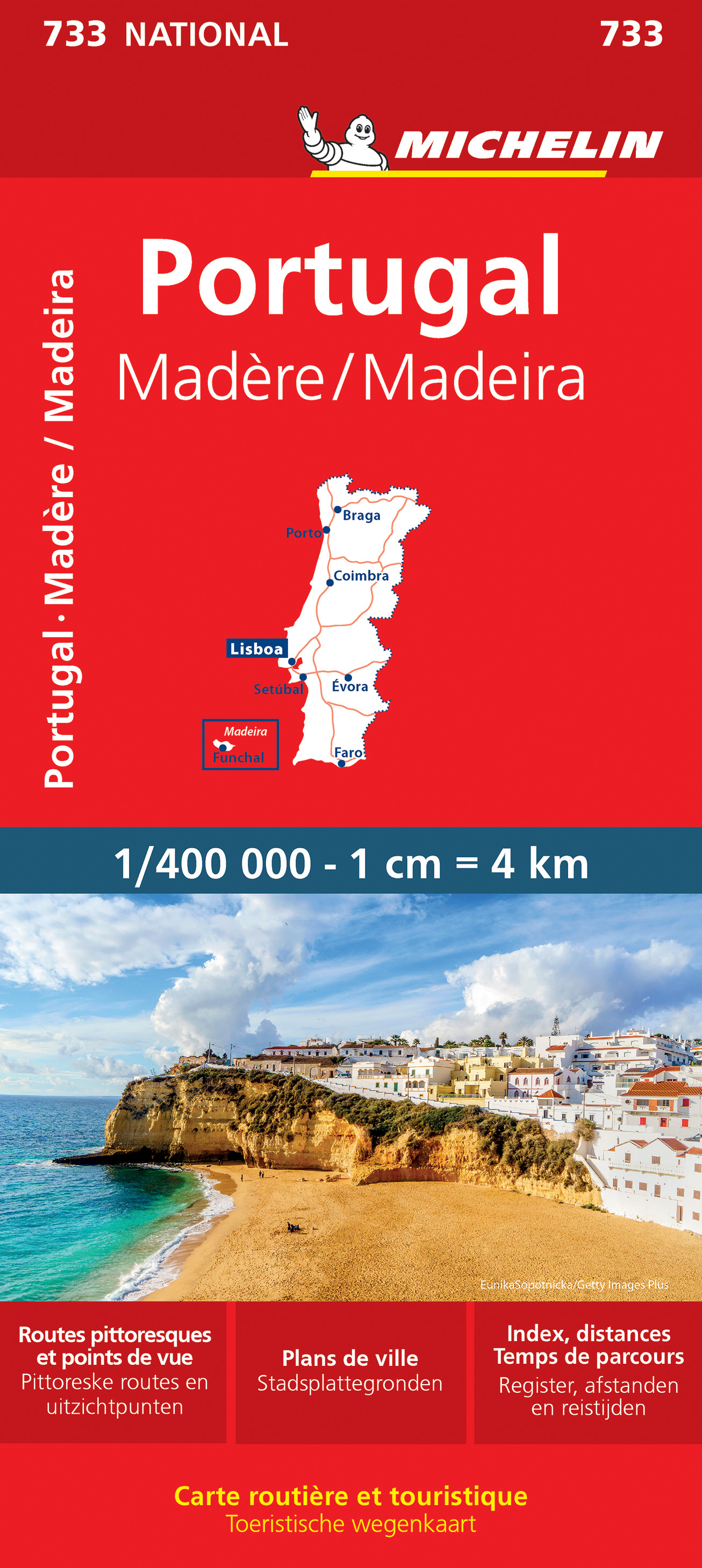
<p> Zoals je van Michelin mag verwachten is deze kaart zeer overzichtelijk en heeft een duidelijk helder kaartbeeld. De kaart geeft uitgebreid toeristische informatie weer. Met register, afstanden en reistijden.</p> <div> Wegen worden naar verschillende klasse ingedeeld en - mooi van Michelin - de interessante mooie routes worden gemarkeerd met een groene streep. Hindernissen voor automobilsiten met caravans zijn gemarkeerd: steile hellingen, bergpassen of een anderzins moeilijke route. Bezienswaardigheden als een kasteel, religieus gebouw, ruine of grot is door een symbool goed te vinden.</div> <div> </div> <div> The Portugal & Madeira 2021 Michelin Map is perfect for route planning as well as navigating overland once you're there, they have excellent road detail and classification and clearly show the regions topography.</div> <div> </div> <div> Roads are well classified, distinguishing between major and minor roads as well as by road surface (e.g. earth roads). Difficult and prohibited roads; and roads that are impassable at certain times of year are also marked, as are the more scenic routes which are marked out in green. Intermediate road distances are given on most roads. Railways, airports, rivers, lakes and vehicle ferries are also shown.</div> <div> </div> <div> The map also features a reasonably comprehensive climate chart giving min and max temperatures and average monthly rainfall for heaps of locations throughout the region.</div> <div> </div> <div> Braga, Coimbra, Faro, Funchal, Le Pico Do Ariero, Lisbonne, Madère, Porto, Portugal, Santana, Sintra</div>
€11,95
Bekijk product
<p> Zoals je van Michelin mag verwachten is deze kaart zeer overzichtelijk en heeft een duidelijk helder kaartbeeld. De kaart geeft uitgebreid toeristische informatie weer. Met stadsplattegrond van de hoofdstad.</p> <p> The Michelin National road map of Poland at 1:700,000 scale is ideal for route planning. The map gives comprehensive coverage of national road networks showing all major motorways, dual carriageways, national & regional main roads and some single-lane roads.</p> <p> Distances between major locations are marked along roads, with total distance and several intermediate distances shown. A quick-reference chart of distances & driving times between major locations is also included. The map also includes a grid-referenced index of principal place names.</p> <div> </div> <div> Clear, easy-to read cartography shows roads in reds, yellows and white with black outlines. Major topography is indicated with relief shading. Woodland & forest is marked with green shading. Built-up urban areas are clearly marked in yellow. Airports, ferries, railways, bridges, are also marked. Administrative divisions are marked, as are sights of special interest.</div> <div> </div> <div> Also includes a quick reference panel giving national driving regulations, including speed limits, equipment requirements (e.g. bulb kits, warning triangles) and seatbelt rules, for all countries principally shown.</div> <div> </div> <div> City plans & regional enlargements:</div> <div> </div> <div> - Warsaw at 1:100,000 scale</div> <div> </div> <div> Cracovie, Gdańsk, Łódź, olsztyn, Pologne, Poznań, Toruń, Varsovie, Wrocław</div> <div> </div> <!-- Image Map Generated by http://www.image-map.net/ --> <p> </p>
€11,95
Bekijk product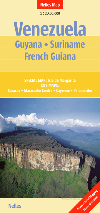
<p> Goede wegenkaart. Aan beide kanten bedrukt. Met veel toeristische aanduidingen als nationale parken en culturele bezienswaardigheden. Prima leesbare kaart.</p> <p> The map is double-sided, showing all but the very southernmost tip of Venezuela on one size, with the other three countries on the reverse. Large overlap means that the Gran Sabana with the Canaima National Park is included on both sides. </p> <p> Isla de Margarita 1 : 400.000<br /> <br /> Caracas 1 : 17.500<br /> Cayenne 1 : 12.500<br /> Maracaibo - Centre 1 : 15.000<br /> Paramaribo 1 : 12.500</p>
€11,95
Bekijk product
<p> Een degelijke kaart met aanduidingen van o.a. nationale parken, vliegveld, dirt-roads en kleine plattegrond van hoofdstad. Als overzichtskaart goed te gebruiken.</p> <p> Peru at 1:1,500,000 on a double-sided, waterproof and tear-resistant, indexed map from ITMB, with large, clear street plans of central Lima and Cusco, highlighting accommodation, places of interest and various facilities.</p> <p> The map divides the country north/south, approximately along the line between the Cordillera Blanca and Cordillera Huyahuash, with very little overlap between the two sides. Topography is very effectively presented by altitude colouring, with spot heights and additional graphics for swamps and marshland, glaciers and volcanos.</p> <p> The map shows the country’s road network distinguishing between all-weather and seasonable roads and indicates driving distances on main routes. Railway lines, including the popular routes linking Cusco with Puno and Arequipa, are very clearly shown. The map also shows local airports and airstrips, as well as internal administrative boundaries with names of the provinces.</p> <p> National parks are highlighted and symbols indicate various other places of interest, including the country archaeological sites. Latitude and longitude lines are drawn at intervals of 1°. Each side has a separate index of localities.</p> <p> Also included are very clear street plans of central Lima and Cusco highlighting selected accommodation, supermarkets, various institutions and places of interest, etc.</p> <p> </p>
€13,95
Bekijk product