
Beantwoord enkele vragen, en binnen seconden geeft AI je een persoonlijk aankoopadvies op maat.
Beantwoord enkele vragen, en binnen seconden geeft AI je een persoonlijk aankoopadvies op maat.
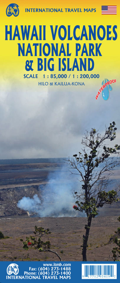
<p> Een degelijke kaart met aanduidingen van o.a. nationale parken, vliegveld, benzinepomp, dirt-roads. Als overzichtskaart goed te gebruiken.</p> <div> We didn't suspect, when we started developing this title, that Mauna Loa Volcano would erupt as soon as our map of the national park was printed, but it did! It is on the news every night, and a marvelous touristic attraction. How many of us can ever see a massive eruption of molten lava? Now, we can! (at least, from a safe distance). The national park occupies one side of the map and is the latest in ITMB's series of national parks. By the nature of such parks, we show all the features and elevations, but in this case, we'll add the proviso that heights and lava flows are changing the landscape on a daily basis. Volcanoes are sort of like elephants-they go where they please! The reverse side of the sheet is a map of Big Island, where the park is located. Its name comes from being the largest island in area of all the Hawaiian archipelago. The map includes an inset of Hilo, the largest city on the island, located on a calm bay of the east coast, and a separate inset of Kailua-Kona on the west coast, which is also the focal point for surfing and resorts. This pretty much completes our detailed mapping of Hawaii; in addition to this title, we have maps of the complete state and of each major island, as well as a new map of Honolulu/Waikiki. The map is printed on waterproof stone paper, which could prove very useful in tropical Hawaii!</div> <div> </div> <div> Legend Includes:</div> <div> Roads by classification, Rivers and Lakes, National Park, Airports, Points of Interests, Highways, Main Roads, Zoos, Fishing, and much more...</div>
€13,95
Bekijk product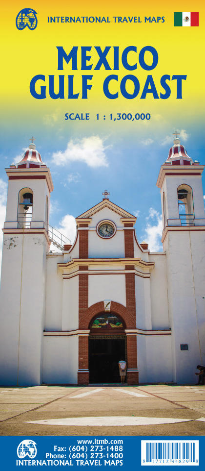
<p> Een degelijke kaart met aanduidingen van o.a. nationale parken, vliegveld, benzinepomp, dirt-roads. Als overzichtskaart goed te gebruiken.</p> <div> Mexico is an ever-popular travel destination. The country is so large that we started mapping it as a series of regional maps years ago. The Gulf Cost extends from Brownsville, Texas through Vera Cruz to the Yucatan Peninsula. Due to the shape of the region, all of Belize and about half of Guatemala is included, but the focus is on the many attractions of the eastern Gulf coast of Mexico. Side 1 cover the northern coastal regions, going inland as far as Monterrey, Zacatecas, Morelia, and Mexico City. Side 2 shows the Gulf Coast from Tampico to Carmen, then on to Merida, Cancun, and the southern tip of Belize. By the shape of this part of Mexico, the Pacific Coast, from the Guatemalan border westwards past Acapulco is also shown. All major roads are shown, but as passenger rail service was discontinued several years ago, we have opted to not show most rail lines. This is a map for explorers and adventurers to discover by driving. It covers all of historic Mexico and complements other ITMB maps detailing regions of a fascinating country, where the first word you learn is 'Hola!'</div> <div> </div> <div> Legend Includes:</div> <div> Roads by classification, Rivers and Lakes, National Park, Airports, Points of Interests, Highways, Main Roads, Zoos, Fishing, and much more...</div>
€13,95
Bekijk product
<div> ITMB is pleased to introduce this new map, using our own artwork, for Madrid, covering essentially all the area within the circular ring road motorway. All the streets are named and included in a place names index. Parks, touristic attractions, hotels, shopping areas, churches, mosques, restaurants, pubs, transit lines – it’s all there. Coverage is from the railway station in the south to the university in the north and from the Parque del Oeste in the west to the bull fighting ring in the east. The reverse side is a detailed regional map for the Castilla La Mancha province to the south of Madrid, with Toledo, Albacete, Murcia, and Cordoba. All roads and parks are shown, as well as major touristic attractions.</div> <div> </div>
€14,95
Bekijk product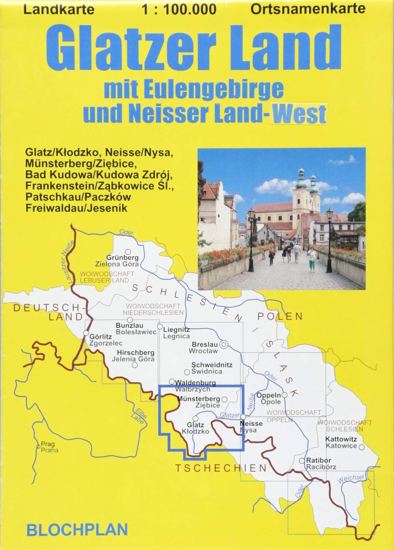
<p> Detaillierte aktuelle Landkarte des Glatzer Landes (Grafschaft Glatz) zwischen Schlesien und Böhmen - heute in Polen gelegen - und der nördlich daran anschließenden Gebiete mit Münsterberger Bergland und dem westlichen Glatzer Land nebst allen hier befindlichen Teilen des Gebirgszuges der Sudeten wie z.B. dem Eulengebirge, dem Heuscheuergebirge, dem Glatzer Schneegebirge oder dem Adlergebirge. Darstellung selbst der kleinsten und auch der seit 1945 verschwundenen Orte - mit allen Ortsnamen in Deutsch, Polnisch bzw. Tschechisch.</p>
€10,95
Bekijk product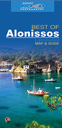
<p> Alanissos algemene kaart gepubliceerd door Road Editions, met overzicht, in het Engels, van de belangrijkste toeristische attracties in de omgeving.</p>
€7,95
Bekijk product
<div> Algemene kaart van Samothrace uitgegeven door Road Editions, met op verso een overzicht, in het Engels, van de belangrijkste toeristische plekken in de regio.</div> <div> Deze kaart is wateproof.</div>
€7,95
Bekijk product
<p> De Road Editions 'Best Of'-kaartenserie bestaat uit gedetailleerde gelamineerde wegenkaarten met uitgebreide beschrijvingen (in het Engels) van de belangrijkste toeristische bestemmingen op de achterkant.</p>
€7,95
Bekijk product
<div> Chios algemene kaart gepubliceerd door Road Editions, met overzicht, in het Engels, van de belangrijkste attracties van de regio.</div> <div> </div> <div> </div>
€7,95
Bekijk product
<p> Overzichtskaart van Nafplio - Argolida uitgegeven door Road Editions, met op de achterkant een overzicht, in het Engels, van de belangrijkste bezienswaardigheden in de regio.</p>
€7,95
Bekijk product
<div> Goede wegenkaart van het hele land. Met register en enkele stadsplattegronden.</div> <div> </div> <div> De berijdbare wegen zijn goed weergeven, zowel de hoofdwegen als provinciale en lokale wegen; wegnummers worden vermeld. Afstanden tussen plaatsen zijn in kilometers op de kaart ingetekend, daarnaast worden ook op belangrijke plekken benzinepompen gemarkeerd.</div> <div> </div> <div> In het kaartbeeld wordt door middel van schaduw het reliëf weergegeven en soms enkele punten in het landschap met de daadwerkelijke hoogte. Provinciegrenzen zijn goed terug te vinden, nationale parken en reservaten ook. Met allerhande symbolen worden toeristische bezienswaardigheden weergegeven als monumenten, historisch belangrijke plekken en uitzichtpunten. In bepaalde plaatsen zijn hotels en campings te vinden, luchthavens, treinverbindingen en havens vindt u er ook op!</div>
€14,95
Bekijk product