
Beantwoord enkele vragen, en binnen seconden geeft AI je een persoonlijk aankoopadvies op maat.
Beantwoord enkele vragen, en binnen seconden geeft AI je een persoonlijk aankoopadvies op maat.
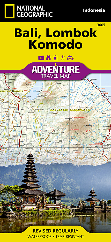
<p> <span style="color: rgb(0, 0, 0); font-family: 'Helvetica Neue', Helvetica, sans-serif, Arial;">Wegenkaart van Bali, Lombok en Komodo met vermelding van veel bezienswaardigheden, nationale parken en attrakties. Watervast en scheurvast. Juist door deze vermeldingen onderscheidt de kaart zich van andere wegenkaarten.</span></p> <div> National Geographic's Bali, Lombok, and Komodo Adventure Map is designed to meet the unique needs of adventure travelers to these Indonesian islands with its durability and accurate information. Each folded map provides global travelers with the perfect combination of detail and perspective, highlighting the area’s terrain and best locations for adventure activities like snorkeling, surfing, fishing, and more. Adventure Maps include hundreds of points of interest that highlight diverse and unique destinations within the country.</div> <div> </div> <div> The map includes the locations of thousands of cities and towns with a user-friendly index, plus a clearly marked road network complete with distances and designations for major highways, main roads, and tracks and trails for those seeking to explore more remote regions.</div> <div> </div> <div> Key Features:</div> <ul> <li> Waterproof and tear-resistant</li> <li> Detailed interpretive information and local travel tips</li> <li> Detailed topography complete with activity symbols, ideal for exploring the country</li> <li> City overview maps</li> <li> Hundreds of points of interest, including the location of World Heritage sites, national parks and nature reserves, aboriginal settlements and protected lands, mines, archeological sites, wildlife parks and more</li> <li> Thousands of place names</li> <li> Important travel aids including airports, lighthouses, ferry routes and rail lines</li> <li> Developed in cooperation with local agencies</li> <li> Updated regularly to ensure accuracy</li> </ul>
€17,50
Bekijk product
<div> <div> Wegenkaart van Oost China met vermelding van veel bezienswaardigheden, nationale parken en attrakties. Watervast en scheurvast.</div> <div> </div> <div> National Geographic's China East Adventure Map is designed to meet the unique needs of adventure travelers with its durability and detailed, accurate information. The map includes the locations of thousands of cities and towns with a user-friendly index, plus a clearly marked road network complete with distances and designations for major highways, major routes and secondary roads. The China Adventure Map is printed in the United States on a durable synthetic paper, making it waterproof, tear-resistant and tough—capable of withstanding the rigors of international travel.</div> <div> </div> <div> The China East Adventure Map differs from a traditional road map for it includes hundreds of points of interest that highlight diverse and unique destinations in the region. UNESCO World Heritage sites, national parks and reserves, archaeological sites, temples, caves and points of interest such as the Great Wall of China and the Wall of Genghis Khan are included, making it an invaluable resource to travelers hoping to experience all the history and culture China has to offer. Additional travel aids include the location of airports, ports and ferry routes. The front side of the China East map details the northeast region of the country, from its border with Russia and Mongolia to the north, to the North Korean border to the east, and extending south to the city of Nanjing. The reverse side of the map details China’s southeastern region, extending from Xi’an and Zhengzhou south to Hong Kong; west to the country’s borders with India and Myanmar (Burma); and east to the Vietnamese border and the shores of the South and East China Seas.</div> <div> </div> <div> Key Features:</div> <ul> <li> Waterproof and tear-resistant</li> <li> Detailed topography complete with activity symbols, ideal for exploring the country</li> <li> Hundreds of points of interest, including the location of World Heritage sites, national parks and reserves, archeological sites, temples, the Great Wall of China and more</li> <li> Thousands of place names</li> <li> Important travel aids including airports, ferry routes, and rail lines</li> </ul> <div> </div> </div> <p> </p>
€17,50
Bekijk product
<div> <span style="color: rgb(0, 0, 0); font-family: 'Helvetica Neue', Helvetica, sans-serif, Arial;">Wegenkaart van India met vermelding van veel bezienswaardigheden, nationale parken en attrakties. Watervast en scheurvast.</span></div> <div> </div> <div> National Geographic's India Adventure Map is designed to meet the unique needs of adventure travelers with its durability and detailed, accurate information. The map includes the locations of thousands of cities and towns with a user-friendly index, as well as a clearly marked road network complete with distances and designations for highways, major routes and secondary roads.</div> <div> </div> <div> The India Adventure Map differs from a traditional road map for it includes hundreds of points of interest that highlight diverse and unique destinations in the region. The map features UNESCO World Heritage sites, national parks, archaeological sites, nature reserves, Hindu and Buddhist temples, and other points of interest, making it an invaluable resource to travelers hoping to experience all the history and culture India has to offer. Additional travel aids include the location of airports, rail lines, harbors and ferry routes. The front side of the map covers India’s southern half, from the Vindhya Range extending south to the city of Trivandrum. The map also includes the island of Sri Lanka and an inset map of the Andaman and Nicobar Islands in the Bay of Bengal. The reverse side of the map features the northern half of the country, spanning its borders with Pakistan, China, Nepal, Bhutan, Myanmar (Burma) and Bangladesh. The India Adventure Map is printed in the United States on a durable synthetic paper, making it waterproof, tear-resistant and tough—capable of withstanding the rigors of international travel.</div> <div> </div> <div> Key Features:</div> <ul> <li> Waterproof and tear-resistant</li> <li> Detailed topography complete with activity symbols, ideal for exploring the country</li> <li> Hundreds of points of interest including UNESCO World Heritage sites, archaeological sites, Hindu and Buddhist temples</li> <li> Thousands of place names</li> <li> Important travel aids including airports, ferry routes, and rail lines</li> </ul>
€17,50
Bekijk product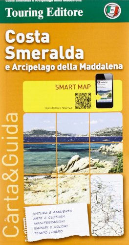
<p> Gedetailleerde toeristische overzichtskaart, gedrukt op scheur- en watervast materiaal. Met stadsplattegrondjes van de belangrijkste plaatsen en veel toeristische informatie op de achterkant (Italiaanstalig).</p> <div> Costa Smeralda and the Maddalena Archipelago Smart Map at 1:175,000 from the Touring Club Italiano, printed on light waterproof and tear-resistant synthetic paper, with a street plan of central Olbia annotated with main sights, plus 11 more recommendations of places worth visiting. Coverage extends from the Straights of Bonifacio between Sardinia and Corsica southwards to Ozieri and Pattada.</div> <div> </div> <div> Cartography is an enlargement of TCI’s excellent regional series at 1:200,000. Additional overprint highlights the publishers’ recommendations. On the reverse are notes, based on Touring Editore’s vast experience of presenting the country’s heritage and culture, about various aspects of the region: nature, art, local festivals, etc, or, since all the text is in Italian only: natura e ambiente, arte e cultura, manifestazioni, sapori e colori and tempo libero.</div> <div> </div> <div> Map legend and all the text are in Italian only.</div>
€10,95
Bekijk product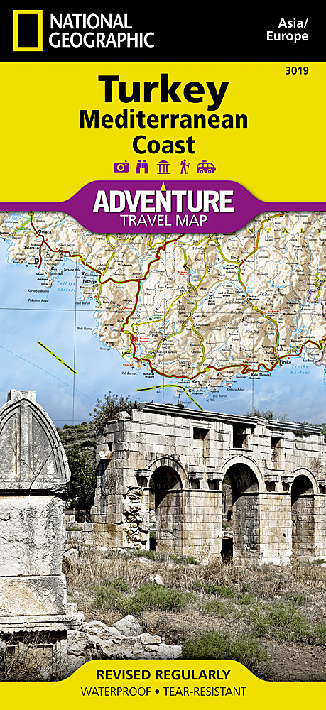
<div> <span style="color: rgb(0, 0, 0); font-family: 'Helvetica Neue', Helvetica, sans-serif, Arial; line-height: 16px;">Wegenkaart van de zuidelijke kust van Turkije met vermelding van veel bezienswaardigheden, nationale parken en attrakties. Watervast en scheurvast.</span></div> <div> </div> <div> National Geographic's Turkey, Mediterranean Coast Adventure Map is designed to meet the unique needs of adventure travelers with its durability and accurate information. This folded map provides global travelers with the perfect combination of detail and perspective, highlighting hundreds of points of interest and the diverse and unique destinations within the country.</div> <div> </div> <div> The front side of the Turkey Mediterranean Coast map details the southern coastal region of the country. This side shows the Mediterranean Sea to the south and Syria to the east. The coastline extends from Kas to Iskenderum. The reverse side of the map details Turkey’s western coastal region of the country and its border with Greece and Bulgaria. This side shows the western coast from the Sea of Marmara down to the Mediterranean Sea. The map includes the locations of cities and towns with a user-friendly index, plus a clearly marked road network complete with distances and designations for major highways, main roads, and tracks and trails for those seeking to explore more remote regions. Every Adventure Map is printed on durable synthetic paper, making them waterproof, tear-resistant and tough—capable of withstanding the rigors of international travel.</div> <div> </div> <div> Key Features:</div> <ul> <li> Waterproof and tear-resistant</li> <li> Detailed interpretive information and local travel tips</li> <li> Detailed topography complete with activity symbols, ideal for exploring the country</li> <li> City overview maps</li> <li> Hundreds of points of interest, including the location of World Heritage sites, national parks and nature reserves, aboriginal settlements and protected lands, mines, archeological sites, wildlife parks and more</li> <li> Thousands of place names</li> <li> Important travel aids including airports, lighthouses, ferry routes and rail lines</li> <li> Developed in cooperation with local agencies</li> <li> Updated regularly to ensure accuracy</li> </ul>
€17,50
Bekijk product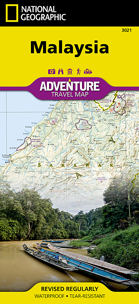
<p> <span style="color: rgb(0, 0, 0); font-family: 'Helvetica Neue', Helvetica, sans-serif, Arial; line-height: 16px;">Wegenkaart van </span>Maleisië<span style="color: rgb(0, 0, 0); font-family: 'Helvetica Neue', Helvetica, sans-serif, Arial; line-height: 16px;"> met vermelding van veel bezienswaardigheden, nationale parken en attrakties. Watervast en scheurvast.</span></p> <div> National Geographic's Malaysia Adventure Map is designed to meet the unique needs of adventure travelers with its durability and accurate information. Each folded map provides global travelers with the perfect combination of detail and perspective, highlighting the area’s terrain and best locations for adventure activities like snorkeling, surfing, fishing, and more. Adventure Maps include hundreds of points of interest that highlight diverse and unique destinations within the country.</div> <div> </div> <div> The map includes the locations of thousands of cities and towns with a user-friendly index, plus a clearly marked road network complete with distances and designations for major highways, main roads, and tracks and trails for those seeking to explore more remote regions.</div> <div> </div> <div> Key Features:</div> <ul> <li> Waterproof and tear-resistant</li> <li> Detailed interpretive information and local travel tips</li> <li> Detailed topography complete with activity symbols, ideal for exploring the country</li> <li> City overview maps</li> <li> Hundreds of points of interest, including the location of World Heritage sites, national parks and nature reserves, aboriginal settlements and protected lands, mines, archeological sites, wildlife parks and more</li> <li> Thousands of place names</li> <li> Important travel aids including airports, lighthouses, ferry routes and rail lines</li> <li> Developed in cooperation with local agencies</li> <li> Updated regularly to ensure accuracy</li> </ul>
€17,50
Bekijk product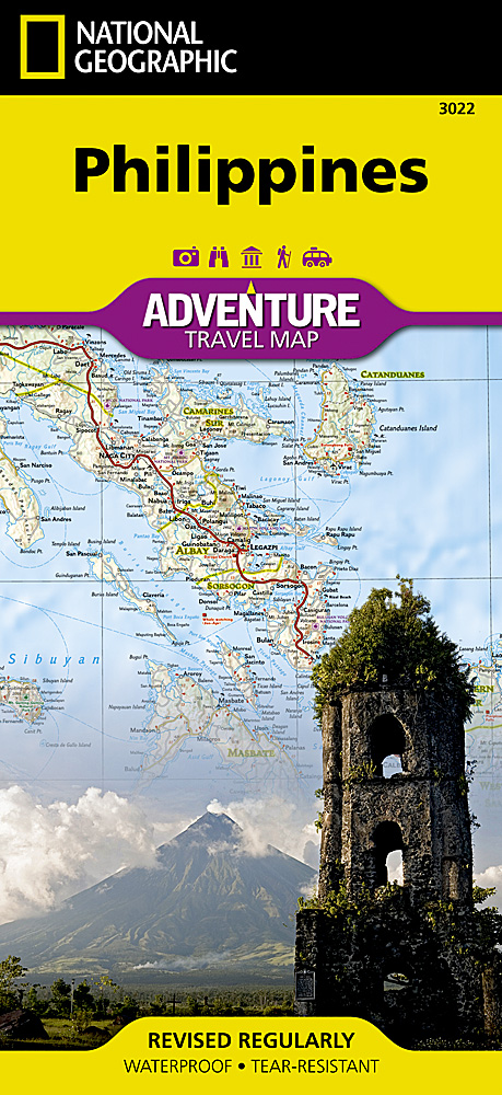
<div> <span style="color: rgb(0, 0, 0); font-family: 'Helvetica Neue', Helvetica, sans-serif, Arial; line-height: 16px;">Wegenkaart van de Filipijnen met vermelding van veel bezienswaardigheden, nationale parken en attrakties. Watervast en scheurvast.</span></div> <div> </div> <div> National Geographic's Philippines Adventure Map is designed to meet the unique needs of adventure travelers with its durability and accurate information. Each folded map provides global travelers with the perfect combination of detail and perspective, highlighting the area’s terrain and best locations for adventure activities like snorkeling, surfing, fishing, and more. Adventure Maps include hundreds of points of interest that highlight diverse and unique destinations within the country.</div> <div> </div> <div> The map includes the locations of thousands of cities and towns with a user-friendly index, plus a clearly marked road network complete with distances and designations for major highways, main roads, and tracks and trails for those seeking to explore more remote regions.</div> <div> </div> <div> Key Features:</div> <ul> <li> Waterproof and tear-resistant</li> <li> Detailed interpretive information and local travel tips</li> <li> Detailed topography complete with activity symbols, ideal for exploring the country</li> <li> City overview maps</li> <li> Hundreds of points of interest, including the location of World Heritage sites, national parks and nature reserves, aboriginal settlements and protected lands, mines, archeological sites, wildlife parks and more</li> <li> Thousands of place names</li> <li> Important travel aids including airports, lighthouses, ferry routes and rail lines</li> <li> Developed in cooperation with local agencies</li> <li> Updated regularly to ensure accuracy</li> </ul>
€17,50
Bekijk product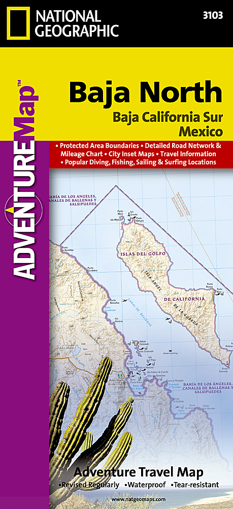
<p> <span style="color: rgb(0, 0, 0); font-family: 'Helvetica Neue', Helvetica, sans-serif, Arial; line-height: 16px;">Wegenkaart van Baja </span>Californië <span style="color: rgb(0, 0, 0); font-family: 'Helvetica Neue', Helvetica, sans-serif, Arial; line-height: 16px;">Noord met vermelding van veel bezienswaardigheden, nationale parken en attrakties. Watervast en scheurvast. Juist door deze vermeldingen onderscheidt de kaart zich van andere wegenkaarten.</span></p> <p> National Geographic’s Baja North Adventure Map combines detailed terrain with local information on the entire State of Baja California. Together with the Baja South Adventure Map, it covers the entire Baja peninsula and includes detailed insets of Tijuana, Mexicali, Ensenada, La Paz, San Jose Del Cabo, Cabo San Lucas, and the Cabo Resort Corridor.</p> <p> Coverage Highlights: Federally Protected Areas, including parks and reserves, provided by the Nature Conservancy of Mexico; detailed road network, ferry routes, and mileage charts; UNESCO World Heritage Sites; historic mission locations; popular diving, surfing, fishing, snorkeling, whale watching, and scenic viewpoint locations; detailed terrain with shaded relief; useful travel information</p>
€17,50
Bekijk product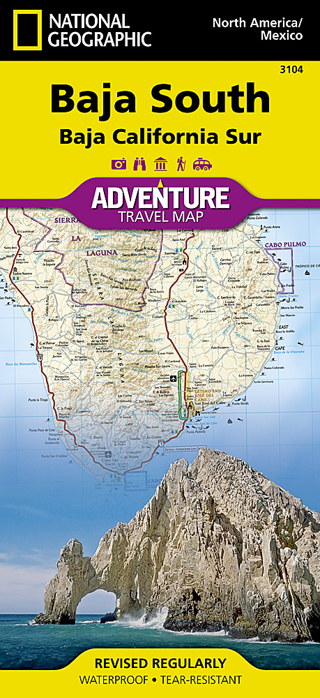
<p> <span style="color: rgb(0, 0, 0); font-family: 'Helvetica Neue', Helvetica, sans-serif, Arial; line-height: 16px;">Wegenkaart van Baja California Zuid met vermelding van veel bezienswaardigheden, nationale parken en attrakties. Watervast en scheurvast. Juist door deze vermeldingen onderscheidt de kaart zich van andere wegenkaarten.</span></p> <p> National Geographic’s Baja South Adventure Map combines detailed terrain with local information on the entire State of Baja California Sur. Together with the Baja North Adventure Map, it covers the entire Baja peninsula and includes detailed insets of Tijuana, Mexicali, Ensenada, La Paz, San Jose Del Cabo, Cabo San Lucas, and the Cabo Resort Corridor.</p> <p> Coverage Highlights: Federally Protected Areas, including parks and reserves, provided by the Nature Conservancy of Mexico; detailed road network, ferry routes, and mileage charts; UNESCO World Heritage Sites; historic mission locations; popular diving, surfing, fishing, snorkeling, whale watching, and scenic viewpoint locations; detailed terrain with shaded relief; useful travel information.</p>
€17,50
Bekijk product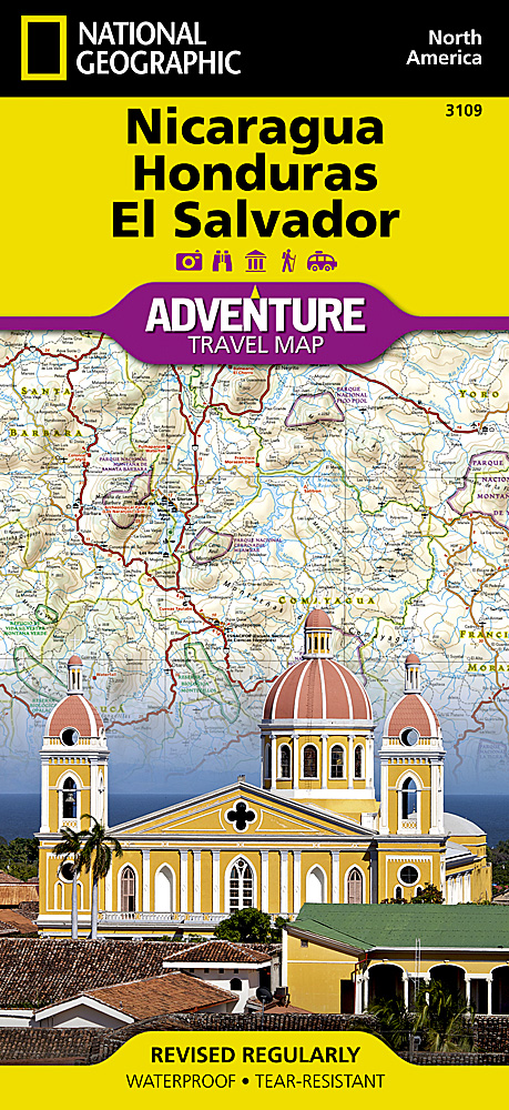
<p> <span style="color: rgb(0, 0, 0); font-family: 'Helvetica Neue', Helvetica, sans-serif, Arial; line-height: 16px;">Wegenkaart van </span>Nicaragua, Honduras, en El Salvador<span style="color: rgb(0, 0, 0); font-family: 'Helvetica Neue', Helvetica, sans-serif, Arial; line-height: 16px;"> met vermelding van veel bezienswaardigheden, nationale parken en attrakties. Watervast en scheurvast. Juist door deze vermeldingen onderscheidt de kaart zich van andere wegenkaarten.</span></p> <div> National Geographic's Nicaragua, Honduras, El Salvador AdventureMap is designed to meet the unique needs of adventure travelers with its durability and accurate information. This folded map provides global travelers with the perfect combination of detail and perspective, highlighting hundreds of points of interest and the diverse and unique destinations within the country.</div> <div> </div> <div> The map includes the locations of cities and towns with a user-friendly index, plus a clearly marked road network complete with distances and designations for major highways, main roads, and tracks and trails for those seeking to explore more remote regions.</div> <div> </div> <div> Every AdventureMap is printed on durable synthetic paper, making them waterproof, tear-resistant and tough — capable of withstanding the rigors of international travel. Each is two-sided and can be folded to a packable size of (4.25” x 9.25”); unfolded size is (26” x 38”).</div> <div> </div> <div> Key Features:</div> <ul> <li> Waterproof and tear-resistant</li> <li> Accurate topography/terrain with a clearly labeled road network</li> <li> Hundreds of points of interest, including the locations parks and nature reserves, protected lands, historical and cultural attractions</li> <li> Thousands of place names including towns and natural features; detailed place names index</li> <li> Important travel networks including airports, lighthouses, ferry routes and rail lines</li> <li> Updated regularly to ensure accuracy</li> </ul>
€17,50
Bekijk product